If you are considering walking this route yourself, please see my disclaimer. You may also like to see these notes about the maps and GPX files.
Walk 1 25/04/08 – Dunstable Downs and Markyate (12.0 miles approximately)
Parked at the Chiltern Gateway Centre, Dunstable Downs.
If you are interested in walking this route yourself, click here to see the route description (but only if you have already read my disclaimer and notes regarding route descriptions).
At last! It felt
good to be setting off on another long-distance path again – I’ve really
enjoyed all the walks I’ve been doing in the Chilterns in recent months, but
it’s nice to have the challenge and the target that a long-distance path gives
me. It’s also nice to be writing a journal again after a gap of about seven
months! As the Chiltern Gateway Centre is only five minutes drive from my home,
I was able to start walking about
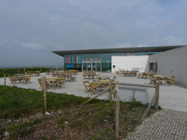
The Chilterns Gateway Centre is situated at the highest point in Bedfordshire, 798
feet above sea level on Dunstable Downs. It cost £2.5 million pounds to build,
and was officially opened by TV presenter Michaela Strachan on
 |
 |
 |
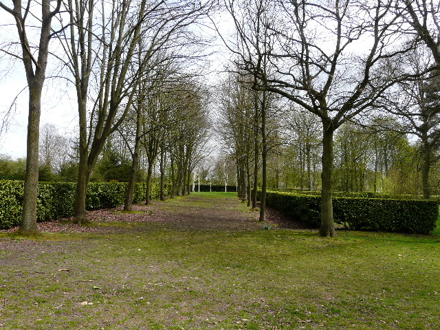
| [1] The Chilterns Gateway Centre on Dunstable Downs | [2] Dunstable Downs | [3] Kensworth Quarry |
From the car park, I followed the path to the left of
the Chilterns Gateway Centre [1]
and soon came to what looked like a modern
sculpture made of rusting metal – in fact it is part of the
environment-friendly heating and ventilation system for the visitor centre. The
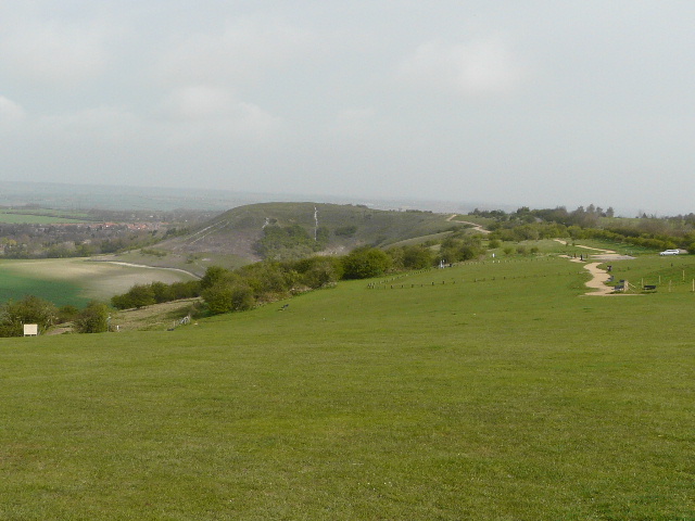
path went right here, along the top of Dunstable Downs. There were nice views
along the
Dunstable Downs
are a steep section of the Chiltern escarpment, lying immediately southwest of
Dunstable. The views from the top of the
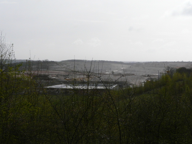
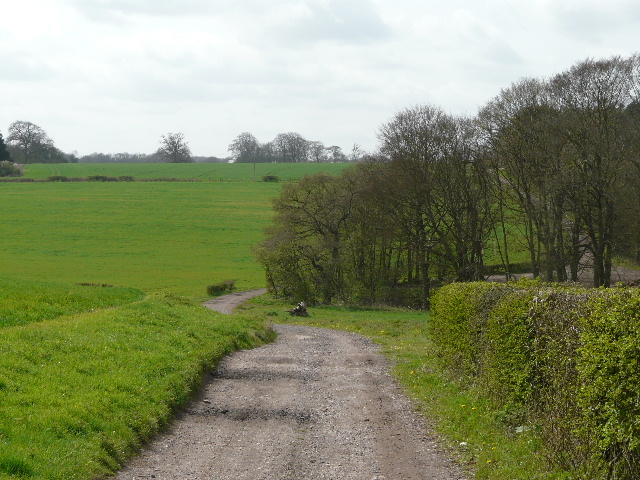
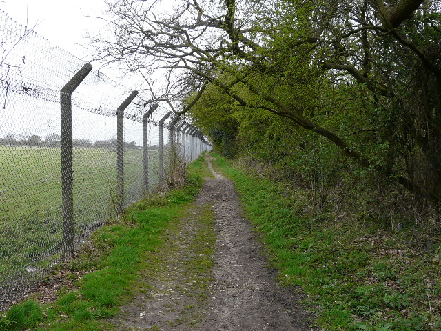
I went through the car park and carefully crossed the road, and set off down a track starting on the other side. Soon there was part of Dunstable Downs golf club beyond the hedge on my left. After passing a metal barrier, I soon turned right through some trees and after a few yards came to the path round Kensworth Quarry, which was visible as a huge white gash in the landscape immediately in front of me, ugly but impressive in its scale [3]. I believe it is the largest chalk quarry in the country, and the chalk from here is pumped in solution to Rugby along a 56 mile pipeline. I turned right and followed the broad track with the quarry fence on my left – I soon saw some Coltsfoot growing to the right of the path.
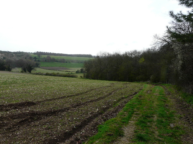
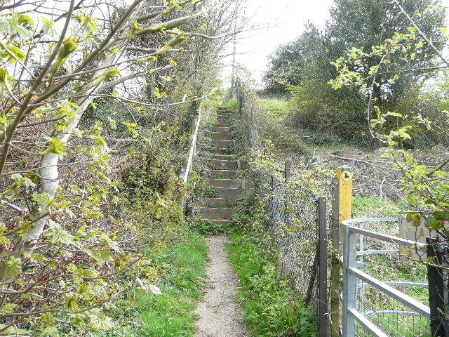
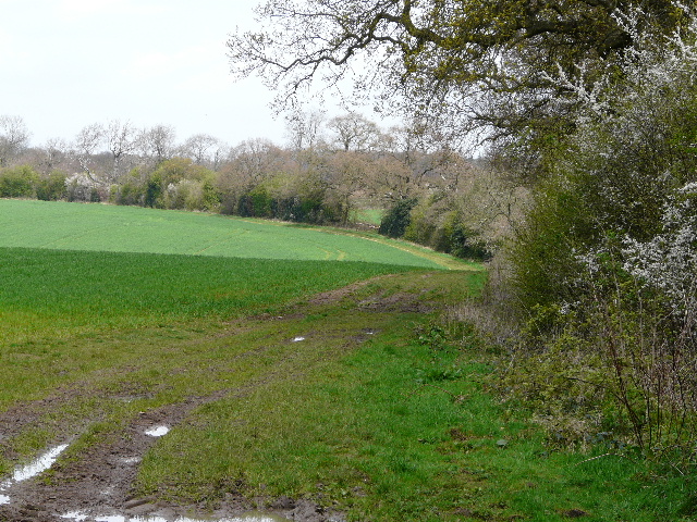
After a few hundred yards I came to the drive to the quarry, where I turned right for 100-200 yards, then turned left. There was now a thin belt of trees on my left, and across the small field on my right the hedgeline marked the course of Isle of Wight lane, heading towards my home in Kensworth. After a while the path turned left through the tree belt, and on the far side turned right along the edge of a field, with some of the quarry workings visible over to my left. The field boundary on my right gradually curved left and descended into a valley [4]. In the valley bottom, the right of way switched to the right of the field boundary and continued a short distance on a farm track, before becoming a path again as it curved right and passed through a small wood. It then turned left, initially going up a flight of steep steps [5] as it climbed the far side of the valley, with the quarry still visible to my left – I saw some Cowslips growing here.
 |
 |
 |
| [4] Path near Kensworth Quarry, heading down into the valley | [5] Steep steps beside the quarry | [6] A Black Squirrel (photo taken at my home in Kensworth, 17/03/08) |
At the top of the hill, I went through a metal kissing-gate and turned right. It was quite muddy along here, as I passed another small wood on my right. Beyond the wood, I had to fork very slightly right, to keep to the right of a young plantation. Looking to my right, I could see a long way across the valley to a row of houses in Kensworth on the opposite hillside (one of which is the home of that trepid Chiltern explorer, yours truly!). The path followed the fence enclosing the plantation as it curved to the left. There then followed a very muddy section of path between bushes, where I saw a couple of Jays fly off ahead of me. As I struggled to pick a path through the mud, I consoled myself with the thought that this would be one of the worst sections for mud on the entire Chiltern Chain Walk. I soon came to a junction where the quarry path went left, but I continued ahead on a track, with a small wooded area now on my left.
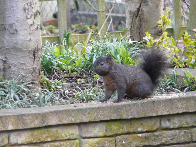
Here I had a very unusual wildlife sighting – a black squirrel! [6] My parents have lived in Kensworth since the early 1950’s and say that there have always been black squirrels around. I’ve seen them numerous times in our garden, but have never seen one anywhere else. They are not true ‘Black Squirrels’ which you can see in some parts of Europe, but a variation on the normal Grey Squirrels. I didn’t have the chance to get a photo of this one, but I was lucky enough to get some nice shots of one in our garden about a month ago.
The track soon emerged into a small meadow, where I
turned right and followed the path through the grass to a stile that took me
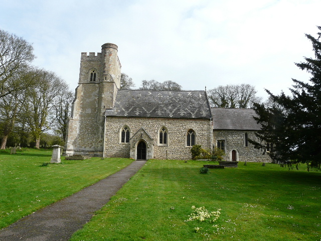
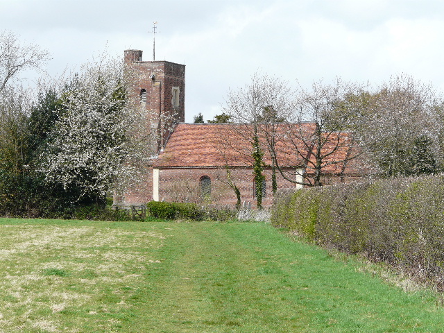
into the churchyard of Kensworth church. I passed the twelfth-century church on
my left to reach the gate [7], where I turned left along a lane. The church stands
amongst a few houses and a couple of farms in Church End, the original nucleus
of the village of
 |
 |
 |
| [7] Kensworth Church | [8] Mounting block, Kensworth Church End | [9] Path back across the valley towards Kensworth |
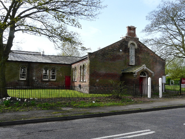
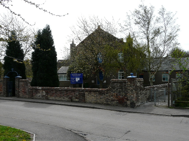
I turned left, immediately passing the Old Red Lion pub on my left [UPDATE: 7/01/12: The pub is now closed and converted to a private residence], and then the recreation ground on the right. There has always been a line of impressive Horse Chestnut trees along the edge of the recreation ground, but sadly about half of them have had to be felled recently on safety grounds – the parish council have planted some native woodland tree saplings to replace them. Further on I passed the village primary school [10] (which I attended in the 1960’s!). A short distance further, I turned right on a footpath that crossed a paddock – I was delighted to see Swallows here, the first I’ve seen this year. The horses in the paddock ignored me, as they did in the next larger paddock where the indistinct path went half-left before turning right to reach the far hedge. Here it turned left alongside the hedge, to reach a kissing-gate in the corner.
 |
 |
 |
| [10] Kensworth School | [11] Path through corn field, heading towards the small copse | [12] Looking north along the A5, heading towards Dunstable |
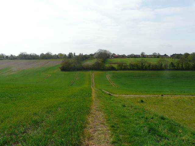
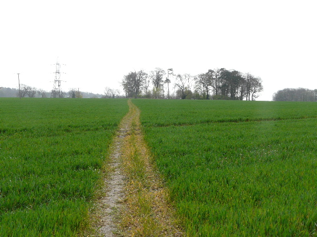
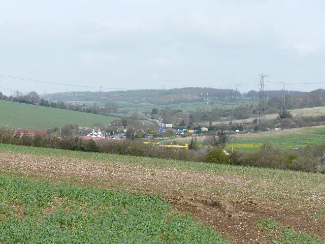
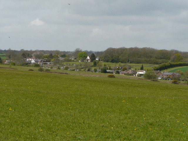
The path continued as a clear thin line through a large field of young corn, with a junction of two valleys at Kensworth Lynch over to my left. I passed to the left of a small copse in the middle of this huge field [11], where I had to detour round a fallen beech tree. There were nice views northwards along the larger of the two valleys, through which the A5 headed towards Dunstable [12]. Eventually I reached the far side of the field, where the path went through the hedgerow and across the corner of the next field – this contained oil-seed rape which was starting to turn yellow, and I saw a yellowhammer fly off as I passed by. The path next bore slightly right, alongside a hedge on the left, running parallel to the A5 in the valley bottom to my left. The valley is that of the river Ver (from which St Albans, about 10 miles away, got its Roman name of Verulamium), though it only really flows here in the winter months and then is not much more than a ditch. I saw my first Greater Stitchwort of the day here. At a gap in the hedge I could see across the valley to Markyate Cell [13].
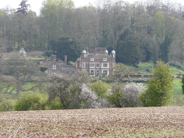 |
 |
 |
[13]
Markyate Cell |
[14]
Baptist Chapel, Markyate
|
[15]
Path to Roe End
|
Markyate Cell is the site of a Benedictine
Priory founded in 1145, although the present house is nineteenth century. An
earlier house on the site was the home of Lady Katherine Ferrers, the
celebrated ‘highwaywoman’ – the classic film ‘The Wicked Lady’ starring
Margaret Lockwood was based (very loosely) upon her life.
The path continued alongside the hedge, and on through some playing fields and then a short alleyway to reach a residential street in Markyate. I turned left, then went right on a paved path, continuing more or less straight on over a couple of minor road junctions and then downhill to reach a junction with Buckwood Road (this heads towards Whipsnade and later becomes Buckwood Lane, though known locally as Bucket Lane). I turned right here, by the large Baptist Chapel [14], and followed the road through a fairly modern residential area. Beyond the last house on the left, I turned left along a footpath, soon coming to a junction where I turned half-right. The path climbed gently across the slope of the hillside, following a hedge on my left [15]. To my right were pleasant views over several rolling hills and valleys, with a surprising amount of woodland in view. Eventually I reached the field corner, where I went through a kissing-gate and continued beside another hedgerow, with a farm visible across the meadow on my right.
The path ended at Roe End lane [16], Roe End being a small hamlet within the parish of Markyate, consisting of two farms and a few cottages. I turned right, immediately passing a house on my left which has an odd foreign sign on its gate (I think it’s the Italian for ‘Beware of the Dog’, but I’m probably completely wrong). After a few hundred yards, the surfaced lane ended (a bridleway continued ahead) and I turned left along a gravel track. This descended into a slight valley and rose gently up the other side beside another wood [17]. Beyond the end of the wood I noticed a couple of Guinea Fowl – I’d seen a larger group of them nearby the last time I came this way.
 |
 |
 |
[16]
Roe End lane
|
[17]
Track leading away from Roe End
|
[18]
Start of the track through Gravelpit wood
|
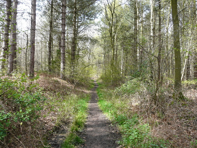
When I reached a track crossroads I turned right (the Hertfordshire Way goes left here, I’d been following it most of the way from Markyate). I passed a few cottages – some penned in dogs barked loudly as they always do when I go by here – and then passed a farm and a duck pond in a small enclosure on my right. The track then veered slightly right as it entered Gravelpit wood [18], soon passing what looks to be a fairly new pond on the left. After about a quarter of a mile, the track went slightly left, but the right of way continued straight ahead through another section of the wood (now called Great Bradwin's Wood), now on a narrow path rather than surfaced track [19]. I spotted my first ever Wood Sorrel along here, and there was some type of Violet growing here too. I got a nice photo of a Peacock butterfly here as well, I’d already seen them in several other places.
The path emerged on the far side of the wood, where I turned right for a short way and went through a hedge gap to reach a corner of Studham Common [20]. I turned left along the top of the common (making a mental note to return here in a month or so’s time, as it is a good place for orchids) [21]. It was nice looking over the grassy section of common towards the village of Studham. I crossed a road and continued along the top of a second grassy section of the common – I managed to photograph a few rooks that were on the grass a little way ahead of me. Over a second road, the common was a mixture of trees and bushes, and the path turned slightly right and descended a very small valley. It reached a more open area of grass where it ended at a bridleway. Here I went left, leaving the common as I passed some cottages and the village school on my right.
 |
 |
 |
[19]
Path through Great Bradwin's wood
|
[20]
Studham Common
|
[21]
Path along edge of Studham Common
|
The path continued along a right-hand hedge to reach Valley Road, where I turned right. I saw some Garlic Mustard by the road-side as I went uphill into a corner of Studham. At the top of the small rise I turned left, and followed a lane (where I saw the first Wood Anemones of the day) a short distance to its termination at the village church [22]. I went through the churchyard, passing left of the church, to an old gate in the far left corner. Beyond that, I turned left and went over a stile into a meadow, with a farm over to my left. I followed the right-hand fence through the meadow, passing a couple of mature trees, to another stile on the edge of a wood. I turned right on a bridleway just inside the edge of the wood (when I first walked this path 20 years ago it was almost impassably muddy, but it has since been very well re-engineered with good drainage).
I heard and saw a small mammal just to my left as I followed the bridleway – it stopped still in a position where it was largely hidden from me, but I think it might have been a bank vole similar to the one I’ve been seeing in my garden recently. There was a good selection of wildflowers here too, the Bluebells, Lesser Celandine and Greater Stitchwort that I’d already seen frequently on this walk. The bridleway soon left the wood, and followed a hedgerow through two fields of young corn [23]. Over to my left I could see part of Whipsnade Zoo, and after passing through a small wood the path ran alongside the metal zoo fence [24]. Here I could see many Chinese Water Deer in one of the Zoo’s paddocks, but curiously there were no Wallabies about today. I passed some more Coltsfoot along here.
Whipsnade Zoo is owned by the Zoological Society of
 |
 |
 |
[22]
Studham Church |
[23]
Bridleway heading towards Whipsnade Zoo
|
[24]
The path along the zoo fence
|
At the end of the path, I turned left along a former lane between Holywell and Whipsnade. Perhaps it was the time of year, but it didn’t seem quite as overgrown as the last time I walked here. I saw several birds here – Chaffinches flew ahead of me along the old lane, and further on I saw a Blackbird and a Robin. In the large ploughed field to my left was a mixed flock of Jackdaws and Rooks, and I heard the distinctive call of a Lapwing (I heard it two or three times before I finally spotted it). I turned right onto a footpath along the end of the ploughed field (the hedge here had recently been relaid, and there was a sign advertising the company that had done it), and beyond the field corner I turned left through a meadow to reach Whipsnade church [25]. As I took a photograph, a Green Woodpecker flew across in front of me. I followed the path round to the left of the church, and went through the gate onto the large irregular green, around which the dwellings of Whipsnade are scattered. I turned left across part of the green, then turned right and crossed the road [26]. I followed a short drive to reach the entrance to the Tree Cathedral.
Whipsnade Tree Cathedral
is a 9.5 acre garden planted with trees in the shape of a Cathedral, with
grassy avenues representing the nave, chancel, transepts, etc. It was created
by Edmund Kell Byth as an act of ‘Faith,
Hope and Reconciliation’ in remembrance of two of his friends, Arthur Bailey
and John Bennett, who were killed in World War I. Work started in 1932 and
continued in stages, the first religious service being held in 1953. In 1960 it
was donated to the National Trust. Religious services continue to be held
occasionally, by several different denominations. There are three houses in
Whipsnade named after Blyth and his two friends.
 |
 |
 |
[25]
Path leading to Whipsnade Church
|
[26]
Part of the green at Whipsnade, from near the entrance to the Tree Cathedral
|
[27]
The 'Nave' of the Tree Cathedral
|
I had a quick look around the Tree Cathedral
[27]. It was now well after
At the bottom of the hill I went through a kissing gate and then between some wooden barriers to join a bridleway, which I followed to the right. The bridleway ran between hedges, where again there were a good selection of wildflowers. In particular there was a nice mixed clump of Wood Anemones and Lesser Celandine. Further on I came across some Yellow Archangel – this was the first time I’d seen the native version, though I’d seen the garden variety with the silver effect on the leaves on several recent walks in Oxfordshire. The bridleway ended near the small car park on Bison Hill. The Chiltern Chain Walk goes right here, but I first stopped to sit on a fallen tree here to eat my lunch, admiring the view towards Ivinghoe Beacon [28]. There was more Coltsfoot here, some nice Violets and several Cowslips, and a lot of Dog’s Mercury (something that I have seen very frequently on my recent walks).
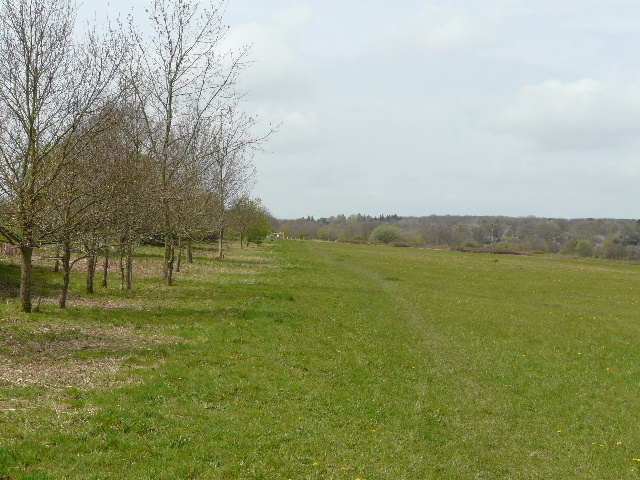
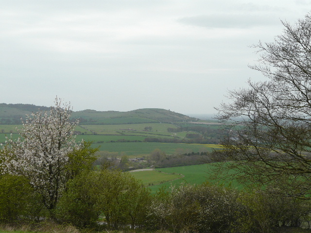
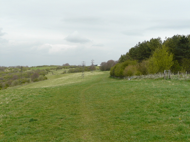
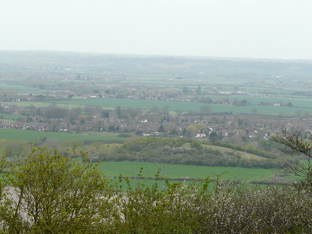
I then just had ¾ of a mile left. The path followed a hedge or fence line at the top of a huge pasture, with the steep slope of the Downs to my left. There were good views along the Downs [29] and out over the Vale of Aylesbury [30], but they were not as good as they could be because of the almost overcast conditions. There were a few gliders (the London Gliding Club is at the foot of the Downs), but I didn’t see any kites or paragliders. The path passed a wood on the right, then made for the far corner of the pasture. It was then just a few hundred yards further, back to the Chiltern Gateway Centre.
 |
 |
 |
[28]
Ivinghoe Beacon, from near the car park on Bison Hill |
[29]
The path along the Downs, from Bison Hill back to the Chilterns Gateway Centre
|
[30]
Looking out over the Vale of Aylesbury
|
The walk had taken me about 4 hours and 50 minutes, a ridiculously long
time for a 12-mile walk. But the reason became clear when I got home, and
discovered that I’d taken 209 photographs, far more than I’d ever done before.
It’s difficult for me to evaluate this walk, as all of it was on my local
patch, using paths that I’m very familiar with. I certainly enjoyed it today,
especially as I saw a good selection of birds and wildflowers. How interesting
it would be to someone who hadn’t walked here before, I’m not sure. But I think
they’d have to enjoy the views from Dunstable Downs, the Zoo and Tree Cathedral
offered something a bit unusual, and the route passed three interesting old
churches. The walk was reasonably undulating, with a mixture of fields and
woods, and I think it serves as a reasonably gentle introduction to the
Chilterns. But certainly the best bits are yet to come!
Total distance: 12.0 miles
To see this walk repeated IN THE OPPOSITE DIRECTION on 1/7/12, CLICK HERE.