If you are considering walking this route yourself, please see my disclaimer. You may also like to see these notes about the maps and GPX files.
Day 1 23/08/05 Wendover to Chesham (8 miles each way)
Parked in car park in Wendover (note: the car park at the station says it is for rail users only).
This turned out be a very good day for walking, warm and sunny but with a breeze that ensured that it never became uncomfortably hot. I started off from the car park in Wendover at about 9.40, first walking to the railway station and then turning back down the high street. I found the inset maps of both Wendover and Chesham in the leaflet from Bucks County Council to be rather unclear, but eventually I spotted the turning for the Ridgeway (the Chiltern Link follows this national trail for about a mile out of Wendover before branching off). I followed a footpath beside some playing fields, and also partly by a stream, crossed over a lane, and followed another short path to reach the edge of Wendover by St Mary’s Church. A short lane walk led to the start of Hogtrough Lane.
This wide farm track led gradually uphill for about half a mile. At Concord Wood, the Chiltern Link parted from the Ridgeway, and took a steep footpath through the woods, climbing the northern escarpment of the Chiltern Hills. At the top of the hill, the path emerged from the trees to pass between two remote cottages, and then followed two sides of a large cattle pasture before crossing another grassy field to reach the hamlet of Kingsash. Across the lane here, the path followed a private drive before crossing two small grassy fields. For the next mile or so, the Chiltern Link followed the edges of a succession of corn fields (now just stubble), crossing the route of the Chiltern Way at one point (between Wendover Dean and Lee Gate). The Chiltern Link then crossed a cow pasture and another small field to reach the road by the old church at The Lee. The road was followed to the attractive village green, surrounded by old cottages and a pub.
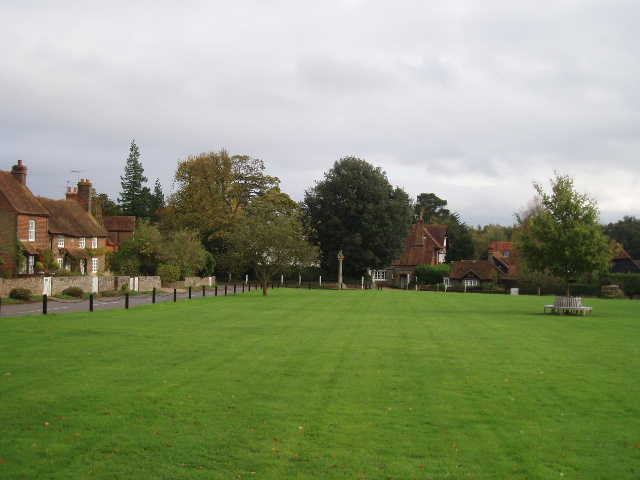
The village green at The Lee 5/11/05
The way then led along a wide track before branching off into a wood. A short section of field was crossed before re-entering the wood, the path remaining close to the wood’s edge for about half a mile to Ballinger Bottom. Here a lane was crossed, and a bridleway led to another short stretch of wood. On the other side of the wood, the path followed the hedge of a grassy meadow to a field corner, where the route turned south and followed a hedge through two large meadows. By a remote cottage, a new path was joined that passed downhill between fences to emerge close to a lane junction.
From the junction, a broad bridleway led down the flat valley bottom of Herbert’s Hole. This was a very pleasant part of the walk, as the Chiltern Link followed the remote valley for almost two miles with very little sign of habitation. I was very pleased to see a solitary Red Kite soar overhead as I was about halfway along the valley! At the end of Herbert’s Hole, a lane was followed for a hundred yards or so, before a couple of fields were crossed diagonally to reach another lane. Across this, the path climbed the side of the valley before levelling out and soon reaching Chesham at a park. Again, the inset map in the leaflet was not much help, but I finally managed to find my way to Chesham Railway Station.
This would be the end of the walk for most sensible people, but I turned round and started to retrace my steps back to Wendover. I stopped to eat my picnic lunch somewhere along Herbert’s Hole, where I was passed by two joggers and two walkers, some of the very few people I saw all day outside of Wendover and Chesham. It was a lovely afternoon, and I enjoyed the walk back as much as I enjoyed the walk to Chesham. I got back to my car at about 3.10pm, slightly tired but very pleased with the day’s exertions.
Total Distance: 16 miles