Pete's Walks - Greensand Ridge Walk
If you are considering walking this route yourself, please see my disclaimer. You may also like to see these notes about the maps and GPX files.
Day 6 24/04/06 Sandy to Gamlingay (6 miles each way)
Parked in Sandy.
Knowing that this was a shorter walk than usual, I set off from home about half an hour later than normal, around 9.30am. I took a totally different route to Sandy, compared to my previous few drives – instead of going through Toddington and Flitwick, I took the route round the south and east of Luton to Hitchin, and then took the A1 northwards from near Stevenage. The journey took about 50 minutes. I called in the Tourist Information Office at Sandy, next to the car park, in the hope that they might have leaflets on the John Bunyan Trail – they didn’t, but I picked up a couple of leaflets on some shorter walks that follow the rivers Ivel and Great Ouse. I started walking about 10.30am.
The Greensand Ridge Walk crossed the High Street at the point where my previous walk had ended, and followed a couple of short residential roads to reach a footbridge over a railway line (the main East Coast line). Beyond this, I crossed a meadow that rose slightly towards woods, which rose more steeply as the greensand ridge re-emerged after the flat region of the Ivel valley. Where the meadow met the woods, there was the sixth of the seven plaques to celebrate the Queen’s Golden Jubilee, on a wooden post carved with leaves. The sandy path rose steadily through the wood (mainly oak, I think) [1], before following a wire fence to a lane. I turned right, and followed the lane for a third of a mile – there was a good path on the left for most of the way.
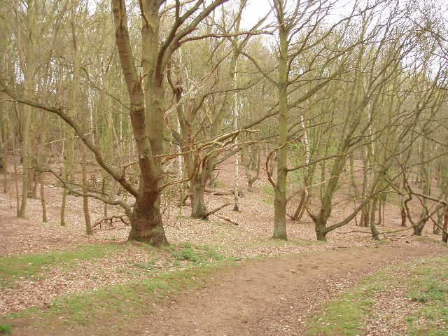
[1]The wood near Sandy
Near a road junction, I turned left on to a footpath that went steadily downhill through a large meadow occupied by sheep, lambs and three calves. It seemed a shame to be leaving the ridge so soon after regaining it, but looking on the map there was no suitable right of way along the ridge at this point, other than what seemed a rather busy B road. Instead, the Greensand Ridge Walk now followed the course of a Roman Road (from Baldock to Godmanchester via Sandy) along the foot of the ridge, which was now running north-south rather than east-west. Across a second, much smaller, meadow, the path became a hard farm track, which I followed for about a mile, with fields on my left and a hedge on my right – part of the section of hedge was Hassells Hedge, an ancient boundary that follows the line of the Roman Road. Just past a farm, the Greensand Ridge Walk left the course of the Roman Road (which continued as a bridleway or path for several miles) and turned right, to follow a hedgerow and then cross two small meadows as it climbed back up the ridge, joining a hedged track that took me into the village of Everton (no, not the home of the third best soccer team on Mersyside, after Liverpool and Liverpool Reserves – sorry, make that fourth best after Tranmere Rovers). At this point I came across the seventh and final of the plaques celebrating the Golden Jubilee, this one on a post carved with leaves and berries. I also had to retrace my steps here, as I realised I’d dropped my Greensand Ridge Walk leaflet, but fortunately found it about 60-70 yards back down the track.
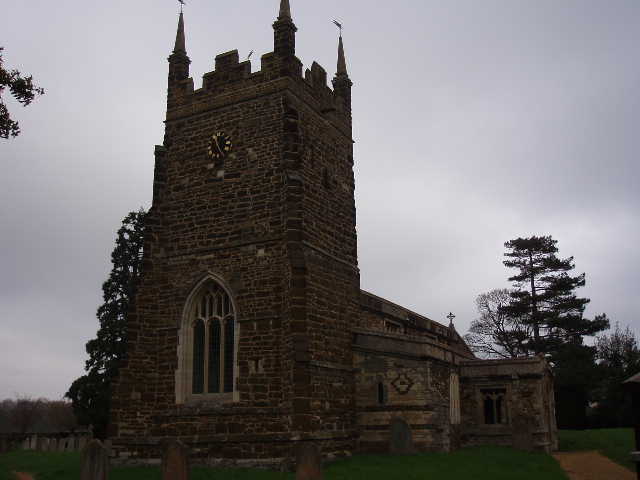
[2]Everton Church
I turned left along the road through the village, and then forked left by the village pub. I stopped to photograph the church [2] – the leaflet said it was late Norman, although I couldn’t really see anything that struck me as Norman (compared to Stewkley church, which I saw on Day 3 of the Cross Bucks Way). From the church, the path followed a long tarmac private drive, leading to some farms and through the parkland of Woodbury Hall. A footpath then continued in the same northerly direction, with views westward to the lower lying ground, passing two more large houses (Old Woodbury, Tetbury Hall) before crossing two meadows to reach a road. Here I turned right and within a few hundred yards reached the hamlet of Gamlingay Cinques (the name is thought to be a corruption of ‘Sinks’ meaning holes dug for water, there is a Woodbury Sinks nearby). I crossed a main road, and within a couple of hundred yards reached the car park at the entrance to the Wildlife Trusts’ Cinques Common nature reserve, the official end point of the Greensand Ridge Walk.
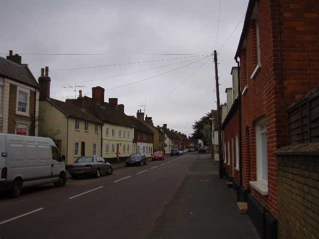
[3]Gamlingay
I decided to carry on and follow the ‘extension’ to the route shown on the leaflet, which took me another 0.7 miles into the village of Gamlingay [3] (in the end I went further than this, as I carried on through the village almost to the church [4]). This was a road walk, but there was a pavement all the way. The part of Gamlingay that the extension went through wasn’t very inspiring, being mainly modern, but I explored on and the old part of the village had some interesting buildings, including a row of Almshouses. According to the leaflet, stone tools have been found here dating to Neolithic times, and the village is unusual in that it has been administered by three Oxford or Cambridge colleges almost continuously since 1599.
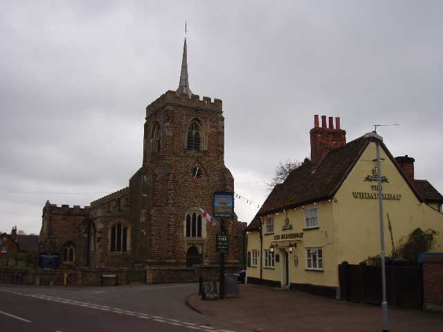
[4]Church and pub in Gamlingay
When I had reached Gamlingay Cinques the skies, which had been grey all morning, looked quite dark and threatened rain, but by the time I’d returned there from Gamlingay the skies had brightened up and there were patches of blue sky visible for the first time. I carried on back towards Sandy. My only problem was that I hadn’t come across anywhere that I could easily stop for lunch (I looked for any benches in the nature reserve but there weren’t any). I had my second ‘Alpen’ bar to keep me going about 1.25pm, and eventually found a bench near the woods on the edge of Sandy, where I had a late lunch about 2.10pm.
I think this was the least interesting of the walks I’ve done on the Greensand Ridge Walk, but that’s not to say it was a bad walk, by any means. Much of it was flat, especially along the Roman Road and then all the way from Everton to Gamlingay. There was only one woodland section, near Sandy at the beginning of the walk. Nor was there too much of historical or other interest on the route. But it was a pleasant enough walk through typical farmland scenery, with a section through parkland as well.
Total Distance: 40.8 miles each way