If you are considering walking this route yourself, please see my disclaimer. You may also like to see these notes about the maps and GPX files.
Walk 20 23/06/08 – Goring and Mapledurham (13.4 miles approximately)
Parked in car park in Goring-on-Thames.
If you are interested in walking this route yourself, click here to see the route description (but only if you have already read my disclaimer and notes regarding route descriptions).
Rather disappointingly it’s been a week since my last walk – the weather has been rather indifferent (or at least the forecast has), and on the one nice day I had something else arranged. It’s been frustrating not being able to get out and finish off the Chiltern Chain Walk, but at least in the end I had an almost perfect day for doing the final walk.
I got up early this morning and set off at 8.15am, about three quarters of an hour before my normal time. Despite being the ‘rush hour’, there was little more traffic than usual on the roads, except at a couple of junctions, so the journey only took two or three minutes longer than I’d expected, and I arrived in Goring at 9.38am.
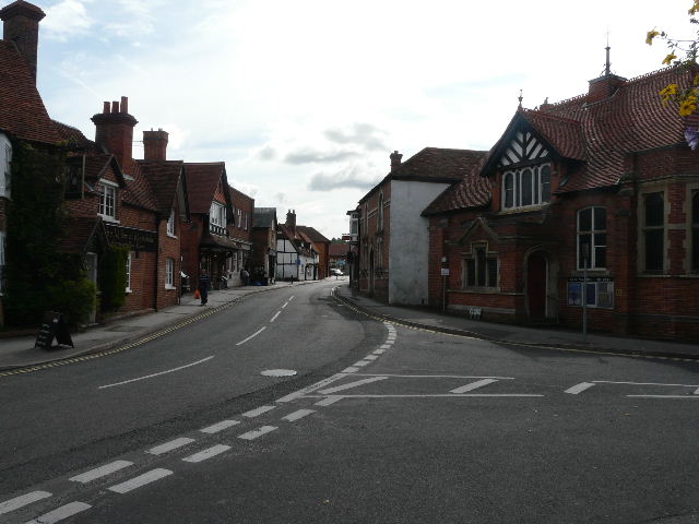
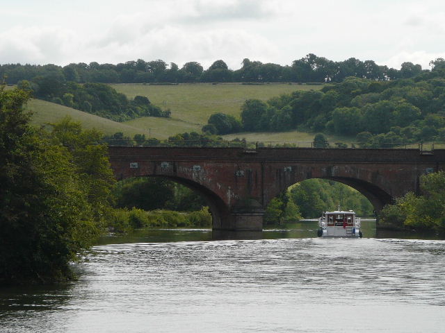
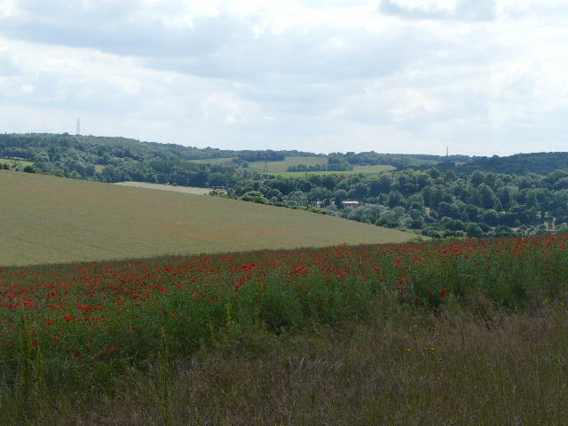
The Oxfordshire village of Goring-on-Thames is situated in the Goring Gap, where the river Thames has carved a route between the Chilterns and the Berkshire Downs. Across the bridge over the Thames here lies Streatley, in Berkshire. Goring is mentioned in the Domesday Book, and the village church dates to the time of the Normans – it was originally dedicated to St Mary, but was later re-dedicated to St Thomas a Becket. Goring Priory, an Augustinian establishment, was founded around 1200 – at the time of the dissolution in 1536, there was only the Prioress and three nuns still in residence.
 |
 |
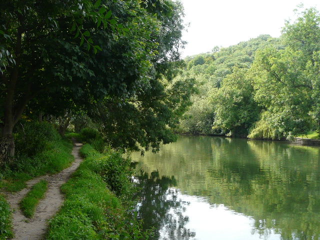 |
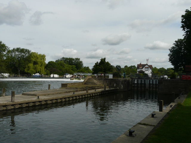
| [1]Goring | [2]Weir and lock on the river Thames, Goring | [3]Path beside the river near Goring |
It was a warm sunny morning as I left the car park, walking down the short alley to the High Street, where I turned left. I followed the road through the village [1] towards the bridge over the Thames (with Streatley beyond, where I started my Berks-Essex walk). Instead of crossing the bridge, I turned left and followed the footpath along the river bank [2]. I passed some narrow boats moored here, and further on exchanged greetings with a fisherman. The path was diverted a few feet away from the river for a short section, because that part of the bank had become unstable. I met one or two dog walkers as I followed the bank, with garden boundaries and then a hedge with a cattle pasture beyond on my left. Across the river, a wooded hillside swept down to the far bank [3] – I was walking through the Goring gap, where the Thames has carved a route between the Chilterns and the Berkshire Downs.
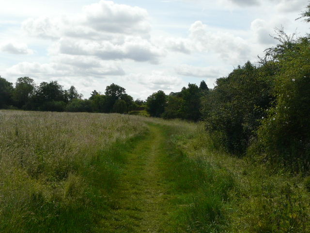
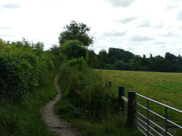
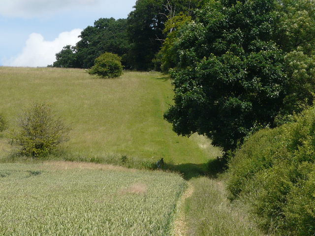
The path continued through two large meadows of tall grass [4], with bushes intermittently between the clear path and the river on my right. The path followed the river as it curved left, and in the second meadow I started to see Brunel’s railway bridge crossing the river ahead of me [5]. The path next went through a smaller meadow which is a nature reserve – unfortunately it was currently almost completely taken over by work on some sort of pipeline. I noticed a World War II pill-box as I passed under the railway bridge, and photographed some Banded Demoiselle damselflies on some nettles. The path was now enclosed by a fence on the left and bushes along the edge of the river on my right. I could see the Chiltern Hills ahead of me, a section close to part of the Chiltern Way between Whitchurch Hill and Goring. The path soon turned left, away from the river, passing between the wooden fences of some paddocks by a farm to reach a junction with a bridleway.
 |
 |
 |
| [4]Path through a riverside meadow, near Goring | [5]Brunel's railway bridge, near Goring | [6]The start of the long bridleway to Whitchurch-on-Thames |
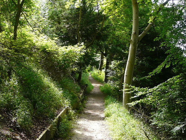
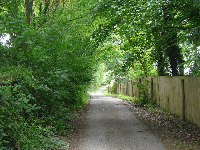
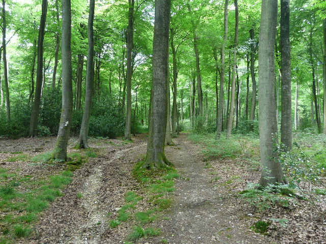
I turned right on to the bridleway [6], which I’d be following for a couple of miles. At first it ran between fences and hedges, the fields on the left sloping steeply uphill. There then came a very pleasant and lengthy section through a wood, the trees on my right sloping steeply down a bank towards the river [7]. I passed at least one section of Yew trees along here, and came upon some Greater Celandine – this is the only spot where I’ve seen this flower so far, I first saw it here a couple of months ago. I spotted another pill-box down to my right, and had occasional glimpses down to the Thames [8].
 |
 |
 |
| [7]The bridleway running through the riverside wood | [8]View of the Thames from the bridleway | [9]The bridleway just beyond the wood |
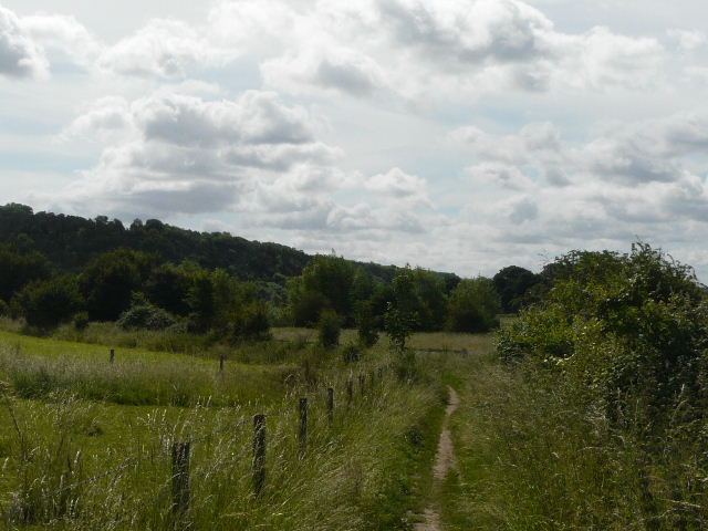
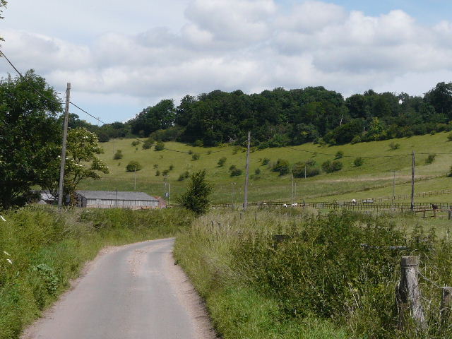
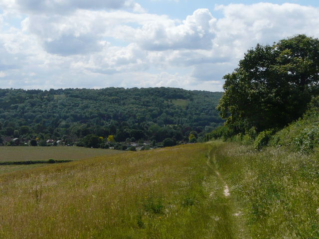
The bridleway emerged from the wood after about three-quarters of a mile, and continued between hedgerows with pastures or meadows either side [9]. There were some Meadow Brown butterflies here and also a Ringlet, the first time I’d seen either of them this year. I also saw some Great Mullein growing here, another first for the year. The bridleway descended a small hollow and rose up the other side on a flight of wooden steps. At the top it joined a tarmac drive, continuing in the same direction and still parallel to the river, which was now out of view, somewhere down to my right. I followed the drive for about half a mile [10], passing a cattle pasture and then some paddocks on the left and occasional houses on the right. Just before the drive reached a road on the edge of Whitchurch-on-Thames, I managed to photograph a Meadow Brown butterfly.
I followed the road to the right, being careful as it was very narrow at this point. I then turned left, and within quarter of mile had left the village behind. I followed a path on the left of a lane at first, the path being a ‘green tunnel’ between hedges. When the path ended I continued along the lane, there being a wide verge on the right. There were large numbers of Alpacas in the fields on the right, and I passed near the entry to the farm where some people were working amongst these charming animals. More Meadow Browns flew up as I walked along the grassy verge, and I saw some Agrimony and Common Mallow growing beside the lane [11].
 |
 |
 |
| [10] The drive leading to Whitchurch-on-Thames | [11]The lane from Whitchurch-on-Thames | [12]View from the drive to Hardwick House |
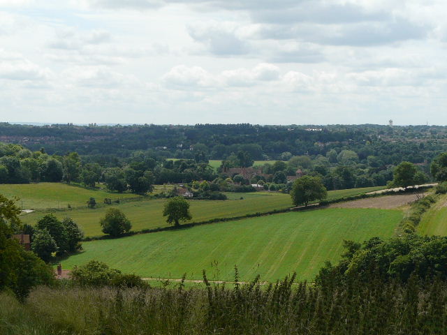
After about ¾ of a mile the lane turned sharply left, but I continued straight on, following a bridleway along the drive to Hardwick House (a large manor house I occasionally glimpsed in trees ahead of me, not to be confused with Hardwick Hall in Derbyshire!). On both sides of the drive were paddocks, and it was an attractive view across those on the right towards the river [12]. I passed stables on the left, and then the drive continued between hedgerows. Near the grand house it split into three, where the bridleway continued on the leftmost track. A short distance along here I came upon a JCB that was resurfacing the track with broken asphalt. The track ended at a lodge house on the far side of the estate, but the bridleway continued, now a narrow track between hedges [13]. There was a steep hillside now rising on my left, and again I occasionally had views towards the river on my right with Purley-on-Thames visible beyond the far bank. There was some Common Toadflax growing beside the bridleway, some more Common Mallow and a lot of St John’s Wort of some kind. When the bridleway ended at a lane, I took a quick detour to visit the charming village of Mapledurham [14,15], ¼ mile to the right.
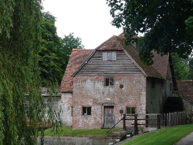
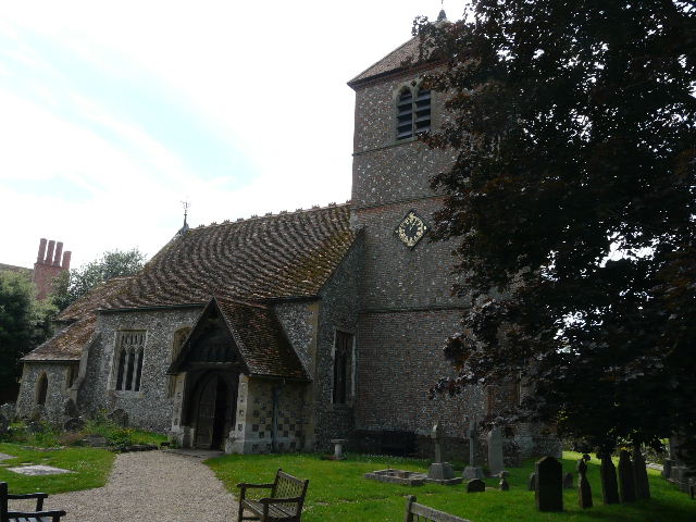
The whole village of Mapledurham still belongs to the Mapledurham estate, which has not allowed any new development for over a hundred years, which is one reason why the village retains its old-world charm. The idyllic and isolated riverside setting also adds to its attractions. Mapledurham House has been the home of the Blount family and their descendants since 1490. Part of the house is fifteenth-century, but most of it is built of red-brick dating from 1585-1588, with nineteenth-century alterations. The house was visited by Elizabeth I, and is mentioned in John Galsworthy’s “Forsyte Saga” (it is Soames Forsyte’s home). St Margaret’s church dates back to the late 13th century, and contains a private Roman Catholic chapel belonging to the Blounts. The watermill here is the oldest one on the river Thames, and the only one to still be working (my parents’ neighbour Tony was brought up in the village, and remembers taking corn to the mill to be ground into flour). There was a mill here at the time of the Domesday Book, but most of the current mill dates from the fifteenth century, with additions in the 1670’s and around 1700. The mill features in the 1976 film “The eagle has landed” and on the cover of a Black Sabbath album. The village also has almshouses (now converted into two cottages) that date from 1613.
 |
 |
 |
| [13]The bridleway heading towards Mapledurham | [14]The watermill at Mapledurham | [15]Mapledurham church |
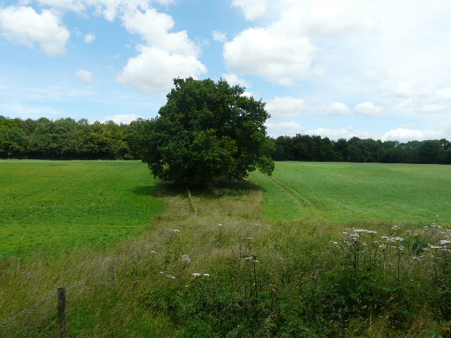
From where the bridleway ended, the Chiltern Chain Walk went left along the lane. There were two or three Red Kites here. After a few hundred yards the lane [16] turned right, while I continued ahead on a drive to a farm, passing some paddocks on my right. I passed the farm and some cottages, then turned right on to a footpath. This followed the right edge of a corn field, where I saw my first Scarlet Pimpernel of the year. I also saw a Marbled White butterfly. The path went over a stile and rose steeply uphill through a large meadow [17], following a hedge on the right. I kept stopping here to take photos [18] – not because of the steepness (honest!) but because of the wildflowers. I saw a good example of Yellow-wort, some Lady’s Bedstraw (another first for the year) and some Pyramidal Orchids (I see these often when I look for wildflowers at Ivinghoe Beacon or Totternhoe, but seldom see them on my walks). And I saw a flower that was new to me, which I later identified as Vervain.
 |
 |
 |
| [16]The lane from Mapledurham | [17] The path from Mapledurham | [18]Looking back at Mapledurham in the Thames Valley |
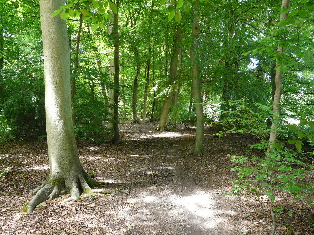
I surpassed myself today by managing to go wrong no less than four times! And this on a route I’d walked before, in both directions! My first mistake came at the top of the hill, where I was so intent on looking at the flowers (that’s my excuse and I’m sticking to it!) that I went a few yards past the stile on the right before realising my mistake. Once over the stile I followed a farm track to the left, passing the ancient Whittles Farm and reaching a minor road. I took the footpath starting on the other side [19], which followed a fence on the left through a mown meadow. Here I went wrong again, mistakenly thinking (remembering my previous two walks here!) that the path went to the right of some long grass around some mature trees. On reaching the corner of the field, I had to back track and cross the long grass to find a faint path right beside the fence. This went through a metal kissing-gate into Nuney Wood, the start of a three-mile section of almost continuous woodland walking. After a few yards, I stopped to eat my lunch on a tree trunk beside the path – it was quarter of an hour earlier than my usual 1pm stop, but then I had had my breakfast half an hour early.
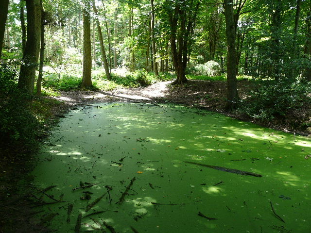
I continued through the wood, and then the path ran between gardens in the small and isolated hamlet of Nuney Green. It ended at a wooden gate, beyond which I turned left on a track through the hamlet, passing a few old thatched cottages with attractive gardens. Where the track ended at the entrance to one such cottage, a bridleway continued between garden hedges and then entered another section of wood. It soon went between two small ponds, the one on the left covered in green slime [20]. It continued straight on through the trees when another path crossed – the trees here where now mainly beech, and soon there were fields just a few yards to my right [21]. After a few hundred yards I reached Deadman’s Lane, which my previous walk had followed to the right [22].
 |
 |
 |
| [19] The start of the path to Nuney Green | [20] Pond near Nuney Green | [21]The bridleway to Deadman's Lane |
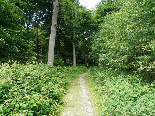
I crossed over and continued along the bridleway through the wood on the other side, retracing my steps of last Monday. The wood here was again mainly beech, with lots of holly bushes. After about a quarter of a mile I came to a junction, where I followed the bridleway as it turned left, slightly downhill. It soon came to another junction, where the bridleway went right on a wide track. A path soon went off to the left, but I stayed on the bridleway [23] and reached a fork where the bridleway went right - as usual, there were white arrows with a blue dash below the arrowhead to denote the route of the bridleway. A short distance further on I came to a crossroads of bridleways – Walk 19 came in from my right at this point, but today I went straight on. The bridleway became a little less distinct as it continued through the beech trees here, but the arrows still kept me going in the right direction.
 |
 |
 |
| [22]Deadman's Lane | [23]The bridleway beyond Deadman's Lane | [24]Field of Opium Poppies |
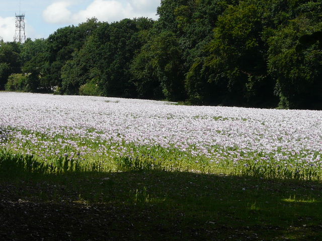
After a few hundred yards I came to another bridleway crossroads, where there was a field ahead and to my right, containing some sort of pink/purple flowers [24]. I checked my photos later and decided the flowers were Opium Poppies! An entry on Wikipedia on the web mentioned that the British government had licensed a firm to grow them near Didcot for medicinal purposes – as Didcot isn’t too far away, I assume this field is part of the same project.
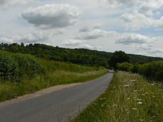
I turned left at the crossroads, following an old boundary between two woods on my right. I reached a more open area, where a crossing path ran through some tall bracken, and continued on through the wood to reach a minor road. I continued on the other side, now in Oaken Wood. After about a quarter of a mile, I reached a junction where I managed to go wrong for a third time. I knew I had to turn right, and started off down an obvious forestry track. But I’d only gone about a hundred yards before doubts crept in as to whether this was the correct way or not – I couldn’t see any white arrows on trees, but then that could have been because the trees here had recently been felled! I checked my map, and realised from the contours that I was on the wrong side of a very shallow depression. I went back, and soon found that I should have turned right just a few yards before the forestry track – the path was very feint and the wide forestry track was so close by it was an (almost) understandable mistake.
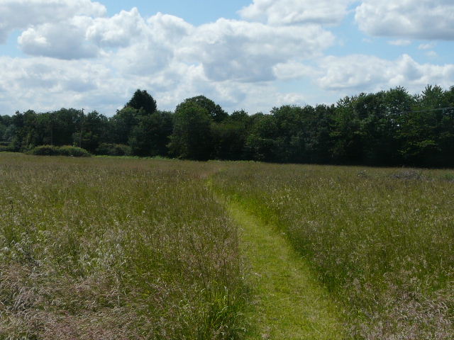
I followed the path through the trees, soon crossing over a wooden stile in a wire fence. A little further on [25] I came to a path junction where I turned left. After a short distance this went through a gate in a boundary fence, and a little later it crossed a muddy track or drive. Not much further on I reached a road, which the path followed to the right for a few yards before I crossed to the other side, finally leaving the woods. A footpath started here, going diagonally across a school playing field although I chose to walk round the edges of it. In the far corner a path had been cut across the neighbouring area of tall grass [26], continuing in the same direction to reach a minor road just south of Cray’s Pond. I went left for just a few yards and then turned right onto a bridleway that began along a tarmac drive.
 |
 |
 |
| [25]Bridleway heading towards Cray's Pond | [26]Path beyond the Playing Field, near Cray's Pond | [27]The path through Great Chalk Wood |
I soon passed a few cottages in Blackbird’s Bottom, the bridleway then continuing through a wood (where I saw some Honeysuckle) to reach Bottom Farm. The drive ended here, but the bridleway continued, initially between hedges with fields sloping gently up on either side and then with a wood on the left. The section beside the wood seemed to go on for longer than I remembered, and I stopped to check the map (which showed that it went on for about half a mile). When I then came to a junction, I made my fourth mistake of the day. The map showed a three-way junction, but in fact there were four paths i.e. a crossroads. My notes for this walk said to go left, so I did. The path went uphill gently, and I soon came to a junction. I realised this was wrong, as I went right and soon came to another junction – I recognised the path here as part of the Chiltern Way, but I knew I should have come out at a junction with it a little to my right. I followed the path to that junction, and instead of following the Chiltern Way to the left, went right to see where I’d gone wrong. Within a hundred yards, I was back at the path crossroads, where I should have gone straight on, not left! Oh well, at least I had the pleasure of seeing no less than 15 Common Spotted Orchids on my little diversion!
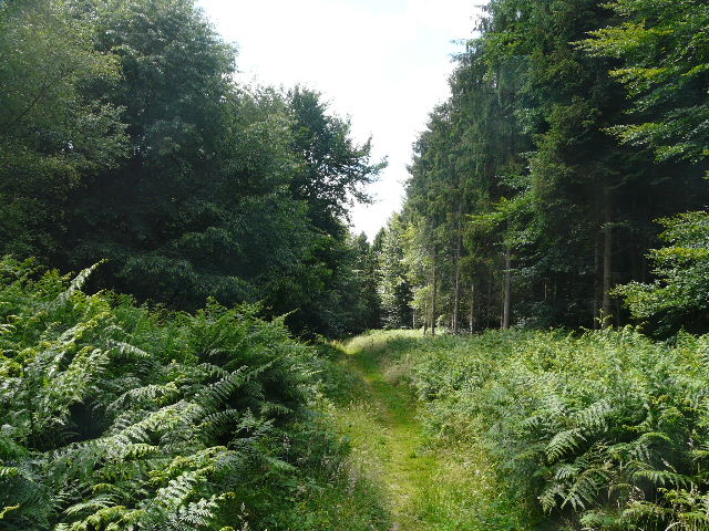
Back on the correct route (but feeling very annoyed with myself for having gone wrong so often!), I followed the Chiltern Way through Great Chalk Wood. Yes, that’s right – the infamous Great Chalk Wood where I managed to go round in a complete circle when I first went through here on the Chiltern Way in 2005! I had then missed a turning (I was obviously lost in a daydream) and ended up back at the point where I first entered the wood! I also managed to miss a turning here when I did this walk in the reverse direction a couple of months ago! Somehow, Great Chalk Wood and I just don’t seem to get along – no idea why, it seems a perfectly nice and innocuous bit of mixed woodland. Anyway, I kept right at a couple of forks and safely made my way [27] to the correct exit from the wood (where I saw a Speckled Wood butterfly).
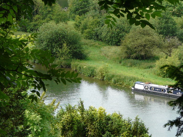
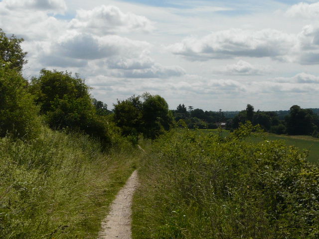
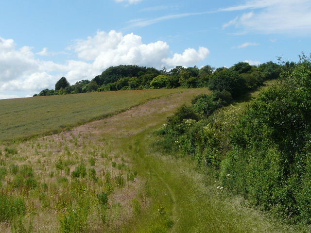
The path now followed a hedge on the right [28], heading quite steeply uphill with a wide band of fallow ground between the path and the corn in the field. There were again plenty of wildflowers to give me an excuse to stop as I puffed uphill – including Weld, Wild Mignonette and the first Dark Mullein I’ve seen this year. At the top of the slope the path turned left along the top of the same field – there were large numbers of Poppies in the corn [29]. Soon there was a cemetery behind the hedge on my right. The path continued on into a second field, where there was again a broad band of uncultivated ground to the left of the path, containing a lot of St John’s Wort amongst other plants. There were some more Pyramidal Orchids beside the path, too. This was a very pleasant section of the walk, as the path gently descended beside the hedgerow [30], with nice views ahead of me over the river Thames in the Goring Gap where my walk had started.
 |
 |
 |
| [28]The path beyond Great Chalk Wood | [29]View towards the Thames Valley | [30] The path heading back to Goring |
At the end of the field, the path crossed a playing field on the edge of Goring. I followed a modern residential street, which turned left and right. At its end I turned left for a few yards to reach a T-junction by a pub, where I turned right, parallel to the railway lane. I soon came to another junction, where I turned left and crossed a bridge over the railway. I followed the road the short distance into the village centre, and reached the alley leading back to the car park. And so ended my walk on the Chiltern Chain Walk!
It had taken me about 5½ hours to walk the 13.4 miles, a very slow rate but easily explained by the detour into Mapledurham and by the large number of photos I’d taken - I’d certainly wasted several minutes in a number of generally unsuccessful attempts to photograph butterflies. I’d been exceptionally fortunate with the weather – although the sun had hidden behind clouds occasionally, it had generally been a pleasantly sunny day with the temperature around 20C, just about perfect for walking.
I was still annoyed with myself for going wrong so often, but that didn’t detract from the fact that it had been a smashing walk. I had first done this walk about six months ago as one of my exploratory walks when trying to devise the route of the Chiltern Chain Walk. It was so good, I immediately decided to keep it exactly as it was as the final stage of the route. It’s definitely a walk of two halves. The first half is surprisingly varied as it follows the Thames from Goring to Mapledurham, then the return half is almost entirely through woodland, with just the final stretch through fields giving good views over the Thames as you get back to Goring. I think it’s an excellent walk with which to finish the Chiltern Chain Walk – and today I had the extra bonus of seeing numerous butterflies and wildflowers for the first time this year.
Total distance: 238.9 miles
To see this walk repeated IN THE OPPOSITE DIRECTION on 16/06/12, CLICK HERE.