Pete's Walks - Berkshire Loop
If you are considering walking this route yourself, please see my disclaimer. You may also like to see these notes about the maps and GPX files.
Day 1 10/11/10 Coppice Hoop to Cookham (6.9 miles each way, approximately)
Parked on road in Holtspur, on the route of the walk.
As the eastern end of the Berkshire Loop splits away from the Chiltern Way in the middle of the countryside, I chose to park in the village of Holtspur (adjoining Beaconsfield) and first follow the Berkshire Loop back to its start, on the edge of a wood called Coppice Hoop near Penn. It had been only 1C as I'd left home this morning, but my car had been frost-free. I'd used the motorway route (M1, M25, M40) to reach Beaconsfield, and there'd been a small holdup on the M25, so it was shortly after 10am when I started walking, and almost 11am when I reached the wood called Coppice Hoop. It was a bright sunny morning, and in the afternoon I wouldn't see a cloud in the sky.
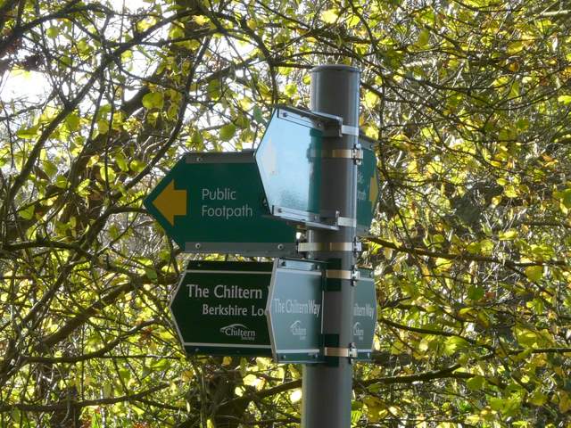
[1] Sign at the start of the walk
[2] The start of the walk
[3] The path from Lude Farm
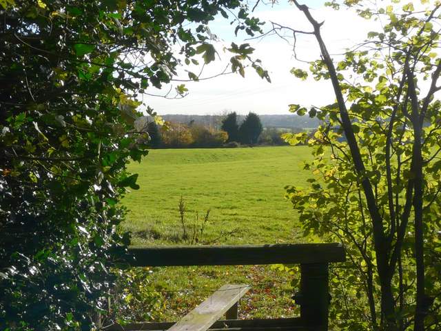
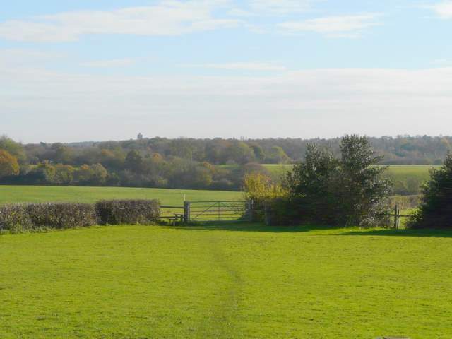
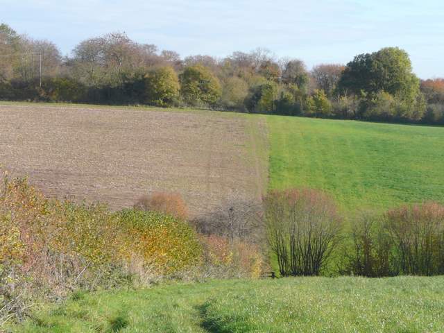
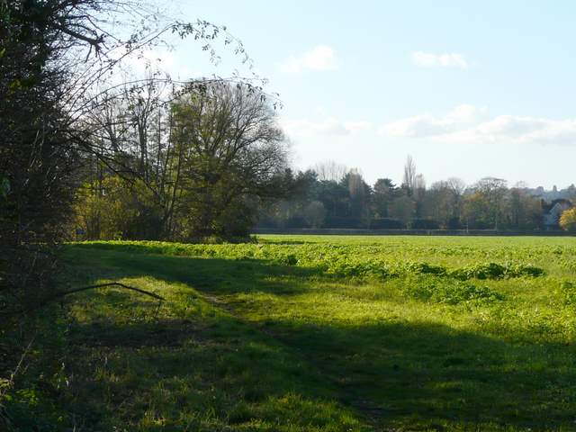
The Berkshire Loop starts at a stile immediately after the Chiltern Way leaves the wood - a three-fingered Chiltern Way sign post indicated the spot [1,2], and I would find that the newly opened route was well waymarked throughout. I crossed a grassy meadow [3] to a lane beside Lude Farm, and then took a path starting opposite the farm. This crossed a smaller meadow to a stile, then turned right along a hedgerow. In the field corner I turned left, now with a hedge on my left as the path descended into a small valley [4]. The path rose up the other side of the valley, the path dividing the field here between a ploughed area on my left and more lush grass on my right. Beyond a small area of woodland, the path started descending into another small valley [5]. I'd been surprised to see a Comma butterfly here earlier, and I now unwittingly startled a horse in the field behind the hedge on my left.
[4] Path from Lude Farm
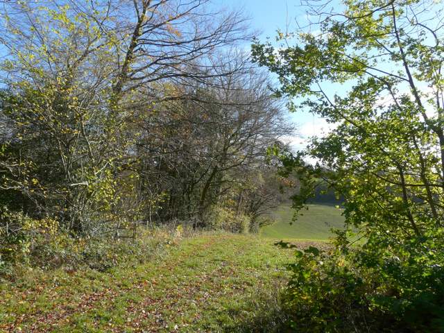
[5] The path from Lude Farm
[6] Approaching Forty Green
The path then went up the opposite slope of the valley, through some rather rough paddocks separated by fences. This up-and -down start to the walk so far reminded me that parts of the Chilterns resemble a giant sheet of corrugated iron, with parallel hills and valleys one after the other. The path was fairly clear through the damp grass as I crossed a couple of stiles [6] and went through a final paddock to reach a lane on the edge of the hamlet of Forty Green. The paddocks had had several old fruit trees in them, and the guide book mentions that this was once a centre for fruit-growing, especially cherries. I totally forgot to go a short-distance left to look at the ancient pub mentioned in the guide book (The Royal Standard of England), but I did recall the book mentioning that this hamlet was the childhood home of Sir Terry Pratchett, author of the highly popular and very amusing Discworld series of novels.
I went a few yards right along the lane into the hamlet, then turned right into Riding Lane, an unsurfaced track between hedgerows. So far I'd been heading east, but was now going south, the direction I'd generally be going until I reached Cookham. I was soon descending slowly back into the valley I'd just left [7], then the long track started following the valley bottom as it curved slowly left [8]. The tall hedgerows either side prevented any views, but there were mainly meadows or paddocks either side as far as I could tell. I passed a junction where a similar hedge-lined track went right, and a little further on I passed an equestrian centre on my left, immediately before the track went under a very tall brick-built railway arch.
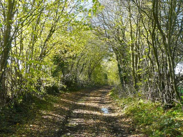
[7] Riding Lane
[8] Riding Lane
[9] The path to Holtspur, beside the nature reserve
At a sharp left bend, the track became a surfaced lane, and after a few more yards I turned off it, taking a path on my right [9]. This climbed steeply uphill, with the Holtspur Bank nature reserve on my right, and a very pleasant view along a green valley on my left [10]. Towards the top of the hill I passed through an area of scrubby bushes, and then reached a road junction on the edge of Holtspur.
I took the residential street opposite me [11], soon passing my parked car. Beyond the grounds of a school on my right, I turned right along a tarmac path, passing some garages and then following the left edge of a playing field. I crossed another village street between a parade of shops and the modern-looking St Thomas's church [12]. The path continued ahead a short distance past more houses, then I crossed a small strip of grass to reach the A40 at a junction. Having carefully crossed over (it was OK now, but a bit of a pain when I came back in the afternoon when the road was much busier), I took the road opposite which immediately crossed over the M40 motorway.
[10] View north from the path to Holtspur
[11] Holtspur
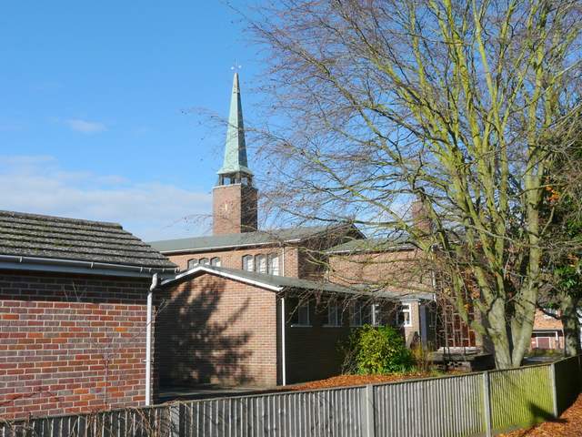
[12] Modern church in Holtspur
A flight of steps on the right was the start of a path parallel to the motorway, with a cemetery behind the hedge on my left. As the path turned left to follow another side of the cemetery, I spotted a Long-tailed Tit in a bush - on my way back in the afternoon I would see a Red Kite over the playing fields that were now on my right. At the corner of the playing fields the path turned right, still enclosed between a hedge on my left and the fence of the playing fields [13]. After two or three hundred yards, I reached a path junction and turned left, my path now crossing a large arable field to reach Mill Wood.
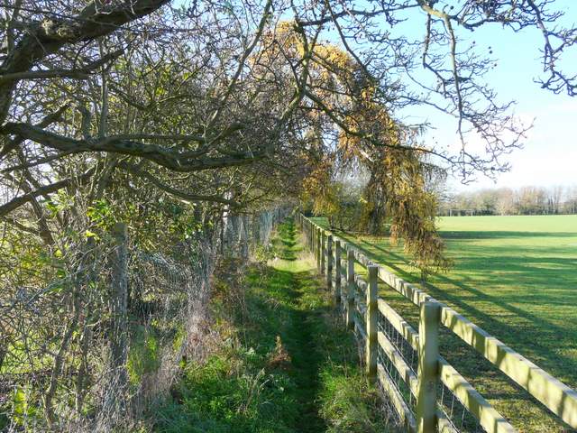
[13] The path beside the playing fields
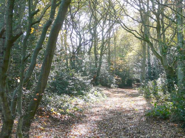
[14] Path in Mill Wood
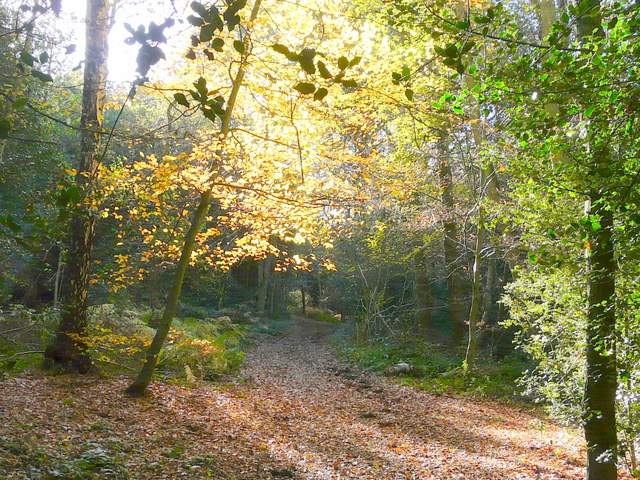
[15] Path in Mill Wood
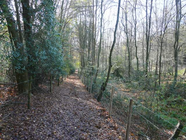
I spotted a couple more Long-tailed Tits shortly after I entered the wood. The path remained fairly straight and level [14] as it passed through the wood for a distance of about two-thirds of a mile. Occasional shafts of sunlight lit up the autumnal colours [15], but the dense understory of holly made the path rather gloomy in places. It was also occasionally very muddy, after recent rains. The path ran along the edge of the wood beside fields briefly, and I heard a Red Kite overhead.
I eventually emerged from the woods at a road junction at the top of Wooburn Hill. A path continued in the same direction on the other side of the junction, running between a fence and the hedge bordering a small private housing estate on my right. The sun was almost directly ahead of me, making photography tricky as it was for much of this walk. After a few hundred yards the path emerged into the very attractive hamlet of Berghers Hill, full of brick cottages and old houses [16].
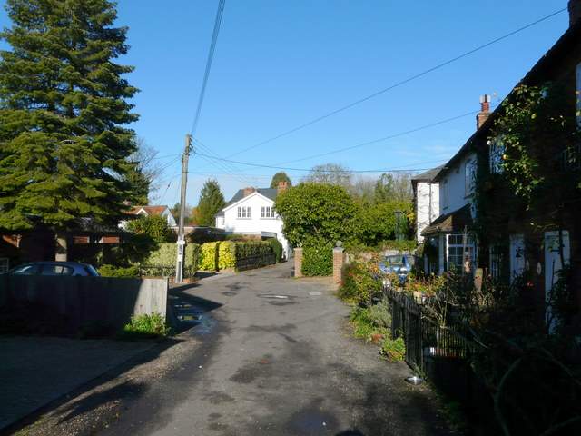
[16] Berghars Hill
[17] The path in Farm Wood
[18] The path in Farm Wood
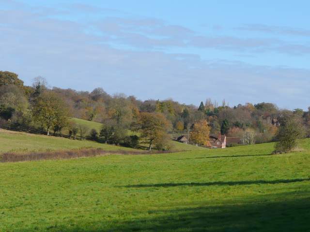
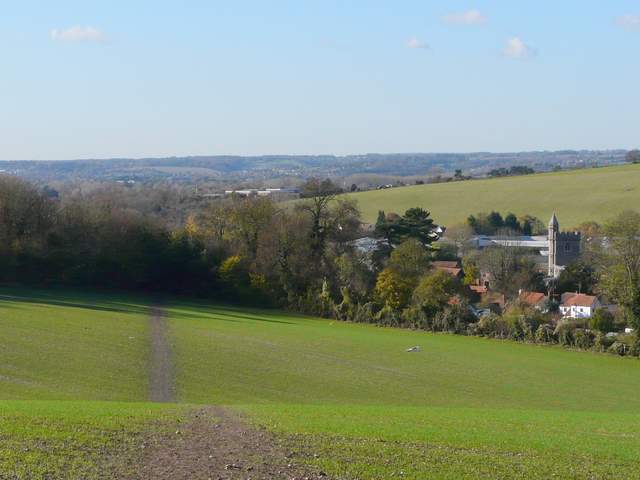
A path soon took me left, past the corner of a house and into Farm Wood. The path descended steadily down through the trees [17,18], this wood being more open and therefore more attractive (in my eyes) than Mill Wood had been. Beyond the wood, the path continued less steeply across a huge arable field, with views ahead over Wooburn towards the Thames Valley [19], and to my right along the valley of the river Wye towards Wooburn Green and Loudwater. I had a close encounter with another Red Kite as I crossed this field on my way back in the afternoon. Over yet another stile, I turned right for a few yards along a green lane, to reach Wash Hill on the edge of Wooburn.
I turned left along a lane. Beyond the last house a path started on the left, soon rising uphill across a very large grass field, again with good views of the Thames valley and back to Wooburn and the Wye Valley [20,21]. The path entered a small wood, and then crossed another meadow to reach a lane on the edge of Hedsor near the Chequers pub. I turned left along the lane for a short distance (coming back later I had to keep pressing into the hedge as there was a surprising number of cars coming the other way) before turning right through part of the village.
[19] View over Wooburn to the Thames Valley, from just beyond Farm Wood
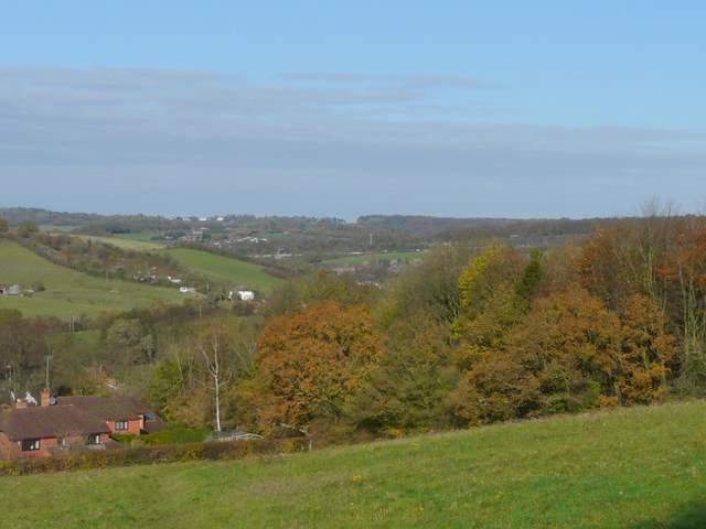
[20] Looking back over Wash Hill to the Wye Valley
[21] Looking back to Wooburn
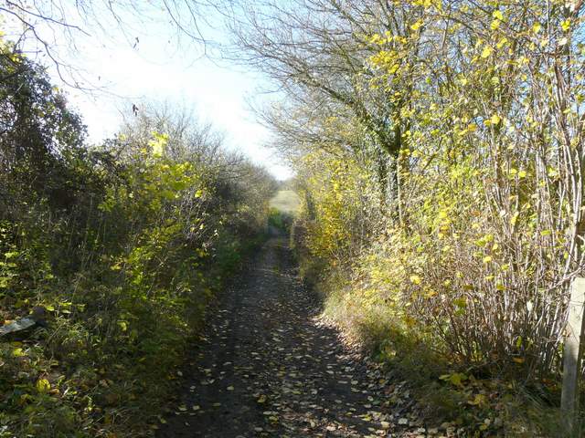
After a couple of hundred yards or so I went left into a narrow lane [22]. A few hundred yards further I reached the corner of Woolman's Wood on my right. As I took a path leading into the wood, I joined the route of The Beeches Way which I walked last summer - I would now be sharing its route as far as Cookham. The path ran for some distance through the wood, gradually going downhill between fences [23]. At the bottom of the hill I reached a private drive, with Hedsor church on a hill ahead of me and Lord Boston's Folly [24] on the hill to my right (on my return in the afternoon I climbed the steep hillside to have a look at the church).
[22] The lane out of Hedsor
[23] Path through Woolman's Wood
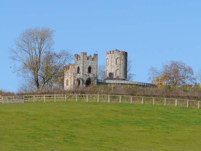
[24] Lord Boston's Folly
At the end of the drive, I crossed a minor road and followed a path through some large houses. Beyond a bridge over a waterway, I reached a large field - this had had cattle in it when I walked Beeches Way, but now had a crop of some type of vegetable. The path followed the left edge of the field for a while, beside a branch of the Thames [25], then headed across the field to a distant gate and stile by a road. I turned left, and crossed the blue iron bridge over the Thames to reach Cookham (and Berkshire, the route so far having been in Buckinghamshire).
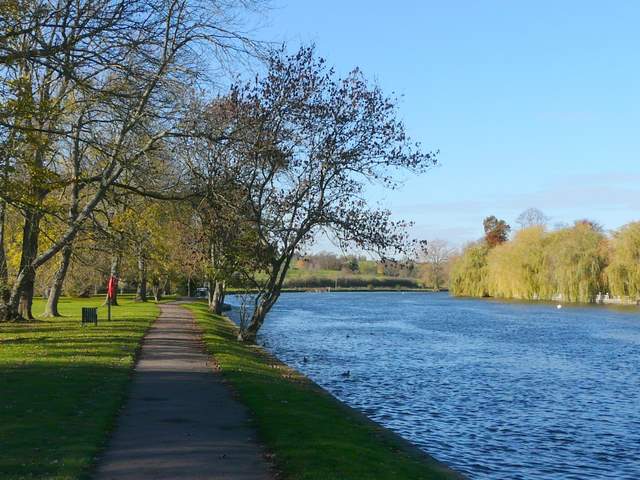
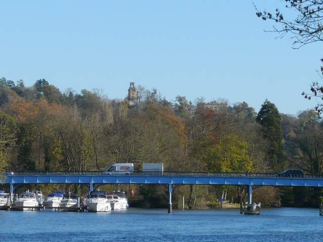
Across the bridge I had to take a path on the left that went round all four sides of The Ferry pub to then pass under the bridge and continue along the river bank. The river here was very attractive [26], with willow trees screening the large houses on the other bank. I walked a few hundred yards alongside the river until a path came in from the left - this came from near the village car park that I'll use for the next stage of the walk, so this made a good turn around point for this walk. I stopped here on a bench to eat my packed lunch (it was now around 1.25pm) and enjoyed the riverside views - to my left I could just see the top of the grand house of Cliveden [27], now an upmarket hotel.
[25] The large river-side field just before Cookham bridge
[26] The Thames at Cookham
[27] Looking back over Cookham bridge - Cliveden is just visible over the treetops
I'd been suffering from a cold for a few days (which had stopped me walking earlier this week, which I've taken as a holiday - very frustrating!) and I think this was the reason why I struggled a bit today. I felt more tired by the time I got back to my car at Holtspur than I should have done after a 13.5 mile walk, and it had taken about five hours which was rather slow. But it had been quite an up and down route, so perhaps that played a part too. It had certainly been a very pleasant walk in the bright November sunshine, and I'm looking forward to the next section, my first walk wholly in Berkshire.