Pete's Walks - The Chiltern Chain Walk, Walk 13
If you are considering walking this route yourself, please see my disclaimer. You may also like to see these notes about the maps and GPX files.
Google map of the walkDownload GPX file of the walk
Walk 13 29/05/08 – Bledlow Ridge and Lacey Green (13.4 miles approximately)
Parked in side street in Bledlow Ridge.
If you are interested in walking this route yourself, click here to see the route description (but only if you have already read my disclaimer and notes regarding route descriptions).
Note: Unfortunately I managed to somehow lose the photos for the first part of this walk (as far as Bradenham), so I have had to use some photos taken on some of my exploratory walks (15/2/08, 18/10/07). I have added the date when the photos were taken to show where this is the case.
Bledlow Ridge is a long linear village straddling the road between West Wycombe and Chinnor, situated at a high elevation along the hill of the same name. Originally a hamlet in the parish of Bledlow, it only became a separate parish in 1868, when the chapel of St Paul was built. It is now a haven for London executives and others of the wealthier social classes. It once boasted an impressive windmill, a post-mill built in 1820. This was allowed to decay during the early part of the 20th century and was eventually demolished.
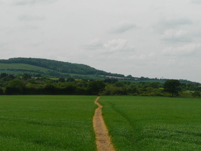
I started the walk just after 10am – it was a really nice sunny morning and surprisingly warm. I started off down a footpath going east from the main road through Bledlow Ridge (it starts opposite a property named Capel House), passing between garden fences and then between the fences of some small meadows. Straight away there were Red Kites over the meadow on my right – I always see them close to Bledlow Ridge, in fact I’d been slightly disappointed I’d not seen one as I walked along the main road. I went over a stile into a large empty sheep pasture that sloped steeply downhill – the path goes right here, gradually moving further away from a fence, and then following the edge of the field downhill. Over another stile, I continued downhill beside the right-hand hedge of another empty pasture, with the broad Saunderton Valley ahead of me.
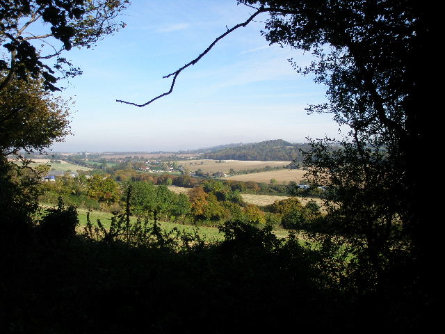
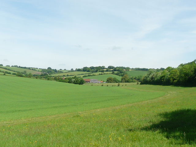
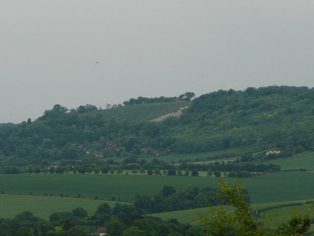
[1] View across the Saunderton Valley and towards the Vale of Aylesbury, from near the top of Slough Hill - photo taken 18/10/07.
I stopped when I reached the next field, in the valley bottom, and despite the warmth donned my waterproof overtrousers. There has been a lot of rain over the four or five days since my last walk, and I could see the corn in the field was very wet. I didn’t want my trousers getting wet, as the dampness can then get through to my socks, leading to blisters. On the far side of the corn field, I turned right along a bridleway on a surfaced track or drive. I soon came to a minor road, where I turned left. I went up and down a small dip (where there was a large puddle across two thirds of the road). I then turned right onto a footpath, which ran along the right edge of three small meadows or pastures, gently rising up Slough Hill. There was a lot of Silverweed growing here, and several small blue patches of Germander Speedwell.
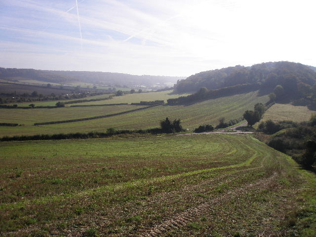
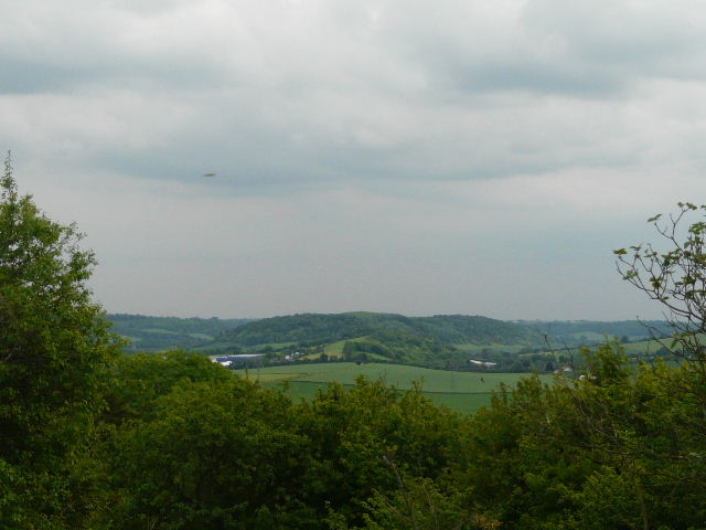
[2] View along the Saunderton Valley and towards Allnut's Wood (right), from near the top of Slough Hill - photo taken 18/10/07.
[3] View back towards Bledlow Ridge from the drive leading to Allnut's Wood - photo taken 18/10/07.
[4]Looking across the valley towards Bradenham - photo taken 15/02/08
Near the top of the small hill, the path went over a stile and continued just inside a wood for a while [1], before emerging to follow the edge of a field down the far side of the hill to a lane [2]. My route now continued along a tarmac farm drive opposite, running between hedges and soon rising quite steeply up another hill (slightly bigger than Slough Hill, but not named on the map) [3]. Near the top of the slope it reached Allnutt’s Wood, and I soon took a footpath forking half-left through the trees. This was a very pleasant woodland path, marked by white arrows, which very gently descended to a gate on the far side. The path continued descending gently, now across a steep hillside covered in scrub [4]. Near the bottom of the hill I reached a hedgerow which I followed to the right. The path soon switched to the other side of the hedge, and then entered a small meadow. Here I turned left and went under a railway bridge (I just missed being ‘run over’ by a train, one passing by just after I emerged from under the bridge). I then went slightly left across another meadow, and crossed over the main road through the valley (from Princes Risborough to High Wycombe, some miles to my right). I went a few yards to my right, then turned left by the Red Lion pub to reach Bradenham [5].
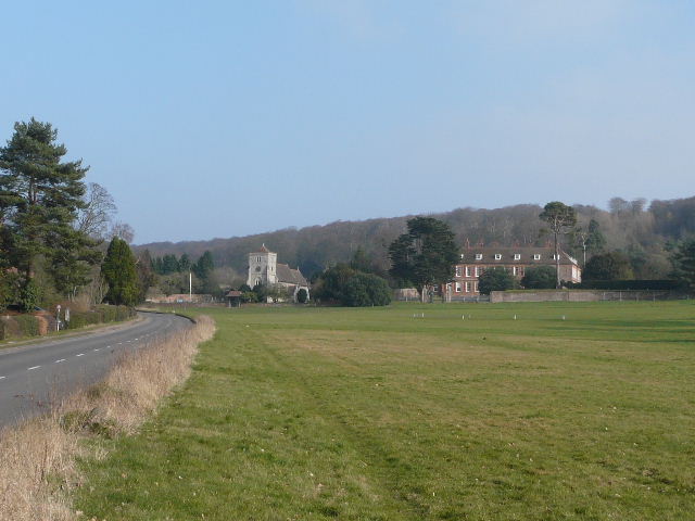
[5]The green, church and manor house at Bradenham - photo taken 15/02/08
Bradenham is very attractive, set in a broad Chiltern valley with the church and manor house at the eastern end of the large sloping green presiding over the rest of the village, with a backdrop of steep wooded slopes. The village dates back to Saxon times, and appears in the Domesday Book. The earliest part of the church is the nave which dates to about 1100, much of the rest dating to the 1300’s. The north chapel was added in 1542 and the new chancel in 1863. The mediaeval tower contains two of the oldest bells in England, cast about 1300 (they were possibly not originally here, but bought from another church). William. 2nd Lord Windsor, built the original manor house here, and his son and heir Edward entertained Elizabeth I when she stayed overnight at Bradenham in 1566 on her return from visiting Oxford University (having stayed at Great Hampden the previous night). During part of the nineteenth century ownership of the estate was in dispute, and in this time it was leased to tenants, one of whom was Isaac Disraeli the father of Benjamin Disraeli (who would later live at nearby Hughenden Manor). The estate is now owned by the National Trust, but the manor house is rented out and is not open to the public.
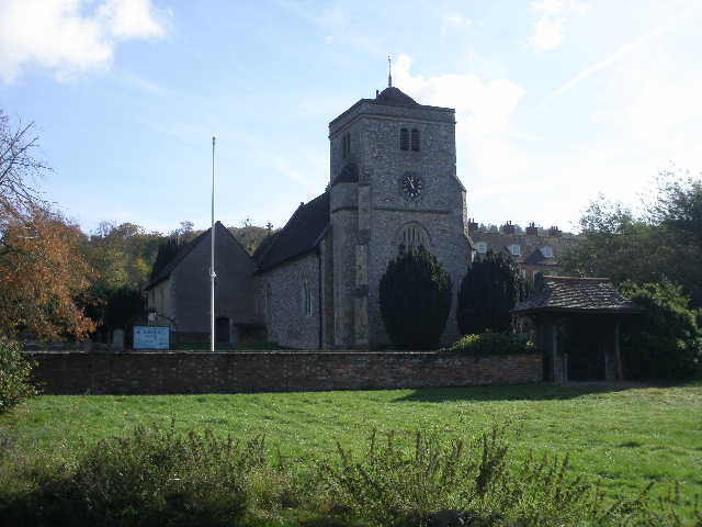
[6]Bradenham church - photo taken 15/02/08
I followed the road into the village, soon having the very large green to my right. Across the green ahead of me, I could see the church and the manor house. By the cricket pitch in front of them, a lady was training her Alsatian in obedience. Just after passing the church [6], I turned left along a short track and went through gates either side of a narrow pasture. The path now continued along a field boundary on my left, with a view ahead of bright yellow meadows rising to woods topping the hillside to my right (I’m really annoyed I lost the photos I took here!). Ahead and to my left, I could see the small eminence of Lodge Hill rising from the Saunderton Valley, where I’d be walking this afternoon.
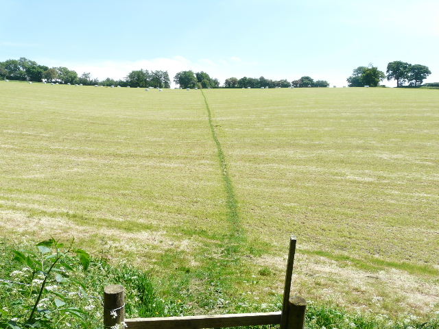
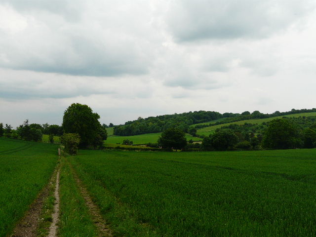
[7] The path heading towards Park Wood
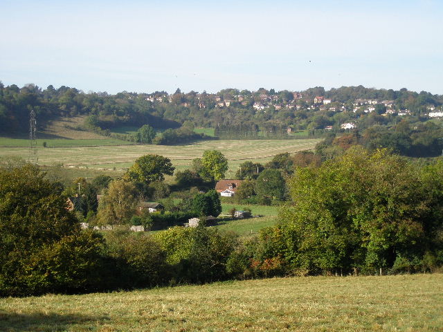
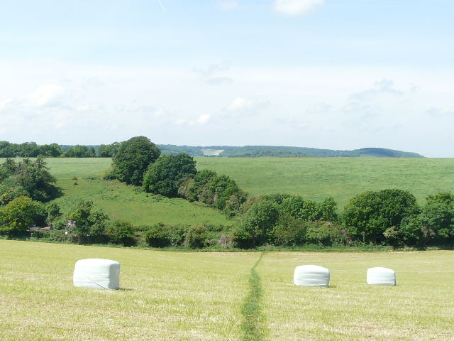
[8] View from edge of Park Wood, back across the Saunderton Valley towards Bledlow Ridge. The visible path through the corn field is on Slough Hill.
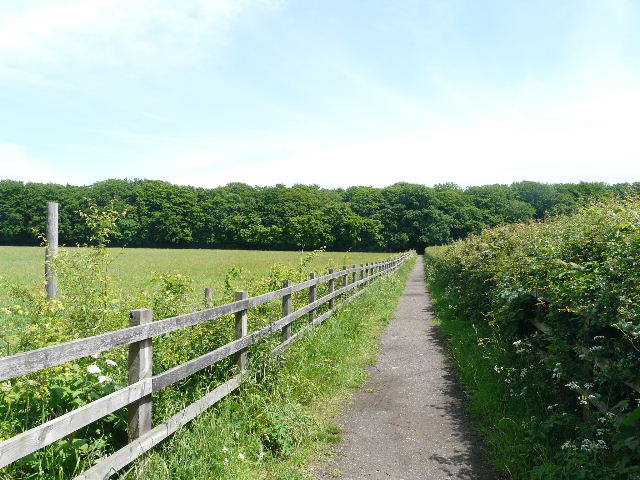
There were several more Red Kites and at least a couple of Buzzards visible here. After crossing a hedge-lined driveway or track (where I spotted a Yellowhammer), the path switched to the left of a hedgerow, rising gently uphill to a corner of a Park Wood [7]. A Small Heath butterfly kept fluttering along ahead of me here. The path continued on beside the wood, where I spotted Common Rock-rose and Wood Spurge amongst the flowers growing here. I stopped at a bench by the highest point of the path, just before the path and wood turned sharply left [8] – I started to take off my waterproof overtrousers, but then noticed the grass was still damp where it was in the shade of the wood so I decided to leave them on. The path now went steeply downhill for a while, then joined a track which it followed to the right. I then turned right again, to continue with Park Wood still nearby to my right [9]. Another Buzzard circled low overhead, but yet again I failed to get a photo. I spotted some Common Milkwort and Hop Trefoil in the grass as I walked along.
[9] The path beside Park Hill, heading towards Smalldean Lane
Beyond the wood, the path turned slightly left and then right, passing through a farmyard to reach Smalldean Lane. I turned left for about 100 yards, before turning right onto a footpath. A 4x4 was parked here, and a lady was just finishing getting her three dogs into it. We said ‘Hello’ and then she said, ‘Oh, we’ve met before!’. It’s a small world – she was the lady I’d passed on my last walk near Parslow’s Hillock, the one I’d talked to briefly about the scent of wildflowers. We talked briefly about the Chilterns, and how good they were for walking.
[10] The path from Smalldean Lane
[11] Flower filled meadow and Lodge Hill from the path from Smalldean Lane
[12] The Vale of Aylesbury from the path from Smalldean Lane
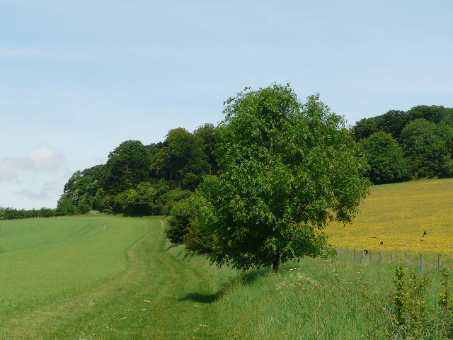
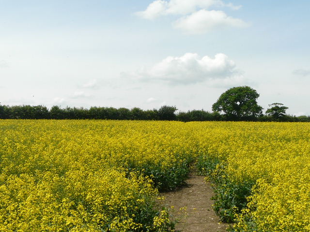
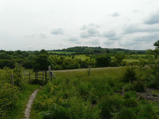
The path soon turned right, to follow a hedge on the right rising gently uphill [10]. I passed through three or four meadows or pastures, with views to my left over the Saunderton Valley [11] and, further on, ahead to the Vale of Aylesbury [12]. This was a very enjoyable stretch, the fields being very colourful with mainly yellow flowers. The path passed through two tree belts separating the fields, and just beyond the second tree belt, I turned half-right onto a path that briefly followed the edge of a field, before continuing between hedges. It curved slightly left, and after a few hundred yards I turned off it, a short path on the right going a few yards between bushes and trees to reach the drive to the quaintly named Promised Land farm, just to my right. The path continued over a stile, rising uphill through the middle of a recently mown meadow [13,14]. It continued through a smaller meadow at the top of the hill, then went along the drive of a house to reach a lane in Lacey Green.
[13] The path uphill to Lacey Green, from near Promised Land Farm
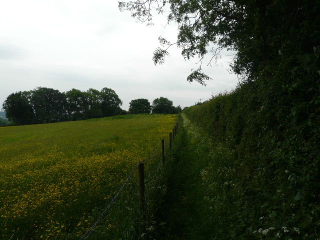
[14] looking back from the path to Lacey Green
I followed the lane to the left. On reaching the main road through the village I went left, but only for a short distance before turning right into Kiln Lane. After about a quarter of a mile, at a fingerpost on the right, I went right for a few yards, then left on a bridleway – this was very muddy and rather overgrown. At the bottom of the hill I rejoined the lane and followed it as it went right [15], along the bottom of a small valley. I passed just a couple of houses on the left as I followed the lane for almost half a mile.
[15] Kiln Lane
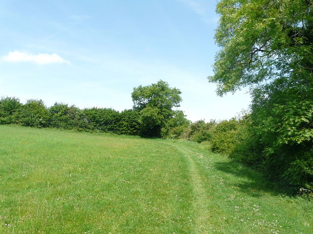
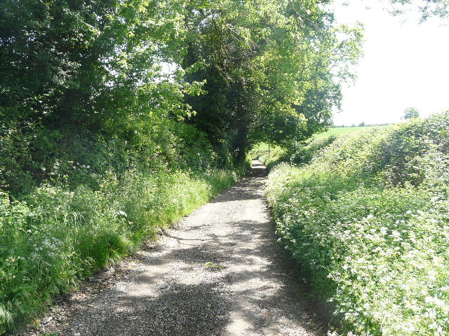
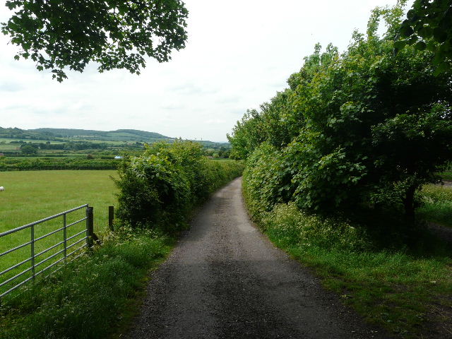
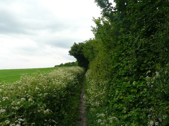
When a wood started on the left, I turned left on a muddy bridleway, rising slowly uphill just inside the edge of the wood. At the top of the slope it continued between hedges, where I stepped aside to let two joggers coming the other way pass by. Beyond a crossing track, the path continued between a wooden fence and a hedge on the right [16] to reach Monkton Wood. Here I turned left, retracing my steps on the last walk as I followed a path just inside the left edge of the wood for about half a mile. The path was much muddier than when I was here on Saturday, but it was still very pleasant walking between the beech trees and holly bushes. At the end I turned left, joining the route of the Chiltern Way, to reach Lily Bottom Lane. Instead of turning right to reach the Pink and Lily pub, I went left for a few yards before taking a bridleway on the opposite side. This was initially very muddy as it rose slightly, with tall trees and holly bushes either side (it runs along another stretch of Grim’s Ditch). After only 100-200 yards I went half-right across the corner of a field of oil-seed rape [17], and stopped on a stile for my lunch as it was now just past 1pm.
[16] The bridleway approaching Monkton Wood
[17] Path through oil-seed rape, on way back to Lacey Green
The path continued through a field of almost knee-high grass. I stopped again almost as soon as I’d started, finally deciding that I should be wearing my sunglasses on such a bright day. I was still wearing my overtrousers, so I probably looked an even odder sight than usual! In the far corner of the field, I went over a stile and followed a track between large paddocks containing numerous horses. When I reached the last paddock on the right, the path went over a stile and went half-right across the paddock [18] (containing a solitary white horse).
[18] The way back to Lacey Green
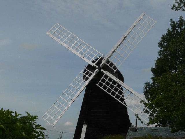
[19] The windmill at Lacey Green
As I then followed the path across a corn field, I met a walker coming the other way. He stopped and asked if the bird he’d just seen would have been a Kite or a Buzzard – I explained that the easiest way to distinguish between them is to look for the Kite’s forked tail. As I said earlier, it’s a small world! We got chatting, and it turned out he came from Markyate, one of the neighbouring villages to Kensworth where I live (I went through it on Walk 1). We chatted for about 10 minutes – apart from walking, we had back problems in common, and discussed the variety of treatments we’d tried (UPDATE 29/08/21 A year or two later I bumped into the same walker, Martin, just outside Markyate. We've since been on two or three walks together and are still in touch). Going our separate ways, my path continued alongside a hedge on my right, through a cattle pasture then a small meadow, where Lacey Green windmill was to my right [19].
[20] The drive from Collins Farm
Lacey Green windmill is the oldest surviving smock-mill in the country. It was originally built near Chesham in 1650, but was moved to its present site in 1821 on the orders of the Duke of Buckingham, presumably due to a lack of wind in the Chess valley. It consists of a three-storey octagonal tower or ‘smock’, with an iron cap. Much of the massive internal machinery has survived, including rare ‘compass arm’ timber gearing. The mill was used for the last time in 1915. After a short spell as a holiday cottage, it was dilapidated by the 1930’s. It was used as a Home Guard look-out point during WW II, and later used as a farm store. It was fully restored by the Chiltern Society in the early 1970’s.
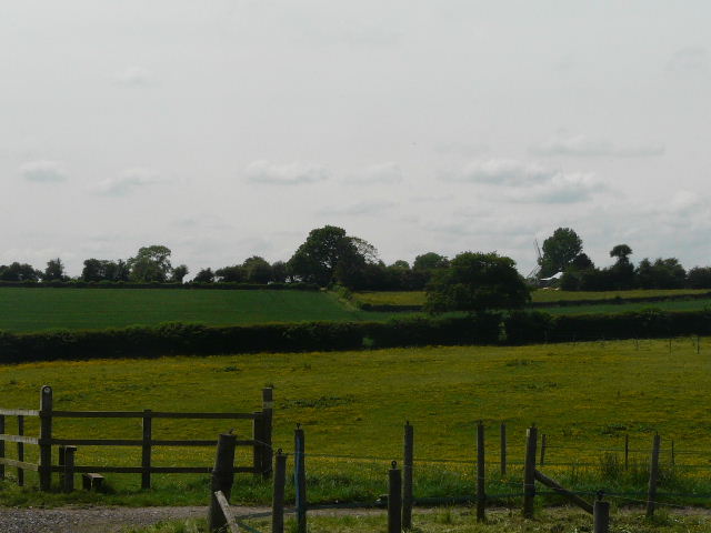
On reaching the main road in Lacey Green (again!) I crossed over and took the road opposite, going downhill into the adjoining village of Loosley Row. I turned right at a junction, and after a short distance took a path on the left – I was still following the Chiltern Way, so this route was very familiar to me. The path went past some horse chestnut trees, and then joined the drive from Collins Farm [20], continuing downhill back into the Saunderton Valley. Near the end of the drive I followed the official line of the footpath, going left through some long grass (still wet, so wearing my overtrousers did serve some purpose!), before turning right (just before reaching a lane) and crossing over the drive, following the edge of a field to reach the main road through the valley again.
[21] The path beyond the main road, heading towards the first railway line
[22] Looking towards Lodge Hill, from the path over the railway tunnel
On the other side, I followed a lengthy path through a flat corn field [21]. Around this time I noticed that it had clouded over almost completely, a marked change from the blue skies of the morning (obviously, it was all my fault for putting my sunglasses on!). I went straight on where a bridleway crossed the path. On the far side of the field, the path turned right, with a railway line running through a cutting on my left. After several hundred yards, the railway entered a tunnel and soon after I turned left at a path junction, through a gate on a path over the tunnel [22]. I was now on the route of the Ridgeway again. As I crossed a meadow beyond the tunnel, I finally decided that it was too warm for the overtrousers and took them off – although the sky was now overcast and getting increasingly grey, it was very warm and humid. A few yards further on, the Chiltern Way turned off to the right, but I continued ahead, following the Ridgeway. I crossed another railway line, and continued on a path between hedges across part of a golf course. The route then went across a field and round the side of a house or farm and along its drive to a minor road.
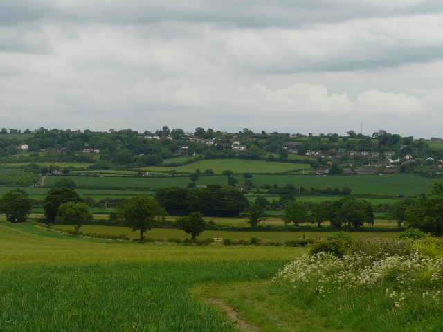
[23] Looking back towards Loosley Row and Lacey Green from near the foot of Lodge Hill
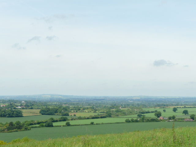
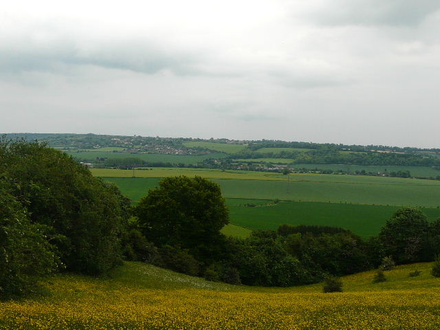
[24] The Vale of Aylesbury from Lodge Hill
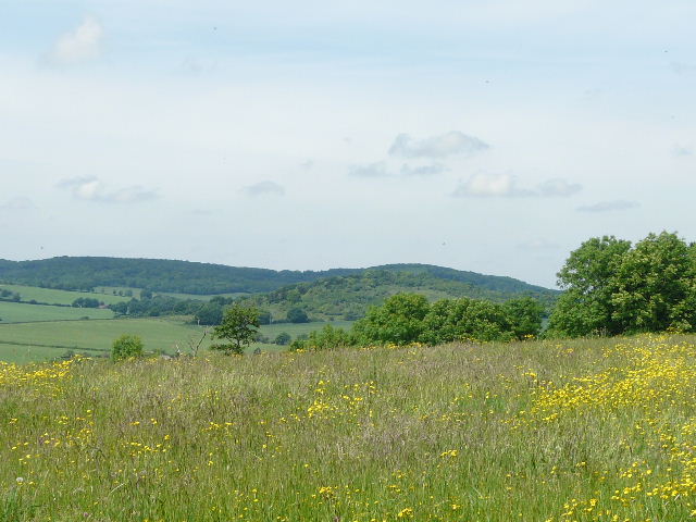
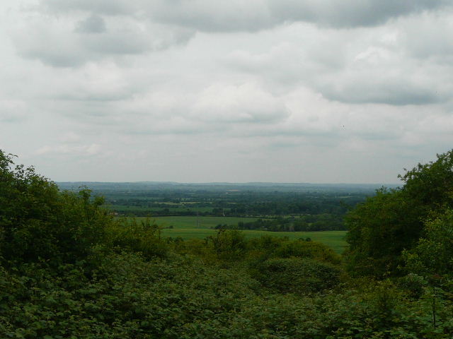
On the other side I followed a left-hand hedge, beside another corn field with Lodge Hill immediately ahead of me. The hedge turned left, then right (now on the wrong side of the hedge, according to the map). In the field corner [23], the path continued ahead, climbing steadily up the scrub covered slopes of Lodge Hill. This was a steady plod, but not a very long climb. There was then a very pleasant section along the flattish top of the hill – I was pleased to see some Common Rock-Rose, as I remembered seeing it here on the day I first got interested in wildflowers two summers ago. There were good views in most directions – north towards the Vale of Aylesbury [24], north-east to Whiteleaf Cross [25] on Whiteleaf Hill (see my previous walk), east back across the valley to Loosley Row and Lacey Green, and south to where Slough Hill and the wooded hill behind it [26] split the wide Saunderton valley into two narrower valleys.
[25] Whiteleaf Cross, from Lodge Hill
[26] Looking south to Slough Hill and Allnut's Wood from Lodge Hill
[27] The bridleway between Lodge Hill and Old Callowdown farm
The path descended through the trees on the western side of the hill, then followed a hedgerow through a meadow. It then went left across yet another corn field. About two thirds of the way across the field I reached a bridleway, where I turned left (leaving the Ridgeway) [27]. There was quite a lot of Common Fumitory between the bridleway and the crop. In the field corner, I turned right on another bridleway. This soon ran past Old Callowdown Farm (where I rejoined the Chiltern Way) and then Callowdown Farm (UPDATE: the path has been officially diverted, it now turns right and then left to skirt round Callowdown Farm). The bridleway then ran beside a hedge [28], climbing gently up the hillside, then rose more steeply through the edge of a wood to emerge at the hamlet of Rout’s Green. I soon turned left at a road junction, then went right on another footpath, initially between garden fences but then going up and down a small dip in a sheep pasture. There was a good view across the valley here, and I had a close-up view of another Red Kite. The path continued between bushes on my left and a paddock on my right, with numerous Ox-eye daisies beside the path. Across a track, the path continued between fences and hedges [29], with another good view over a yellow meadow to my left [30], back to Bledlow Ridge.
[28] The bridleway to Rout's Green
[29] The path back to Bledlow Ridge
[30] View across the Saunderton Valley from the path back into Bledlow Ridge
I was glad to get back to my car about 3.45pm without having got wet – the skies had been getting steadily darker, and indeed it soon started to rain as I drove home. The overcast afternoon had been a complete contrast to the blue skies of the morning.
This was another very good walk, the only weakness in the route for me being that the second half of it was almost entirely on the Chiltern Way and/or the Ridgeway, so I’d done it several times before. But I knew that this was unavoidable, as in planning the route I’d needed to find two interesting ways across the Saunderton Valley. There was perhaps less woodland walking today than on on recent walks, but there was still a decent variety of scenery along the route. There were good views throughout most of the walk, across the Saunderton Valley or out to the Vale of Aylesbury. It was certainly a circular walk that I’d be very happy to do again.
Total distance: 159.1 miles
(To see this walk repeated IN THE OPPOSITE DIRECTION on 15/12/12, CLICK HERE)