Pete's Walks - The Dales Way
Day 3 29/06/04 Buckden to Far Gearstones (12.7miles)
Today’s section of the Dales Way saw us continue along the ever narrowing Wharfedale to reach the source of the river Wharfe, and then gradually climb up into the bleak moors of the Pennines. Sadly the weather was a bit indifferent, and I only took a couple of photos.
We re-crossed the bridge at Buckden to pick up the route of the Dales Way, and followed the river Wharfe for about half a mile to the tiny hamlet of Hubberholme. The church here dates to the Normans at least, and inside some of the pews are the work of ‘Mousy’ Thompson, complete with his trademark carved mice. We crossed the bridge here, and continued along the north bank of the river. I think it was along here that someone pointed out a Pyramidal Orchid (not that I was interested in wildflowers at the time!).
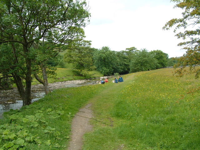
A mid-morning break along the infant river Wharfe
We passed another small settlement, Yockenthwaite, as we continued alongside the infant Wharfe. It had been interesting to follow the river valley over the last two and a bit days, seeing it change gradually from broad and pastoral to narrow and more rugged in this moorland setting. After a while, we crossed to the other bank on a bridge, continuing on a track close to the river. We then came to a footbridge and stepping stones to take us back over the river next to its source, the confluence of Oughtershaw and Greenfield becks, overlooked by the farm buildings of Beckermonds.
From Beckermonds we had a mile of road walking along a narrow lane – initially there was a surprisingly steep pull uphill, possibly the steepest part of the whole route. We left the road immediately after the village of Oughtershaw, following a long farm track. I can’t remember if it was actually raining, but I do remember this section as being very grey with low clouds filling the sky, and limiting the view of the rising moorland ahead. We stopped for lunch somewhere along this track.
We continued on, the track or path very gradually ascending, eventually the route becoming steeper across a couple of pastures that led to the very remote farming hamlet of Cam Houses. We had a short break, then carried on across the rough moorland pastures. Soon there came a short section through Cam Woodlands, and then a steeper but short pull led up to the Cam High Road, a broad track across the bleak Pennine landscape and at 1710 feet above sea level, the high point of the Dales Way.
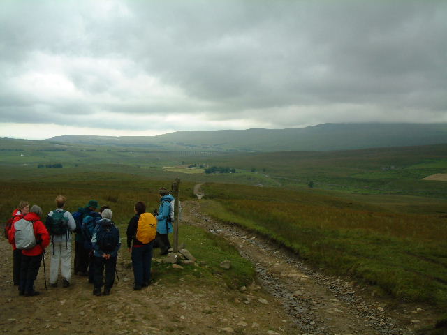
Cam End, looking towards the Ribblehead Viaduct
We turned left along the Cam High Road, which very gently descended for about a mile to Cam End. Here we could see the celebrated Ribblehead Viaduct, part of the popular Settle-Carlisle line. There was then a steeper descent, followed by a beck crossing to reach the B6255 road near Far Gearstones. This was where our minibus was to pick us up – we were lucky, as most walkers have to go on to Dent Head, or further, making this a long walk of 16.5 miles or more.