Pete's Walks - Four Hills Walk (part 1)
If you are considering walking this route yourself, please see my disclaimer. You may also like to see these notes about the maps and GPX files.
I did this 13 mile circular walk on Thursday, 9th July, 2009 - I've called it the 'Four Hills Walk' as that is a lot snappier than 'Coombe Hill, Beacon Hill, Pulpit Hill and Whiteleaf Hill'!
The walk is basically a variation of one of my old favourites, the circular walk from Coombe Hill that is Walk 12 of my Chiltern Chain Walk. For various reasons, today was the only day this week that I could do a long walk, so I wanted to make the most of it by doing a really good walk, one that I knew I'd really enjoy. Yet at the same time I wanted to try walking somewhere new. So a happy compromise seemed to be to do the 'Coombe Hill and the Hampdens' walk, but to vary the start by going over Beacon Hill. I'd never walked on this distinctive hill before, because there are no paths to its top. But I've recently seen on the latest version of my OS map that the northern side of the hill is open access land, so there is no problem visiting the top of the hill (actually, as I would discover, the very top of the hill is out-of-bounds as it is just within the security area surrounding Chequers, the Prime Minister's country retreat).
In the end, I went on to vary the route in another three or four places, so the walk ended up quite a bit different to the one I'd set out to do. This report will concentrate on the parts of the walk that were new. I may do the walk again sometime and put it in the Chiltern Hills section of this site, but I need to improve the route a little first - in particular I need to find another way down from Pulpit Hill.
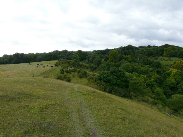
I parked at the car park at Coombe Hill. As I went through the gate I turned left as usual - there was a small herd of Belted Galloway cattle lying down amongst the bracken here. Instead of turning left again onto the Ridgeway Path as I usually do, I continued ahead - the path now descended very steeply down the western side of Coombe Hill. This was certainly one of the steepest bits of downhill I've ever done in the Chilterns - I was edging my way down very slowly, which was quite painful on my arthritic knees.
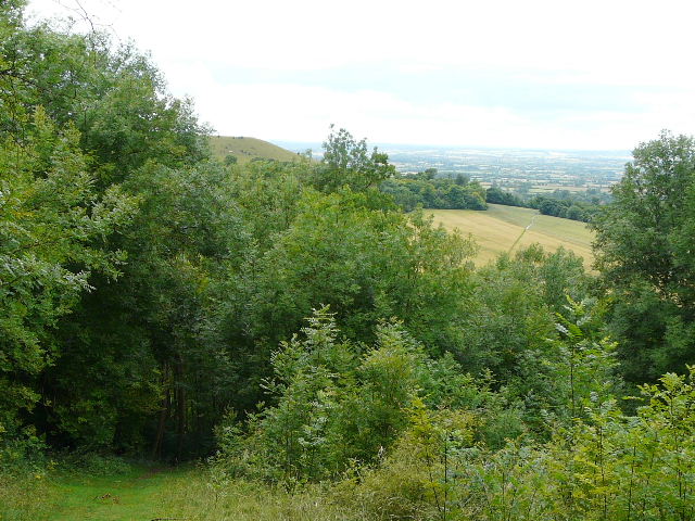
Steep descent of Coombe Hill - Beacon Hill is just visible, as is the path through corn fields that I would soon take
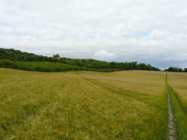
Path through corn fields between Coombe Hill and Beacon Hill
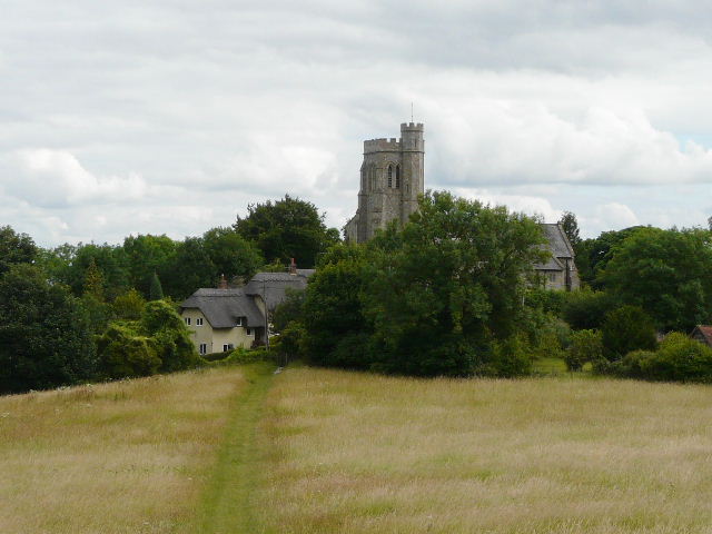
At the bottom of the slope I passed a few cottages in the hamlet of Coombe and crossed a minor road I went a few yards right and then followed a long path through cornfields, with Beacon Hill ahead and to my left. The path then followed a short track or drive right to reach Ellesborough, opposite the church. A few yards to my left, I took a path heading through a meadow back towards Beacon Hill.
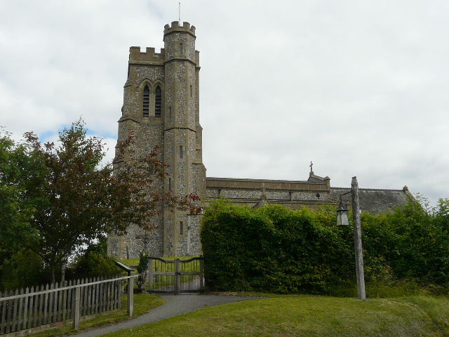
Ellesborough church
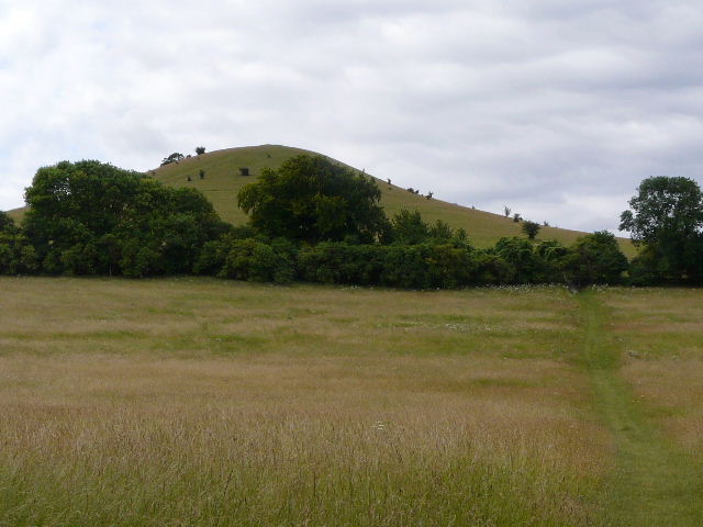
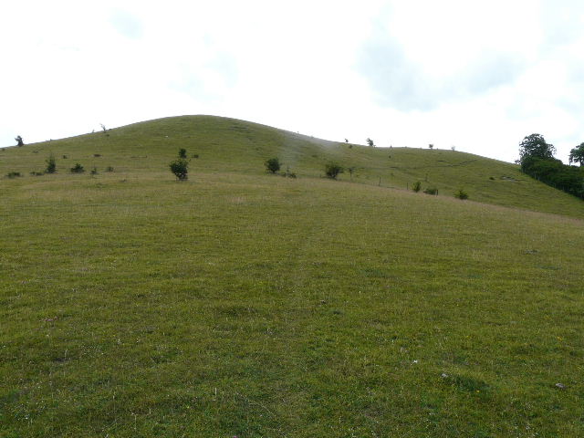
Approaching Beacon Hill
Beyond the meadow, the path entered a grassy area of Open Access land. There is no footpath to the top of the hill, the path I was on skirting round its western flank. I decided to follow the path to its highest point, then turn left and make my own way to the top of the hill. Other people had obviously had the same idea, as there was a barely visible path through the grass as I made my way steadily up the steep slopes. About halfway up the step section, a better path went half-right, approaching the southern end of the hill at a gentler gradient, but I persevered up the thin path to reach the northern top of Beacon Hill. The views to Coombe Hill and out over the Vale of Aylesbury made the exertion worthwhile.
Looking back at Ellesborough
Beacon Hill
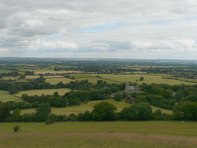
Ellesborough and the Vale of Aylesbury from Beacon Hill
Coombe Hill from Beacon Hill
I walked along the flattish top of the hill towards some prominent trees. The highest point of the hill seemed to be just beyond the trees, behind a wire fence surrounding the strictly guarded grounds around Chequers. I dropped down a few yards to my right, to join the better path I'd seen earlier, and followed it back (right) to the junction with the thinner path I'd taken to the top of the hill and then returned to the footpath. This western side of Beacon Hill had masses of the tiny Squinancywort and a large number of Pyramidal Orchids.
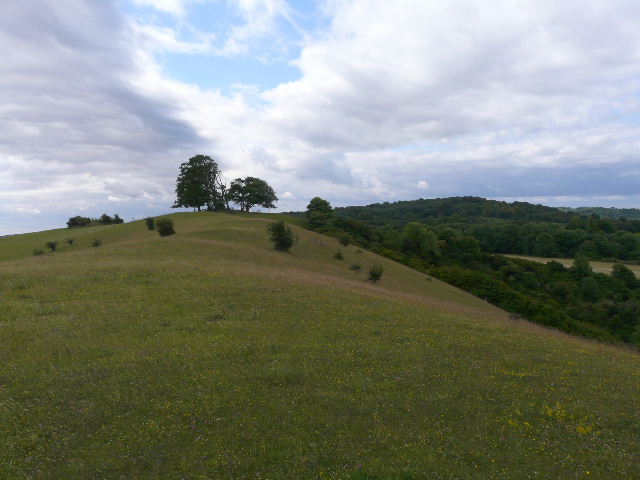
The top of Beacon Hill - the highest point, just beyond the trees, is out-of-bands as it lies within the grounds of Chequers
Looking north along the top of Beacon Hill towards the Vale of Aylesbury
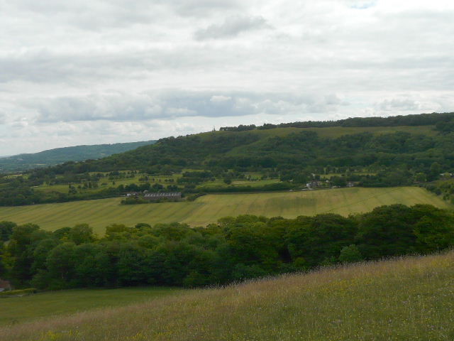
I turned left to continue along the footpath, now a chalky track traversing a steep slope - a Red Kite flew nearby. The path passed through a small wood and then crossed another hay meadow, with nice views to the right over the Vale of Aylesbury. There were numerous butterflies along the path through the meadow, including Marbled White, Large Skipper and my first Gatekeeper of the year. As I entered another short section of trees I spotted a Comma, the first of three or four I'd see today.
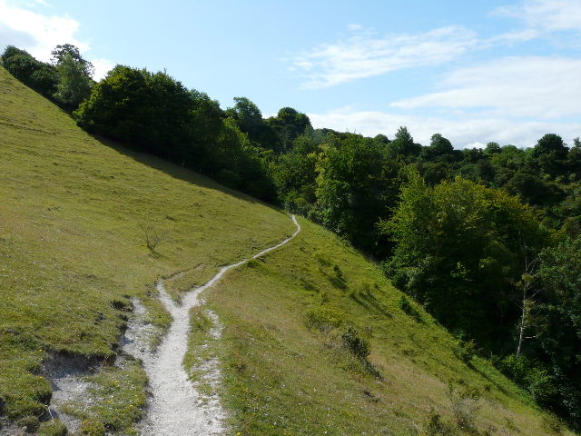
Path round the western side of Beacon Hill
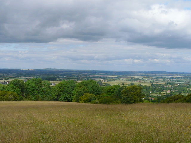
The Vale of Aylesbury from a meadow near Beacon Hill
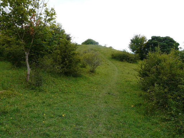
The path crossed a private drive, and then a few yards further on I forked right - the path kept close to the right edge of a large pasture and soon passed through a small clump of trees. Over a stile in a fence, I went on a few yards up a small rise, then turned left along its top. The path went through grass and scrub to reach a gate or stile, beyond which I turned right on the 'Cradle footpath', part of the Ridgeway and the route I usually take. I followed it a few hundred yards to the right, and went up the small hillock of Chequers Knap to admire the views.
Approaching the 'Cradle footpath'
Approaching Chequers Knap
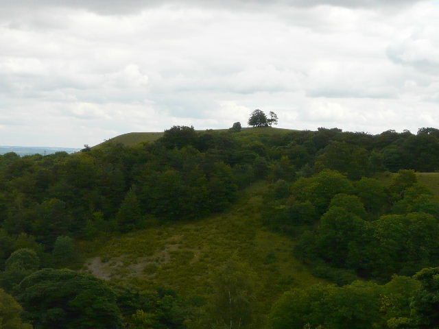
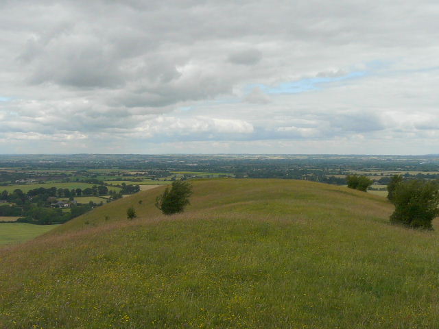
Beacon Hill from Chequers Knap