Pete's Walks - Pitstone Hill, Dagnall, Ashridge (page 1 of 3)
If you are considering walking this route yourself, please see my disclaimer. You may also like to see these notes about the maps and GPX files.
I did this walk of roughly 12.8 miles on Thursday, 3rd September, 2009 - the title I have given it is a bit of a misnomer as I didn't visit the top of Pitstone Hill, but the walk started and finished at the adjacent car park.
I had planned this circular walk so that it would include a couple of paths I'd not used before, plus a couple of other paths that I'd only walked in the opposite direction. They linked up quite nicely, leaving just a lengthy gap through Ashridge, where I knew there were plenty of paths I could take depending on how long I wanted to make the walk.
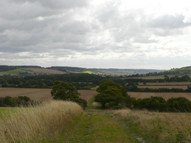
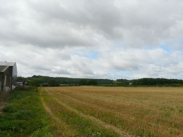
It was a grey and very blustery morning as I left the car park about 9.30am, crossing the lane and heading away from Pitstone Hill, following part of the Ridgeway National Trail as it headed across the edge of a huge downland meadow or pasture and on up Steps Hill. Almost immediately I had what would turn out to be the best wildlife sighting of the day - a bird with a white rump flew along the path in front of me and stopped on one of the fence posts to the right of the path. I managed to get some very distant photos, which when I examined them on my PC later confirmed that it was a juvenile Wheatear.
The Ridgeway crossed the wonderful path from Ivinghoe to Ashridge that I'd walked on Saturday, and made its way beside the deep cleft of Incombe Hole to the top of Steps Hill - there were lots of Harebells beside the path here. The strong wind was so cold that I stopped and put my 'wind jacket' on - I was already wearing one of my warm Paramo shirts for the first time in months. From here to Ivinghoe Beacon I usually follow the Ridgeway or a parallel path to its right, but today I took a path branching half-left from the Ridgeway, crossing the top of the hill with good views over the Vale of Aylesbury, then contouring northwards to rejoin the Ridgeway. I'm not 100% sure, but I think it was the first time I'd used that path over Steps Hill in this northerly direction.
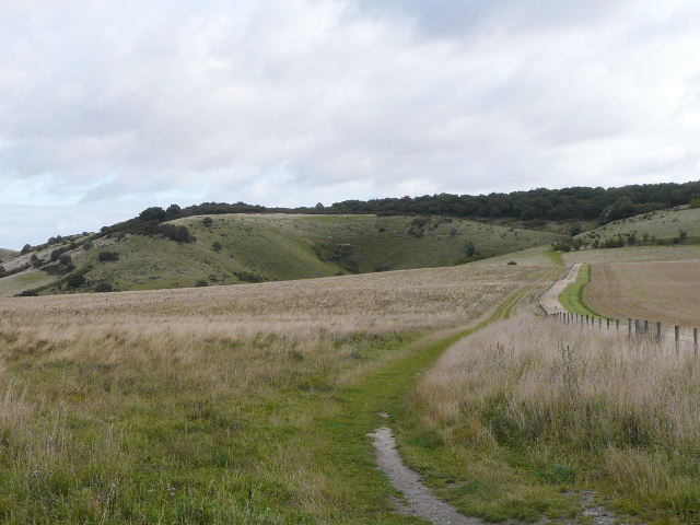
The start of the walk, across the lane from the Pitstone Hill car park - the Ridgeway National Trail heading towards Steps Hill
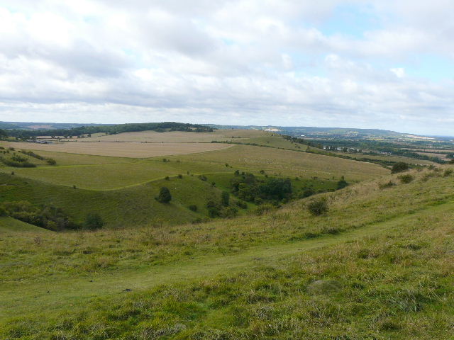
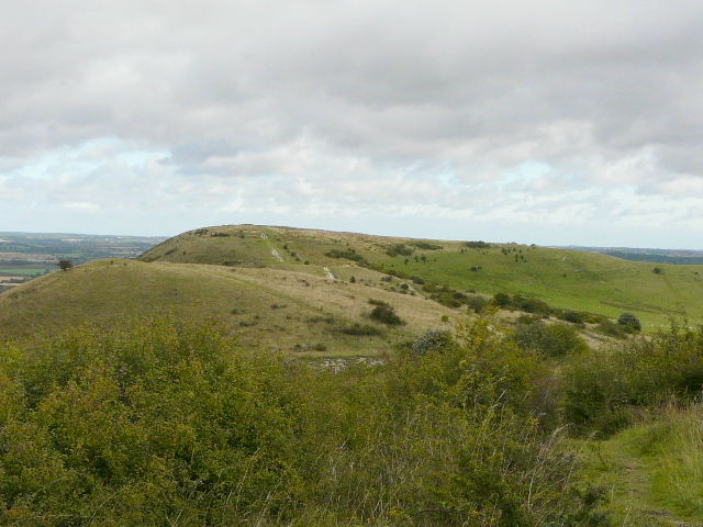
From near the top of Steps Hill, looking back over Incombe Hole towards Pitstone Hill
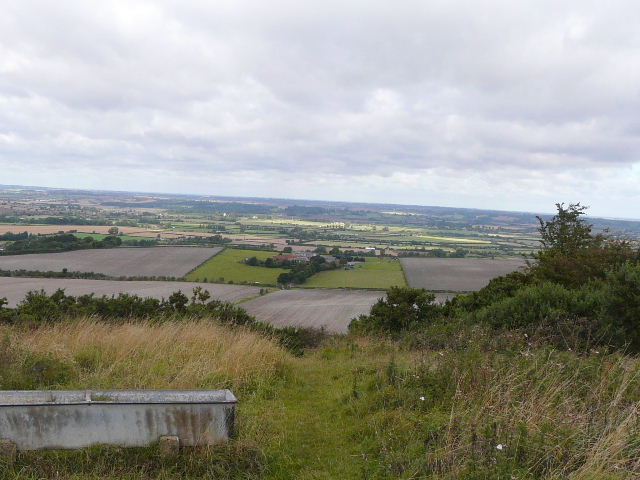
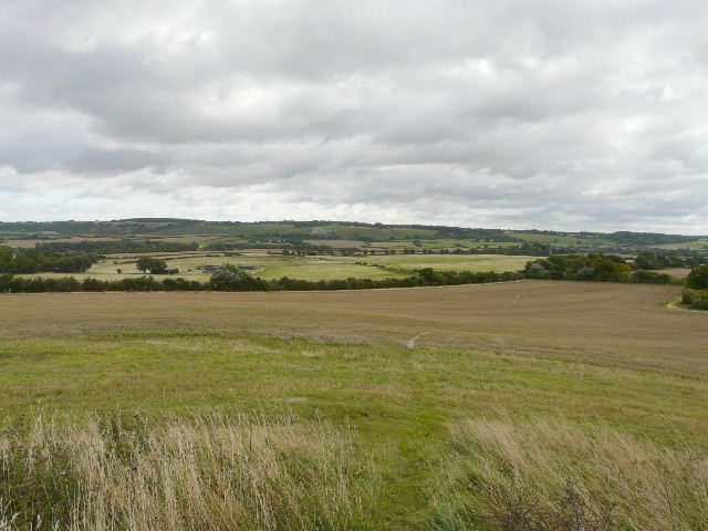
View over the Vale of Aylesbury from the path on top of Steps Hill
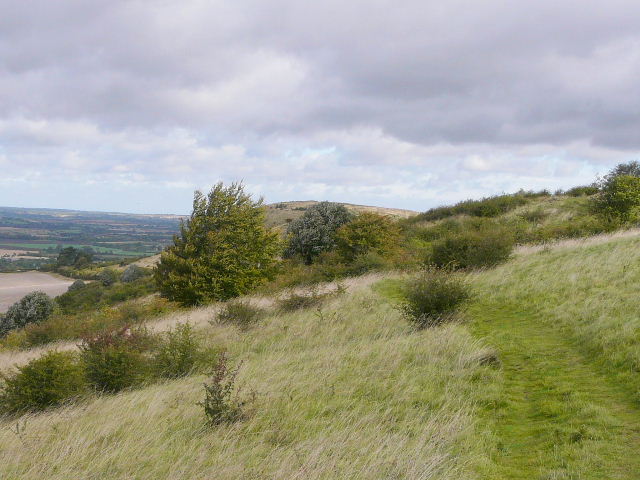
The path on Steps Hill, heading towards Ivinghoe Beacon
Further along the path - looking at Ivinghoe Beacon and the ridge to Gallows Hill
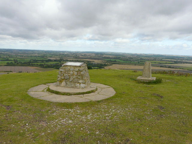
The top of Ivinghoe Beacon
I turned right at the top of Ivinghoe Beacon, and followed the long ridge over Gallows Hill. This is always a delightful path, with views ahead towards Dunstable Downs and Whipsnade Downs, with the Gade Valley starting over to the right. Having gone through the first of a couple of gates along the ridge, I noticed an obvious large 'doughnut' shape in the grass - I immediately realised that it was the remains of a tumulus or ancient burial mound, the hole in the centre being where the top had collapsed or where it had been dug out by treasure seekers. I checked on my map, and sure enough it said 'tumulus' in Gothic lettering. I've walked this path so many times before, I was really surprised that I'd not noticed this feature before.
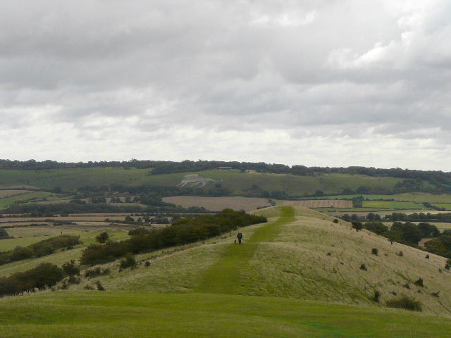
The path from the Beacon over Gallows Hill, heading towards Whipsnade Downs (the White Lion indicates the location of Whipsnade Zoo). The very bottom left of the photo shows part of the remains of a tumulus or ancient burial mound.
I knew there was a second, much more obvious, tumulus at the end of the ridge. I'd seen it but not visited it before, as I usually turn right just before reaching it (the Ashridge Estate Boundary Trail and Walk 3 of my Chiltern Chain Walk go that way). But today I followed the path to the top of the tumulus, where I saw some Wild Mignonette and some Common Toadflax, and continued downhill across a field of stubble. This path, which I was walking for the first time, then turned right along a tall boundary fence topped with several strands of barbed wire. This marked the limit of what the map calls a 'Wireless Station', although the numerous masts and transmitters that once dotted this huge enclosure have all gone now, apart from what looks like a mobile phone mast. The path ran between the fence and a hedge on my right, turning left near a farm and eventually reaching the main road from Leighton Buzzard to Hemel Hempstead, where I turned right and carefully followed the road into Dagnall.
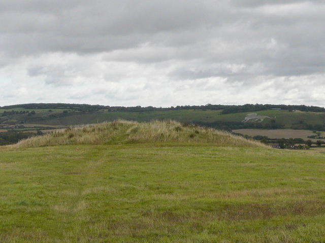
A second tumulus, at the end of long ridge of Gallows Hill
Looking south-east from just before the second tumulus, towards the start of the Gade valley
The path continuing from the second tumulus
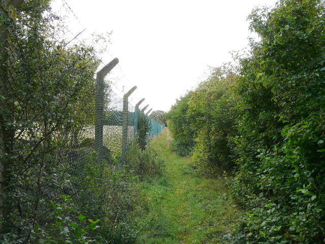
The path along the boundary fence of the former Wireless Station
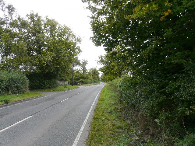
The road to Dagnall
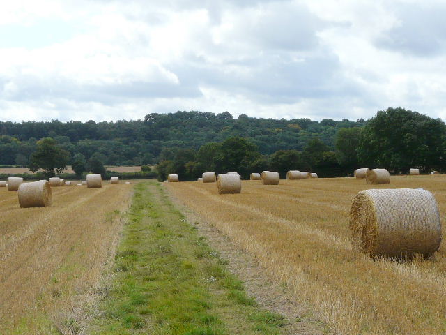
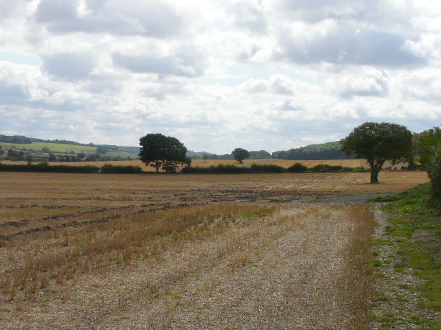
In the centre of Dagnall I took a footpath on the right - this used to go through a garden and a large farmyard, but on my walk on Saturday I'd seen that it had been recently officially diverted to go round them. Having gone round two sides of a farm, the path went diagonally across a stubble field, with large cylindrical bales of straw scattered about. On the far side of the field I continued ahead, but now on a bridleway - for the next two or so miles to Little Gaddesden and Hudnall I'd be walking part of a route I did two weeks ago, but in the opposite direction. As far as the edge of Hudnall, this would be the first time I'd walked the paths in this direction. The path continued beside more stubble fields and then across a large empty field that had continued several horses when I came here the other day, to reach Hoo Wood.
The start of the path to Little Gaddesden, recently diverted around the edge of a farm
The footpath from Dagnall - it joins a bridleway at the end of the hedgeline coming in from the right
The Gade valley, from the bridleway to Little Gaddesden
Looking back towards Dagnall and Whipsnade Zoo, from the edge of Hoo Wood