Pete's Walks - West Wycombe, Speen, Hughenden (page 1 of 4)
If you are considering walking this route yourself, please see my disclaimer. You may also like to see these notes about the maps and GPX files.
Google map of the walkDownload GPX file of the walk
PLEASE NOTE: The very large car park in West Wycombe used to be free. When I came here on 15th January 2022 I found it is now a pay and display car park, only free if you stay less than one hour and costing £4 if you stay more than 2 hours. I think you have to pay by credit card, I don't think the machine takes cash.
I did this 11.1 mile circular walk on Monday, 5th April 2010 (Easter Monday).
There is quite a large area of the Chilterns to the northeast of West Wycombe that I've hardly explored at all - no long-distance paths go through the area, and only a couple of my walks have touched on it (going through Bradenham and Downley). I've often thought about walking there, but what has previously put me off is that on the map it looks to be fairly heavily built-up, with several large villages and not too much countryside in between. However I finally managed to find a route (admittedly slightly shorter than usual) that avoids spending too much time in built-up areas, and so for the first time in a long while I set off on a walk in the Chilterns which would be almost entirely new to me.
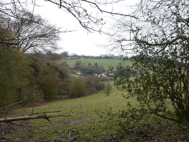
I started out from the car park at West Wycombe (grid reference SU 826947) about 9.30am, taking the footpath starting across the road and making my way around the foot of West Wycombe Hill (keeping right at a path fork, not continuing uphill - there are actually two parallel paths that fork right within a few yards of each other, it didn't really matter which one I took). On reaching a lane I turned left, and passed the entrance to the Hell Fire Caves. I turned left at a junction with Church Lane, then within a few yards I took the left-most of two footpaths starting from the same point on the right of the lane. This path ran through an area of grass next to the hedge on the left for about a hundred yards, then descended gently half-right across a very large arable field, heading towards the road from Princes Risborough that I'd just driven on. The path continued on the other side of the road, crossing a smaller arable field, then crossed a railway line and entered Kit's Wood - [UPDATE 2/6/14 - this section of path has been officially diverted, because the railway crossing was deemed unsafe. You now have to turn left along the road for a quarter of a mile, then immediately after going under a railway bridge take a footpath on the right. After about a quarter of a mile (where a view to the right looks back along the path you came from West Wycombe to the road, and just before a bench on the left), go through a metal pedestrian gate on the left to rejoin the original route]. It was quite steep at first, passing close to the edge of the wood on my right, then levelling out and bearing left (northwards). The path merged with a track at one point, where I continued in the same direction. Somewhere along here I was startled by a Buzzard flying off from a tree very close to me, and a bit later I saw a Red Kite flying just over the tree tops.
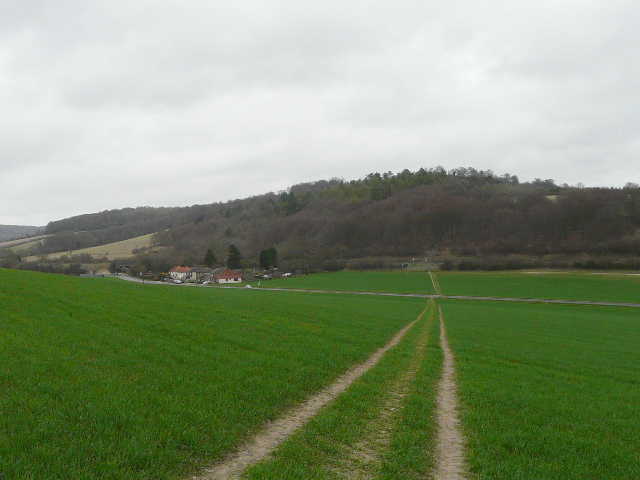
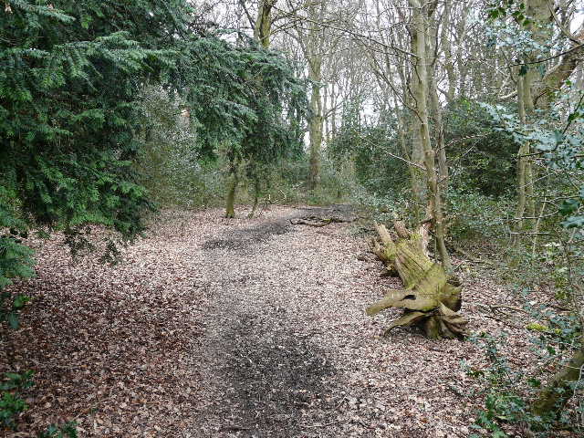
The path from West Wycombe, looking ahead across the road and railway line towards Kit's Wood [Note: the path across the road to the railway line is now closed, see the UPDATE in the description above]
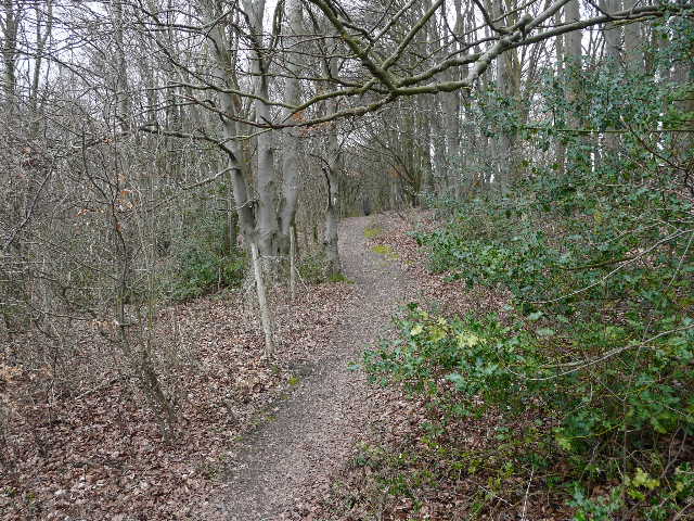
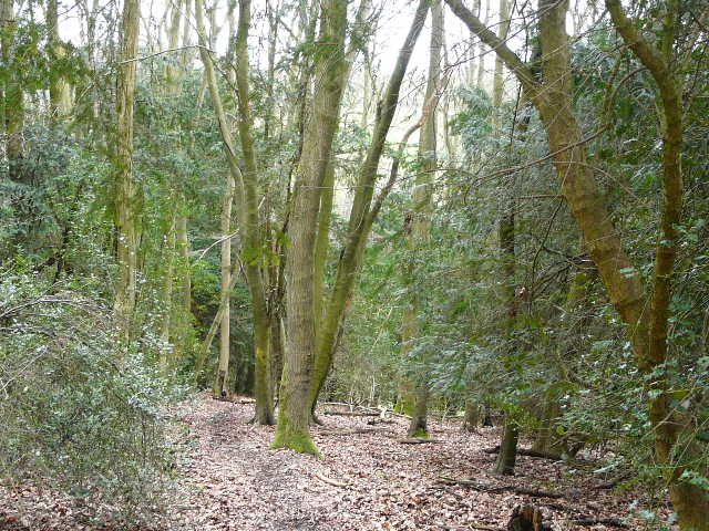
Near the start of the path through Kit's Wood
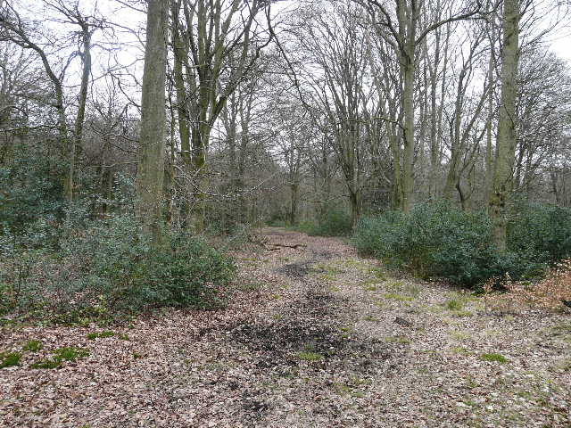
The path through Kit's Wood
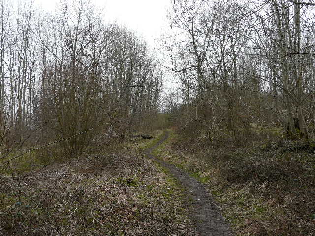
After about half a mile of walking through the wood, I turned half-right onto another track at a path crossroads (marked by waymarks on a post). Within a few yards I turned further right onto a narrow path (leaving the track before it turned further right itself). After a while I had some pastures by Bradenham Hill Farm on my left, with an area on my right where the wood had been cleared a few years ago and was slowly regenerating. Further on the path entered the woods of Naphill Common, initially with a lot of holly bushes. I soon crossed a bridleway I'd walked a few weeks ago. A little further on I reached a junction in the woods (now Naphill Common) where I turned right onto a bridleway [Note after repeating the walk on 19/12/15: the OS map shows that I must have first crossed a footpath at some point between the two bridleway junctions, but I definitely didn't see that. To add to the confusion, immediately before I turned right onto the bridleway a waymark indicated a public footpath on the right - that path is shown on the OS map, but NOT as a public footpath]. This bridleway soon forked (by an algae-covered pond on the right) - I took the left fork. A little further on I spotted a male Muntjac deer, which stood stock still while I took my camera out and photographed it.
After turning right in Kit's Wood, the path besides the pastures of Bradenham Hill Farm
Start of the bridleway through Naphill Common
The bridleway through Naphill Common
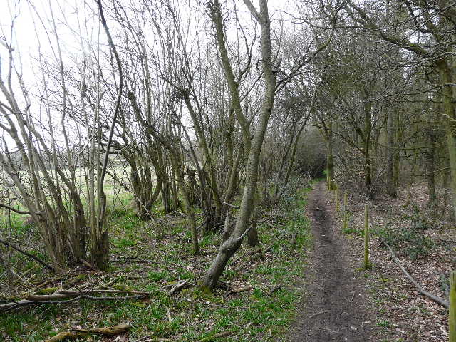
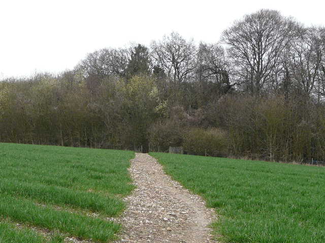
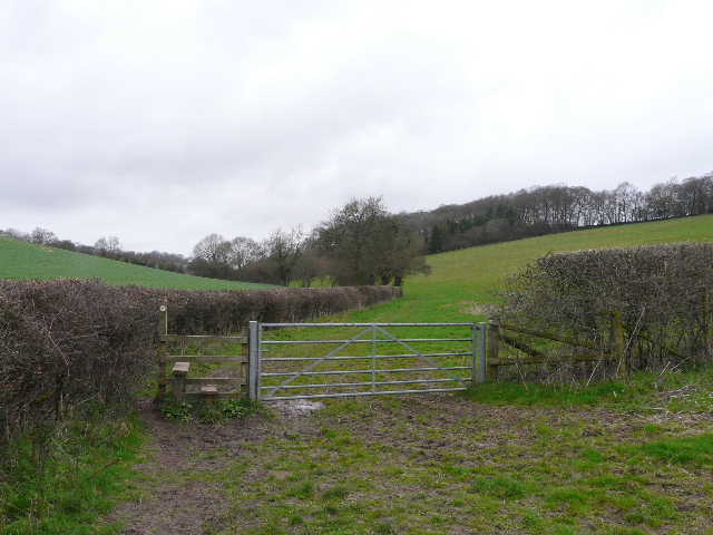
The bridleway continued through the woods for a while, then joined the drive from properties on the right. Where this turned right, the bridleway went straight on, soon leaving the common and continuing down a side-street to reach the road through the large village of Naphill. I turned left and then after about a hundred yards took a lane on the right, which appeared to be the boundary between Naphill and the adjoining village of Walter's Ash. The lane went downhill, and just past the edge of the built-up area I took a path going half-left across a field to Courns Wood. Almost immediately the path through the wood was running between fences either side. after these ended I soon reached a path crossroads in the wood, where I turned right but then immediately forked left. I reached a junction that was not shown on my map, but yellow arrows on the trees clearly showed that the right fork was the public footpath. I was soon descending quite steeply and exited the wood at a stile.
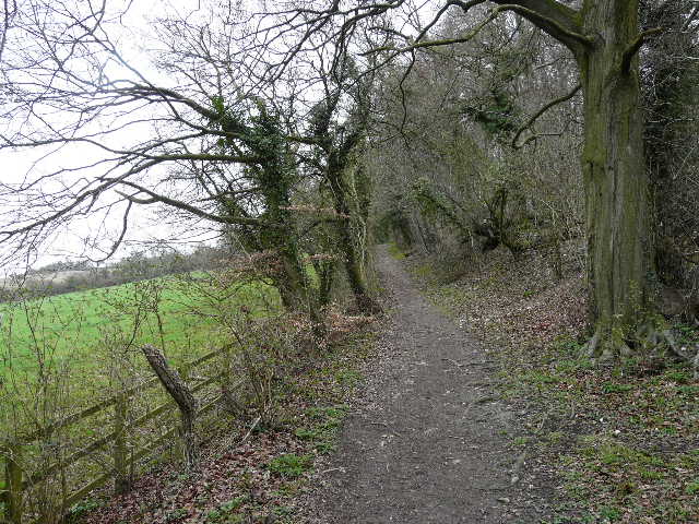
The path from Naphill, approaching Courns Wood
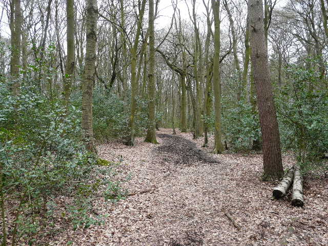
The path through Courns Wood
The path through Courns Wood, as it is about to descend
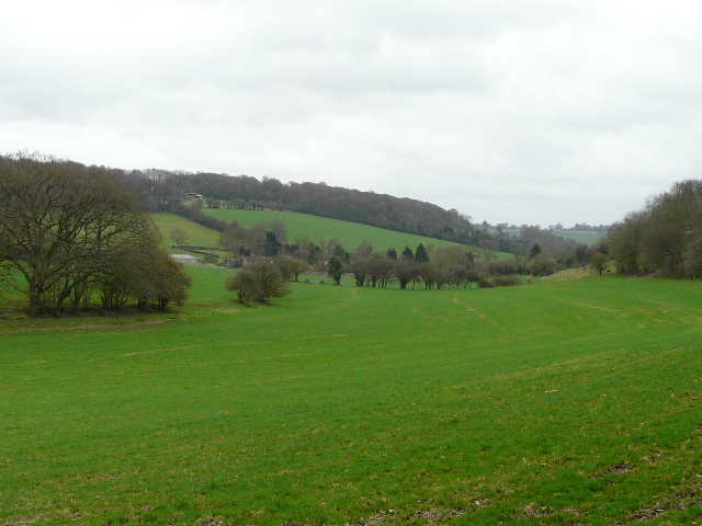
There was now a good view along the valley to my right. The path continued ahead, alongside a broad and well-trimmed hedge, then turned left along the valley bottom. Beyond a large pasture, I reached another path junction where I turned half-right. The new path initially ran between a hedgerow and a small wood on my right, steadily going uphill. The path then followed a hedgerow curving right as I reached the edge of the village of Speen.
Looking east from the edge of Courns Wood, towards Upper North Dean
The path along the valley bottom, on the way to Speen
The path to Speen
View of Flowers Bottom from the path to Speen
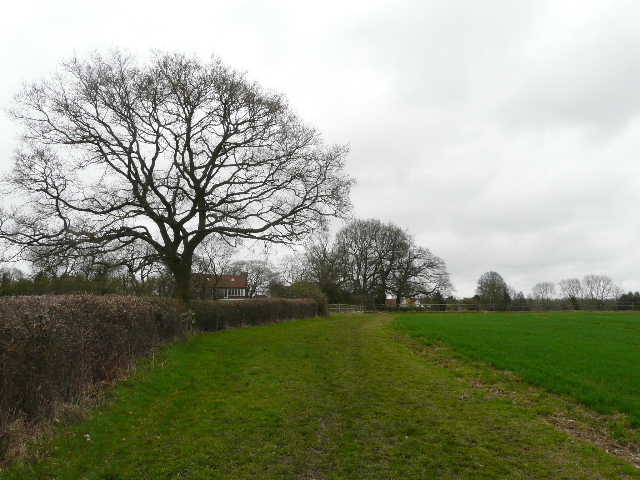
Approaching Speen
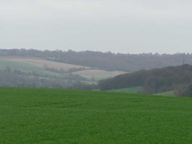
Close-up shot of the view south-east from Speen