Pete's Walks - The North Bucks Way, Day 5
Day 5 22/9/05 Whaddon to Wolverton (7.2 miles each way, approximately)
Parked in Wolverton. (Note that the car park is actually much closer to the canal than is shown on the OS Map and on the leaflet!)
I chose to do this walk in the opposite direction to normal, starting at Wolverton and walking to Whaddon before turning round. This was for three reasons. Firstly, the North Bucks Way indicated a car park in Wolverton whereas I wasn’t sure of finding a suitable place to park in Whaddon. Secondly, I guessed that the section through Milton Keynes wouldn’t be too interesting and doing the walk in this direction meant I did it at the start and end of the walk, rather than doing it in both directions one after the other in the middle of the walk. Thirdly, I wanted to complete my walk at the official termination of the North Bucks Way rather than back at Whaddon. However, I will describe the route as I returned from Whaddon to Wolverton, to be consistent with the rest of this journal.
Weather-wise, it was very pleasantly warm today, surprisingly so for the middle of September. The footpath from Whaddon led down a good track before turning off to go round two sides of a small field. A gate lead into a very large pasture (with a large herd of cows), where the path went down the right-hand side, next to a wood. At the far end, another gate led onto bridleway running between fences or hedges, where the North Bucks Way turned left (signs for the Midshires Way and the Swans Way were also here). Although the view to the left towards Whaddon and Whaddon Hall was attractively rural, on the right a new housing estate was being built as Milton Keynes extends still further. Consequently the sounds of construction accompanied me for the next half-mile or so, as I followed the bridleway northwards. I almost trod on a very large caterpillar on this section, so large that I took a photo of it as I don’t think I’ve seen one like it before and I’d be interested in knowing what it was.
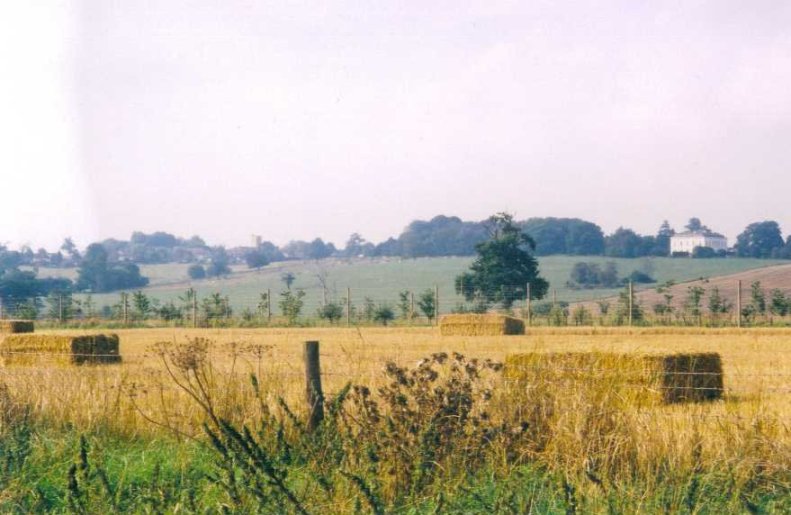
Looking towards Whaddon and Whaddon Hall
Eventually the banging and clattering faded as the bridleway entered a wooded section. The bridleway was clearly well used, particularly by cyclists as the tyre prints in the mud and sand showed. In fact I passed a man and woman with bikes, who had stopped to pick some berries. After going through a gate, the bridleway emerged into a very wide hedged track between fields. This only lasted a few hundred yards, before another gate led onto a dead straight tarmac farm drive – I walked on the grass growing in the middle of the tarmac, as I knew the route included a lot of road walking anyway, which is hard on the feet. After about half a mile, the drive reached a road where the North Bucks Way turned right. Although not too busy, the road was a bit of a nuisance to walk down as there wasn’t really a verge that I could walk on very easily, so I had to keep stopping every time a car came my way.
That road ended at a roundabout after half a mile or so, where I turned left along a busy main road (with a good footpath, though) for a few hundred yards before turning right along a path that skirted an industrial estate. Further paths led on for about a mile through residential areas of Milton Keynes, before I reached the Grand Union Canal. Here I turned left and followed the canal towpath for just over half a mile to reach the ‘Iron Trunk’, a metal aqueduct built in 1811 to carry the canal over the river Ouse. The bridge marks the county boundary between Buckinghamshire and Northamptonshire, and is the end of the North Bucks Way.
In all, I found today’s walk a rather disappointing way to end the North Bucks Way, despite the lovely weather I enjoyed throughout the day. Apart from a very short section from the start at Whaddon, and another further section along the bridleway, I was almost always in sight or sound of Milton Keynes. I hadn’t expected too much from this walk, as it was clear from the map that half of it was through the built-up area of Milton Keynes or along roads. I was glad that I walked it the way that I did, because the walk through the residential areas was as unexciting as I’d imagined and it was good to split it between the start and the end of the walk rather than doing it all in the middle of the walk. To be fair to Milton Keynes, the paths through it were actually very pleasant and ‘green’ compared to most towns. It just seems odd to me that a long-distance path should be routed through such a large urban area.
Total Distance: 34.9 miles each way