Pete's Walks - Swan's Way
If you are considering walking this route yourself, please see my disclaimer. You may also like to see these notes about the maps and GPX files.
Day 1 28/08/07 Salcey Forest to Great Linford (7.8 miles each way, approximately)
Parked in car park in Salcey Forest.
Swan’s Way starts at a car park in Salcey Forest in Northamptonshire, a few miles north of Milton Keynes. I started walking at about 9.55 am, following a surfaced track heading south through the trees [1]. Another walker had just set off before me, and I waited a couple of times for him to go round a corner before I took a photo of the path ahead of me. There was some Ragwort and Great Willowherb growing beside the path in places. I passed a large pile of gravel by a path junction. I had been through the forest just a few weeks ago on the Milton Keynes Boundary Walk and I remembered a sign saying some of the paths had been washed out. I’d also just passed a sign indicating that a side path was temporarily closed. Presumably the gravel was part of the repair work.
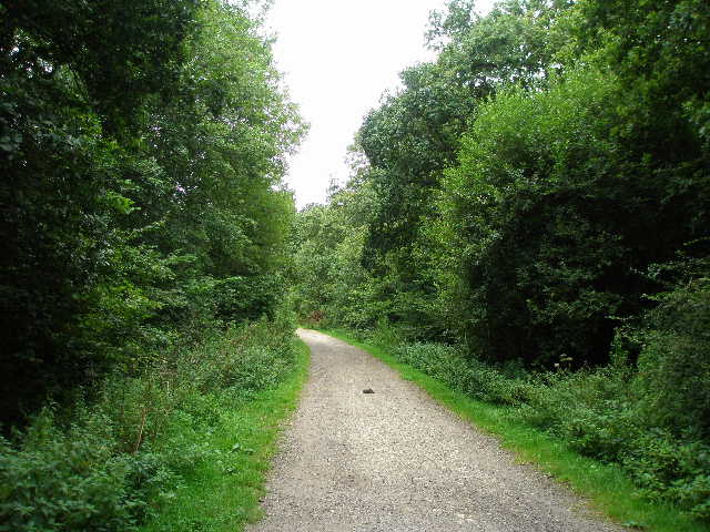
[1] Start of the track through Salcey Forest
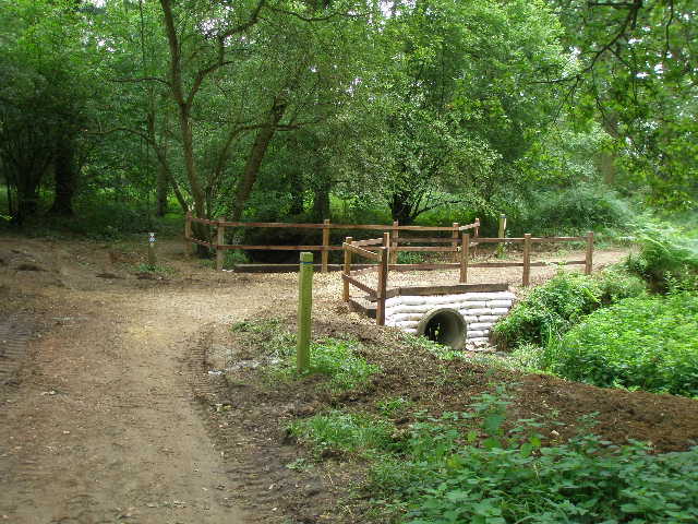
[2] New footbridge in Salcey Forest
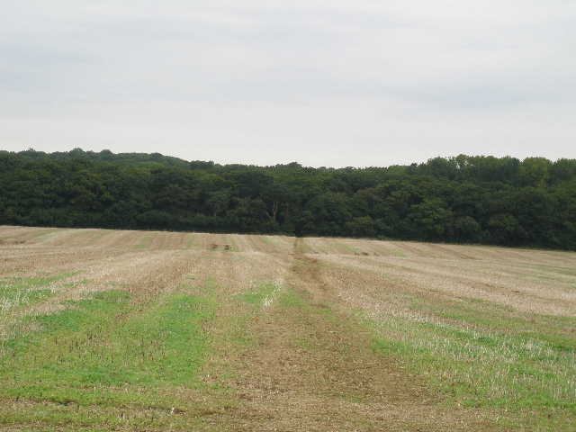
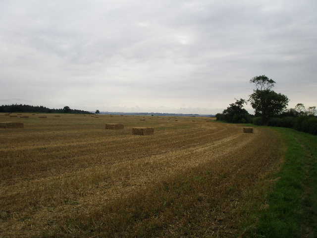
[3] Looking back to Salcey Forest, from path through stubble field
I soon went over an obviously new bridge over a stream or gully [2], and quickly came to a junction by the edge of the forest which I recognised from the Milton Keynes Boundary Walk. I left the forest (moving from Northants into Buckinghamshire) and crossed a stubble field on a bridleway heading south – the corn had still been growing here when I was here about a month ago [3]. On the far side of the field I crossed a footbridge through a hedge – here the Milton Keynes Boundary Walk turned right, but my route turned left. The walker who had left the car park ahead of me was still in front of me, and I now caught up with him as I followed the hedge on my left through another stubble field. We greeted each other and discussed our different routes – in the field corner, I turned right while he was continuing ahead on a circular walk. I saw a stoat in this corner when I came back in the afternoon.
Swan’s Way continued on a wide grass verge beside a left hand hedge through this and the next stubble field, then turned left alongside the gently curving left-hand hedge of a large ploughed field [4]. Looking across the fields on my right, I could see the tall spire of Hanslope church, a familiar landmark from my recent Milton Keynes Boundary Walk journey (the tall and graceful spire was apparently rebuilt after being struck by lightning in 1804). At the next field corner, the bridleway crossed a bridge over a ditch on the left, immediately turning right to continue alongside the other side of the hedge. The path was narrower here, more like a footpath than the wide grass verge of the previous fields. I soon entered a much larger stubble field – across the field to my left I could see Stokepark Wood [5]. I heard the sound of Buzzards, and as I walked along beside the hedge I eventually got a very distant view of one, soaring over the wood.
[4] Looking back along path by ploughed field near Hanslope
[5] Path by large stubble field near Stokepark Wood
[6] Farm track through narrow empty pasture
After quite some way, I reached a crossroads of rights of way, where I turned right. I followed a left-hand hedge through yet another field of stubble, then went through a gate and followed a rather stony and uneven farm track through a long narrow pasture [6]. I then went though another gate, and continued on a wide track between hedges, the ground rising gently on either side. I saw some Water Mint for the first time here, growing in the ditch on my left. I soon came across an odd sight – some shiny red promotional balloons (with ‘Summer Giveaway’ on them) [7], lying in the middle of the track. I then went under a bridge carrying the M1 Motorway [8], and soon reached the attractive small village of Tathall End.
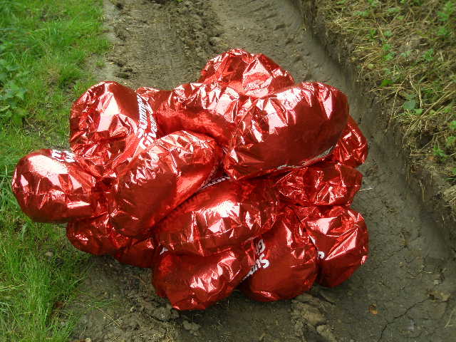
[7] Promotional balloons on bridleway
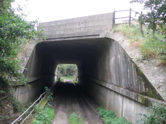
[8] Bridge under the M1, near Tathall End
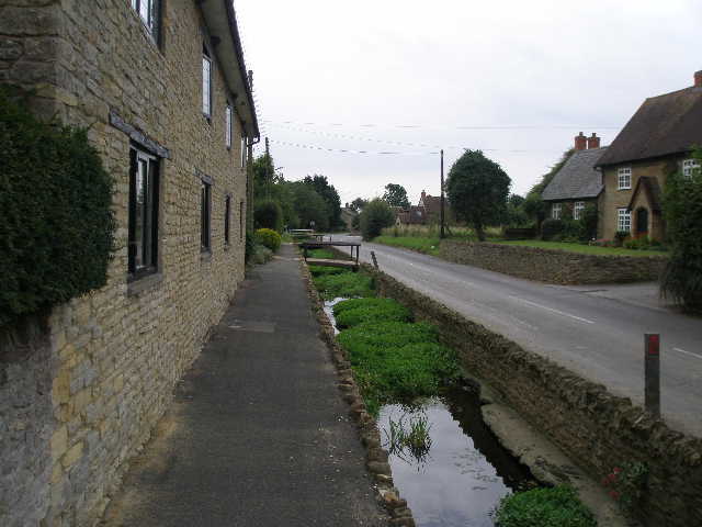
[9] Tathall End
I continued along the road south through the village. The houses, both new and old, were built with the attractive yellow limestone that I’d seen in other villages in the area on the Milton Keynes Boundary Walk. A stream ran through the village to the left of the road, so that the drives of the houses on that side all had small bridges [9]. Where the main road turned right on the edge of the village, I continued ahead on another minor road. For some reason, I felt quite hungry and had to have an Alpen snack bar (about 40 minutes before I usually eat one at 11.30 – I’m very much a creature of habit!). I had a second one about an hour later.
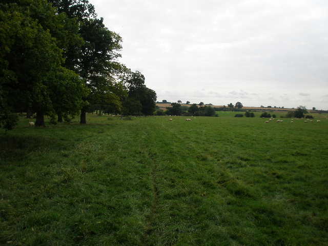
As I came back along this road in the afternoon I saw a buzzard. The road soon passed through a small wood, and then I turned left on a bridleway. This went along the right edge of a large grass field, with a pleasant view ahead over a slight valley to Linford Wood. On my right here was what looked look like some sort of prison or detention centre, it was certainly ringed by two sets of wire fences with several CCTV cameras in evidence. At the end of the field I went through a gate, and entered a large sheep pasture with a narrow belt of mature trees down the left hand side [10]. I followed the edge of the trees through the pasture, several nervous sheep scattering at my approach. I went through a gate at the end of the pasture – the next field also contained sheep, but it was a field of something that looked like clover rather than a grass pasture. I followed the hedge round to the left, and continued along it as it then turned right – several sheep were sheltering beneath the hedge, and again fled rapidly as I approached.
[10] Path by belt of trees in sheep pasture
[11] Old farm buildings near Linford Wood
[12] Path through Linford Wood
I went through a gate in the field corner, and crossed a field of rough grass close to some old farm buildings [11] – there were more sheep grazing here. After another gate, I went through a small area of nettles, and then the path went uphill a short distance between a hedge and a wire fence, with another sheep pasture beyond. Swan’s Way then entered another wood, Linford Wood, and almost immediately reached a junction with paths going off half-right and right. I took the middle, half-right, path, and was soon walking with the wood on my left, and just a tall hedge separating me from farmland on the right [12].
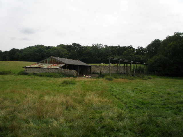
After a quarter of a mile or so, I turned right and left the wood behind. I followed the right-hand hedge of another stubble field, with the ruins of Wood Farm visible ahead [13]. Through another gate, I entered a large pasture with the ruins on my left. Some cattle were grazing on the other side of the ruins, as I continued alongside the hedge on my right. Through an open gate into a second pasture, I then had a barbed-wire fence on my right, with pleasant views over more fields of stubble towards the distant village of Castlethorpe. Swan’s Way then went through a couple of gates, and followed a wide grass strip beside a large ploughed field (I stopped for lunch on a tree trunk along here on my way back).
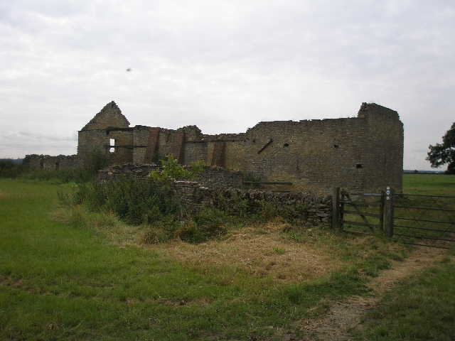
[13] Ruins of Wood Farm
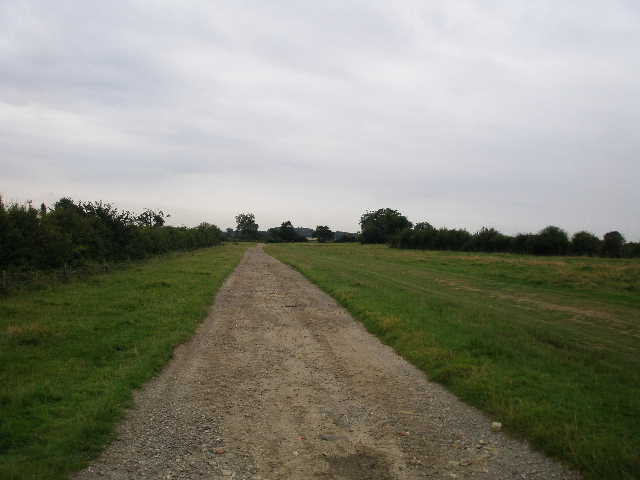
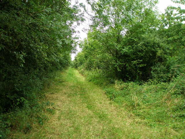
[14] The green lane
[15] River Great Ouse from the bridge
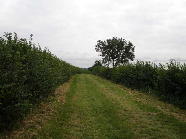
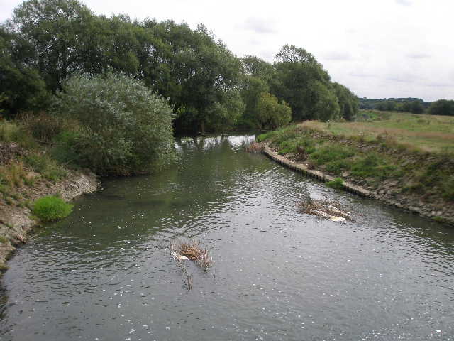
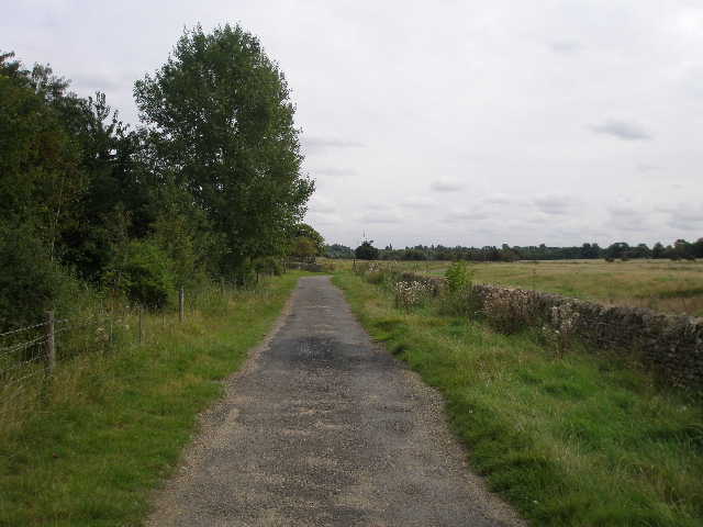
After several hundred yards I reached the next field boundary, where there was a rather complicated junction of paths. My route now took me down a very pleasant green lane [14], a strip of nicely cut grass between hedges about 10 yards apart. I saw Haversham church through a hedge gap on my right, and after quarter of a mile or so passed close to a farm on my left. The green lane ended at a road, where I turned left. I passed a house on the right, and then turned right on a gated lane, with some modern houses on my left at first. Through a gate, the lane descended to where some builders were at work on Haversham Mill. The lane crossed what was presumably the mill race next to the house, and then went over a bridge over the river Great Ouse [15] (there was another gate across the lane on the far side of the bridge).
[16] The lane near Linford Lakes
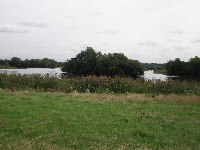
[17] Linford Lakes
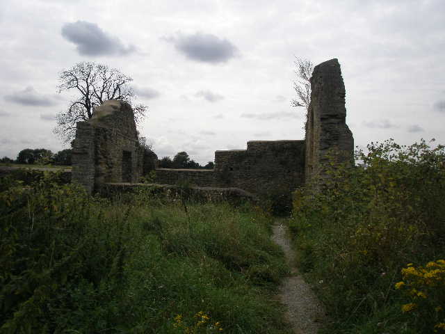
[18] Ruins of St Peter's Church
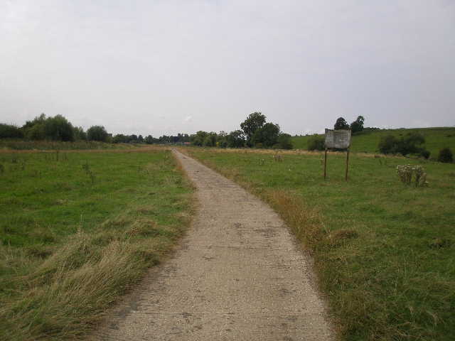
The lane now turned right, with the river a short distance to my right [16] and a short but steep slope beyond where a few cattle grazed. Over to my left was Linford Lakes – some of these former gravel pits are now a mixed coarse fishery, others are a Wildfowl Centre and a nature reserve [17]. The lane was now concrete, with only a few faint remnants of tarmac. There were no hedges, the lane passing through a large area of rough grass. After almost half a mile, I reached the ruins of St Peters church (which the guide says is now restored as a local monument) [18, 19]. The lane continued, with a small wood on the left [20], then crossed another open area of grass to reach a hedge, beyond which was the Grand Union Canal. I followed the towpath a few hundred yards to the left, as far as a road bridge in Great Linford which was as far as I was going today [21].
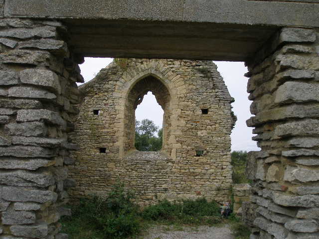
[19] Inside the ruins of St Peter's church
[20] Lane heading towards the Grand Union Canal
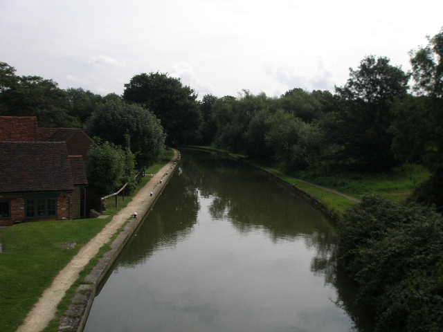
[21] View from the bridge over the Grand Union Canal at the end of the walk
The weather had been quite pleasant when I started the walk, quite cool compared to the heat of the previous few days. The skies were almost overcast, but only with very high, thin clouds that never threatened rain. But as the day wore on, it became very humid and sticky. I was therefore a little tired by the time I got back to my car at 3.10pm. It took me two hours and forty five minutes to walk to Great Linford, but only two hours and twenty minutes to walk back (allowing ten minutes for lunch). This was down to taking about 50 photos on the way out and none on the way back.
This was a perfectly pleasant walk, which I enjoyed. It was very flat, apart from a slight rise to Linford Wood and short descent down to the Great Ouse. Much of it was following hedgerows through stubble fields, but there was enough variety to keep it interesting – a couple of woods, the ruined farm and church, the river and the canal. Tathall End was the only village I went through, apart from the cluster of houses near the end of the green lane (they are part of the parish of Haversham and Little Linford).
Total Distance: 7.8 miles each way, approximately