Pete's Walks - A Dales Walk
If you are considering walking this route yourself, please see my disclaimer. You may also like to see these notes about the maps and GPX files.
Day 1 11/06/06 Leyburn to Aysgarth Falls (12.5 miles, approximately)
A Dales Walk has an unusually high number of alternative routes, there being a high and low level option on most of the six sections of the walk. I was glad that we were to do the high level option today, as the low level route from Leyburn to Aysgarth was only eight miles long and sounded somewhat boring from the description in the guide book – it was almost completely flat, and seemed to go through an almost endless number of meadows with only a couple of small villages to add any variation. The flower-filled meadows are delightful, but we would be seeing enough of them on subsequent days anyway! Our high-level alternative would not only be longer, but would pass some places of historic interest as well as going over the summit of Penhill.
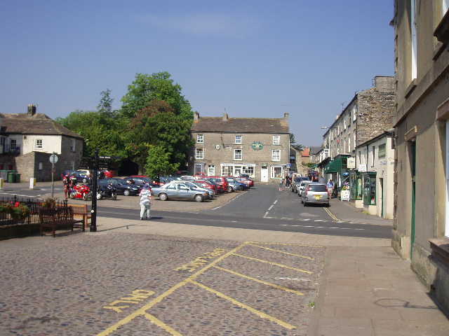
[1] Leyburn
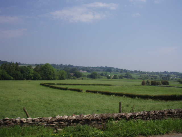
[2] View of Wensleydale, from between Leyburn and Middleham
We started in the large market square in Leyburn [1]. It was after 10.30am when we set off – the journey here from the hotel in Sedbergh took longer than it would normally have done, as the road through Garsdale is closed (due to part of it subsiding into a river!) and so we had to take a 13-mile detour via Kirkby Stephen. This is going to be a problem for us on most days this holiday. A series of footpaths took us gradually downhill through meadows and pastures to a lane, which we followed a short distance to where it met a road [2]. We turned right and followed the road, crossing an interestingly styled bridge over the river Ure, and then took a footpath leading slightly uphill through hay meadows to Middleham [3,4]. We paused near the very impressive looking castle [5] (home of Richard III when he was the Duke of Gloucester), to take some photos and to have some water. It was already very hot, although there was a bit of a breeze.
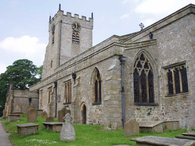
[3] Middleham church
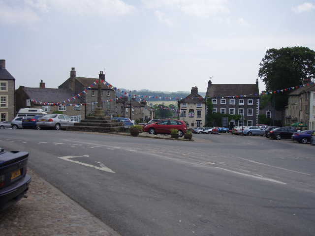
[4] Middleham
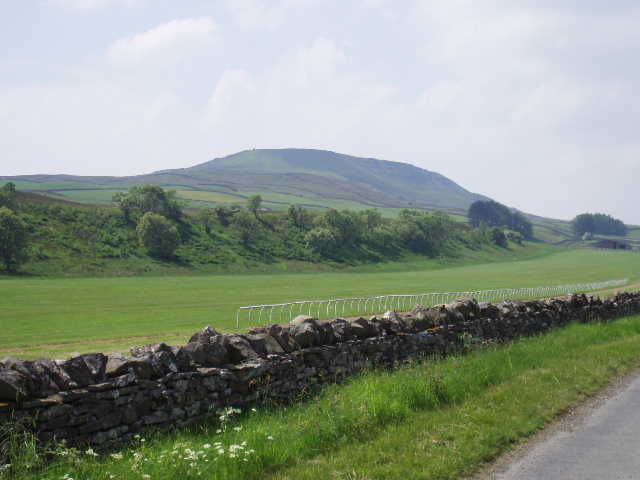
We followed the road heading uphill out of Middleham, until we reached the start of Middleham Low Moor [6]. So far we had been heading generally south, but now we turned to head across the moor in a westerly direction, the way we would be going for the next couple of days as we progressed through Wensleydale. Middleham is the home of a large number of racehorse stables, and the moor is used for training the horses [7]. There was plenty of evidence of this, although we didn’t see any horses as the training finishes by noon and it was now about 12.15 – we saw an all-weather gallop, fence rails and even a few jumps. The moor went on for a mile or longer – all rough grass, no heather or shrubs at all. We saw several curlews and one or two oystercatchers and lapwings, all birds we’d become familiar with over the next few days. As we tramped across the moor, being careful not to tread on any young birds hiding amongst the grass, we could see Penhill ahead of us, and had good views over Wensleydale to our right – Castle Bolton being a prominent landmark.
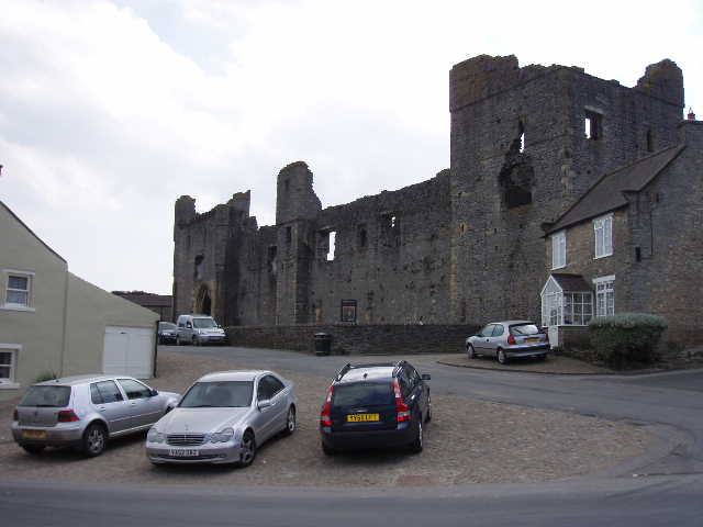
[5] Middleham Castle
[6] View back over Middleham
Eventually we reached the end of Middleham Low Moor. We continued in the same direction, climbing almost imperceptibly all the time, with Penhill gradually seeming to get closer to us. We followed tracks and paths, and then a long tarmac lane leading towards Penhill farm [8]. We stopped to inspect a building marked ‘Rubbing house’ on the map – we assumed it was where the horses were ‘rubbed down’ (there was another gallop adjacent to the building). There had been a sign on the side of the building, but it had been taken down – from the part of it we found inside, we could tell that whatever the building was used for, it dated to the 19th century. At Penhill farm, we turned left and followed a minor road quite steeply uphill. Where it started to level out, we turned right into a field, with Penhill now looming ahead just a short distance away.
[7] The racehorce gallops on Middleham Low Moor, with Penhill in the distance
[8] Looking towards Penhill from the drive to Penhill farm
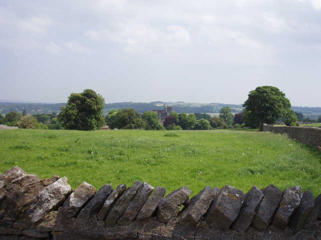
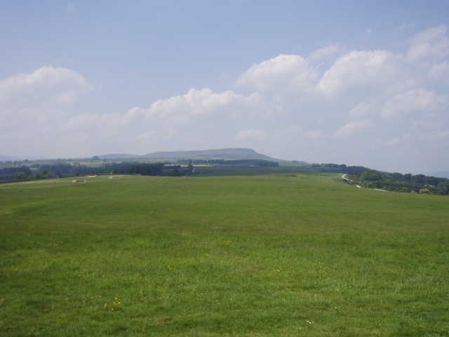
We stopped for lunch by an old wall in the middle of the field. Suitably refreshed, we then girded our loins (whatever that means!) and set off for the summit of Penhill. The path rose gradually across three or four narrow grassy pastures, before a last steep climb of two or three hundred feet brought us to the massive summit cairn. The extensive views over Wensleydale [9], and back the way we’d come from Middleham [10], certainly made the effort of the climb well worth it. Having rested awhile to get our breath back, we set off again, following the edge of the hill westwards with an almost vertical drop on our right. After about half a mile, we took a ‘groove’ in the heather going downhill on the right, which soon joined an old miner’s path heading downhill into Wensleydale. This path through the rough moorland on the side of Penhill was delightful, so well graded that it made the descent almost painless on my doddery old knees. Having reached the intake wall and crossed a couple of rough grass fields, we reached a broad track between walls, and turned left to continue our westerly progression through Wensleydale.
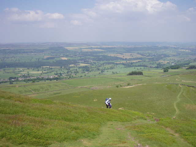
[9] View over Wensleydale from Penhill
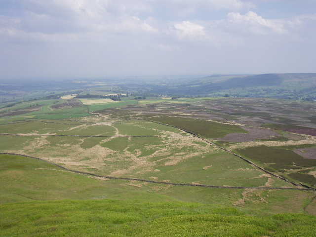
[10] View from Penhill back towards Middleham
After half a mile or so, we left the track and took another descending track on the right, before turning left and following a path that went between two small wooded areas and into another field, where we paused to examine the remains of a Knights Templar Preceptory [11]. Only the lowest part of the wall of the chapel remain, along with one or two stone sarcophagi, of this building which was erected about 1200 and handed over to the Knights Hospitaller in 1312 when the Templars were suppressed. Our path then continued through more stone-lined fields where sheep grazed, until we emerged on a road. We turned left and followed the road until it took us over a bridge over Walden Beck. A fingerpost then indicated a footpath leading across fields. We could soon hear the river Ure, and then could see it as it tumbled over Aysgarth Lower Falls [12]. Our path continued westward along the south bank of the river – it had been a long hot day, and I found the gentle undulations somewhat annoying now. We walked through the churchyard of Aysgarth church to reach a road, which we followed downhill to cross the river, and then a short path led us to the National Trust Car Park, where our minibus was ready to take us back to Sedbergh.
[11] Remains of the Knights Templar Preceptory
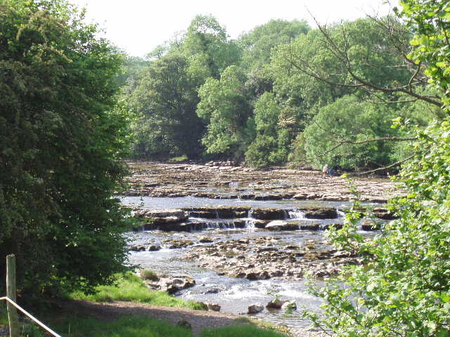
[12] Aysgarth Lower Falls
This was a really nice walk, the fields at the start and end of the walk contrasting with the moorland around Penhill in the middle of the walk. Middleham Castle and the remains of the Templar Preceptory added a historic interest, too. Most of the climbing was very gradual, and the views from Penhill were well worth the effort involved in the final steep pull to the top. It was a very warm day, but fortunately there was generally a cooling breeze to take the edge off temperatures that had been forecast at 26-27C. Unfortunately I had a very slight headache all day, due to a poor night’s sleep and the heat, which rather marred my enjoyment of the day – I was very worried that I could develop one of the mild type of Migraine I very occasionally get. But I managed to close my eyes and sleep a little on the journey back to Sedbergh, and felt fine afterwards, so I’d been worrying about nothing.
Total Distance: 12.5 miles