Pete's Walks - A Dales Walk
If you are considering walking this route yourself, please see my disclaimer. You may also like to see these notes about the maps and GPX files.
Day 4 14/06/06 Kirby Stephen to Keld (10.5 miles, approximately)
Because it was such a short journey from Sedbergh to Kirkby Stephen, we started our walk today well before 10am. We left Kirkby Stephen by means of the picturesque Frank’s Bridge [1]. An information board said that this was part of a Corpse Road, used in times past by people bringing bodies from villages and hamlets with no churches of their own to be buried in the consecrated ground of the church at Kirkby Stephen, but which was now a nice walk for a picnic – I had visions of people picnicking around their coffins! We followed a paved path along the river a short distance and then slightly uphill to a lane into the nearby village of Hartley. Here we took another narrow lane steadily uphill, diverting off it at one point to walk over a disused railway viaduct (Olwen needed her daily fix of railways!).
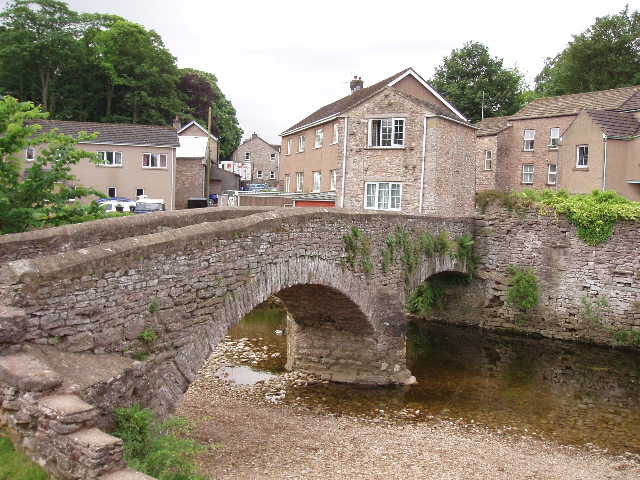
[1] Frank's Bridge, Kirkby Stephen
As we continued climbing up the lane, passing the huge and unsightly scar of Hartley Quarry, it was very apparent that we were now on the route of the Coast-to-Coast path. Whereas we had so far seen very few walkers at all on our travels, now we saw several pairs or small groups of walkers toiling slowly up the steady gradient of the lane ahead of us. Over the course of the day, we would see well over 20 people walking the Coast-to-Coast. A year or so ago, I was told (or else I read somewhere, I can’t quite remember where I got this from) that on a peak day over 200 people might complete the walk in Robin Hood’s Bay! A far cry from when I walked it with two friends in 1977, just a few years after Wainwright wrote his guide book that created the route – I don’t think we came across any body else walking the route on our entire journey from St Bee’s Head to Robin Hood’s Bay. We had only heard about the walk through meeting someone who was walking it when we stayed in the Youth Hostel at Keld the year before, when we walked the Pennine Way (Keld is where the two routes cross). From Kirkby Stephen to our final destination of Richmond, A Dales Walk generally follows the same route as the Coast-to-Coast path, so for the rest of today and the remaining two days of our journey, we never went very far without passing, or being passed by, Coast-to-Coast walkers.
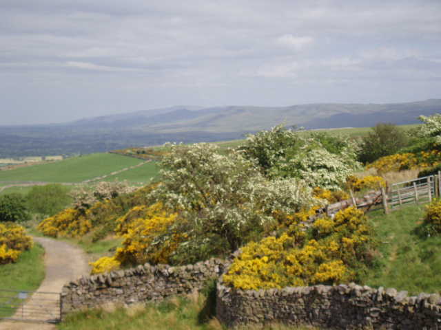
[2] Hazy view towards Cross Fell from near the end of the lane
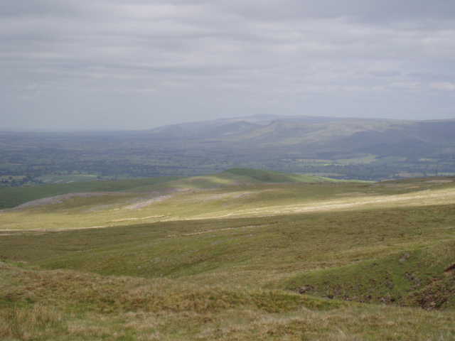
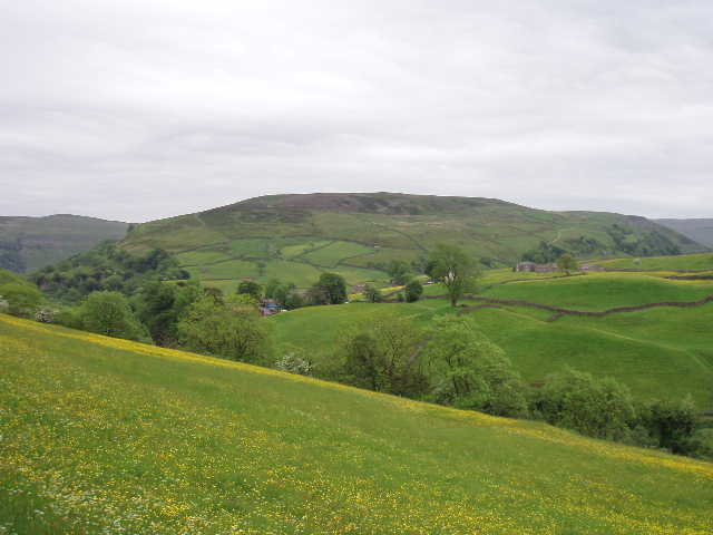
[3] Hazy view towards Cross Fell from the path up to the Nine Standards
Near where the lane ended and a track began, we rested for a breather and a water stop by a seat or ‘throne’. We had good views back over the Eden valley, and north towards Cross Fell [2], the highest point in the Pennines.While getting our breath back, we were passed by a man doing the Coast-to-Coast with his black Labrador dog – I wondered if the poor dog knew what it was in for when it owner called ‘Walkies!’, but it seemed to be enjoying itself. We continued onwards and upwards, and took the track still heading uphill towards Nine Standards Rigg – the tall columns of stone now clearly visible on the skyline ahead of us. So many people now walk the Coast-to-Coast path that there is a serious problem with erosion in places, and here on Nine Standards Rigg three different routes (Red, Blue, Green) have to be used according to the month of the year – as this was June we had to follow the Red Route. The gradient wasn’t steep, but the climb went on for a long time. We took another breather by a small wooden bridge crossing some boggy ground [3], then set off for the final ascent to the Nine Standards. Again, the climb was fairly gentle [4] and we soon found ourselves amongst a small crowd of Coast-to-Coast Walkers at the tall cairns that are the Nine Standards [5]. Each of the cairns is 8-10 ten feet tall and of considerable girth, but no-one really knows for sure why they were built here. One story has it that they were built to look like an encamped army from a distance, to deter the marauding Scots from plundering the rich lands below.
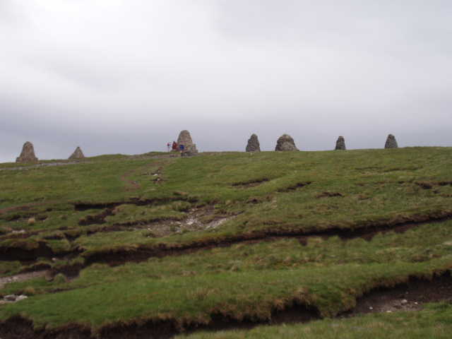
[4] Approaching the Nine Standards
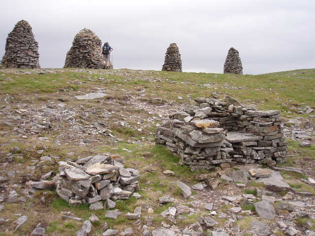
[5] A stone seat and some of the Nine Standards
From the cairns we walked the short distance to the actual summit of Nine Standards Rigg, where there were two triangulation columns about 100 yards apart [6]. Near the higher of the two, an Australian Coast-to-Coaster (whom we would meet several times subsequently other the next couple of days) kindly took some photos of us, this being the highest point we would reach on A Dales Walk. We carried on, following the crowds. We were now in really bleak and empty moorland, with very few distinguishing features – I really enjoyed being back in such empty scenery, so typical of this part of the Pennines, as I hadn’t walked in this type of landscape for many years. There were no crags or really steep slopes, just mile after mile of undulating and almost featureless heather moorland [7]. The weather had been dry so the path underfoot was nice and springy – I probably wouldn’t have enjoyed my return to the Pennine moors if it had been wet and slimy as it more often is! This morning had started out sunny, but it had clouded over and cooled down, so that we had donned our waterproof jackets before we reached the Nine Standards and kept them on well into the afternoon. We stopped for lunch beside an isolated cairn or ‘pile of stones’ as it was described on the map, admiring the bleak scenery around us.
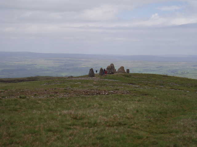
[6] Looking back to the Nine Standards from one of the triangulation columns
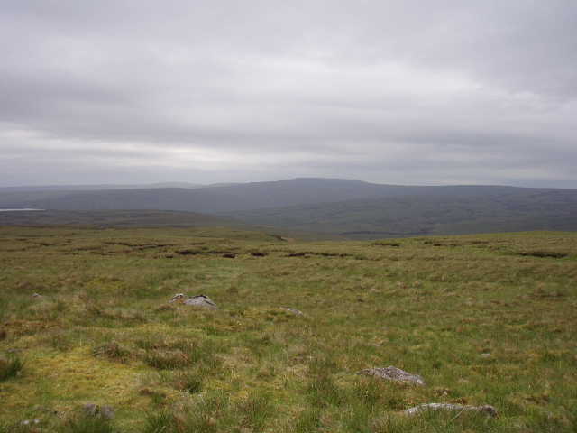
[7]The bleak moors east of Nine Standards Rigg
We carried on for miles on the well-trodden path through the heather, gradually descending as we continued westward, eventually picking up a new track used by shooters (the shooting business must be doing very well – we came across several new tracks that went for miles out into the moors, purpose built for those brave souls that go out to kill the mighty and dangerous grouse). This led us down to a farm in the charmingly-named Whitsundale. We followed a good path down this valley, now off the moors and back into sheep grazing land [8], until we reached Swaledale, which we would be following westward for the rest of our journey. Field paths took us towards Keld [9], the highlight of this section being a good sighting of a short-eared owl.
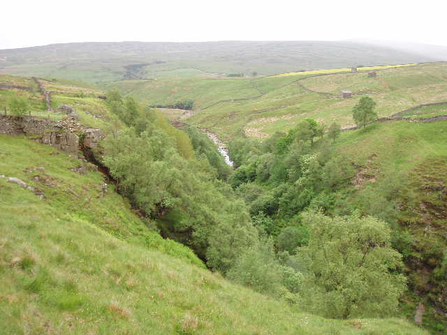
[8] Steep-sided ravine beside the path to Keld
[9] Looking towards Keld and Kisdon Hill
We joined the Pennine Way not far from Kisdon Force (which we would see tomorrow), near a wooden seat erected as a memorial to two sisters who had walked the Coast-to-Coast and Pennine Way when they were over 70 – this had inspired Anne to walk the Coast-to-Coast four years ago. It was now just a short walk for us into the tiny village of Keld, where we stopped for an ice-cream and waited for the minibus to arrive to take us back to Sedbergh.
Total Distance: 50 miles approximately