Pete's Walks - A Dales Walk
If you are considering walking this route yourself, please see my disclaimer. You may also like to see these notes about the maps and GPX files.
Day 3 13/06/06 Appersett to Kirby Stephen (15 miles, approximately)
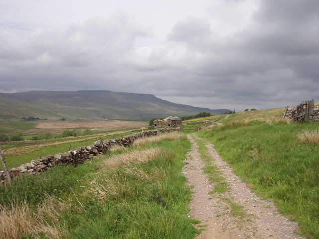
From Appersett, we followed field paths for about a mile [1], mainly through rough grazing land, until we reached a road. We followed this to the left, still heading roughly westwards, until we reached a junction where a lane came in from the left after about half a mile. Here we left the tarmac, and started walking along a rutted track that was signposted as The Highway.
This was a part of the route I’d been especially looking forward to, in fact it’s a walk I’ve wanted to do for many years. The Highway’s full title is really Lady Anne Clifford’s Highway, named after a remarkable seventeenth-century woman who did much to repair and renovate many of the historic buildings in this part of the country. She was the only child of a great northern landowner, but when her father died he left all his lands to his brother rather than to her, and she only inherited them at the age of 53 after, first, her uncle died and then her cousin died childless. This was during the Civil War, so it was not until 1649, when she was almost 60, that she was able to begin her amazing campaign of restoration and rehabilitation. Her main residence was Skipton Castle, which she repaired after it had been ‘sleighted’ by the Parliamentarians during the war. Over a period of 26 years, until her death aged 85, she travelled tirelessly between her numerous properties, organising the repairs of Appleby Castle, Beamsley Hospital, Barden Tower, Pendragon Castle, Brough Castle, Brougham Castle and several churches. Her travels often took her from Wensleydale into Mallerstang, which is why this track now bears her name. Having visited several of the places that she restored, and heard of this route that she used, I have wanted to walk it for many years. Not just for its historic associations, but because it is an interesting route into Mallerstang, a dale that I know well from childhood holidays but which I have not previously explored on foot.
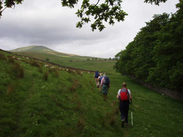
[1]Path from Appersett heading towards Cotter End
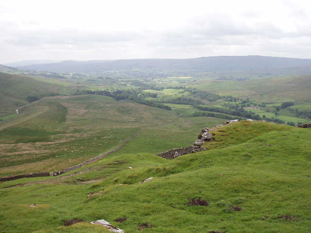
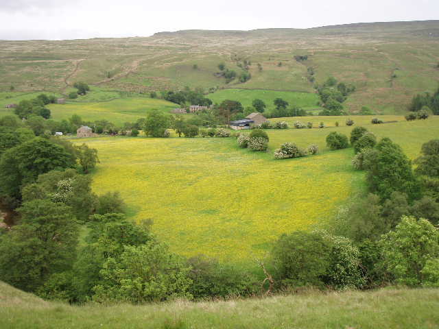
[2]View of Wensleydale from Cotter End
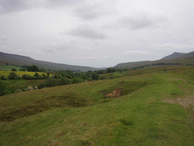
The start of The Highway was fairly level for about a third of a mile – this section was heavily rutted due to use by off-road vehicles. But then came the very long and steep climb of Cotter End. On the way back to Sedbergh in the minibus yesterday, James kindly pointed out this very steep section of path and told us that was where we’d been walking today! So this morning we all joked about having had nightmares about it. We all took the climb at our own steady pace (some steadier than others!), pausing for a breather about halfway up where another right of way crossed, heading into Cotterdale on our right. In her diary, Lady Anne Clifford mentioned going over this hill in her carriage, a feat never thought to have been done before as previously it was just a way used by drovers – I felt very sorry for any horses having to drag a carriage up this hill! Eventually we reached the top of the climb, where there was a very large lime kiln in good condition, and a bench where we all took a long breather – the bench was a memorial to a trail rider who had ‘found neutral at last!’. The views from the top made the toil well worthwhile, as we could look down on the start of Wensleydale [2] (much narrower and wilder than the wider and more pastoral parts of the dale we’d seen on the previous two days) and into Cotterdale, with Great Shunner Fell beyond (I well remember this hill from when I walked the Pennine Way 30 years ago!).
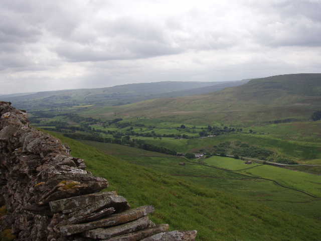
[3] Looking back at the start of Wensleydale from The Highway
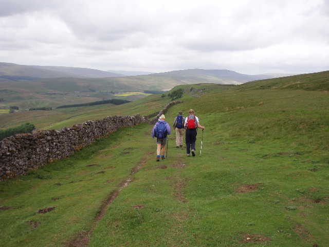
[4] Walking along The Highway towards Mallerstang
[5] The Highway, with Wild Boar Fell across Mallerstang in the distance
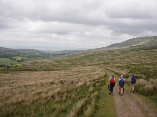
The walk from here along The Highway was every bit as enjoyable as I’d hoped it would be. The clear and wide path contoured round the fellside above a typical dry stone wall, gradually changing direction from west to north as we moved from Wensleydale into Mallerstang [3,4], the only dale that runs north-south. Early on, in the distance we saw the viaduct at Garsdale Head, and an impressive shooting lodge owned by one of Prince Charles’s chums apparently. As we came into Mallerstang, we could see Wild Boar Fell on the far side of the valley [5], getting nearer and nearer as we followed The Highway for mile after mile [6]. We crossed one or two becks on our way, and passed two or three ruined buildings, one an old inn. At one point we met another party of walkers from our hotel in Sedbergh, who were walking from Mallerstang to Cotterdale and on into Hawes. After a brief chat with them about our respective walks, we carried on, enjoying the marvellous views ahead along Mallerstang and over towards Wild Boar Fell on the left (this fell was reputedly the place where the last Wild Boar in England was killed – a tomb in Kirkby Stephen church allegedly contained a tusk from it).
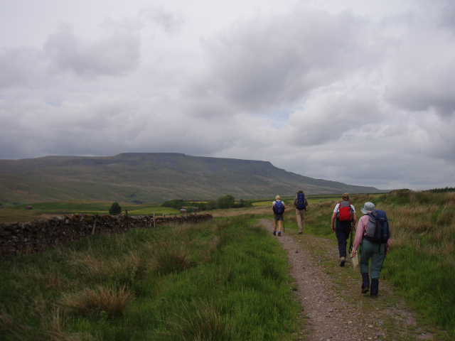
[6] Walking along The Highway, with Wild Boar Fell across Mallerstang in the distance
[7] Looking across Mallerstang to Wild Boar Fell, from near the sculpture
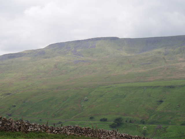
[8] Mallerstang Edge
We stopped for lunch shortly after crossing Hell Gill, although we saw nothing of the falls or ravine that are quite spectacular in places. We had now crossed the main watershed of England, as the becks now ran down to the infant river Eden in the valley below us, destined for the Solway Firth and the Irish Sea, whereas before the water in the tributaries of the Ure all ended up in the North Sea. We carried on along The Highway, with Wild Boar Fell now directly opposite us across the deep valley of Mallerstang [7], with the matching cliffs of Mallerstang Edge [8] coming into view ahead on our side of the valley. Today, for the only time, we did the shorter option of the two alternative routes in the guide book – the high level route crossed the valley and went over the summit of Wild Boar Fell, but this would be a walk of 19.5 miles with well over 2000 foot of ascent so it wasn’t really a feasible option for us. Further along The Highway, we came across a large modern sculpture [9] (erected so recently it isn’t mentioned in the guide book), its two pieces divide by a wavy gap that apparently was meant to represent the meandering river Eden. We stopped here for some photos, as it was a good viewpoint of the steep slopes and cliffs on either side of the valley, as well as along the valley northwards towards our destination of Kirkby Stephen.
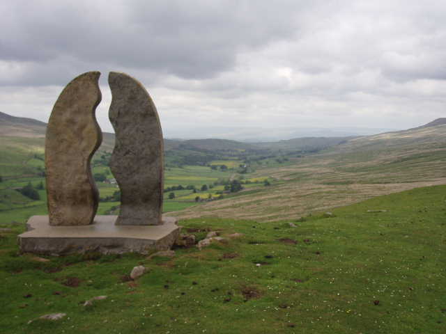
[9] The sculpture, overlooking the northern end of Mallerstang
[10] Lady Anne's Highway descending into Mallerstang
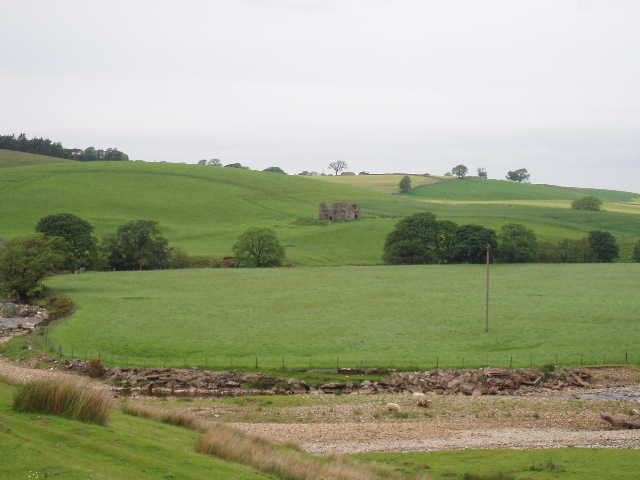
[11] Pendragon Castle
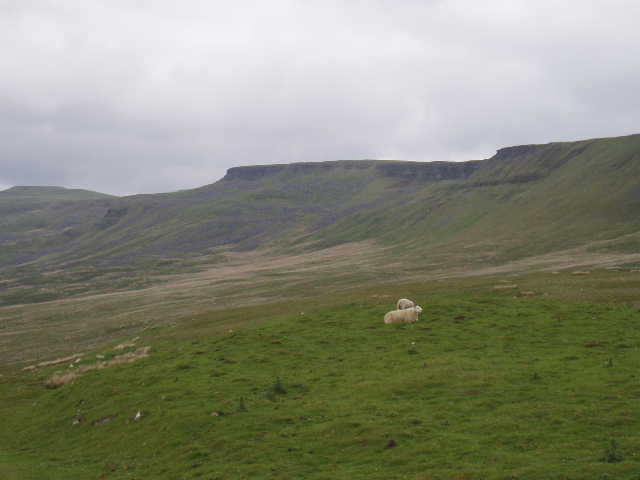
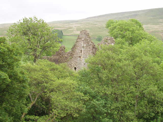
The Highway continued heading northwards, but now gradually descended down the rough grassy hillside [10], to meet the road through Mallerstang near a building called The Thrang. We crossed the road, and continued on footpaths through sheep pastures close to the valley floor. We stopped again when our path went close to Pendragon Castle [11] (one of Lady Anne Clifford’s properties) which we could see rising through the trees on our right. The castle was built by Hugh de Morville, one of the conspirators in the murder of Thomas Becket. From near here, the outline of Wild Boar Fell can appear to show the silhouette of a man’s face [12] (as if he were lying on his back), and legend has it that this is the face of Becket, come back to haunt de Morville for all time!
[12] Looking back along Mallerstang from near Pendragon Castle
[13] View across Mallerstang from near Pendragon Castle
We continued on our way along clear paths [13], still mainly through sheep pastures, until within a mile or two we reached another castle, Lammerside Castle [14,15]. It seemed odd that there were two castles so close together in this small valley. It also seemed odder still that the castle was positioned just below a small hill that overlooked it, so that it seemed to be in a totally indefensible position. We were now out of the wilder parts of Mallerstang and had come back to cultivated fields. With appalling timing, we managed to reach one field just as the farmers were finishing spraying it with slurry! Despite washing them when we got back to Sedbergh, some of our boots still stank the next day. Shortly after this unsavoury episode, we passed Wharton Hall [16], a fortified farmhouse thought to date back to the eleventh century (the same as Pendragon and Lammerside Castles – this must have been a pretty violent area in those days!), although the architectural historian Pevsner claimed that no part of Wharton Hall was earlier than the fifteenth century.
[14] Looking ahead towards Lammerside Castle
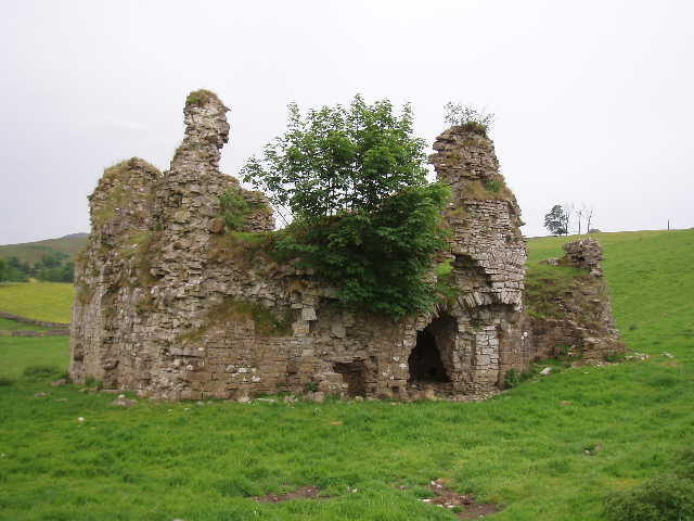
[15] Lammerside Castle
[16] Wharton Hall
We now soon reached the town of Kirkby Stephen, and walked along the main road to the market square, passing the chapel converted to a Youth Hostel in which I stayed when I walked the Coast-to-Coast walk in 1977. Our minibus was waiting to take us the 12 miles back to Sedbergh, the shortest and easiest journey for any of our walks on this holiday – having spent three days walking nearer to Sedbergh, we would now be walking away from it as we headed back east towards Richmond.
Total Distance: 39.5 miles approximately