Pete's Walks - Aylesbury Ring
If you are considering walking this route yourself, please see my disclaimer. You may also like to see these notes about the maps and GPX files.
Day 4 13/03/06 Hulcott to Wendover (9 miles each way, approximately)
Parked in Hulcott.
Tough day today, one of the longest walks I’ve done. Due to a couple of unintentional ‘diversions’ I must have walked at least 19 miles. Although there was no frost this morning, it was very cold – although I was plenty warm enough, I kept my thermal hat and my mitts on all morning, only taking them off when it warmed up a bit in the afternoon. A very grey day, overcast for most of the time, although it stayed dry all day. It was a week since my previous walk on the Aylesbury Ring as we have finally had a rainy spell (I managed to do a couple of shorter local walks in the meanwhile). Despite the rain we’ve had, the paths weren’t too bad today, although there were a few puddles in some of the fields I crossed.
This was an almost completely flat walk – the only up and down was where I went over a couple of bridges! The route from Hulcott went south-east and then south, crossing the Vale of Aylesbury on farmland that was mainly sheep pastures, before following the Wendover Arm of the Grand Union Canal in a south-westerly direction to Wendover.
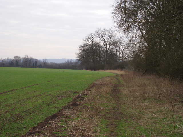
I started out from Hulcott at just after 9.30. The Aylesbury Ring followed the edge of a field, passing the moated site I’d seen on my previous walk, and then crossed a couple of empty sheep pastures. Near a farm, it continued across a rather muddy pasture, and then crossed a ‘set aside’ field diagonally (no marked path). In the corner of that field it crossed a short and narrow brick bridge, to enter another sheep pasture (with a few lambs in it) and then continued in the same south-easterly direction across a much larger sheep pasture (a waymark on a line of posts about halfway across kept me on the right track). I saw a hare in this field, both on the way out and on my return in the afternoon. Ahead and to the south, I could see the northern escarpment of the Chiltern Hills. The Aylesbury Ring then went across a small and muddy field, and then left along a hedgerow that marked the course of a disused railway. I then had to cross two fields that had been ploughed and planted without the footpath being reinstated – although there were footprints showing where other walkers had already crossed.
[1]Footpath near Long Marston
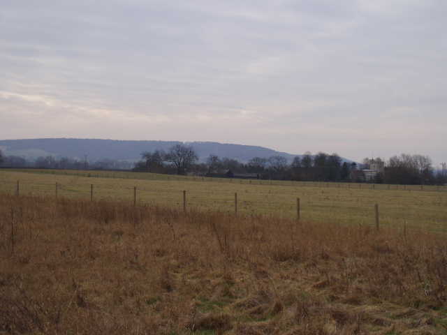
[2] View towards Puttenham, with Aston Hill in the background
After 100 yards or so on a farm drive, I crossed a stile and walked across a freshly manured pasture to where two further stiles gave access to a drive through another farmyard. The Aylesbury Ring then followed a hedgerow in another pasture, and continued in the same direction along the edge of another freshly planted field, with a small wood on the right [1]. I saw two more Roe Deer in this field in the afternoon – they were lying flat in the middle of the field, obviously hoping they wouldn’t be seen (I was glad I’d remembered to take my binoculars with me again). At this point, I could see the church and village of Long Marston, with Ivinghoe Beacon in the distance. The Aylesbury Ring continued, crossing another pasture diagonally [2], with the church and hamlet of Puttenham over to the right, and then went through another field near an impressive modern development of old farm buildings. After a field of rough grass, I followed a path behind some houses and then diagonally across a small pasture to a road in the hamlet of Astrope.
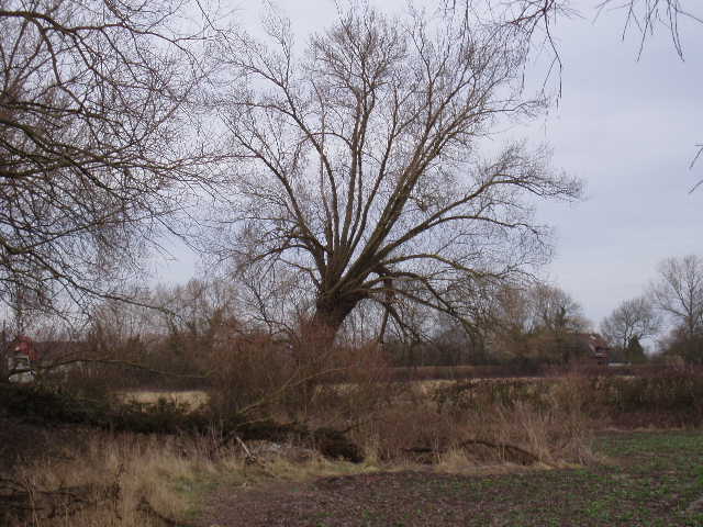
[3]A Black Poplar (?) near Astrope
From Astrope, I was now heading south rather than south-east. I first crossed yet another small pasture, and then followed a hedge along the right-hand side of a large ploughed field. The leaflet about the Aylesbury Ring said there were good examples of the rare Black Poplar tree on this section, and I’m pretty sure I saw and recognised them along this hedgerow [3] (oddly enough, I’ve just received my membership pack from the Woodland Trust and read the booklet about native trees last night). At the corner of the field, I crossed two stiles into a large paddock. I could see a lone horse on the far side, by the gate and stile near a road. As I crossed the paddock, the horse came trotting towards me – I was a bit wary of it, but it stopped and let me stroke it, then returned to the gate. When I got there, it again let me stroke it as I climbed the stile to the road. A similar thing happened on my way back, except it galloped towards me rather than trotted, which was a bit unnerving until it stopped just a few feet from me. I think it was disappointed that I didn’t give it something to eat, but I never feed animals.
I followed the road a few yards to the left, where a hump-backed bridge took it over the Aylesbury Arm of the Grand Union Canal [4,5]. Opened in 1814 to carry goods to and from Aylesbury, it faced closure in the 1960’s until the Aylesbury Canal society campaigned to ensure its survival. There were several narrow boats moored along it just west of the bridge.
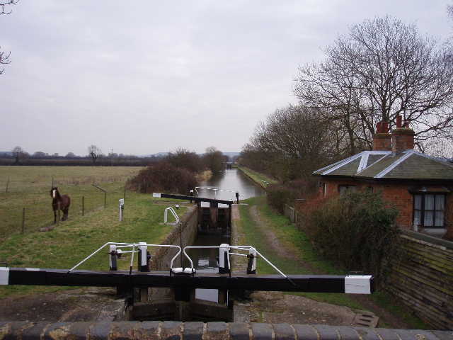
[4]The 'friendly' horse and the Aylesbury Arm of the Grand Union Canal
[5]Aylesbury Arm of the Grand Union Canal
It was at this point that I started to have problems with my route-finding, although I don’t think it’s all entirely my fault that I went wrong a couple of times. On the other side of the bridge, there was a metal signpost with two Aylesbury Ring signs, one pointing back the way I’d come, the other along the canal to the right. However, my OS map, and the map on the leaflet, clearly showed that the Aylesbury Ring did not follow the canal, but took a footpath that left the road a few yards further on. I assumed that the route must have changed (although on the other two occasions where the route differed from that on the OS map, the new route was shown on the leaflet) so I duly followed the sign and headed west along the canal towpath. After about 300 yards I came to a signpost where a footpath branched left away from the canal. There were various waymarks pointing both along the towpath and to the footpath, but no sign at all for the Aylesbury Ring. Looking on the map again, I saw that if the rerouted Aylesbury Ring did not take the footpath, then there was no other footpath leaving the canal for a very long distance and so the new route would be different to the old one for several miles. This seemed unlikely, yet if the Aylesbury Ring used the footpath where I now was, surely it would be signposted? Confused, I decided to return to the road, to see if there was any indication of the old route shown on the map and the leaflet. Sure enough, just up the road was a footpath with Aylesbury Ring waymarks.

[6]The new section of dual carriageway on the A41 that bypasses Aston Clinton
I guessed that maybe the Aylesbury Ring had been rerouted, but the old route had been left in place for a while until the maps were updated (although this obviously hadn’t happened elsewhere where the route had been altered). I followed the waymarked path, which followed the hedges of a couple of fields and then across yet another empty sheep pasture. Ahead I could see the relatively new dual carriageway section of the A41 that bypasses Aston Clinton [6] – this was not shown on my map, so it occurred to me that this might be the reason for the route being altered to follow the canal. Where the path I was on reached the road, a waymark pointed right along a concrete farm road, obviously going to where a lane crossed a bridge over the dual carriageway. As I walked towards the bridge, over to my right, I could see a hump-back bridge that obviously crossed the canal – I thought the new route must leave the canal there and follow the lane to cross the dual carriageway. (UPDATE - on 26th February 2007 I walked the Aylesbury Arm of the Grand Union Canal in both directions. There was indeed an Aylesbury Ring signpost by the hump-back bridge, so the new route does follow the canal between two bridges then follows the minor road towards Buckland). Looking on my map, I couldn’t see any way of getting back to the old route, except for following the lane through the village of Buckland, to where the old path came out just beyond the church. So I followed the road for half a mile through Buckland, and then continued onwards on the path shown on the map, following roads for about half a mile to Aston Clinton.
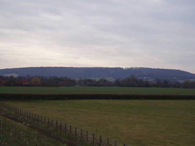
[7]Looking towards Aston Hill from near Buckland
In fact, when I came back in the afternoon I discovered I’d made a mistake. With hindsight, it was quite obvious what the Aylesbury Ring did. When it reached the new dual carriageway, it followed its embankment to its right to the bridge [7], and then on the other side followed a new footpath (obviously not on my out-of-date map) along the opposite embankment back again to the original path i.e. a diversion of a few hundred yards along either side of the dual carriageway to a safe crossing over the bridge. Why I didn’t twig this I’m not sure, but basically the totally spurious signpost pointing along the canal had totally confused me and persuaded me that there must be an old and a new route that must merge somewhere. Anyway, when I got back here in the afternoon, having again followed the road through Buckland, I saw the Aylesbury Ring waymark that I’d missed in the morning, and so I had to detour to walk the bit I’d missed in the morning. I followed the embankment for a few hundred yards, then picked up the path that crossed a large empty paddock and then followed the edge of a ploughed field. The path then crossed two more small grass fields, before entering consecrated ground outside Buckland church [8]. The path emerged on a small side road, which joined the main road through Buckland near the church. Having done this, I turned round and went back the same way before continuing on my way back to Hulcott. My erroneous walks along the canal and through Buckland both ways added at least a mile to my journey.
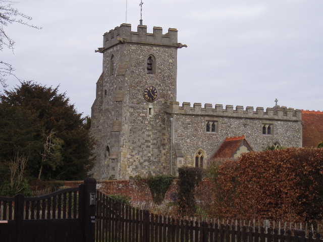
[8]Buckland church
Having followed the road section to Aston Clinton, with pleasant views ahead of Aston Hill and its woods, I continued down another road (passing the entrance to Green Park, another former Rothschild home) which took me over a hump-backed bridge to the towpath on the southern side of the Wendover Arm of the Grand Union Canal. This arm of the canal was completed in 1797 – its purpose was as a feeder supplying water to the main Grand Union Canal, although leakages meant that it never worked properly. It is no longer navigable, although the Aylesbury Ring leaflet says that the Wendover Arm Trust are campaigning to get it re-established as a navigable waterway. Personally, I’d be glad to see it left as it is – in its wilder, unkempt state, with the water only a foot or so deep, it seemed more natural and better for wildlife. I saw herons, dabchicks, coots and moorhens as I followed the towpath for several miles. I’m not too keen on walking towpaths for too long (bit monotonous and very, very flat!), but this wasn’t too bad at all. I passed the RAF training college at Halton (yet another former Rothschild home), and I also saw some gliders being towed into the sky at the nearby airfield. At Halton, the canal passed under a bright blue iron bridge [9], another legacy of the Rothschilds (this part of Buckinghamshire was once nicknamed ‘Rothschildshire’).
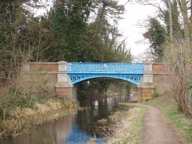
[9]Looking back at the Iron bridge over the Wendover Arm of the Grand Union Canal
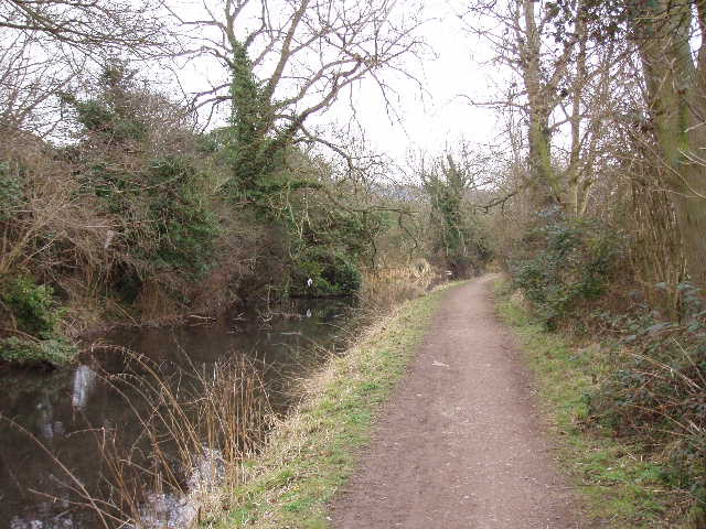
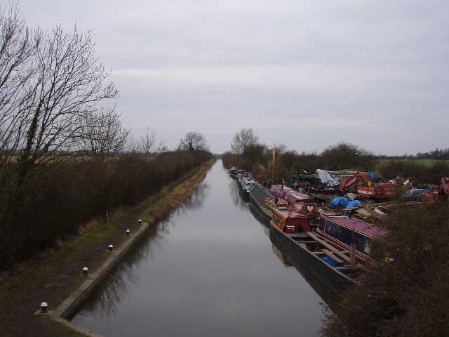
[10] The Wendover Arm of the Grand Union Canal
The towpath switched to the northern bank at Halton, and continued on for another couple of miles [10]. I eventually left it opposite a noisy school in Wendover (obviously playtime!), to follow a short road that joined the main road that goes from Wendover to Aylesbury. I turned left here, and within a few hundred yards reached the village centre [11,12], and shortly after arrived at the entrance to the car park by the library where I had started out from a couple of weeks ago. It had taken me exactly three hours to get here from Hulcott, so I turned round and headed back straight away, knowing that I would be really tired by the time I got back. I stopped for lunch on a bench by the canal by RAF Halton – I even bothered to do a few simple stretches, to make sure I wouldn’t feel too sore at the end of the walk. The return trip was pretty uneventful, apart from having to do the extra bit where I’d gone wrong near Buckland (and seeing the Roe Deer near Astrope). I did feel very tired by the time I got back to my car. This walk was four miles longer than my usual average of 15 miles, and I could certainly feel the difference.

[11]Wendover (the building with the clock tower is the Tourist Information Office)
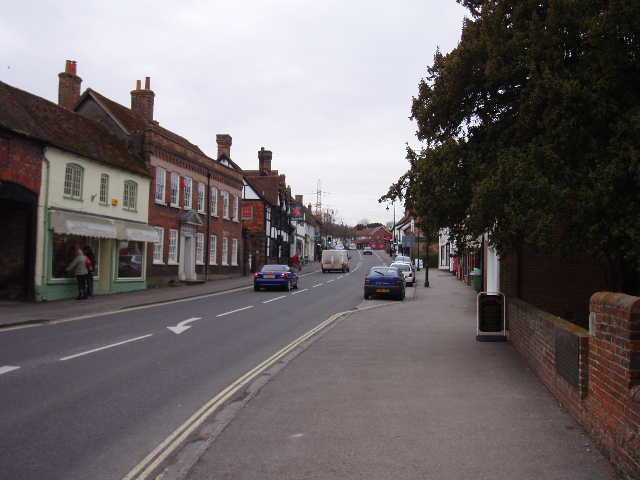
[12]Wendover
This was a pleasant enough walk, but very flat and with little of great interest en route. It was longer than my usual walks, so it was a bit more of a challenge than usual. I enjoyed the canal section more than I’d expected to, although the stony towpath was rather tough on the feet after a while.
Total Distance: 31 miles each way (Note that all distances for this route are very approximate)