Pete's Walks - Aylesbury Ring
If you are considering walking this route yourself, please see my disclaimer. You may also like to see these notes about the maps and GPX files.
Day 3 06/03/06 Waddesdon to Hulcott (8.5 miles each way, approximately)
Parked in lay-by on main road into Waddesdon.
Waddesdon is the furthest point on the Aylesbury Ring from my home in Kensworth, but I still managed to get there and start walking by about 9.50am. It was another cold morning, with the temperature only a few degrees above freezing. The day started quite sunny but gradually clouded over, although it never became completely overcast.
From Waddesdon, the Aylesbury Ring continued to follow the route of the North Bucks Way, heading north across two pastures. Here, at a stile giving access to a third pasture, the two paths split, with the Aylesbury Ring heading slightly left to the far corner of the pasture, while the North Bucks Way went half-right. I double-checked the map at this point to make sure I got it right – I managed to take the wrong turning near here when I walked the North Bucks Way and didn’t want to do it again. After this third pasture, the path followed the edge of a ploughed field to a long farm drive [1]. I followed this to the right for a few hundred yards, before turning slightly left across two ploughed fields, the route being marked out by a tractor track.
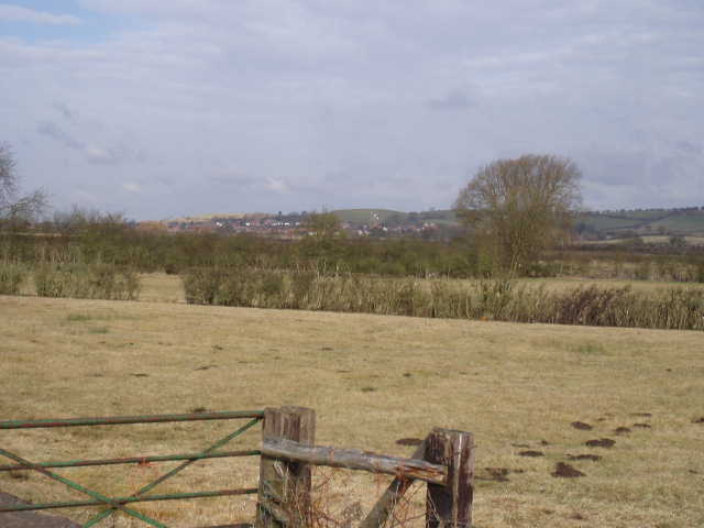
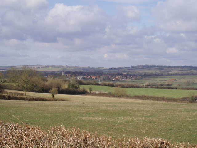
[1]Looking towards Quainton from near Waddesdon
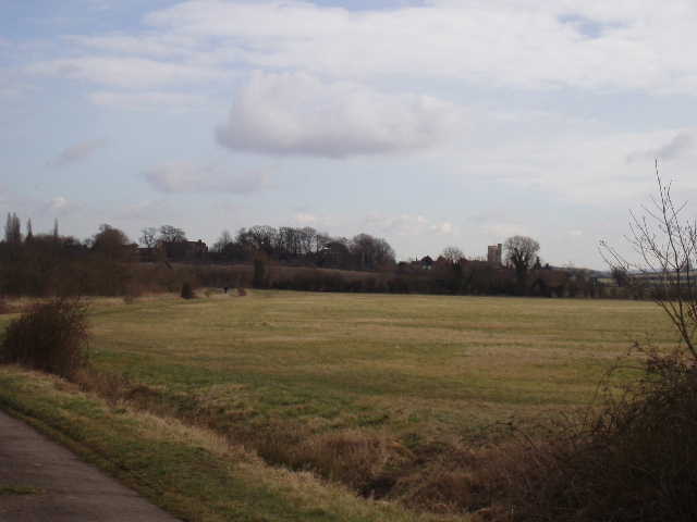
[2] Looking towards Hardwick from the lane leading to it
I then followed a fairly busy road to the left, now heading north again. Ahead of me I could see a fairly steep hill, connected to Quainton Hill which the North Bucks Way crossed, although I knew the Aylesbury Ring didn’t go as far as the hill. Indeed, after about a quarter of a mile it turned off on a path on the right, heading north-east across a large pasture, rising slightly, then continued across some more pastures, one containing sheep, in the same direction until it reached a minor road. Across this, the path continued in more or less the same direction across further pastures, before crossing a narrow footbridge and turning north again across a further large and empty pasture.

[3]17th Century pub in Hardwick ('Ye Olde Jug')
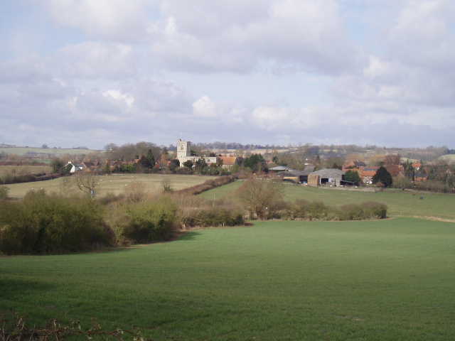
[4]Looking back to Hardwick from Weedon
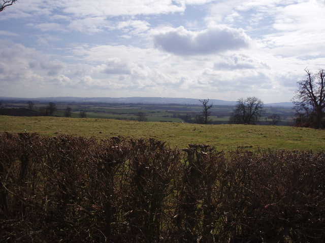
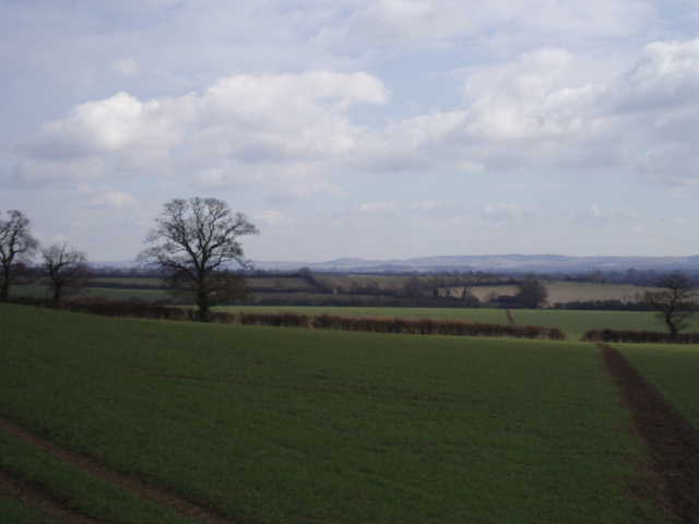
The Aylesbury Ring then turned right on a bridleway, heading slightly south of east for about a mile through several more grassy fields, with the steep hillside to the left where the villages of Pitchcott and Oving could be seen. Eventually the bridleway reached a farm (a friendly collie dog greeted me here – when I went to pat its head it lay on its back, wanting its tummy tickled) and then a lane [2] led on for another half mile to the village of Hardwick. Here I passed a 17th century pub [3], a small green and the village church. A footpath across another pasture and then beside an arable field led uphill to the neighbouring village of Weedon [4], where I passed a well that had been restored in the mid 1990’s [5]. The footpath out of Weedon led through a garden and a small paddock, then across a larger grassy field to a final row of houses on the edge of the village, where I followed the road to the left. Here I was on top of a ridge, relatively high to the ground both north and south, giving quite extensive views. To the north, I could see Hardwick [6] and the next ridge of hills beyond, while to the south I could see across the Vale of Aylesbury to the Chiltern Hills [7].
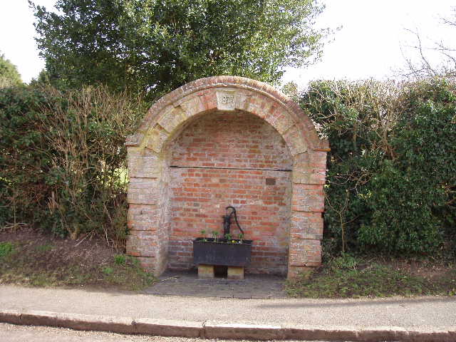
[5]Old water pump in Weedon
[6]Looking back to Hardwick from Weedon
The Aylesbury Ring then took a footpath on the right, still heading slightly south of east, downhill across another grassy field, and then up and over a smaller ridge in a ploughed field. The next two fields were arable, with the shoots of some crop just emerging, but the path had been nicely cleared through both of them [8]. Ahead of me, I could see Ivinghoe Beacon in the distance. In the second field, I saw two hares over to my left, and then two Roe Deer over to my left – this was possibly the first time I’d seen any in the south of England (although I know they are supposed to be widespread and numerous), I usually only see Fallow and Muntjac deer. The next field was ploughed and very muddy, a very shallow tractor track just about showing where the path went – there were two more Roe deer here as well. The path continued in the same direction, rising slightly in a large field of rough grass and then following a hedgerow in a field containing sheep of several different breeds. A further ploughed field followed, then a rough pasture which brought me to the edge of the village of Rowsham.
[7]View towards the Chiltons from just outside Weedon
[8]Footpath between Weedon and Rowsham
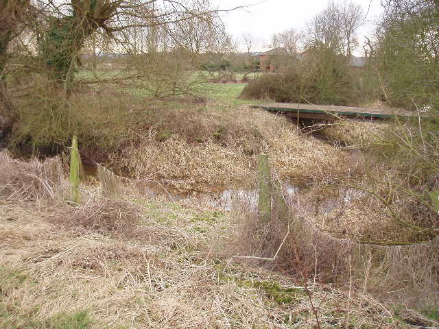
I crossed the busy main road here, and then discovered that the Aylesbury Ring had been rerouted since my OS map was printed – it took a slight shortcut across a pasture to avoid a short bit of lane walking. This pasture was the first one containing cows that I’d walked through for months, as they are kept penned up in farms over the winter months because of the wet ground. The next pasture, containing sheep that were obviously about to lamb, showed the signs of the ridges and furrows of the mediaeval ploughing system (although I wouldn’t have noticed if I’d not read the Aylesbury Ring leaflet). A few further grassy pastures, one where a footbridge crossed the infant river Thame [9], soon led me to the village of Hulcott [10], my ‘turning round’ point for the day. Behind the church [11], there was a moated site [12], one of several in the Vale of Aylesbury, mainly dating to the thirteenth century.

[9] The infant river Thame
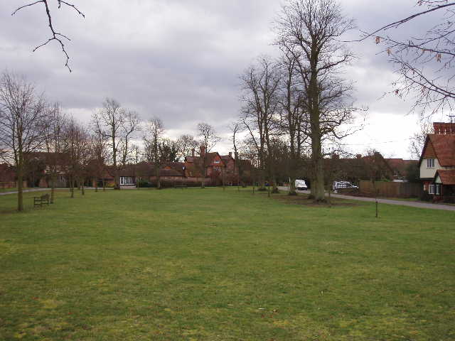
[10]Hulcott
I hadn’t passed many places to sit down, so I walked all the way back to Hardwick before having lunch on a seat on the green, about 1.50pm. I saw a buzzard as I was walking between Rowsham and Weedon – I’d taken my binoculars with me for the first time in ages, and also saw Fieldfare, Redwings, a Yellowhammer and a Bullfinch during the walk. This walk was slightly longer than usual, and for some reason I was really tired and felt very glad to get back to the car. In fact, the return journey actually took about 15 minutes longer than the walk out, so I’d obviously slowed up a bit in the afternoon. Normally, the inward and outward journeys take about the same amount of time, any slight tiredness later on being offset by the fact that navigation is so much easier on the way back.
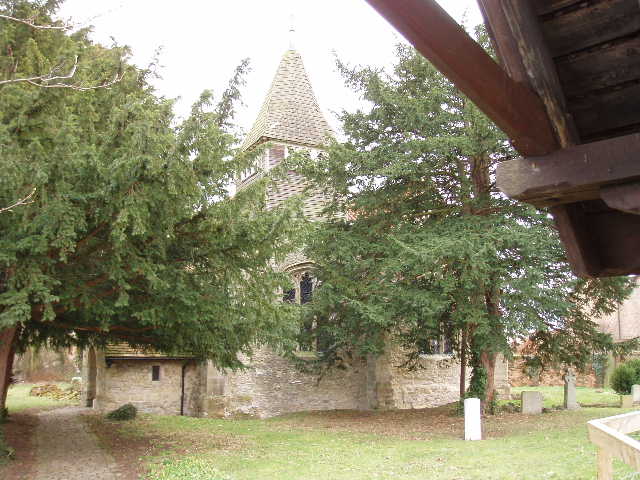
[11]Hulcott church
[12]Moated site at Hulcott
This was a pleasant and straightforward walk, although the map needed to be checked several times to work out which way to go across the numerous large pastures en route. There was nothing outstanding on the walk, although the views from Weedon were nice. Much of the route was flat, but there were enough small hills to keep it interesting – the climb back up to Weedon on the way back was one of the longest bits of uphill that I’ve done for quite a while. The views were usually nice, with the hills just to the north near the start of the walk, and more distant views of the Chilterns later on.
Total Distance: 22 miles each way