Pete's Walks - The Chiltern Chain Walk, Walk 2
If you are considering walking this route yourself, please see my disclaimer. You may also like to see these notes about the maps and GPX files.
Google map of the walkDownload GPX file of the walk
Walk 2 26/04/08 – Studham and Little Gaddesden (10.6 miles approximately)
Parked in the car park on Byslips Road at Studham Common.
If you are interested in walking this route yourself, click here to see the route description (but only if you have already read my disclaimer and notes regarding route descriptions).
This was a glorious day, the nicest day of the year so far. There were blue skies with just some high, thin, white clouds and it was very pleasantly warm – the forecast said it would reach 20C. It was a perfect day for walking. I wore my lightweight summer walking gear for the first time this year, and was glad that I did so.
Studhamis the southernmost village in Bedfordshire, and borders both Hertfordshire and Buckinghamshire (until 1897 part of the parish was in Hertfordshire). It appears in the Domesday Book as Estodham, and the village church was consecrated in 1220. Studham Common is a 128 hectare area of land that escaped the enclosures acts. It is popular with walkers and horse riders as it is well-connected to surrounding rights of way. The common is divided into three by two roads – the western section contains many trees and bushes but the middle and eastern sections are mainly just grass as a result of their use for crops during World War II. The common is home to dormice, skylarks, sparrowhawks and green woodpeckers, among many other species. Orchids, including Bee Orchids, are among the numerous flowers that bloom here in the Spring and Summer months.
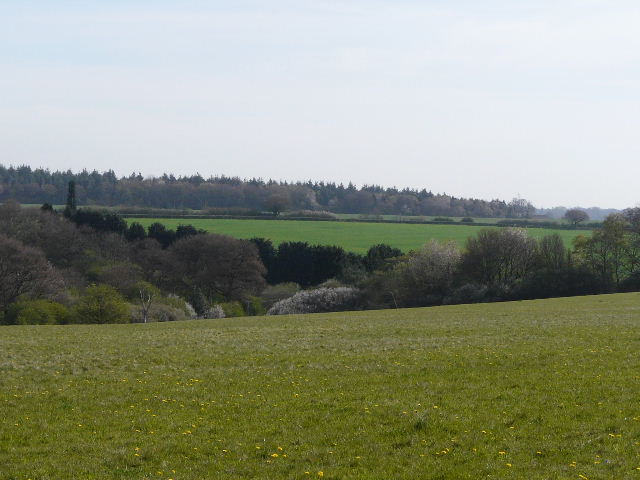
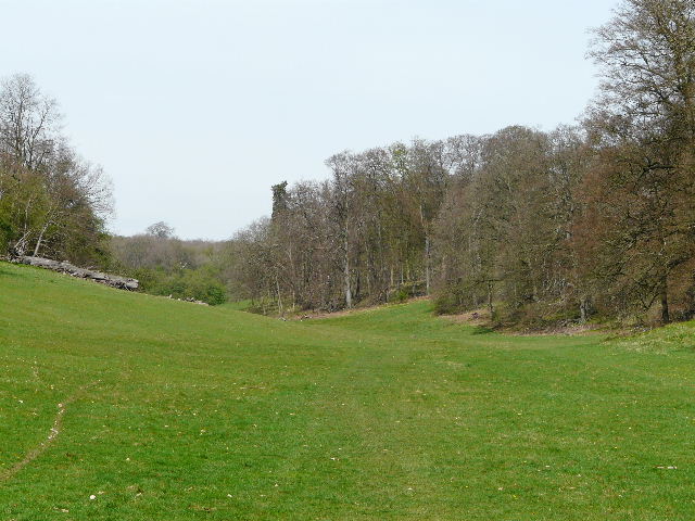
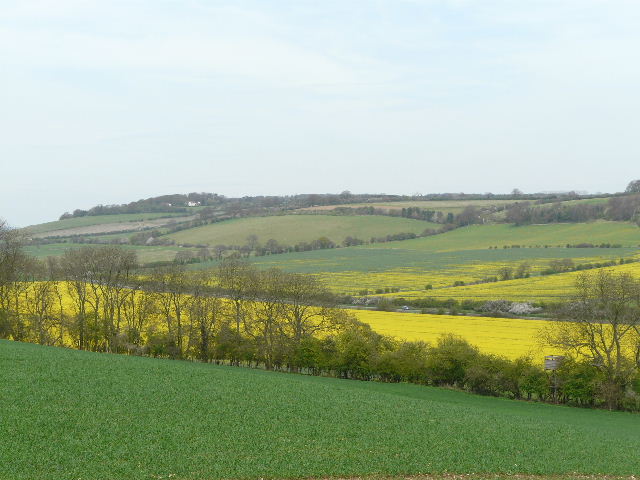
[1] View from Studham Common
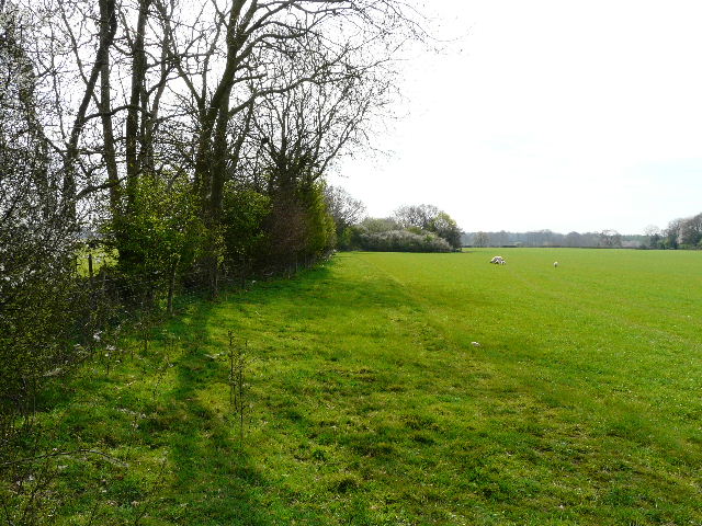
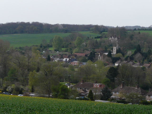
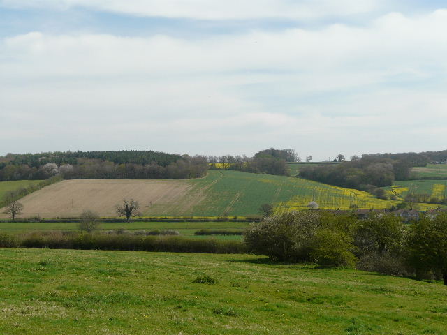
[2] Looking back to Studham from Studham Common
The walk started at Studham Common. As this is a ‘chain walk’, on each walk from now on I will come across a section of the previous walk – it just so happens that Walk 2 starts where it overlaps with Walk 1. So I started off (early again, about 9.20 as I was just a few minutes drive from my home) by retracing some of my route from yesterday. A Skylark sang me off on my way again, as I left the car park and followed the top edge of Studham Common eastwards, with nice views across the common to the valley on my left [1] and backwards towards Studham [2]. In the corner of the common I turned right through a hedge gap, and followed a hedge and then the edge of Great Baldwin’s Wood on my left. The route of Walk 1 soon turned left into the wood, but I carried on, following a wide strip of rough grass beside the wood with a field of young corn to my right.
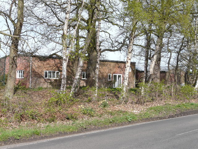
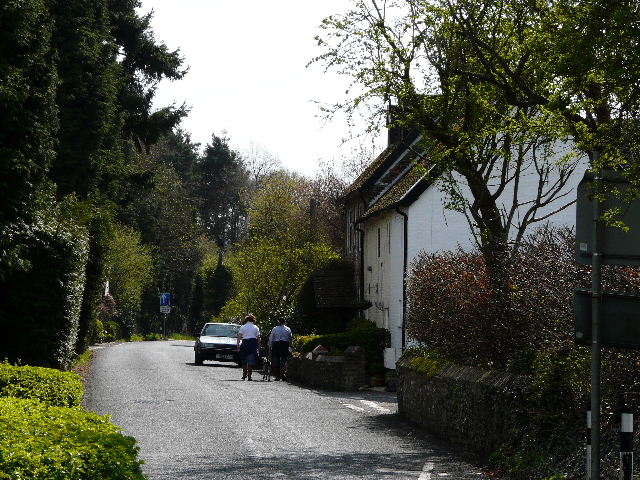
[3] Scout huts at Studham
Where the wood ended, the footpath went through a wooden gate and continued alongside a fence through a paddock. It then joined the gravel drive from a house, which led to a road – opposite me were some Scout huts, with a large sports ground beyond (I was a cub scout here back in the 1960’s!) [3]. I turned left, and followed the main road round to the right at a junction. After a few hundred yards, I turned left onto a footpath and followed a hedgerow on my left – again I was on a very broad band of rough grass, with corn growing to my right. In the field corner I turned right, and after a short distance I reached a waymark on a post, where the path switched to the left of the hedge. There was now a very large green field on my left, planted with grass rather than corn [4]. As I walked along, the hedge on my right broadened out in places to become a thin tree belt, where there were sometimes a good carpet of Bluebells [5].
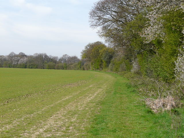
[4] Path between Studham and Jockey End

[5] Bluebells beside the path from Studham to Jockey End
[6] The sheep pasture between Studham and Jockey End
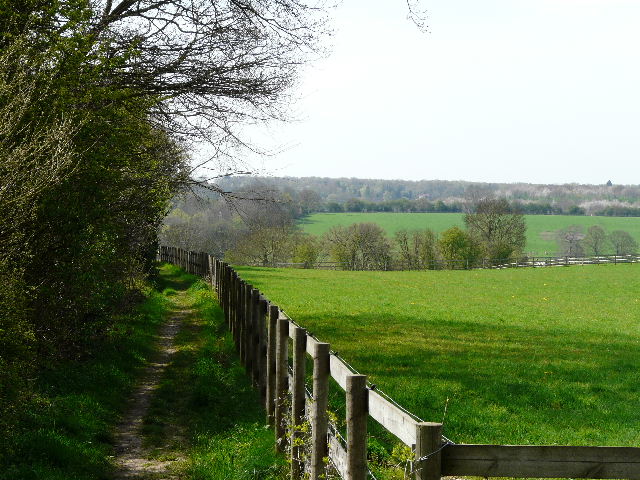
The hedge-side path turned left then right a couple of times before reaching the field corner. I went through a gap in the hedge and turned left, following the far side of the hedge. The hedge soon turned left, only to equally quickly come to a right turn. Here the path went through another hedge gap and turned right along the far side of the hedge (there is a clearer track on the near side of the hedge, but the map shows the right of way on the far side). At the end of the field I went through a metal kissing gate into a sheep pasture [6] (complete with sheep and young lambs). I followed a hedge on my left for about a hundred yards or so to another kissing gate, beyond which the path continued between hedges and fences, soon becoming a farm track that led to a lane.
A couple of dogs ran out of the neighbouring farm and barked as I turned right here. I saw my first Comma butterfly of the year here, sunbathing in the middle of the lane. I soon turned left onto a footpath, which ran a short distance through a green meadow then went through a gap [7] to switch to the left of a hedgerow, again in a large green meadow. The path descended very slightly, then went through another gap to switch back to the right of the hedge – there was a nice view down hill and across the Gade valley here [8]. As I followed the hedge I saw a lot of Ground Ivy and then some Primroses (the only ones I’d seen on yesterday’s walk were on the edge of gardens).
[7]Near the start of the path from Jockey End
[8]View from the path from Jockey End to Great Gaddesden
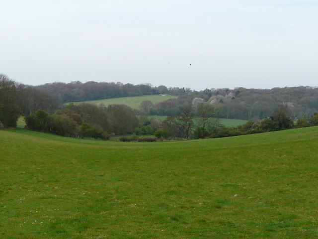
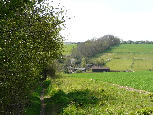
The path then entered a corner of the private Hoo Wood, and turned slightly right. This was a very pleasant stretch through the wood, where again there was a good carpeting of Bluebells [9]. The wood is chiefly deciduous, with occasional conifers. As I followed the attractive path, I remembered that I often saw Buzzards here, and sure enough, as I reached the end of the wood I heard and then saw two of them overhead. I stopped here to take photographs of the views along the Gade Valley and over Great Gaddesden [10] in the valley bottom. The path continued in the same direction, but now descending across a field of oil-seed rape [11]. On reaching the far side, the path turned right to follow the hedge to some cottages and a road on the edge of Great Gaddesden.
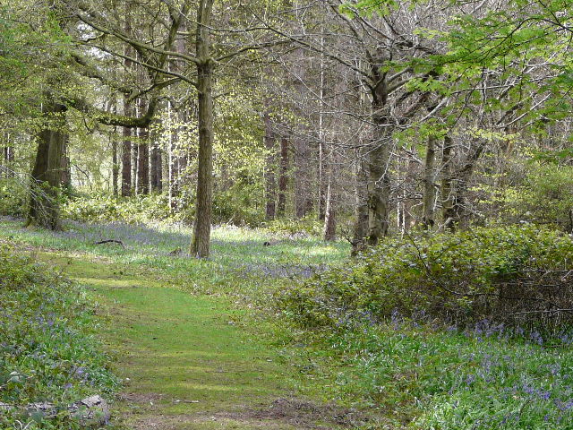
[9]The path through Hoo Wood
[10]View of Great Gaddesden from the edge of Hoo Wood
[11]The path from Hoo Wood, leading to the Gade Valley and Great Gaddesden
There has been a church at Great Gaddesden since Saxon times, as shown by the massive Hertfordshire puddingstones in the foundations. The fabric of the church also includes re-used Roman tiles. The first Rector was recorded in 1255. Gaddesden Place, the grand house on the hillside overlooking the village, was gutted by a fire in 1905, in which the butler died. The house has since been restored.
Across the road (the A4146, from Hemel Hempstead to Leighton Buzzard) I noticed that the stile had recently been replaced by a wooden kissing gate. The path crossed a water meadow in the valley bottom - the long footbridge over the River Gade had also recently been replaced [12]. At some times of the year there can be almost no water here at all, but today the river was as full as I can ever remember seeing it [13]. This point is close to the start of the river, and there are some springs here that add to the river’s volume. I heard and saw a few Lapwings here, and some Swallows. Beyond the footbridge (really more like a board walk) the path went half-left across the meadow to another new kissing gate and a residential street in Great Gaddesden.
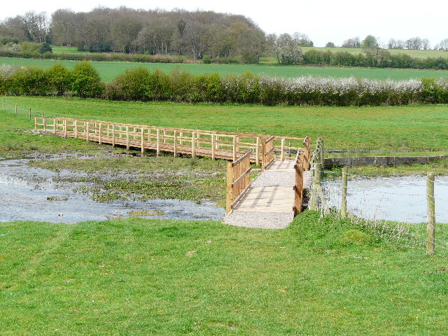
[12]The new footbridge over the river Gade
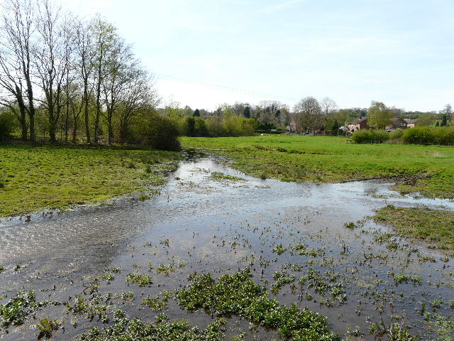
[13]The river Gade at Great Gaddesden
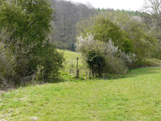
I followed the street a short distance to the right, then took a footpath on the right. This led uphill through a pasture, linked to the meadows in the valley bottom. There was a herd of cows here, with some young calves, all crowded into the top right corner where I was headed. I had to gently shoo them out of the way to reach the kissing gate I wanted. It became clear that the cows had been congregating here because there were five young bullocks over the fence in the next field, presumably only recently separated from their mothers. The bullocks were friendly and inquisitive, one sucking the salt off the back of my hand. I followed the clear path through their pasture, now more gently uphill to another new wooden kissing-gate [14]. Beyond it, a new wire fence had been put in, separating the path from a paddock on the left, with a wood on my right. At one point I looked into the wood to see if there were any bluebells – instead I saw a small circle of stones, almost like a miniature Stonehenge, with someone sitting on one of them Very odd. At the end of the path I went through another new kissing-gate to reach a lane in the hamlet of St Margaret’s, opposite a Buddhist Monastery [15].
[14]Looking back across the Gade Valley from the path to St Margaret's - Hoo Wood is on top of the hill on the left
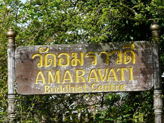
[15]The sign outside the monastery
According to its web site, the Amaravati Buddhist Monastery “is a monastery in the Theravada tradition of Buddhism and a centre of teaching and practice. Its heart is a resident community of monks and nuns, whose life of meditation and work is open for visitors to share, as a living example of the Buddhist path. ‘Amaravati’ means ‘Deathless Realm’ in the Buddhist scriptural language, Pali, a verbal reminder of the highest spiritual aspiration.” There are usually about 60 people living there – 20 monks, 15 nuns and 25 guests.
I went a few yards to my left, then took the footpath on the other side of the lane. This initially goes down the drive of a house, with the monastery grounds beyond the hedge on the right. The path then continues through trees, still with the monastery grounds on the right. I carried on as the path then followed a hedge line steadily downhill, passing a paddock on my right [16]. Ahead of me I could see the edge of the village of Nettleden. This was a very nice section of the route, continuing downhill beside a field of young corn [17] to reach a road in the valley bottom, on the edge of the village [18].
[16]The path from St Margaret's to Nettleden
[17]The path leading down to Nettleden
Until 1895 Nettleden was a hamlet within the parish of Pitstone in Buckinghamshire, though it was entirely surrounded by Hertfordshire. Its name comes from the Saxon for ‘valley of the nettles’. It sits in an attractive valley setting on the edge of Ashridge Common.
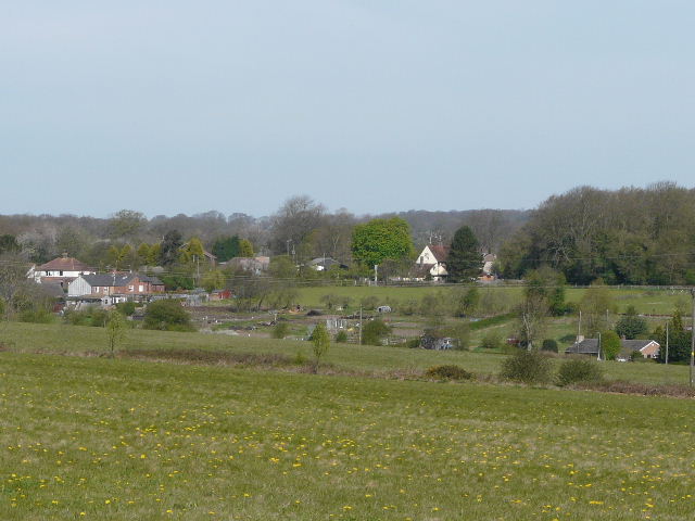
[18]Nettleden
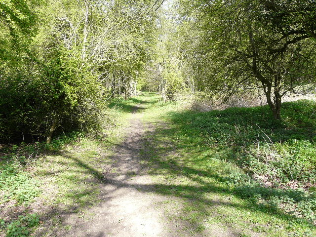
I turned right, away from the village, taking a footpath on the right after a few yards. This started off almost parallel to the road but gradually veered further away from it. The first section of the path was rather indistinct, but I made my way through the young corn to a lone tree [19] standing at the end of a side valley. Beyond the tree the path was quite clear. It continued on along the bottom of the side valley, through the middle of the enormous corn field. This path is most unusual for this part of the country, as it goes for over a mile without passing anything at all, not even hedgerows. The sole exception is a pond surrounded by bushes. It was a long steady plod along the gradually rising valley bottom [20]. The ground here is incredibly flinty, it’s amazing anything grows here. When I first walked this path a few years ago, the huge field here was all rough grass, an enormous hay meadow. Last year it was some strange straggly crop that I’d not seen before, this year it’s a much less interesting corn field. I saw and heard several Skylarks here as I marched on.
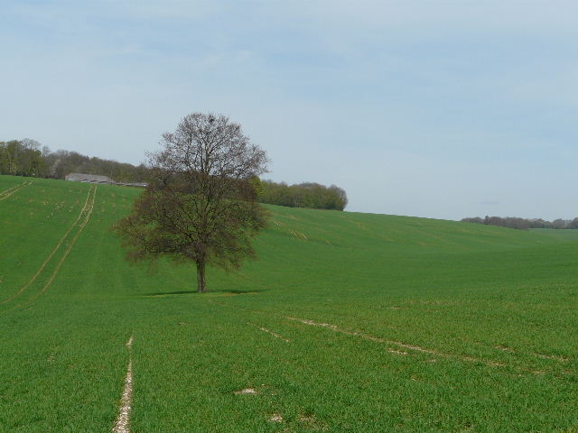
[19]The lone tree at the start of the long valley walk
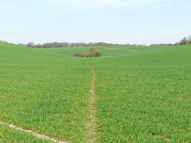
[20]The long valley walk, looking towards the bushes surrounding a pond
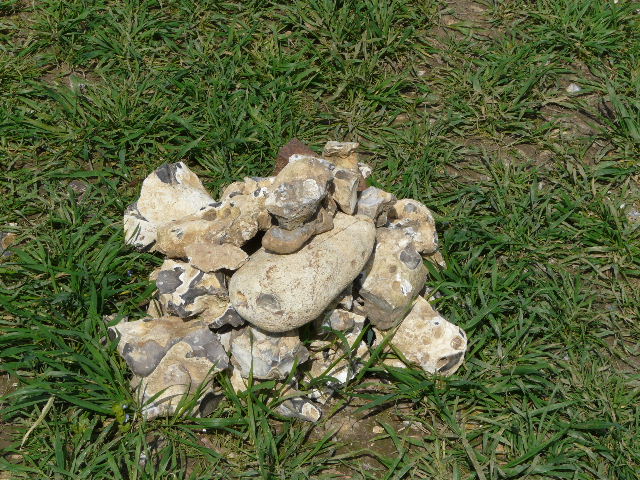
[21]Cairn along the long valley walk, at the junction with the Hertfordshire Way
After passing the pond (the path actually goes left of it, though the map shows it going to the right), the path followed the valley bottom slightly left. Soon I came across a cairn of flint stones [21], marking a path junction where the Hertfordshire Way came in from the right (I’d earlier followed its route from Hoo Wood to St Margaret’s). I finally came to a fence and the end of the corn field. The path went half-left through a small meadow or paddock (I had seen some lovely Fox-and-cubs here last September) to a stile in the corner, where I reached a road on the edge of Little Gaddesden.
Little Gaddesden was once in Buckinghamshire but is now in Hertfordshire. As well as Little Gaddesden itself, the parish includes Hudnall, Ashridge and part of Ringshall. The valley of Witchcraft Bottom is reputedly where the last witch in Buckinghamshire was tried and executed. A local man called John O’ Gaddesden was the physician to the Royal Household in the 14th century – he served the household at the same time as Geoffrey Chaucer and it is claimed the main character in The Doctor’s Tale was based on him. The house John O’Gaddesden lived in still stands in the village (though some claim this house dates to a later period).
I walked down the cul-de-sac opposite, continuing down an alley at the end, before turning right on a short path between gardens to a small playground. I crossed this to the start of a path that entered a wood, part of the huge Ashridge Estate that is managed by the National Trust. The path led me through the trees, dropping down a small embankment to join a wide track, which I followed downhill to the left. The track emerged from trees at the bottom of a small valley, where I turned right on a gravel track for a few yards, before forking slightly right on to a path through the grass that covered the bottom of this small valley.
This valley is marked as Golden Valley [22] on the map. There is a broad strip of grass along the bottom, with woods along the tops of either side. It was an attractive walk along the valley, which curved slightly to the left. There was a brick-built bridge over to the right at one point, and I got a glimpse of the top of a tower of Ashridge House over to the left (the house is now a Management College, and there’s a photo of it on Day 9 of my Hertfordshire Way Journal). The path curved to the right as it approached a drive to Ashridge House – I saw a lot of Coltsfoot here, as the path finally reached the drive.
[22]Golden Valley
I went just a few yards along the drive to the right, before the path continued on the other side. It was now back amongst the trees again [23], and this was a very pleasant section of woodland walking. I saw a Peacock butterfly here, and another one that may have been another Comma. After about a third of a mile, the path ran along the garden boundaries of some impressive houses on the right. After a further hundred yards or so, close to part of Ashridge Golf Course on my left, I turned right onto a crossing path (thus joining the route of the Chiltern Way, which I’d be following most of the way back to Studham Common). This ran slightly uphill between garden hedges, crossed over a private drive and continued on for a short distance to reach the car park of the Bridgewater Arms pub [24], back in another part of Little Gaddesden.
[23]The path from the Golden Valley towards Little Gaddesden
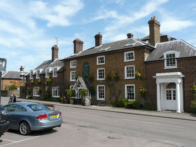
[24]The Bridgewater Arms, Little Gaddesden
I crossed the road, and took a path almost opposite which ran between the fences of some paddocks. I saw a Pied Wagtail on the path ahead of me here. The path led to a gate by some houses, which took me into a small L-shaped meadow. On the far side I crossed the drive leading to Little Gaddesden church [25], a short distance to my left, standing amongst some impressive trees. I passed through a couple of small empty sheep pastures, and then crossed a large field of young corn, the path here being marked by tractor tracks through the crop. The path headed diagonally towards the far corner of the field, passing a lone mature tree standing almost in the corner. I then went half-left at a rather complicated path junction, initially with some garden fences on my right, the houses here being part of Hudnall. The path continued alongside the right-hand hedge of a large corn field. Ahead of me I could see across the Gade Valley [26], as the path started to descend steeply. Lower down the slope I reached a field of Oil-seed Rape [27], and I met a pair of horse riders here, coming the other way at a brisk trot.
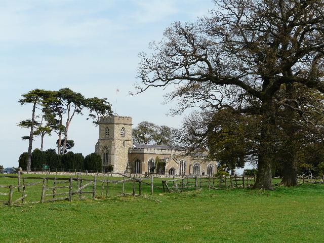
[25]Little Gaddesden church
[26]View across the Gade Valley
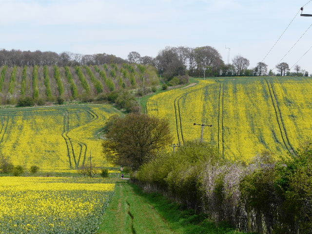
[27]The path across the Gade Valley
In the valley bottom, I re-crossed the Hemel Hempstead to Leighton Buzzard road. For the last half-mile or so I’d seen a couple walking ahead of me, and they stopped just here and asked if I could help them. They were on the first day of a holiday walking along the Icknield Way, but had realised they’d gone wrong. After discussing where they’d gone from their starting point at Ivinghoe Beacon, I realised they’d turned right instead of left when they’d come to a T-junction as they followed the path beside Whipsnade Zoo (I’d passed that point on my walk yesterday!). This mistake was understandable, as the junction wasn’t shown in the guide book they were following. They had then (again understandably) been further misled by signs for the Icknield Trail bridleway, which are remarkably similar to the ones for the Icknield Way footpath. I remembered being confused by these signs when I walked part of the Icknield Way (see my Berks-Essex Walk journal) – as they said, it would have helped if the guide book had mentioned the signs for the bridleway, which runs parallel to the long-distance path.
They had realised they’d gone wrong and turned round (just when I first saw them, by the complicated path junction at Hudnall). I now walked with them, as the path rose steeply up the hillside. Towards the top of the hill, the path switched to the left of the hedge, where it followed a track with a young plantation to the left. At the top of the hill we passed through a small wood (the path is always muddy here). A short distance further the Chiltern Way forked right, but we continued ahead following the edge of a corn field.. In the corner, we continued on along a short drive to reach Common Road in Studham (really a lane between Studham and Dagnall). On the other side, the path went half-right across another corn field, descending into a small valley.
[28]Looking back from Valley Road towards Common Road, Studham
At the corner of the field we reached Valley Road [28], where I parted from the couple (I’m sorry, I didn’t get their names). We’d had a good chat about walking long-distance paths, and I’d plugged this web site mercilessly! They asked if their was an email address on the web page, and said they’d email to let me know how they get on with the rest of their walk on the Icknield Way. It had been really nice chatting to people with a similar interest in long-distance paths – they live near High Wycombe, and were interested in whether my Chiltern Chain Walk went near them (it took me a minute or so to remember that it goes through West Wycombe!). I checked they knew how to retrace their steps to where they’d gone wrong (funnily enough, it was along the route I’d walked yesterday!) and wished them well with their holiday.
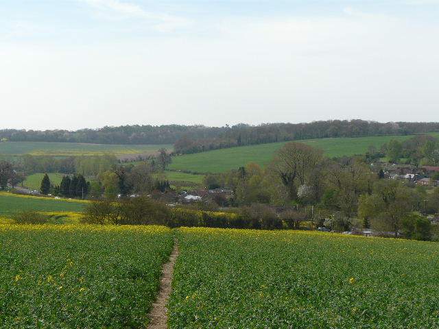
As they set off up the road to the left, I crossed the road and followed a hedgerow along the small valley. I passed Studham School and a couple of cottages on my left, and then reached Studham Common. I turned right on a path that went slightly uphill through trees and bushes. I crossed a road to reach a grassy section of the common [29], where the Rooks I’d seen yesterday had been replaced by a small group of Jackdaws. I stopped to eat my lunch on a bench (it was now about 1.20pm), enjoying the fine weather and the views [30]. It was then a mere 200 yards or so along the edge of the common to Byslips Road and the car park where I’d started the walk.
[29]The path along the top of Studham Common
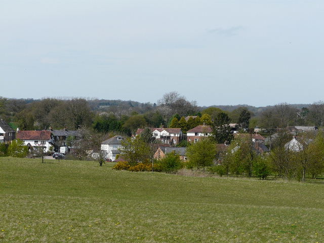
[30]Studham from Studham Common
This was a very good walk, on an almost perfect day for walking. I knew that I’d enjoy the walk, as it was largely a shortened version of my favourite local walk. There were fewer species of wildflower to be seen today, compared to yesterday’s walk, and the Buzzards were the only interesting bit of wildlife. But I just found it a very pleasant route, largely through fields but with a few good woodland sections for variety.
Total distance: 22.6 miles
(To see this walk repeated IN THE OPPOSITE DIRECTION on 28/7/12, CLICK HERE)