Pete's Walks - The Chiltern Chain Walk, Walk 3
If you are considering walking this route yourself, please see my disclaimer. You may also like to see these notes about the maps and GPX files.
Google map of the walkDownload GPX file of the walk
Walk 3 28/04/08 – Ashridge and Ivinghoe Beacon (12.5 miles approximately)
Parked at the car park at the Bridgewater Monument, Ashridge.
If you are interested in walking this route yourself, click here to see the route description (but only if you have already read my disclaimer and notes regarding route descriptions).
The weather forecast was pretty dire for this week, so I decided to do this walk this morning, hoping to finish it before the expected heavy showers started around lunchtime. I skipped my second cup of coffee at breakfast (the sacrifices I make for you, dear reader! J) and managed to start walking from the car park at the monument about 9.05am.
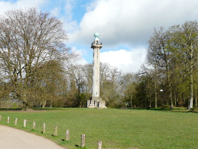
[1]The Bridgewater Monument, Ashridge
The Bridgewater Monument is a Doric column 108 feet high, with 107 steps inside leading to a viewing platform (not always open). It was erected in 1832 as a tribute to the 3rd Duke of Bridgewater, “the Father of Inland Navigation”. He commissioned the Worsley-Liverpool canal (often cited as the first canal of the modern era) and the Manchester-Liverpool canal, and his canal and coal interests eventually made him the wealthiest aristocrat in the country. He died in 1803 at the age of 66.
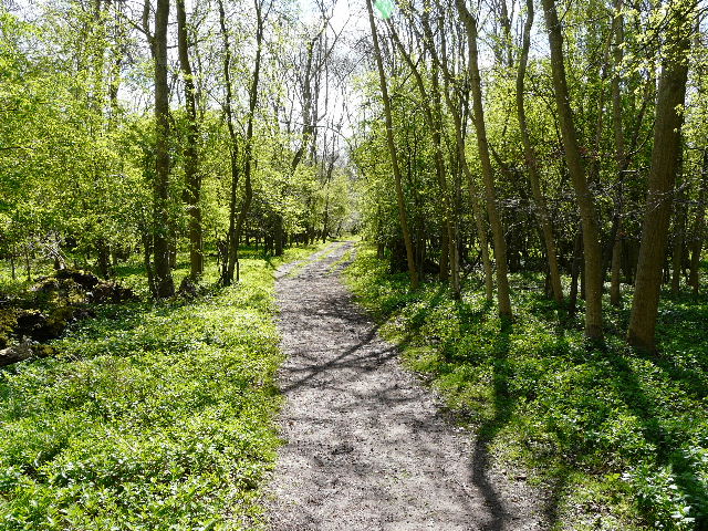
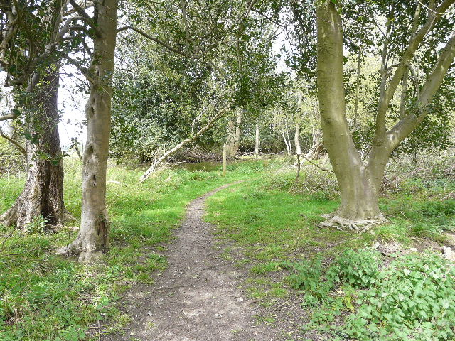
I crossed the grass in front of the monument [1] and took the clear and well-surfaced track running into the trees that would lead after 2½ miles to Ivinghoe Beacon. This is a popular path and I soon passed a few joggers and dog-walkers. It was a very pleasant morning, sunny but with quite a few clouds about, much cooler than on my previous walk two days ago. The track [2] soon went over a sturdy wooden bridge over a gully, and a bit further on passed a wooden cabin on the left.
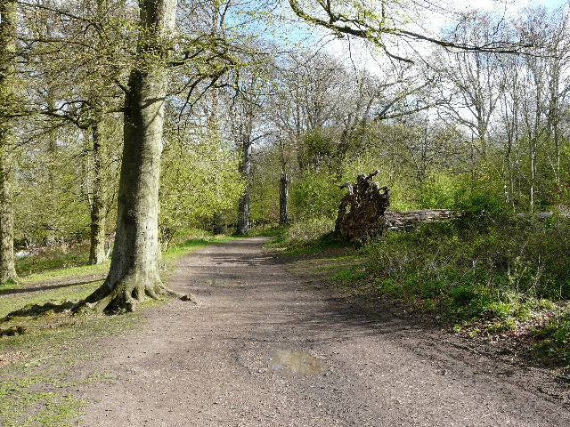
[2]The track from Ashridge to Ivinghoe Beacon
The Ashridge estate stretches across the Hertfordshire/Buckinghamshire border, and originally surrounded Ashridge Priory, founded in 1276 by Edmund, 2nd Earl of Cornwall. A later house on the site was once the home of Elizabeth I. From 1604 to 1848, the estate belonged to the Egerton family, the Dukes and Earls of Bridgewater. The 3rd Duke, the famous canal builder, demolished the old house here but died before work commenced on its replacement. So the current gothic extravaganza was built by his heirs – it is now an internationally famous management college. In 1921 the land (but not the house) was given to the National Trust. There are 5000 acres in all, mainly woodland (especially beech) but also chalk downland and open commons, supporting a variety of wildlife (including about 800 Fallow Deer).
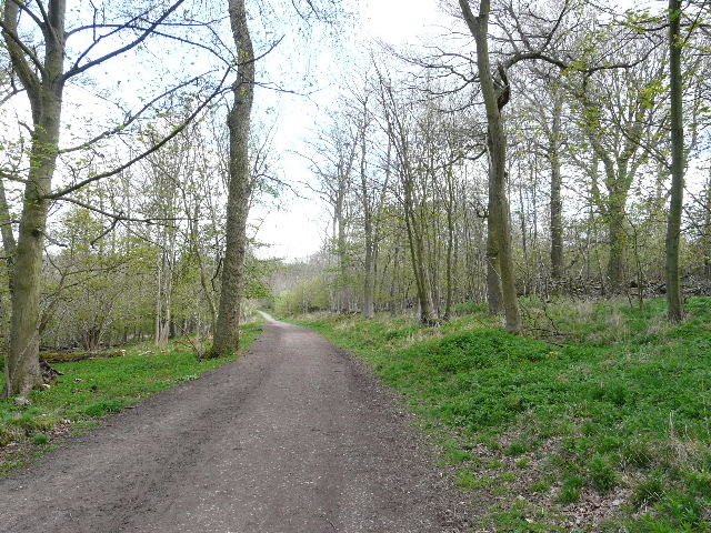
[3]The track from Ashridge to Ivinghoe Beacon
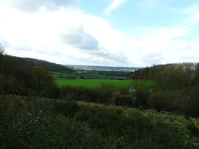
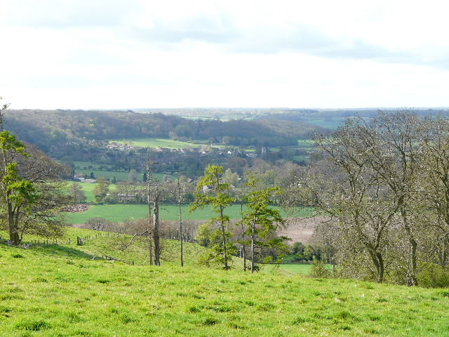
The track [3] was pretty level, as it followed the edge of the steep northern escarpment of the Chilterns on my left. Some parts of the woods were carpeted by Dog’s Mercury, while further on I came upon the first sections to be carpetted by the Bluebells for which Ashridge is renowned. I was looking out also for some Oregon Grape which I’d seen here a few weeks ago. When I did see it, I found a gentleman admiring it and we got into conversation for about five minutes or so. He said that the plant was used as snow cover by small mammals in its native Oregon, and had been planted here some years ago for the same purpose (but there haven’t beeen any hard winters since!). He told me about some of the other plants in the woods (he said the Bluebells would be at their best in about a week’s time), and we discussed the various birds around here, such as the Great Spotted Woodpecker, Red Kite and Buzzard. I carried on [4], and after a while I passed a small kennels on my right. There were good views here, south towards Aldbury [5], and I saw a Buzzard overhead (one of these days I’ll get a decent photo of one!). Shortly after the kennels [6] I passed a junction where the Ashridge Estate Boundary Trail went left (most of today’s walk would share the route of that 16-mile path). I carried on, the track now being the roughly surfaced drive to the kennels. There were again nice views out to the left, over Pitstone Hill and the Vale of Aylesbury beyond.
[4]Looking over the valley of Duncombe towards Aldbury from the track to Ivinghoe Beacon
[5]Looking towards Aldbury (on the route of Walk 4), from near the kennels
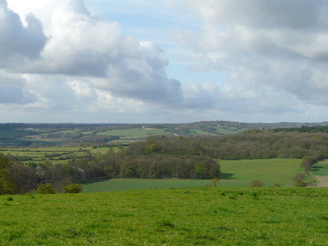
[6]Looking across the Tring Gap towards Wigginton (also on the route of Walk 4), from near the kennels
Eventually the track led to a road. There was a grass clearing in the trees here, with good views northeast towards Dunstable Downs and Whipsnade Downs. I turned left along the far side of the road, soon entering the trees again, where a path parallel to the road led between the beeches to reach the car park for Ivinghoe Beacon. On the far side of the car park I joined a path [7] that followed a fence gently downhill, to reach a point near a bend in the road. The path went slightly right here (this is a great area for orchids and other wildflowers, at the appropriate season), over a subsidiary bump and then up the steep chalky slope [8] of Ivinghoe Beacon [9].
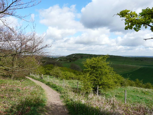
[7]The start of the path from the car park to Ivinghoe Beacon
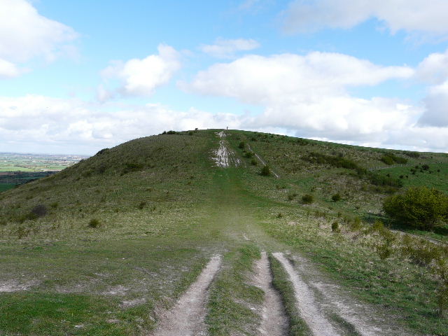
[8]The path to Ivinghoe Beacon
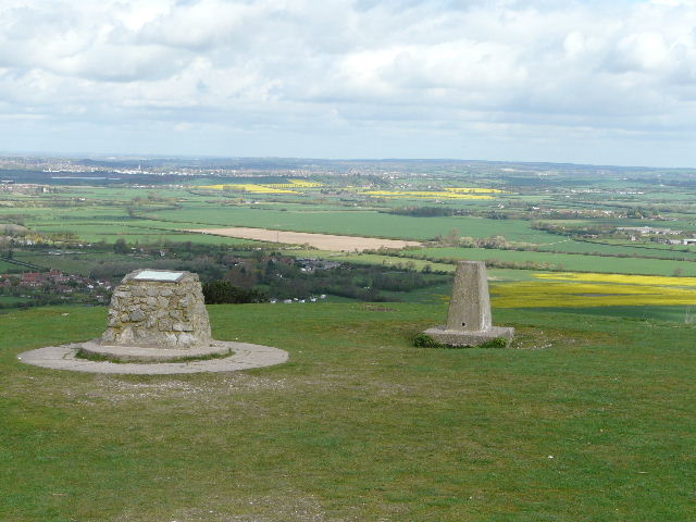
[9]The top of Ivinghoe Beacon, looking towards the Vale of Aylesbury
Ivinghoe Beaconis a prominent hill jutting out from the escarpment of the Chiltern Hills, rising to a height of 817 feet above sea level. It is in Buckinghamshire, though very close to the county boundaries of both Bedfordshire and Hertfordshire. It was the site of an Iron Age hill fort, being a natural defensive position with steep sides almost all the way round. It is the starting point of both the Ridgeway (going west) and the Icknield Way (going east). It is usually visited for the extensive views towards Dunstable Downs and over the Vale of Aylesbury, but it is also popular with walkers and model-aeroplane enthusiasts, and is a good site for wildflowers (including pyramidal and common spotted orchids).
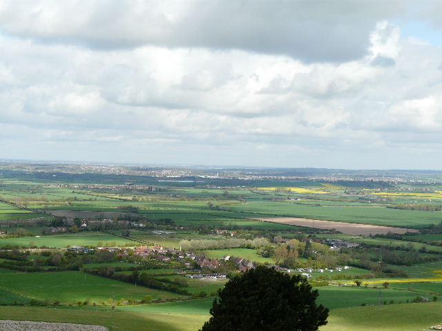
[10]From Ivinghoe Beacon, looking across the Vale of Aylesbury towards Leighton Buzzard
It was quite chilly in the wind at the top of the Beacon, so I didn’t spend too long admiring the views (to the Downs, the Gade Valley and across the broad expanse of the Vale of Aylesbury [10] – you’ve probably already seen these views several times before on this web site!). I turned right, slightly north of east, and enjoyed the promenade along the grassy ridge of Gallows Hill [11], with the White Lion of Whipsnade Zoo directly ahead of me. I had to pull my broad-brimmed hat down tight on my head, as I was worried it would be blown away in the strong winds here. I went through a kissing-gate and further on went over a stile – there were many Cowslips amongst the grass here. A few yards further on I turned right, on a chalky track going quite steeply downhill, with a nice view of the Gade valley (which I crossed twice on the last walk) ahead of me [12]. At the bottom of the hill, I turned right alongside a hedge, with a large cornfield to my left. Where the hedge ended I continued on a clear path through the green young corn – Ivinghoe Beacon over to my right seemed quite insignificant from here.
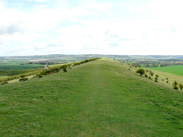
[11]The long ridge of Gallows Hill, pointing towards the downs at Whipsnade Zoo
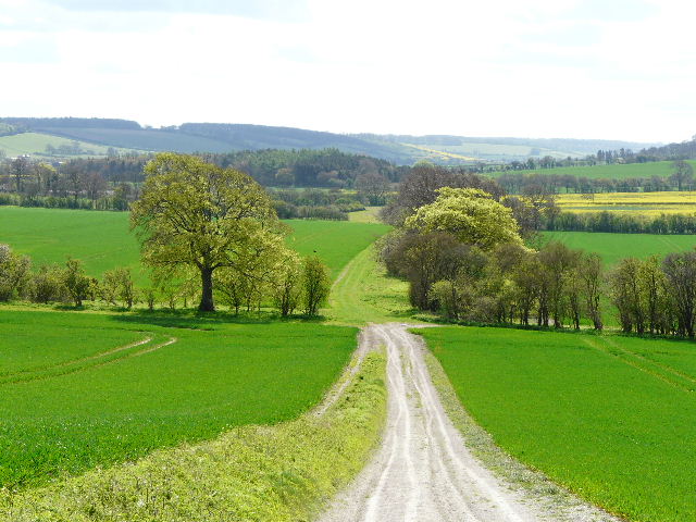
[12]The path down from Gallows Hill, looking towards the Gade Valley (which I crossed and re-crossed on the previous walk)
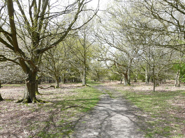
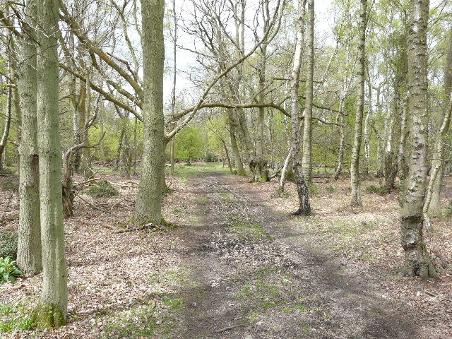
Beyond this large field I headed slightly left, through a grassy area at the foot of another hill. I joined the route of the Icknield Way (which starts at the Beacon), and went through a wooden kissing-gate into a wood. The first part of the wood was deciduous [13], and again was carpeted with Dog’s Mercury. Further on the path led through a coniferous section of the wood – I always think of this section as rather sinister and spooky, as it is so dark and dismal between the tightly-packed evergreens. On the far side of the conifers, I joined a track which went right, then I turned left at a fork (now back amongst deciduous trees again). This path went steeply up a flight of wooden steps with a hand rail [14], installed here a year or so ago. Again there was a lot of Dog’s Mercury here, and at the top of the slope I saw some Ground Ivy growing on a moss-covered log.
[13]The path through the wood (note the masses of Dog's Mercury either side of the path)
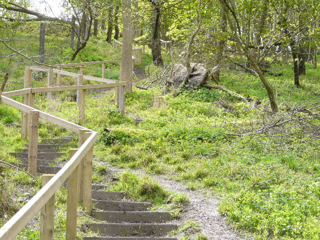
[14]The steps up out of the wood (as always with my photographs, they're actually steeper than this looks)
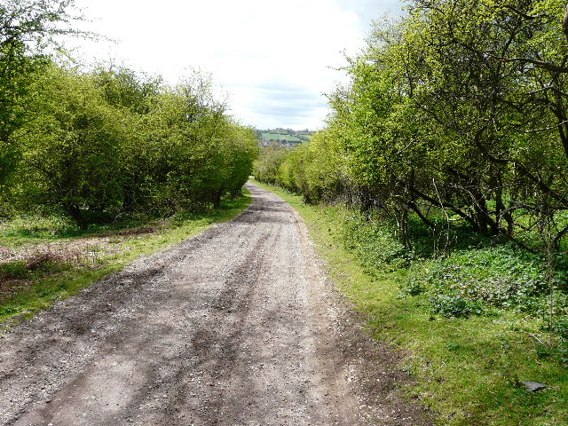
Exiting the wood, I crossed a sheep pasture, and left the route of the Icknield Way as I crossed the yard of Ward’s Hurst Farm. I followed the waymarks that guided me between the various buildings here, then crossed three further sheep pastures [15] (there were plenty of cute little lambs here). In a fourth pasture, the path followed the edge of a wood, Ringshall Coppice, on my left. In the field corner, I went through a gate, continuing alongside the wood with a wire fence and some odd enclosures on my right. I went through two or three further gates, then followed the edge of the wood across an empty pasture or meadow. The path then squeezed between rhododendron bushes on my left and the tall wire fence of a small reservoir on my right, before turning right along the far side of the reservoir fence and then joining a driveway that led to a road on the edge of Ringshall.
[15]The path through sheep pastures, heading towards Ringshall Coppice
I crossed the road and re-entered the woods of Ashridge. I was still on the route of the Ashridge Estate Boundary Trail as I followed the path through the trees, initially with a large open grass area to my right. I turned right, left and then right again, a long wide grassy track then taking me to another road (from Ringshall to Berkhamsted). Across this, I continued on a very pleasant path between silver birch and other trees, with garden fences a few yards to my left and part of Ashridge golf course to my right [16]. After almost half a mile I turned right at a path crossroads (this was where this walk touched on the previous walk, which came from the opposite direction and turned to my left towards the Bridgewater Arms at Little Gaddesden). Although I was now leaving the Ashridge Estate Boundary Trail, I was now following the route of the Chiltern Way, as I crossed a fairway of the golf course and then carried on between garden hedges.
[16]The path beside Ashridge Golf Course
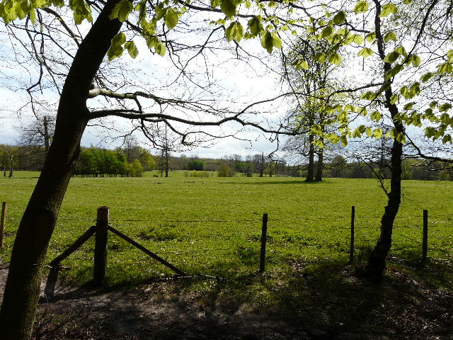
I came to a staggered junction of private drives, where I carried on almost in the same direction, following the drive towards the club house of the golf club. Just before reaching its car park, I turned slightly right through a small belt of trees, then passed in front of the club house and crossed another fairway to a yellow marker post on the far side. The path continued through the woods again, passing to the right of some buildings and then I joined another drive. This soon crossed Prince’s Riding, the broad strip of grass between woods that runs from Ashridge House [17] (to my left) for about a mile and a quarter to the Bridgewater Monument. Shortly after, the drive turned right but I went straight ahead on a track for a few yards, before forking left on a thin path between the trees once more. After a short distance the path ran alongside the edge of a huge pasture [18] on my left, which is entirely surrounded by woods and is often a good spot for seeing large numbers of Fallow Deer (but not today). There are some particularly impressive beech trees along here too.
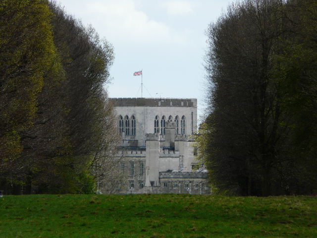
[17]Close-up of Ashridge House from the crossing of Prince's Riding
Ashridge House, now home to a Business School, is on the site of an Augustinian Priory, founded in 1276 by the Earl of Cornwall. In 1290, Edward I held a parliament here, and after the dissolution of the monasteries it was a private residence of Elizabeth I when she was a princess – she was arrested here under suspicion of treason against her sister Mary in 1552. The estate was in the hands of the Egerton family, the Dukes and Earls of Bridgewater, from 1604 to 1848. They built the current neo-gothic fantasy in the early 1800’s – at the time, the county boundary between Buckinghamshire and Hertfordshire ran through the dining room! The 3rd Duke of Bridgewater, who commissioned the building before his death in 1803, was the main mover behind the creation of much of the canal network in this country (as previously mentioned, the monument at the other end of Prince's Riding was erected in his honour).
[18]The huge pasture in the middle of Ashridge
[19]The avenue of beech trees
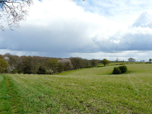
Near the corner of the huge pasture I turned left (the Chiltern Way went right here), and walked along a very attractive avenue of beech trees [19], with the pasture to my left and the wood sloping uphill slightly to my right. I was delighted to hear my first Cuckoo of the year here. After a quarter of a mile or so, the path curved slightly right, passing to the right of some cottages and reaching their drive. I turned right here, and followed the drive slightly uphill with the extensive woods on either side. It was briefly rather gloomy as a large and very dark grey cloud passed overhead, but fortunately there was no shower. Where the drive turned right, I continued ahead, along the short drive beside a former farm on my right (I had now rejoined the Ashridge Estate Boundary Trail). The path then went through a meadow, passing right of a pond [20] then curving left to a stile in the corner. There was then a straightforward section on a farm track between a hedge on the left and a vast corn field [21], with pleasant views all around.
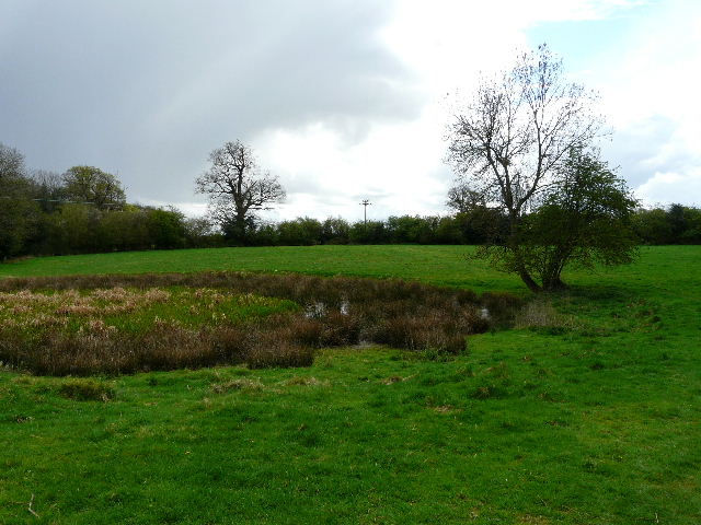
[20]The pond near Coldharbour Farm
[21]The farm track beyond Coldharbour Farm
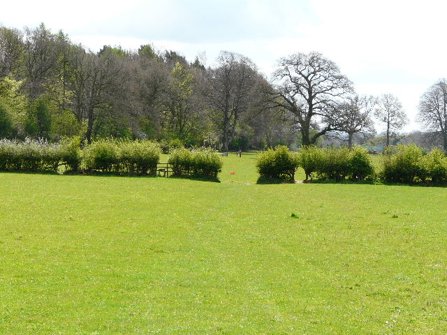
[22]View from just before reaching the playing field
It must have been about half a mile before I reached the far corner of the field, where the track turned left at the bottom of a small valley, then quickly turned right with a wood now on the left. A short distance further the track turned right again, but the path continued ahead, uphill beside the right-hand hedge of another corn field [22]. In the field corner the path went a few yards left, then continued across a large level playing field (I imagine that this is what it is, it’s a broad area of well-manicured grass anyway). On the far side I reached a farm or stables (there were large horseboxes here, anyway), and followed its drive to the right. Just beyond the gate, I turned right, back into another part of the Ashridge Estate woods, close to Northchurch [23]. The path soon passed to the right of a circular cluster of conifers (there are several of these dotted about the estate, including two near the avenue of beech trees I’d walked along earlier), then turned half-right to reach the Ringshall-Berkhamsted road again.
[23]The path heading towards the Ringshall-Berkhamsted road
I continued on the other side, the path descending slightly to reach a drive where I turned left [24]. I frequently see Fallow Deer along here, but not today, although I did see my first Orange-Tip butterfly of the year. Just before the drive reached a set of wooden gates, I turned right, the path going uphill through the trees, but with fields beyond the edge of the wood on my left. I found a large clump of Garlic Mustard growing along here, and there were Primroses and Cowslips close to the edge of the wood. The path levelled out, then descended into another small valley, where I saw a large amount of Lesser Celandine. The Ashridge Estate Boundary Trail went right here, but I continued ahead, uphill through the trees on a narrow path. Two Green Woodpeckers flew off at my approach. Towards the top of the hill, the path slowly curved right [25], to emerge in a more open area, with a view over the valley to my right.
[24]The drive, just beyond the road crossing - I frequently see Fallow Deer here
[25]The path to Northchurch Common
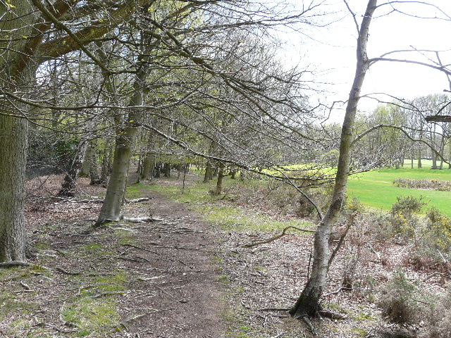
I walked straight on, re-entering the woods briefly, before emerging at a corner of the vast grassy expanse of Northchurch Common [26]. I followed the edge of the common, with the woods on my left. After a short distance, the path turned left then right to remain alongside the trees. I carried on for several hundred yards, with the Ringshall-Berkhamsted road a long way off to my right on the far side of the common [27]. I passed a woman with three dogs who’d stopped at a large fallen beech tree, and saw several other dog walkers on the common (there are always some around here). Eventually, just before the path and tree line curved right, I turned left into the woods [28]. I soon crossed over a bridleway, and a short distance further on turned right at another crossing.
[26]Part of Northchurch Common
[27]The path along the edge of Northchurch Common
[28]The path from Northchurch Common I was now on
a wide and muddy track, with a section of conifers on my left and a deciduous
wood carpeted by Bluebells on my
right. For some reason, large logs or branches had been strewn periodically
across the track, perhaps so some kind of vehicle could get a purchase in the
mud. At the end of the track I crossed a minor road (going to Aldbury, downhill
to my left) and continued on the footpath opposite. Again this was a broad and
muddy track, and again the woods along here showed a profusion of
Bluebells
[29]. 
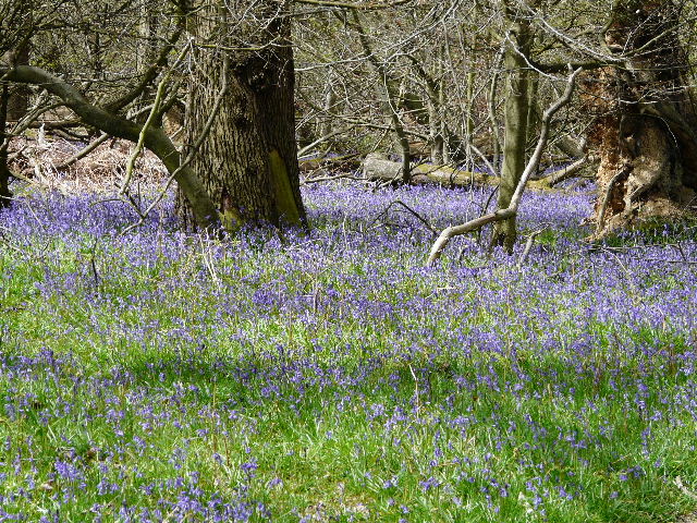
[29]Bluebells alongside the track through Ashridge
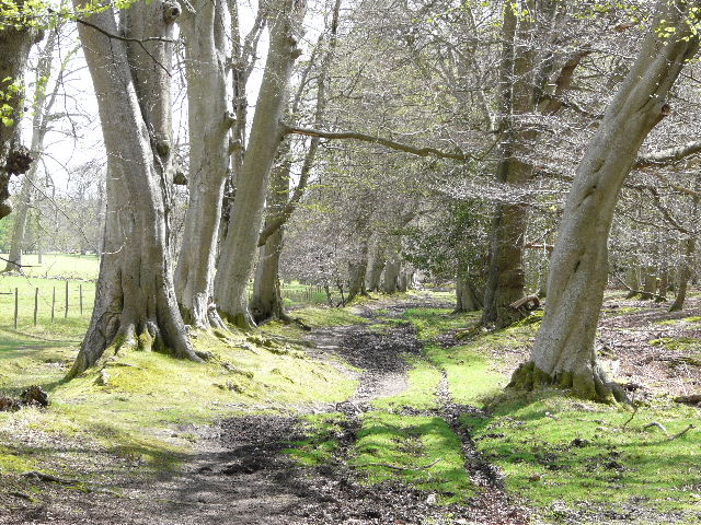
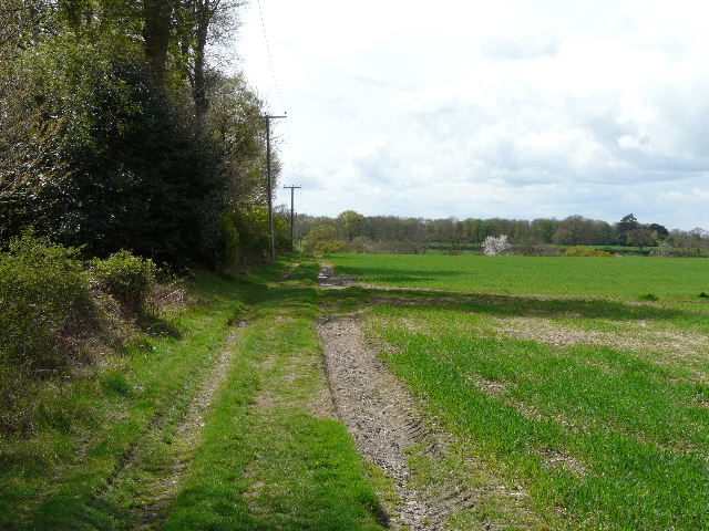
I passed a large pasture on the right at one point – as well as cows, there were about half a dozen Fallow Deer here, very surprisingly the first and only ones I’d see on this walk. After about three quarters of a mile, the track [30] ended at the drive to the monument, where I turned left and soon reached the car park where I’d started.
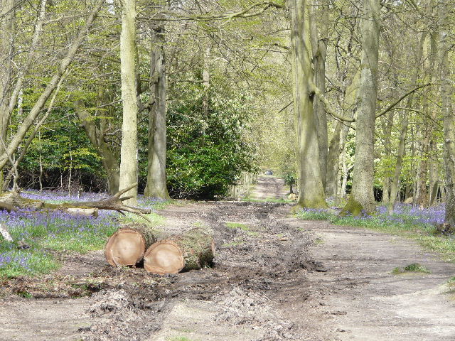
[30]The track through Ashridge
It was about 1.25pm when I got back to my car – again, the walk took longer than expected because of the large number of photographs I took. I was just glad that I’d manage to finish the walk without getting any rain – the skies had darkened a couple of times as ominous dark grey clouds passed overhead, but the showers that had been forecast to arrive had held off.
This was a really good walk (I don’t want to sound too immodest, as I was the one who specified the route!). There was a lot of good woodland walking, made the more enjoyable by the vast number of Bluebells, some field walking to add variety, a short stretch of chalk downland over Ivinghoe Beacon and Galleys Hill, and some very attractive views at different points on the route. My only slight disappointment today was that I just saw the one group of Fallow Deer and no Muntjac Deer. Almost the entire route was very familiar to me, but I wasn’t in the least bit bored by it – I don’t think I will ever grow bored of walking in Ashridge. I’m pretty sure anyone walking here for the first time would be keen to come back.
(To see this walk repeated IN THE OPPOSITE DIRECTION on 30/7/12, CLICK HERE)