Pete's Walks - The Chiltern Way (2)
If you are considering walking this route yourself, please see my disclaimer. You may also like to see these notes about the maps and GPX files.
Day 6 5/04/07 Lilley to Peter’s Green (7.4 miles each way, approximately)
Parked in side street in Lilley (Note: the car park mentioned in the guide book at Lilley Village Hall is for patrons only, according to a sign).
Again the weather was a complete contrast to the previous walk! Today was absolutely gorgeous, just about perfect for walking. It was warm, but not too warm (it was 19C when I got back to my car, which is 66F in old money), there was no detectable wind at all, and there were just a few wispy white clouds in the wide blue sky.
Today I carried on from Lilley, where I finished my last walk, completing the section of the original route of the Chiltern Way that the northern extension omits. Of course, most people walking the Chiltern Way would just do a circular route, either following the original route or using the northern and southern extensions (I suppose a few might just do one extension but not the other). There are a number of reasons why I’m doing both the extensions and the bits of the original route that they miss out. Firstly, because this journal may then be of interest to people doing either route. Secondly, it makes the walk even more of a challenge for me. Thirdly, and most importantly, simply because all the walks are enjoyable and worth doing!
Lilley is an old estate village, according to the guide book many of its cottages bear the silver lion that was the symbol of the Docwra (pronounced Dockray) and Sowerby families who owned the nearby Putteridge Bury. I have often seen vehicles round here belonging to Clancy Docwra Ltd, apparently a leading utilities and civil engineering contractor, and had always mistakenly assumed Docwra was a foreign name, possibly Polish! Both families were originally from Cumbria, and there are still villages called Dockray and Sowerby in that county. Putteridge Bury is now the main campus for the University of Luton (like the football team, usually found near the bottom of any league table!). Lilley was a centre of non-conformity in the seventeenth century – John Bunyan is believed to have preached secretly in a cellar here, and James Janeway was born here in 1636. Janeway was second only to Bunyan in fame as a Puritan preacher and author. His work A token for children giving accounts of the conversion of children in his pastoral care was the most widely read book in nurseries after the Bible and Bunyan’s Pilgrims Progress. Janeway achieved fame as a preacher in Rotherhithe – when soldiers burnt his chapel down, the people simply built a larger one for all those who came to hear him preach. The Church of England often threatened to have him shot because of his popularity, and on one occasion a bullet passed through his hat without hitting his head. His elder brother John Janeway, also born in Lilley, was a noted scholar and writer on religion.
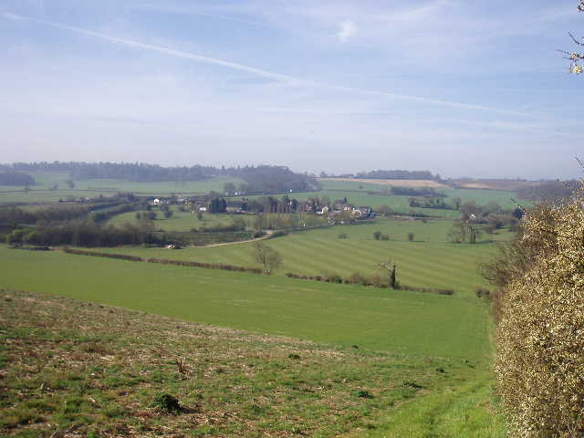
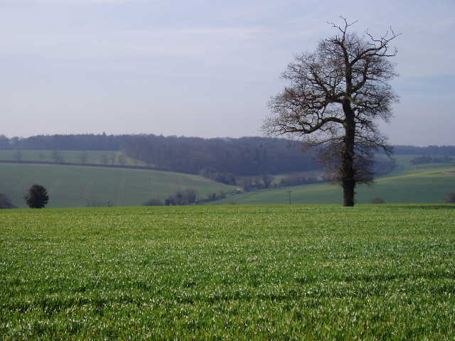
[1] Looking back towards Lilley
[2] Lilley and Lilley Bottom
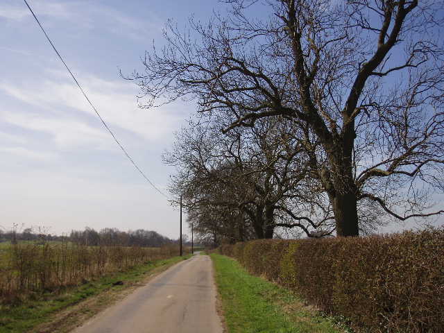
[3] Path parallel with A505, Great Offley in the distance
I started walking about 9.40am. I took a footpath opposite the village church in Lilley, which ran for a few yards between garden fences and then went through a kissing gate into a field. I was rather relieved to see that this field was now being used as a horse paddock, as when I did this walk almost two years ago there had been some rather unfriendly bullocks in here. I crossed the field to a kissing gate on the far side, where I met a jogger and his dog coming the other way. The next field was also being used as a paddock, with four horses munching contentedly away in it. The path went half right across the field to the far right corner, where I turned left and followed a hedge steeply uphill between arable fields. The map shows the footpath to be on the left of the hedge, but the guide book says to walk on the right of the hedge and there was a much clearer path on this side. This was a pretty steep and long climb, by Chiltern standards, I don’t remember it being this tough last time! There were great views as I neared the top of the slope, over the valley of Lilley Bottom to my right and back over the village of Lilley [1,2]. This hill is another part of the Lilley Hoo ridge where there was once a race course and where the Prince Regent trained his horses – I came across it the other day near Telegraph Hill.
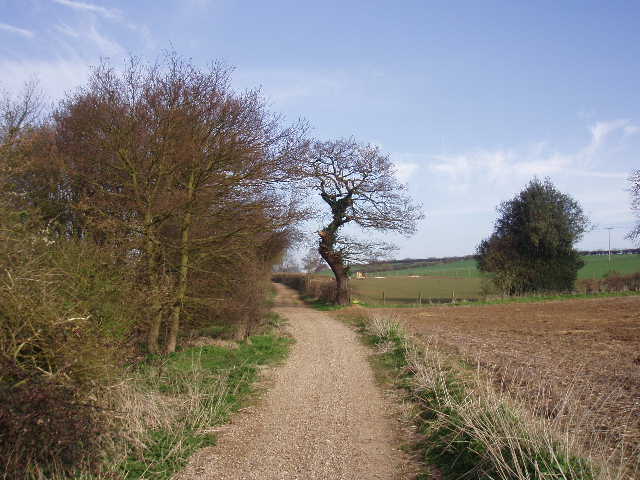
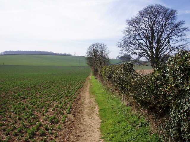
From the top of the hill, the path continued beside the hedge, descending at a much gentler gradient. Ahead of me I could see the land rising again towards Great Offley [3], where I walked a few days ago. There was some slight traffic noise, as the A505 dual carriageway between Luton and Hitchin was a short distance to my right, but it didn’t spoil my enjoyment of walking on such a wonderful day. The path came to a lane, where I turned right, passing through a bridge under the dual carriageway after a few hundred yards to reach the old road between Luton and Hitchin. Here I turned left for a few yards, then crossed the road and followed a very good track that started to the left of Glebe farm. The track was well-surfaced and flat (i.e. no tractor ruts), running between hedges at first, then with a large ploughed field on my left [4]. I remembered meeting a party of ramblers near the end of this track last time I did this walk. The path ended at a lane, an old route between Luton and Hitchin, where I turned right. On my way back in the afternoon I noticed a mass of Lesser Celandine on the verge here [5]. As well as the ubiquitous Skylark, I also heard a Lapwing as I walked along the lane.
[4] Looking back along the track from Glebe Farm)
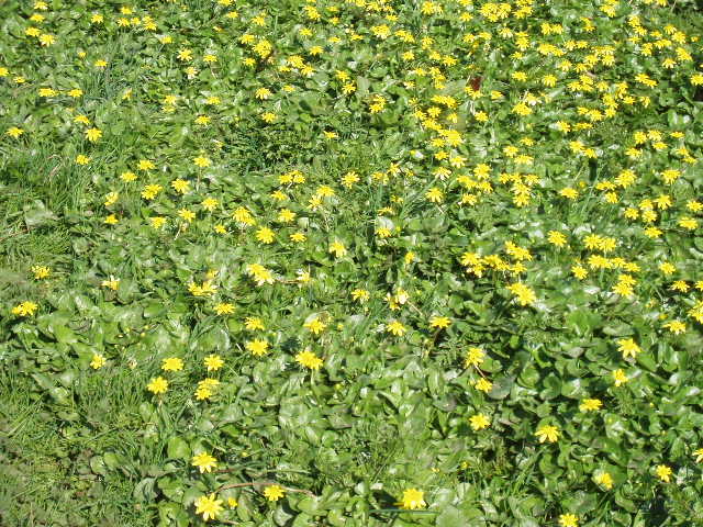
[5] A mass of Lesser Celandine beside the lane
[6] The path beside the Putteridge Bury boundary wall, near East Lodge
The lane ended at a junction with another lane, but I continued on ahead on a track that was obviously an old drive into the Putteridge Bury estate. Just before a house called East Lodge, I turned slightly left along a path that followed the outside of the high brick wall surrounding the estate [6]. There were nice views to my left over the wide valley of Lilley Bottom, as the path gently rose uphill beside the wall for about half a mile. On my way back, I managed to photograph a Small Tortoiseshell butterfly sunning itself on the wall. Near the top of the hill I turned and admired the view looking back along the path and over Lilley Bottom towards Great Offley on top of the opposite slope [7]. The path followed the wall through a small meadow, then turned left away from the wall to pass to the left of Mangrove Hall and joined its drive, soon reaching a lane through the small hamlet of Mangrove Green.
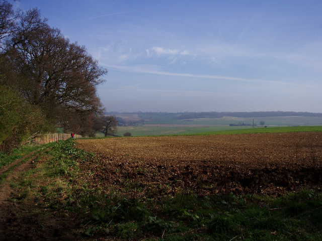
[7] Looking back from near Mangrove Green
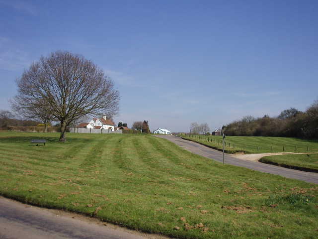
[8] Mangrove Green
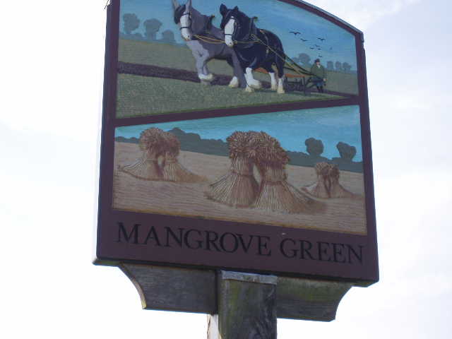
[9] Village sign, Mangrove Green
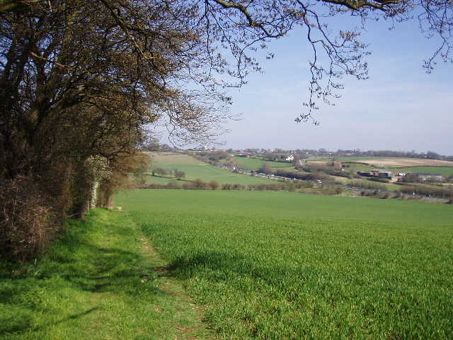
Mangrove Green [8,9] and its adjoining neighbour of Cockernhoe [10] are both pleasant villages surrounding large greens. They are both within half a mile of the houses of Luton, yet largely retain their rural nature – they are protected from further encroachment as they lie across the county boundary in Hertfordshire. I followed the lane through the villages for about half a mile, then took a path on the left opposite the last house in Cockernhoe. This was a surprisingly pleasant section of the walk, considering that the large housing estates of Luton were just a field away to my right. The path ran along through a narrow belt of trees, emerging at one point to follow the edge of the arable field on my right, before re-entering the trees. It finally emerged from the trees again, and followed the field edge again before passing beside a row of cottages to emerge at a road junction by Waldon End farm.
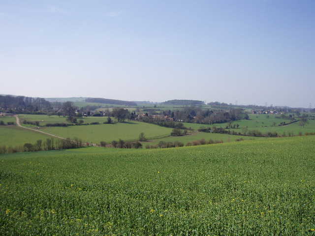
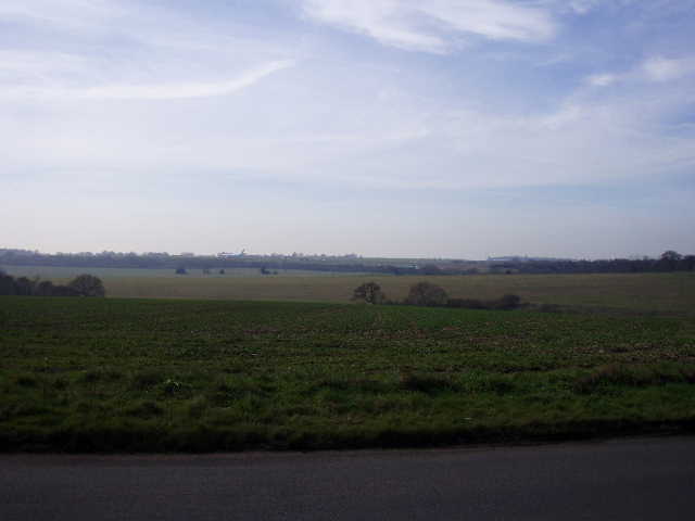
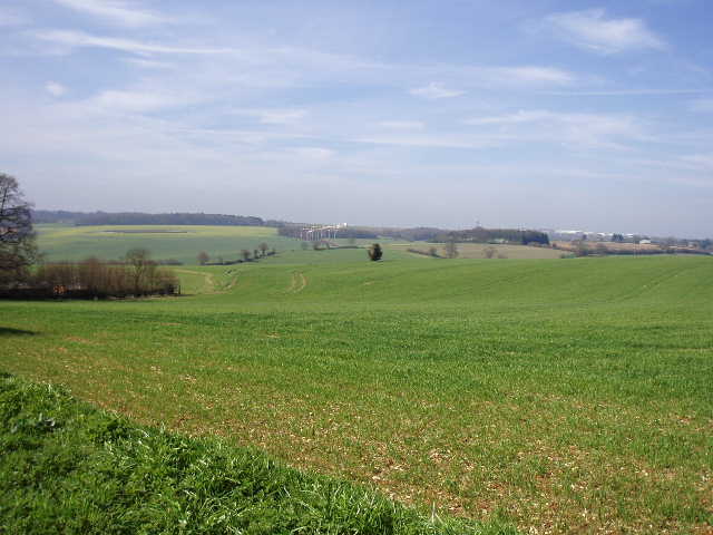
I took the lane opposite for a few yards, then took a path which followed the field edge to the right of the lane. I had now left the houses of Luton behind, but over to my right I could now see Luton Airport [11], on top of the hill on the opposite side of a valley to me. The path followed the lane, cutting a corner at one point, to where another lane coming in from the right joined it. I saw two hares in this field on my way back, and three or four Buzzards circling high in the sky overhead. At the lane junction, I followed the lane ahead for a few yards, to a bend where a bridleway went right. Despite the proximity of the airport [12], the scenery here was absolutely charming [13] - a long valley between rolling hills, brown and green fields, many woods, isolated cottages and small hamlets. I didn’t realise it until I looked at the map again when I got home, but the long valley extending away ahead of me was Whiteway Bottom – my next walk will end at a lane further down the valley.
[10] Cockernhoe
[11] Looking towards Luton Airport from near Waldon End farm
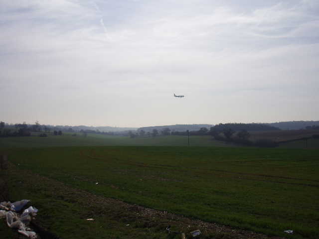
[12] Plane coming in to land at Luton Airport
The bridleway followed a track winding its way between arable fields, descending the nascent valley slightly, then ascending to pass through a hedge. It followed the hedge a short distance, still slightly uphill and still with glorious views over the rolling Chiltern countryside. When the hedge turned left [14], the bridleway followed it, but the Chiltern Way took a footpath that went a few yards to the right, before turning left to continue in the same eastwards direction as before, now on a track between arable fields dotted by one or two mature trees. The path next went slightly right round the edge of a paddock, with the houses of the village of Breachwood Green beyond, before resuming as a track through the arable fields. It soon reached a lane near the edge of the village, where I turned right. Two or three planes had come into land while I’d walked this section, seeming quite incongruous in such a lovely rural setting. Though obviously noticeable, their noise and the noise from the airport hardly detracted from the pleasure of the walk at all.
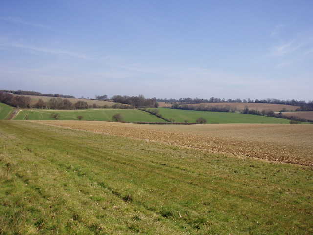
I followed the lane a short distance, passing a junction where another lane went off to the left and then a cottage on my right, where two or three dogs barked as I went by. I then took a path on the left, which continued steeply downhill through a field of some young cereal crop, keeping almost parallel to the lane. At the bottom of the hill, the path turned left alongside a hedge, and I walked along the valley of Whiteway Bottom for a few hundred yards [15], before turning right. The path now rose up the other side of the valley, on very faint tracks crossing a very stony ploughed and harrowed field, where the crop was just beginning to pierce the surface. Towards the top of the hill, the path joined a broad stretch of grass beside a right-hand hedge [16]. It then went through a gap in the field corner and continued ahead, now fairly level, beside a wood. I saw a Buzzard fly out of this wood, and presumably the same one was still circling round about when I came back about forty minutes later. I also got a fleeting glimpse of two Fallow deer as I went past the wood.
[13] View from the path near Waldon End)
[14] Looking back towards Luton Airport from near Breachwood Green
[15] Path along Whiteway Bottom
It occurred to me the other day that people reading these journals might come to he conclusion that I am a somewhat one-dimensional character, obsessed with walking to the exclusion of almost everything else. After all, I go out walking three times a week, then spend a lot of the rest of my time mistyping these journals about my walks (what takes you 2-3 minutes to read, takes me at least 2-3 hours to write – I know, I know, so much pain for so little gain!) and making changes to the web site. While there is certainly an element of truth in that view, for me one of the great joys of walking is that it allows me to indulge in so many of my other interests at the same time – bird watching, wild life, history, wild flowers, butterflies, classical music (Classical music? Well, I listen to Classic FM on the car radio on the way to the walk!). I also get to take lots of very poor photographs, and to write all this drivel. So I do actually do a bit more than just put one foot in front of the other a ridiculously large number of times.
Having passed the wood, the footpath continued ahead on tractor tracks through a field of potatoes or similar crop, then went through a small meadow. It then followed a short track between a house and its outbuildings. One black dog in the garden behind the house barked as I went by, while its companion just wagged its tail. When I came back, both dogs were out on the track – the friendly one came up to me, its tail still wagging, while the other one was lying on its back having its tummy rubbed by its lady owner. I turned left along a lane for about a hundred yards, then turned right along another lane. I now had about a mile of lane walking to reach Peter’s Green, my destination for the day. Of course, the fact that I’d turn round there meant I would be doing two miles of lane walking – the longest stretch on this or any of the other walks I’ve done. But it was no real hardship walking this lane, and it only took 15-16 minutes each way in any case – there were good verges one each side of the lane, and only one or two cars passed me in each direction. On my right I passed the grounds of Lawrence End Park [17] – there’d been cattle grazing there when I came this way two years ago, but now there were sheep there. A short distance along the lane, a horse seemed to be eating its way gradually through the hedge on my left – it was determined to get at a certain bit of branch, adjusting its head two or three times so that it could get at the desired bit of wood without poking itself in the eye on another branch.
[16] View over Whiteway Bottom
[17] Lane leading to Peter's Green
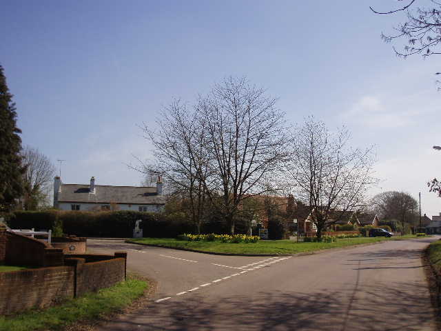
[18] Peter's Green
It was just gone noon when I turned round in the small village of Peter’s Green [18]. I sat and had lunch by the side of a path between Breachwood Green and Waldon End – I heard and saw a Buzzard here, and also heard a woodpecker drilling. The early afternoon passed very quickly and pleasantly – this really was an ideal day for walking. It was one of those days that make me really feel how fortunate I am – I considered setting up a charity for the benefit of those poor unfortunate people who have to work in offices and factories on days such as this! It was only just gone 2.30 when I got back to Lilley. I now seem to be back to my usual walking speed – hopefully the days when muddy conditions added 30-40 minutes to my walks are over, until next winter. I think these walks will take me a very similar time to when I first walked the Chiltern Way – while this time round I hardly ever need to pause to navigate as I can generally remember the way to go, I am now stopping and taking photographs which I didn’t do last time. I don’t know if it is because of the scenery or the good weather, but I am taking far more photos on this walk than I’ve ever done before.
I was very pleasantly surprised by this walk. I hadn’t been especially looking forward to it, thinking that it was one of the three or four least interesting sections of the Chiltern Way. In fact it was a thoroughly pleasant walk – although a part of the walk was very close to the edge of Luton and another part was close to the airport, this hardly affected my enjoyment of the route at all. There were some lovely views over very attractive countryside – no wonder the locals are protesting strongly against plans to expand the airport! Even allowing for the fact that I had almost ideal weather conditions today, I think this was a really good walk, much better than I remembered it. Curiously, there were bits of today’s route that I couldn’t recall when I tried to run through it in my mind the night before – generally I can remember almost all the route of both this and the other long-distance paths I’ve walked (having walked them both ways obviously helps to fix them in my memory).
Total Distance: 45.6 miles each way