Pete's Walks - The Chiltern Way (2)
If you are considering walking this route yourself, please see my disclaimer. You may also like to see these notes about the maps and GPX files.
Day 7 7/04/07 Preston to near Whitewaybottom Lane (7.3 miles each way, approximately)
Parked on main road in Preston, near the village hall.
When I started this walk, I only intended to walk as far as Whitewaybottom Lane, between Whitwell and Peter’s Green. This would have been a slightly shorter walk than usual at 6.9 miles each way. After walking a mile or so, I started contemplating walking all the way to Peter’s Green, but when I checked the distances in the guide book I saw that this would add 1.8 miles to the journey each way, making this walk 8.7 miles each way while the next walk would then only be 6.0 miles each way. So in the end I compromised by walking to the next lane after Whitewaybottom Lane (it is not named on the map or in the guide book), adding about 0.4 miles to today’s route and thus nicely balancing this and the next walk at 7.3 and 7.4 miles each way respectively.
Having completed the section of the original route omitted by the Northern Extension on my last walk, this walk was back on the Northern Extension, carrying on from where I left off at Preston. I started walking at about 9.40 am. So far the walks have all been fairly close to my home in Kensworth, meaning I only have a drive of 20-25 minutes, but after a couple of more walks the distances I’ll have to drive will get ever longer until I reach Goring, when the drive time will start to reduce again as I head back towards Dunstable Downs. It was quite cloudy as I started walking, although there were holes in the cloud where blue sky was visible and it was reasonably bright.
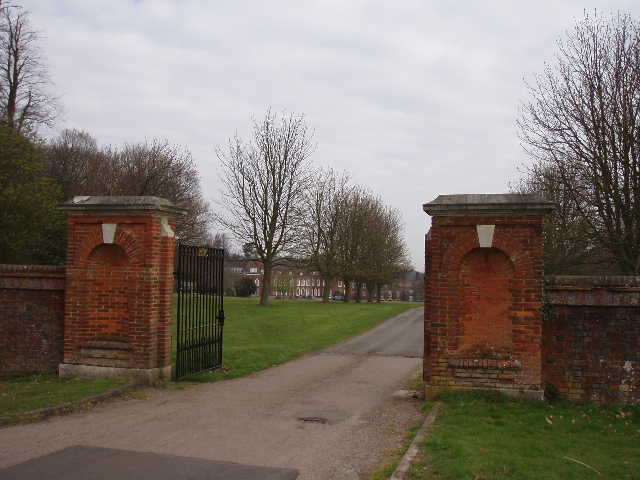
[1] Entrance to Princess Helena Collage, Preston
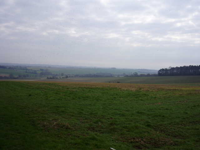
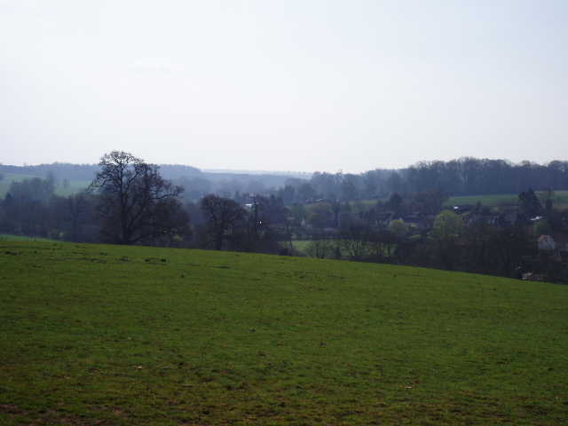
[2] View from near Poynder's End farm
[3] Path leading towards ruins of Minsden Chapel
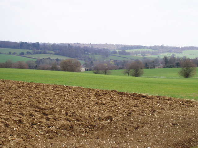
I followed the main road through Preston southwards, passing the entrance to the Princess Helena College, a private school for girls [1]. The manor of Preston was once held by the Knights Templar and later by the Knights Hospitaller, and the school is built on the site of the old monastic buildings, as evidenced by a 13th century stone coffin lid found in 1902. The current building was erected in 1714 but enlarged by Sir Edwin Lutyens in 1908. I followed the road for about half a mile, taking care as beyond the school entrance it ran between high hedges in open countryside, with no verges and at least one blind bend. When it ended at a T-junction, I turned left for a few yards and then took a footpath on the right. This ran between the wire fence of a reservoir on my left and a hedge on my right, then continued to follow the hedge through a field of rough grass. I turned left in the field corner, and after a few yards went through a gap in the hedge. I now continued along the other side of the hedge, with a large field of stubble on my right.
There were now quite extensive views opening up ahead of me, over a valley and beyond towards Stevenage. Most of the clouds had now disappeared, and it was now a warm and bright morning, ideal for walking. The path followed the edge of the field [2], passing Poynders End Farm on my left, and started to descend the slope ahead of me. Where the hedge on my left ended, the path continued downhill on a good grass track between arable fields, passing the right end of a hedgerow and then following a left-hand hedge as the gradient eased considerably near the bottom of the slope. On the opposite side of the valley I noticed a clear path across a corner of an arable field by Almshoe Bury farm – this was part of the Hertfordshire Way, and I’d had to walk round the edges of the field when I was there eighteen months ago, as there was no sign of the path then.
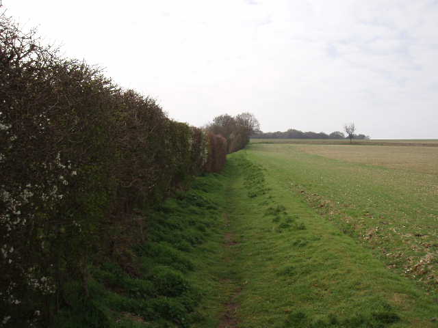
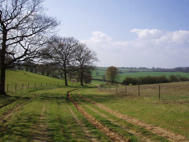
The track ended at a minor road, where I turned right for about a hundred yards to reach the Royal Oak pub. I then took a bridleway going half-right from the far side of the pub, here joining the route of the Hertfordshire Way which the Chiltern Way would share for several miles until Whitwell. These two long-distance paths cross in several places, and share their routes for short distances elsewhere, but this is the only long stretch where they share the same route. The bridleway followed a left-hand hedge at first [3], gradually climbing back up the slope of the hill at an easy gradient, then continued onwards beyond the end of the hedge on a clear path between stony ploughed fields, heading for the corner of a wood where I could see the ruins of Minsden Chapel.
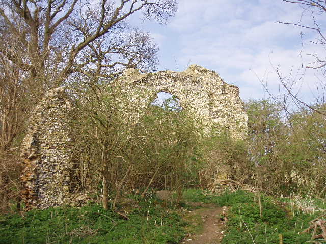
[4] Ruins of Minsden Chapel
[5] Path between Langley End and St Paul's Walden
[6]View back along the same section of path between Langley End and St Paul's Walden
As I drew near the wood, I met a man coming the other way. He said he’d been looking at the ruined chapel, and asked if I knew anything about it. So I got out my Chiltern Way guide book and read what it had to say on the subject. Built in the fourteenth century, it served the lost hamlet of Minsden, mentioned in the Domesday book but thought to have gone by 1650, when the chapel was already reported to be ruinous. At the last recorded wedding at the chapel in 1738, the Curate is thought to have narrowly missed being hit by falling masonry. Reginald Hine, well-known as a local historian in the early part of the twentieth century, was intrigued by the allegedly haunted ruins and was buried here in 1949. His grave stone is still visible.
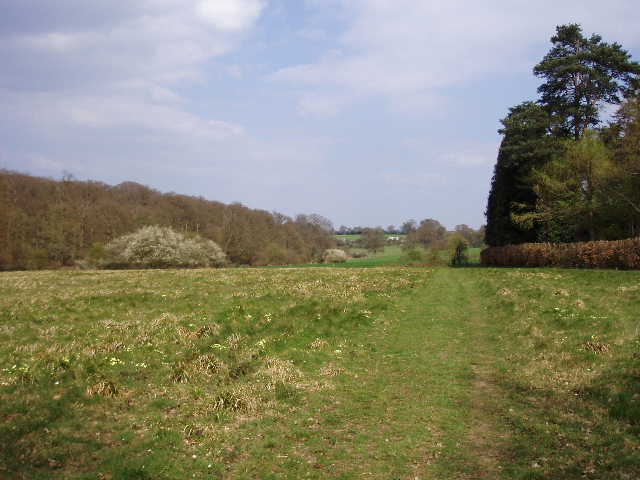
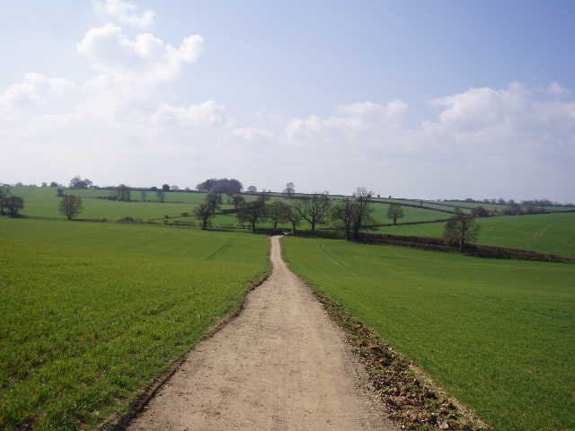
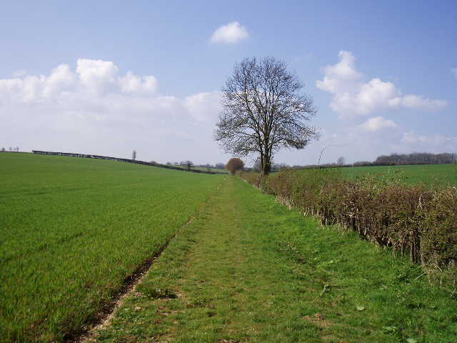
I had a quick look round the ruins and took some photographs [4] – this is the third time I’ve been here, having passed by before on the Hertfordshire Way and on my first Chiltern Way walk. I then continued along the bridleway, at first with the wood (Minsden Chapel Plantation) on my right, and then downhill across the ploughed field to a road. A few yards to the right, I took a hedge-lined track on the other side of the road, which rose steeply up the hillside to reach the hamlet of Langley End. Here I took a track that followed a garden fence to a stile, and continued beyond alongside a right-hand hedge. Across the arable field on my left there were attractive views over rolling countryside in the direction of Stevenage – only the large white blocks of the Lister Hospital indicated where the town was. At the next field corner, the path continued between hedges for a short distance to reach a lane. On the other side, I passed through a small belt of trees (where I saw my first Bluebells of the year) and then followed the narrow path across a large field [5], green with the young shoots of a cereal crop. This was a very attractive part of the walk, with woods ahead and to the right.
On the far side of the arable field, I entered an area of grassland beside a wood on my left [6]. There were lots of Primroses here, and one or two white flowers which I later identified as Wood Anemones. The path then went through a small wood, where there were more Wood Anemones, to reach a minor road where I turned left. Again the road required caution, as there were no verges, just tall hedges, and there were a couple of tight bends where oncoming cars wouldn’t see you until quite late. I passed the entrance to Stagenhoe Park on my right, now a Sue Ryder Care Centre specialising in the treatment of people with neurological conditions, providing long term and respite care for adults. The house was built in 1737, and its most famous resident was Sir Arthur Sullivan, who composed ‘The Mikado’ here in the 1880’s and apparently outraged the local populace with his life-style.
[7] St Paul's Walden church
[8] Drive to St Paul's Waldenbury)
[9]View over Mimram valley near Whitwell, from path from St Paul's Walden
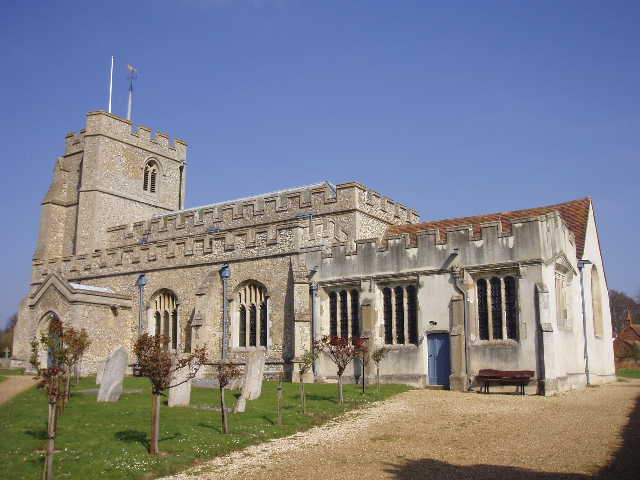
I soon turned right onto a footpath which followed a new fence on my left and then passed between garden boundaries to reach a village street in St Paul’s Walden, where I walked left for a short distance before passing through the church yard on my right [7]. The late Queen Mother was christened in the church here, and it is disputed whether she was born here or in Scotland – her family have owned the house of St Paul’s Waldenbury for over 200 years. The village was originally called Abbott’s Walden (there is a nearby King’s Walden) as it belonged to the Abbey of St Albans, but after the dissolution of the monasteries it was passed on to St Paul’s Cathedral and so the village acquired its current name in 1544. There is a memorial in the church to Henry Stapleford, who died in 1633 having acted as a servant to Elizabeth I, James I and Charles I.
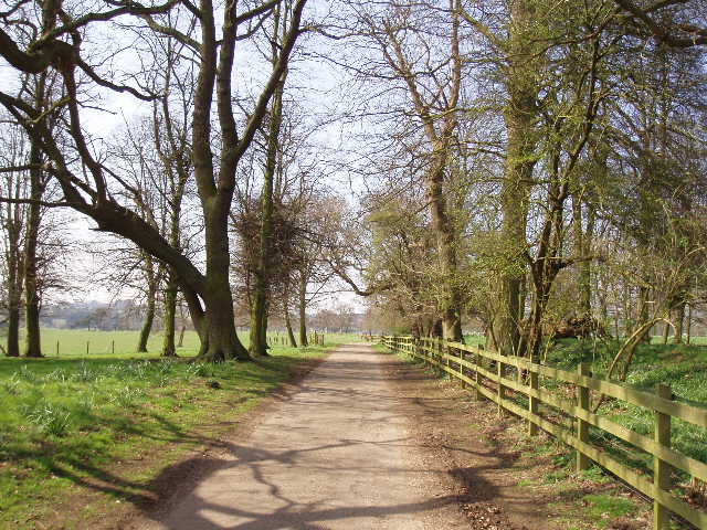
I continued onwards, taking a bridleway on the opposite side of the church which ran along a decent track between hedges. Two young horse riders ahead of me kindly stopped to let me pass them. Over to my right I saw a Buzzard flying over the trees around St Paul’s Waldenbury. I soon reached the end of the track and turned right along the drive to the big house [8], which I could glimpse ahead and to my right. After a few hundred yards, I turned left along a path through a section of parkland divided into small paddocks by fences. I passed through several gates as I walked by a number of horses. It was now a really bright and sunny day, and I had long since put on my sunglasses. The path went through one more gate, and then started downhill between the fences of further horse paddocks on either side. I was now descending into the valley of the River Mimram, with nice views on either side along the valley [9], and also ahead over the substantial village of Whitwell with its prominent white water tower [10]. A small bridge at the bottom of the hill took me across the river [11], and then I crossed another paddock half-left to pass between some buildings and reach the main street through Whitwell.
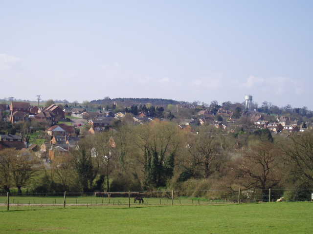
[10] Whitwell from across the Mimram valley
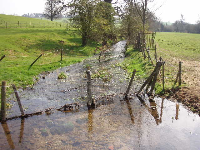
[11] The river Mimram at Whitwell
[12] Water tower on edge of Whitwell, at start of Long Lane
Apparently pronounced “Whi’ll” by locals (just as the nearby town is pronounced “Lu’on”), the village was long famous for its watercress beds along the Mimram valley, and was once a centre of straw plaiting for the local hat-making industry. Despite always being a hamlet of St Paul’s Walden, it has long been much larger than its mother village, and the number of old houses along its high street, both half-timbered and Georgian, testify to its long history.
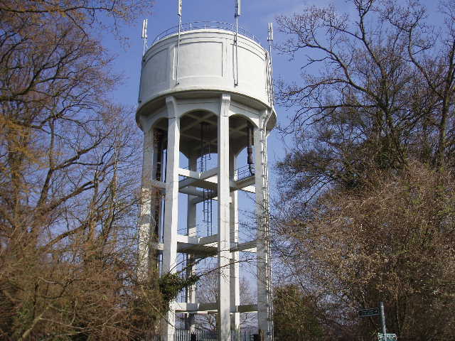
I turned right along the main street, but soon took a path on the left. This led uphill between fences and hedges to reach a large stubble field. Here the Hertfordshire Way went left for a few yards before crossing the field, but the Chiltern Way now went a different route, turning right along the edge of the field to reach a car park by a playing field. Here I took a path going right alongside the playing field, and then down a short alley to a residential street. Here I turned left to a T-junction, where I followed the road to the left. The houses of Whitwell were still on my left, but to my right was a nice view over green fields to the Mimram Valley. I soon left the village behind, and at a sharp left-hand bend I turned off the road by the tall water tower [12] I’d seen from across the valley.
[13] Mimram valley from Long Lane
[14] Towards the far end of Long Lane
[15] End of Long Lane, running down to Whitewaybottom Lane
Here I started down Long Lane, an aptly named track that I would follow for about a mile to Whitewaybottom Lane. The surface of this unmade public road had obviously been repaired fairly recently – it was fairly flat and even, without any ruts, although very stony in places, and piles of earth lined the sides of the track in places. This was a very easy and pleasant part of the walk, with nice views over the Mimram Valley [13] towards Stagenhoe Park on my right. The track generally ran between hedges with arable fields on either side, although it passed a small wood on the left at one point – here the track was quite muddy, and I resorted to walking along the bank of earth on my right. I suspect this section of track was about to be repaired. After turning slightly left, the track started to descend gently, now running across a broad stretch of grass between fences [14]. Ahead and to my left was another wood, where I saw another large bird – I initially assumed it was a Buzzard, but quickly saw the forked tail and realised it was a Red Kite! As you no doubt know by now, I am always delighted to see these birds but I was especially so this time, as it was more evidence that they have successfully spread to this north-eastern end of the Chilterns. When I walked the Chiltern Way almost two years ago, I didn’t see a Red Kite until I was near High Wycombe. Until my walk from Barton to Old Wellbury last week, I’d never seen one further east than Ivinghoe Beacon. I’m sure I’ll get to see one in my home village of Kensworth soon.
A bit further on, Long Lane went quite steeply downhill across an arable field towards Whitewaybottom Lane at the bottom of the valley [15]. There was a lot of Common Field Speedwell here, as elsewhere on this walk – it is well-named, as it is very common in the arable fields I’ve walked through recently. About a quarter mile along the valley to my right I could see a house which I’d seen from a similar distance on the other side on my last walk. The Red Kite circled overhead as I crossed the field, then flew away to my right. Further off I saw another bird, which as it drew nearer I recognised as a Buzzard. The successful reintroduction of Red Kites to the Chilterns and elsewhere is well known, but Buzzards have also made a remarkable come back. I never saw them when I was a child in the 1960’s, and remember being thrilled to see them at Ashridge a couple of years ago. Now they seem to be doing well all over this region – I’ve seen them regularly in Kensworth and several of the neighbouring villages, and have seen them on many of my walks all over Bedfordshire, Buckinghamshire and Hertfordshire. I remember being excited at seeing one near Sharpenhoe Clappers on the second day of my Chiltern Way walk two years ago, but don’t remember seeing them often after that. Already I have seen them numerous times on this trip, which would indicate that they are doing well.
[16] The field path on the far side of Whitewaybottom Lane
[17] Looking back from near the end of the walk
[18] Looking back from the unnamed lane at the end of the walk
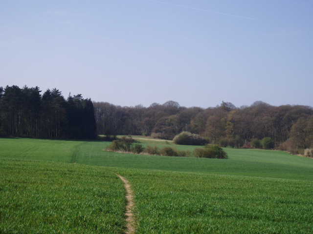
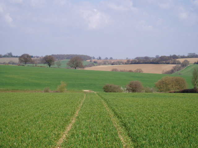
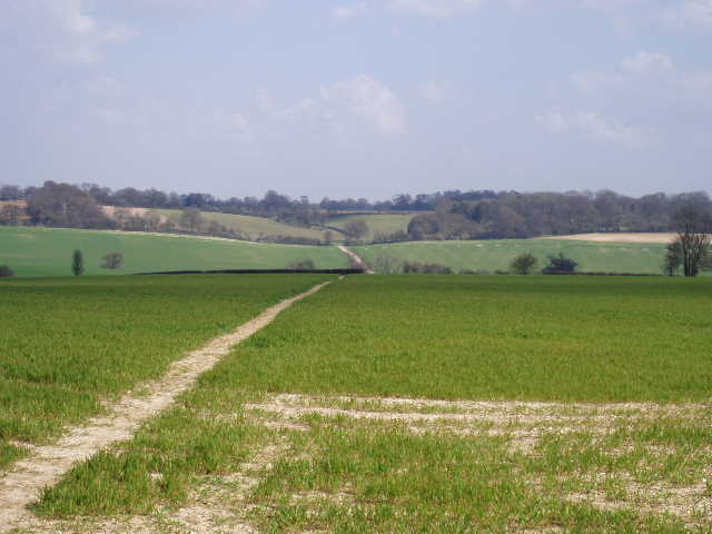
I crossed Whitewaybottom Lane, where I’d originally intended to end this walk, and followed a path alongside a right-hand hedge between green arable fields [16]. At the next field corner I turned left and followed a hedge on my left uphill [17], before turning half-right onto a clear path through the young cereal crop. This took me to an unnamed lane where, after taking a few photographs of the charming countryside roundabout [18], I turned and headed back.
I ate my lunch sat on a bench beside the playing field in Whitwell. The early afternoon was a bit cloudier again, but brightened up by the time I got back to Preston. It was pleasantly warm, and I very much enjoyed the walk back. I saw another Red Kite too, this one flying near the entrance to Stagenhoe Park.
This was yet another very enjoyable walk on the Chiltern Way. Obviously the good weather is helping, plus the fact that I don’t have to worry much at all about navigating, but so far it has definitely confirmed my view that this is the best of the long-distance paths that I’ve walked.
Total Distance: 52.9 miles each way