Pete's Walks - The Chiltern Way (2)
If you are considering walking this route yourself, please see my disclaimer. You may also like to see these notes about the maps and GPX files.
Day 8 10/04/07 Near Whitewaybottom Lane to M1 (7.4 miles each way, approximately)
Parked on main road in Peter’s Green.
I started walking about 9.40, first of all heading back from Peter’s Green to the lane where I finished the previous walk. I got there about 10am – I took a couple of photos, and heard the distinctive and somewhat plaintive call of a peacock at a farm nearby.
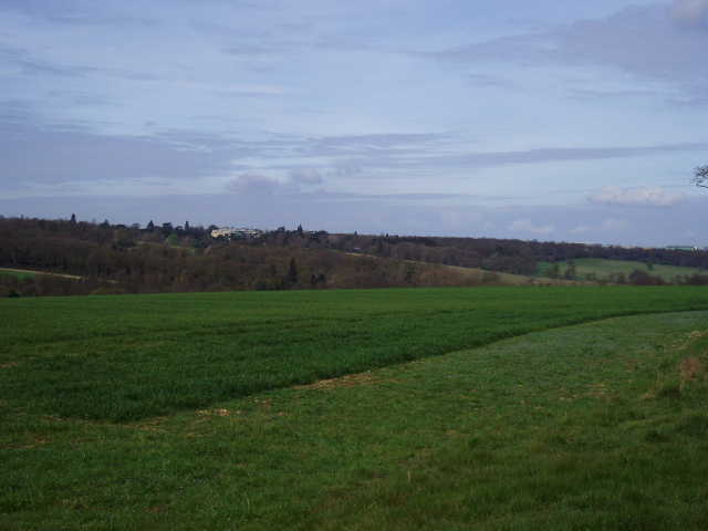
I followed the lane to the left, as it ran between hedges with arable fields either side. After a hundred yards or so there was a small wood on my left. After another hundred yards or so, the wood ended and I took a path on the right. This followed a left hand hedge, on a broad strip of grass on the edge of a green arable field [1]. The path soon started to go downhill, soon with a small area of scrubby bushes on the left. At the field corner in the bottom of the valley I turned right, still following a left-hand hedge, and followed the path as it very gradually left the valley bottom and rose up the hillside. The ground here was somewhat uneven, where hoof prints had been baked dry in the sun. After about a quarter of a mile, I turned right onto another path, which ran along garden fences on my left with another smaller arable field on my right. I then turned left down an alley between wooden garden fences to reach the short gravel drive to a house, and went through a gate to a road in Peter’s Green, opposite the Bright Star pub.
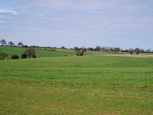
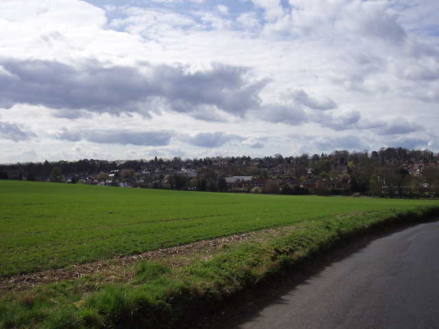
[1] View towards Peter's Green from near the start of this walk
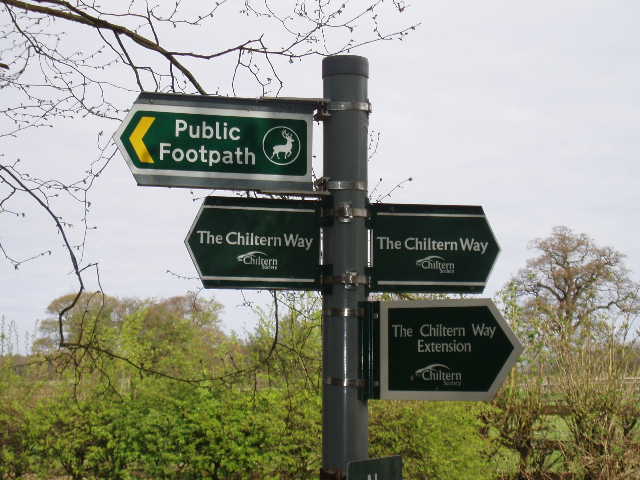
[2] Footpath signs at Peter's Green where the Northern Extension rejoins the original route
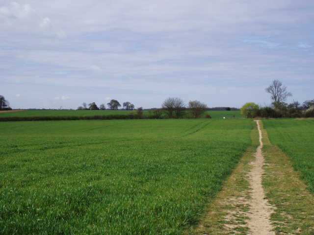
[3] Footpath leading away from Peter's Green
I turned right along the road, soon crossing it, and after a few hundred yards reached a signpost where the various fingers indicated that this was where the Northern Extension rejoined the original route of the Chiltern Way [2]. I followed a path half-left, passing the village hall on my right, and continued on a clear path across another field containing the green shoots of some cereal crop [3]. Near the end of a row of houses, the Chiltern Way went through a metal kissing gate and followed a left-hand fence through a paddock. There then followed a very pleasant section of the walk, as I followed the path along a headland between more green fields [4]. There were occasional bushes along the headland, showing that there was probably a hedge all along here at one time. There was also a lot of the ubiquitous Common Field Speedwell. After about a third of a mile, I passed one or two trees beside the headland.
The view ahead started to open up as I approached a wide valley. Ahead and to my right, on the far side of the valley, I could see the large house of Luton Hoo amongst trees [5]. An earlier house on the site is said to have been Anne Boleyn’s birthplace. The current house was originally designed by Robert Adam for the Earl of Bute, a Prime Minister during the reign of George III and a keen botanist who was largely responsible for the establishment of Kew Gardens. After two major fires, the house was largely remodelled in 1903. In the trees to my left was another smaller Georgian mansion, The Hyde.
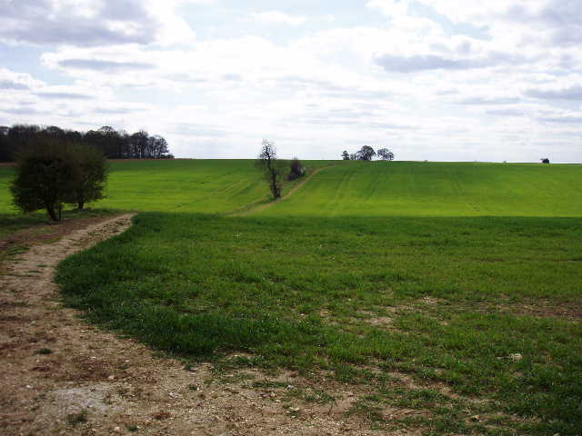
[4] Path from Peter's Green to East Hyde
[5] Looking across the Lea valley towards Luton Hoo
[6] Looking east along the river Lea at east Hyde
Having followed the path along the headland for about two thirds of a mile, I turned left at a path junction, and after two or three hundred yards turned right on another headland between arable fields, now heading quite steeply down into the valley. This was the valley of the river Lea, not many miles from its source and on its way to join the Thames at London. I followed the path downhill, eventually turning left to walk beside a garden fence to reach a lane. Here I went right, continuing downhill with some of the houses of East Hyde on my right, soon reaching a T-junction with the fairly busy Luton to Wheathampstead road which follows the river valley.
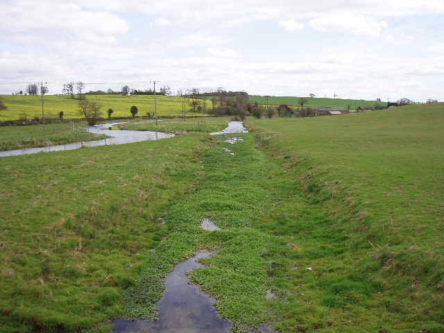
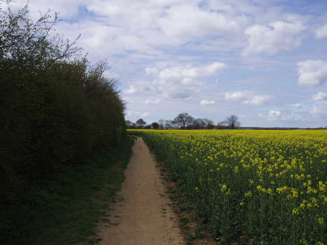
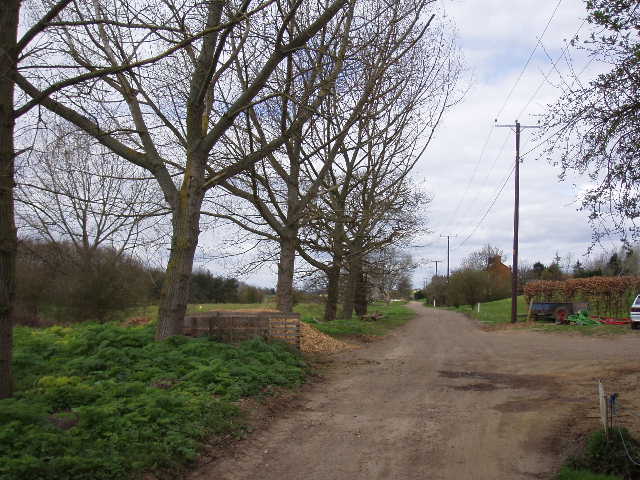
I turned right for a few yards then took a lane on the left. This soon crossed the river Lea [6,7], and went uphill slightly before going under a railway bridge carrying the main line from Bedford to St Pancras (the ‘Bedpan’ line). Immediately after the bridge I took another lane going left, Cooter’s End Lane, still rising uphill at first between yellow fields of oil-seed rape [8]. I heard two or three trains pass by on the railway line in the valley behind me. The lane then dropped and rose through a small dip, now running between hedges with arable fields on either side. In places the lane had a strip of grassing growing down the middle. I then passed the half-dozen or so dwellings of Cooter’s End on my left – there was now a fairly flat area of arable fields to my right. The lane twisted and turned a few more times, and then started to descend into another valley, with the town of Harpenden ahead of me and also over to my left [9].
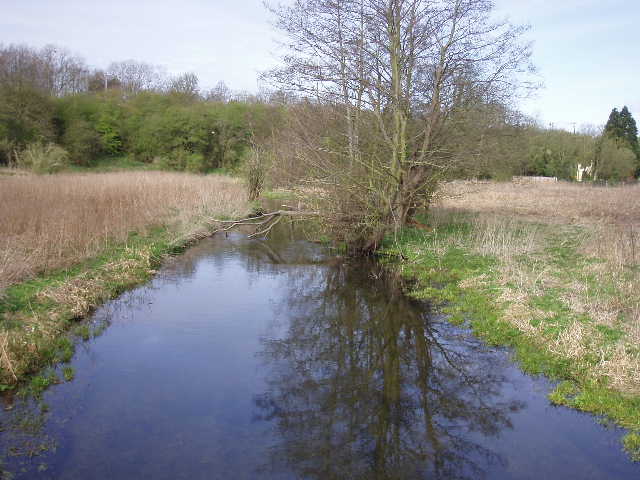
[7] The river Lea, looking west, at East Hyde
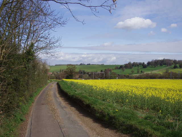
[[8] Looking back towards the Lea valley and East Hyde from Cooter's End Lane
[9] Approaching Harpenden on Cooter's End Lane
On my last walk, the Bernwood Jubilee Way, I came across many fields containing Ridge and Furrow, the evidence of the mediaeval system of farming in strips - I referred to such fields as being like sheets of corrugated iron, because of the regular pattern of humps and hollows. Well, the Chiltern Hills have always struck me as being like that on a much grander scale, a sequence of rolling hills alternating with valleys. Of course it’s not that regular, some valleys are much deeper than others and the hills and valleys don’t follow dead straight lines, but by and large I think the term ‘corrugated’ is an apt description of this area. For much of the Chiltern Way I shall be following a steady routine of up and down, up and down, up and down … not that I’m complaining, far from it, because the subsequent constant changing of perspective is one of the things that makes walking in this area so pleasurable.
I followed Cooter’s End Lane to its termination at the bottom of the valley, where it met the A6, heading out of Harpenden towards Luton, a few miles to my right. I carefully crossed over, and walked three or four hundred yards to my left, entering the outskirts of the town. I took the first turning on the right, but almost immediately left the road and took a footpath going half-left. This ran between a couple of office or factory buildings to a small grass area. I crossed this half-right, with a children’s playground to my right, then followed a path uphill, at first with allotments on either side, then garden fences. I crossed one residential street, then continued uphill along the alleyway with wooden fences either side. I crossed two further residential streets, and saw a large clump of Lesser Celandine along here. Across a final street, the path levelled out and ran alongside a large school on my left, emerging in the corner of a field of oil-seed rape [10]. It had only taken me 10-15 minutes to get through Harpenden, a surprisingly painless experience – but then I remembered from last time, that all the sections of the Chiltern Way that passed through towns were shorter and pleasanter than I’d expected.
[10] Path by oil-seed rape field just outside Harpenden
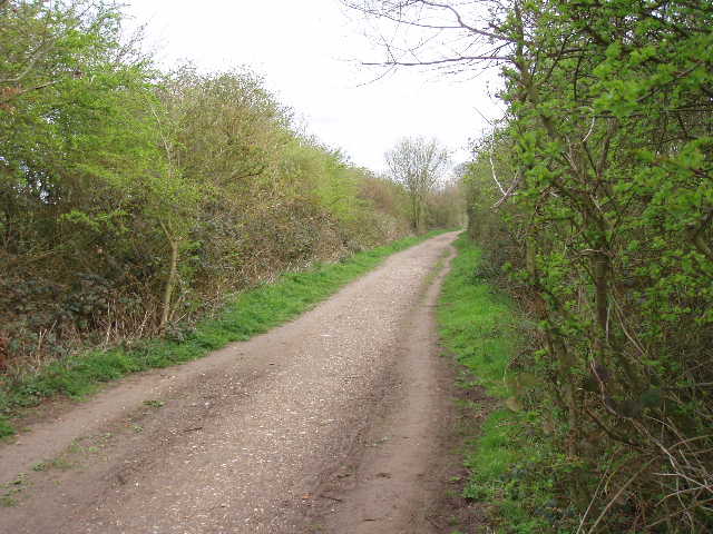
[11] Looking back along the Nicky Line path, near Harpenden
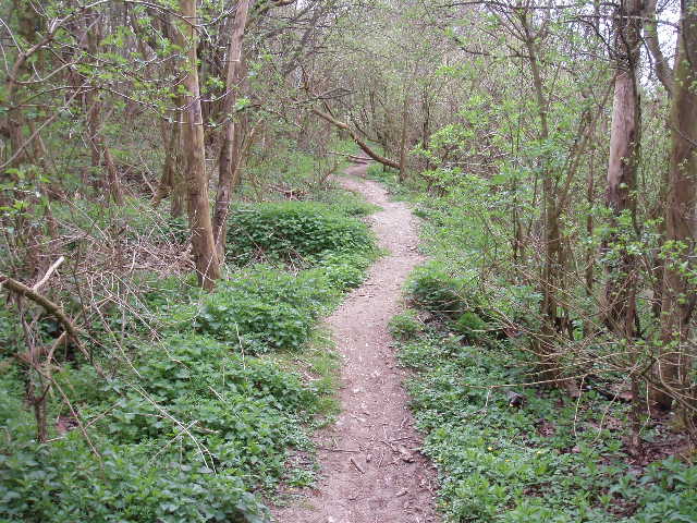
[12] Path through wood next to Redbourn Golf Club
I followed a left-hand-hedge beside the yellow crop, following the hedge as it turned sharply left. At the subsequent field corner, I went through a gap in the hedge and turned right. I was now on the course of an old railway line [11], the ‘Nicky line’ that ran from Harpenden to Hemel Hempstead until closed in the 1970’s – it is now a pedestrian and cycle route between the two towns (I walked another very short section of it near Redbourn, on Day 7 of my Hertfordshire Way walk). I saw a clump of Forgetmenots here (and what I thought I was a wildflower I’d never seen before, only to be informed that it was a very common garden flower when I got home!). After about quarter of a mile, I turned right off the old railway line, and within a few yards entered Redbourn Golf Course, by a green. I turned left alongside a wood for thirty or forty yards or so, then followed a signposted path that entered the wood and went downhill [12], with the fairways and green of the golf course just a few feet to my right. There were a few Bluebells here, and a lot more Lesser Celandine. There were some nice Violets too [13].
At the end of the wood I went through a gate, and continued downhill on a grassy path. On my left, an electric fence separated me from some paddocks, while on my right a wooden fence with an intermittent hedge marked the edge of the golf course. I then went through another gate and followed a track for about 100 yards to a cluster of outbuildings. Here I turned right to follow another good track [14], close to the valley bottom, that went across the golf course, passing two or three greens and two or three tees. I saw a Long-tailed Tit gathering material for its nest as I walked along here.
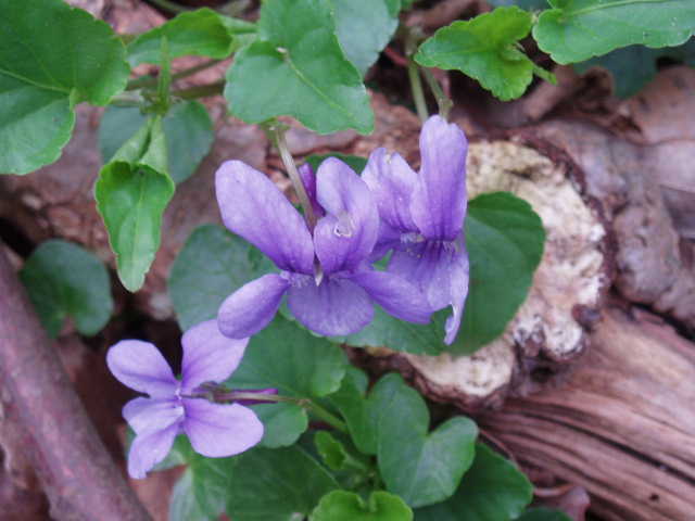
[13] Violets in the wood next to Redbourn Golf Club
[14] Track through Redbourn Golf Club
[15] Looking back along path through valley of the river Ver
The track ended at a small lane, which I crossed and then continued on along the valley bottom, crossing a section of an arable field on a clear path and then following the edge of the field. This valley, incidentally, was that of the river Ver, which gave St Albans its Roman name of Verulamium – the river actually rises in my home village of Kensworth, at least during the winter months. In summer, long stretches of the river bed here remain dry. As I reached the end of the field, I saw a man park his 4x4 and start coming towards me, meeting me on the edge of a thin grassy field. It turned out he was a bee-keeper and had just moved one of his hives – he suggested I make a slight detour through the field to avoid the four hives that were right next to the path. I did so, following a short semi-circular path through the clover and grass, but there was no problem – the bee-keeper waited in his 4x4 to check I got by safely, before driving off.
I went through a hedge-gap into the next field, and then through another gap in order to switch to the left side of a hedge, which I followed for a few hundred yards before veering slightly left away from it towards a wooden fence [15]. A stile here gave access to a garden (a sign said it was a permissive path rather than a right of way – another sign said beware of the dog!), where I crossed an area of grass, then went through two gates, across the drive and through another gate into a field. I went left a few yards over a bridge (no sign of water in the infant river Ver), and then went half-right, crossing a large field diagonally, rising slightly uphill as I did so. There was no obvious path, just a darker line in the grass and clover which led unerringly to a footpath sign on the other side. Here I went over a stile to reach the pavement beside the busy A5.
The final quarter mile of this walk was probably the messiest section of the entire Chiltern Way. I turned right to where the A5 and the M1 crossed (junction 9 of the M1). Currently, this part of the motorway is being widened to four lanes, so as well as the usual slip roads that I needed to cross, I also needed to dodge round temporary barriers where lanes were closed because of the construction work. I managed to make my way through the bridge under the motorway, and past the roundabout on the other side. I then carefully crossed the A5, and went back a few yards along the other side of the road to a footpath sign by the roundabout. This was currently by the entrance to a temporary car park for the construction workers, and a friendly security guard came out of his hut to point out where the footpath was meant to go. I explained I was only looking to see where the path was going, as I was about to turn round and go back the way I came. I told him I’d be coming back in a day or two’s time to carry on my walk, but I’d actually come from the opposite direction as I’d park in the nearby village of Flamstead.
The walk back to Peter’s Green was pleasant but uneventful – same as usual! I stopped to eat lunch on a bench beside the section of old railway line. Driving home, between Peter’s Green and East Hyde I saw a Red Kite close to the road – in fact, a motorist coming the other way had stopped and got out of his car to get a better look at the bird! So I’m not the only one fascinated by these birds! Actually, the Red Kites in the Chilterns are so popular that the wildlife organisations have recently had to ask people to stop feeding them – apparently, this artificial feeding was hindering the natural spread of the birds throughout the region. From what I’ve seen recently, they seem to be spreading out perfectly well, as they’ve at least reached the north-eastern end of the Chilterns.
This wasn’t too bad a walk, but it is certainly one of the least interesting walks on the Chiltern Way. It would be unfair to expect each of the 26 walks I shall do to all be of a uniformly high standard. From my memories of this long-distance path two years ago, there were four walks that weren’t so good – I’ve now done three of those walks again, and in fact the other two were perfectly OK, much better than I’d expected. The first part of the walk, as far as East Hyde was fine. But then this walk had a very long section of lane walking (Cooter’s End Lane) – this wasn’t too bad at all, it’s just I prefer to be on footpaths or bridleways rather than a surfaced road. It also had the short section through Harpenden – uninteresting (unless you have a penchant for alleys between garden fences), but it only lasted quarter of an hour or so. Somehow I didn’t particularly like the section between Harpenden and the M1, although I’m not really sure why not – I did like the wildflowers in the wood by the golf course, though. The M1 junction was noisy and a bit of a pain, probably the worst quarter of a mile on the whole of the Chiltern Way.
Total Distance: 60.3 miles each way