Pete's Walks - Hertfordshire Chain Walk
If you are considering walking this route yourself, please see my disclaimer. You may also like to see these notes about the maps and GPX files.
Walk 1 12/10/06 Whitewebbs Park to Crews Hill (7 miles each way)
Parked in lay-by beside Whitewebbs Park.
I parked in a lay-by near the King and Tinker pub (or the Kink and Tinker, as the chalkboard advertising a Karaoke night called it), alongside the boundary fence of Whitewebbs Park in the borough of Enfield. It was about 10.20 when I started walking – I had been delayed slightly as I’d needed to call in at my doctor’s surgery in Markyate to pay for a prescription, and then I’d gone slightly wrong with my directions, forgetting the last turn I needed to take after reaching Crews Hill. Still it hadn’t been a bad journey and had taken less time than I’d expected. It was a lovely day for walking, with clear blue skies, no wind and a warm temperature – I rolled my shirt sleeves up after a couple of miles as the weather was so mild.
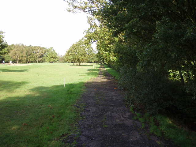
The Hertfordshire Chain Walk started by walking alongside the road, with Whitewebbs Park on my left. The guide book said it was also possible to follow a bridleway just inside the park, but I chose not to do so, partly because the guide book said the park wasn’t always open and partly because I suspected it would be very muddy – the last three days have been very rainy, which has been quite frustrating as I’d hoped to start this walk on Monday rather than today, Thursday. After less than half a mile, I turned left through a gap in the hedge to join the bridleway, which here turned left to head south away from the road. It was a broad track between fences, with the woods of the park on either side.
Whitewebbs Park consists of 196 acres of formal parkland and woodland, with an 18th century house and a pay-as-you play golf course (I didn’t see either of these, as the bridleway was almost entirely within the woodland). The parkland was laid out after the 1803 enclosure of the former Enfield parish common land which had been created when Enfield Chase was divided up in 1777. The present house was built in 1791 by Dr Abraham Wilkinson, a notable agricultural improver, but a former house on the site was reputed to be a meeting place of the Gunpowder Plot conspirators.
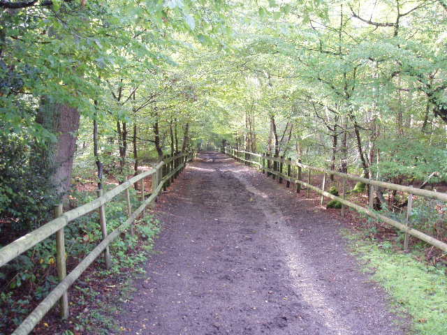
[1] Bridleway through Whitewebbs Park
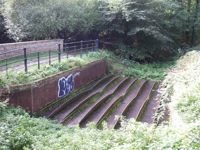
[2] Flash Lane Aqueduct
The bridleway ran steadily downhill between the trees, at an easy gradient [1]. It was not too muddy, although there was a groove meandering along its course that had obviously been washed out by rain water. At the bottom of the slope I came across the remains of the Flash Lane Aqueduct [2], with a notice board about its history (the far end of the bridleway is still called Flash Lane). The cast iron aqueduct once carried a section of the New River over the Cuffley Brook – if you’ve read my Hertfordshire Way journal, you may recall that the New River is an aquifer built in the early 1600’s to carry drinking water from springs near Hertford to London. The loop through Whitewebbs Park was abandoned in 1859 when the New River was straightened – an ornamental lake was formed from part of the redundant section in the park.
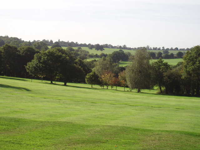
[3] Looking across Whitewebbs park towards the Lea Valley
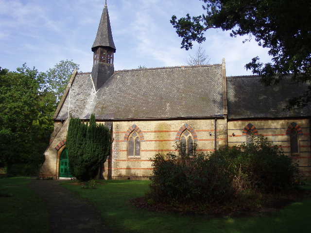
[4] The church at Clay Hill
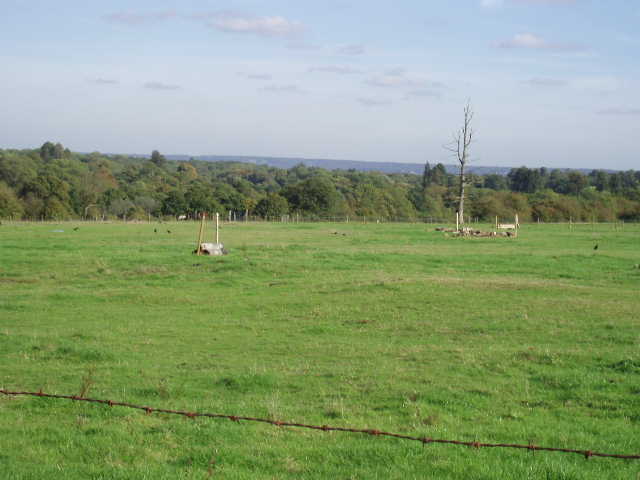
The bridleway now started to rise gently uphill, and the woods on the left soon gave way to an open field, with a nice view back looking over the woodlands to the far side of the Lea valley in the distance [3]. After passing a few houses, the bridleway ended at a road in Clay Hill. The Hertfordshire Chain Walk then took a road almost opposite, with a church on the right [4]. The paved road soon came to an end, with a footpath continuing onwards in a north westerly direction. It soon crossed a railway line – presumably a busy commuter line, as trains passed in both directions just before I reached the crossing – and then started to turn more northwards as it reached a golf course. Sadly, at the start of the path there had been a couple of signs posted to trees about a missing dog, and here there were a couple of signs about a missing cat. The path followed a line of trees with a fairway on the left [5], and nice views across the golf course to open countryside further left [6]. On my return in the afternoon, I saw a Green Woodpecker here – unusually it didn’t make its distinctive ‘yaffle’ call when it flew off. I then crossed through the car park by the clubhouse to reach a road, where I turned right.
[5] Path through the golf course at Crews Hill
[6] View from the golf course at Crews Hill
The road soon went under a railway bridge, with Crews Hill station then immediately on the left. When researching this walk on the internet, I came across a joking reference to Crews Hill being the Garden Centre capital of the world and I could now see why. In the next half mile of road walking I passed about 10 or 11 businesses connected to gardening – several full-blown Garden Centres, others specialists in such things as Garden Furniture, Fencing, Turf or Garden Sheds. I made a mental note to tell my parents about this place (in fact it turns out they went there once, it’s where they got their garden seat).
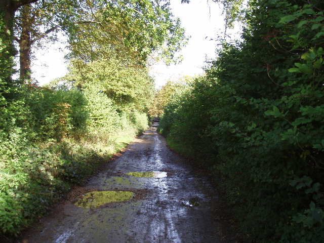
Where the road turned sharply to the right, I turned left (north) along a private road. There were many ‘Keep out’ and ‘No trespassing’ signs on the business premises I passed on my right. The road soon became a track between hedges [7], and in a few hundred yards passed under the M25 – the rumble of traffic noise could be heard throughout much of this walk, but was never loud enough to become too much of an irritant. The track continued onwards, passing a couple of cottages, to reach a crossroads of farm tracks, where I turned right. The crossroads is where Walks 1 and 2 of the Hertfordshire Chain Walk meet, Walk 2 coming the other way from Goff’s Oak and turning to what was my left. I recognised the crossroads anyway, as that part of Link 2 follows the same route as the Hertfordshire Way (see Day 15 of my journal for that walk).
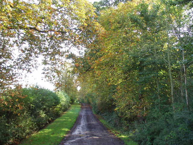
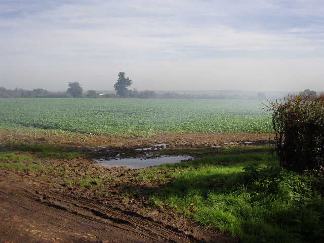
The track I was now on headed almost due east in a dead straight line for about half a mile, mostly with a wood on my right and a hedge on the left [8]. A feature of this walk was the number of Horse Chestnut trees that I passed – or perhaps I only noticed them so much because of the abundance of conkers on the ground. I also noticed many hazel nuts on the ground during this walk. As I walked along this track, one conker missed me by inches as it fell to the ground. Where the track eventually turned half right, I turned left along another track heading north – there was a bonfire here where people from a tree-cutting firm where burning branches (they were there with their van when I came by on my return journey) [9]. I noticed several Red Admiral butterflies as I followed the track beside a left-hand hedge, with views over a field of cabbages towards the Lea Valley on my right. The Hertfordshire Chain Walk then passed through a farm yard before continuing along the farm drive, with a wood on the right and several horses in a paddock on the left – a kestrel flew off as a walked along here.
[7] Track leading from Crews Hill towards M25
[8] Track leading away from the junction where Walk 1 meets Walk 2
The farm drive ended at a country lane called Silver Street where I turned right, soon passing a Jewish cemetery on my right. I now had about half a mile of lane walking, but there were very few cars on these quiet lanes. I saw a Jay fly by as I walked along. At a T-junction I turned right, to start heading south back towards Whitewebbs Park. Just after the lane turned left, I took a footpath on the right which followed the right edge of an overgrown pasture [10], and then turned left at the field corner. I followed a fence, with nice views over the small valley on my right [11], to reach a house and some farm buildings. The path took a somewhat circuitous but well sign-posted route through the buildings (I remembered the way from a diagram in the guide book), to join a good track heading south between hedges. Where this turned right, I went slightly wrong by following the track for a further 100 yards or so before realising my mistake and turning round – my excuse is that the stile I needed to take was broken and hard to see, and the yellow arrow indicating the way had been broken off the gatepost (there was just a tiny sliver of yellow plastic left nailed to the wood).
9] Rather smoky view towards the Lea Valley
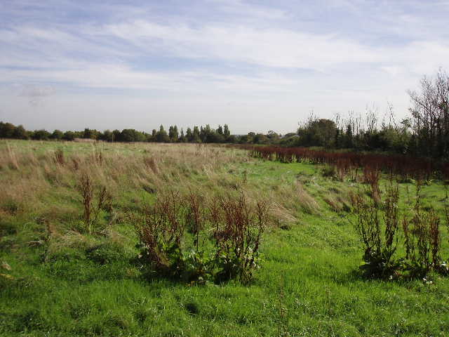
[10] Field of rough grass near Silver Street
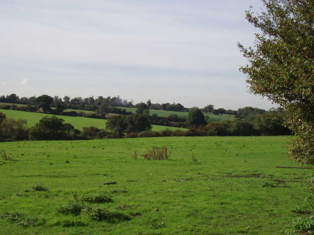
[11] View from near Silver Street
Having crossed the remains of the stile, I headed uphill beside a right hand hedge through a paddock containing two inquisitive ponies. Across another stile (in a fence not shown on my map), I continued alongside the hedge in another grassy field [12]. Having crossed a further stile (where I would stop for my lunch on the way back), I turned right along the hedge of a very large cabbage field, turning left at the next corner to continue alongside the field, now with a wood on my right. At the end of the wood, the path went half right with a horse paddock on the left, to reach the drive to some isolated houses. A short way to the left, I turned right to follow the left hand boundary of another cabbage field. I saw on the map that the actual path should have cut across the field slightly to where I could see a gateway into a wood, so I turned right at the corner of the field and went through the gate. I checked the map again, and immediately realised I was wrong again – the path went to the gate but turned left there to the corner of the field I’d just passed. I retraced my steps, and took a path to the right, with the wood on my right and another horse paddock on my left. There were views from here over London to the south – it was very hazy, but I could make out the building known as ‘the Gherkin’. The descending path soon brought me to a concrete bridge over the M25, with spiral steps on either side.
[12] Looking back towards Silver Street
Beyond the bridge, I crossed a pasture with some young cows in it – the guide book mentioned a hedge but that has obviously been dug up in the last few years, a solitary tree being all that remains. There was also a brown pony in this field, but curiously I couldn’t see it when I returned this way about 10 minutes later. I followed the right hand fence through the next two empty grassy fields, then the path ran between hedges or fences as it went round the outside of some farm buildings – there were more paddocks on my right, one of the horses looking like a Dalmatian, white with black spots. This path brought me back to the road opposite the King and Tinker, with my car just a few yards up the road to my right.
It did feel strange getting to my car only to turn round and go back the way I’d come. I dare say I’ll get used to this over the next few walks. Shortly after re-crossing the M25 bridge, I passed a couple of walkers coming the other way – later on I met them again at the golf course in Crews Hill. The walk back was quite straightforward on this lovely sunny afternoon, and I got back to the car about 3pm.
This was quite a pleasant walk, despite the noise of the motorway. Some if it was through parts of outer suburbia, but the half-mile stretch of road through Crews Hill was the only bit where I felt I was in a large built-up area. I didn’t see any wildflowers or much in the way of wildlife. But I did notice several very dark, almost black pheasants – I remembered seeing them around here, especially near Northaw, when I walked the Hertfordshire Way. I was also surprised that there were no waymarks or signs for the Hertfordshire Chain Walk, unusual for a path that is shown on the OS maps.
Total Distance: 7 miles (each way)