Pete's Walks - Hertfordshire Chain Walk
If you are considering walking this route yourself, please see my disclaimer. You may also like to see these notes about the maps and GPX files.
Walk 2 16/10/06 Goff’s Oak to Newgate Street (9 miles each way)
Parked in car park in Goff’s Oak.
Just as well I’d decided to park in the car park in Goff’s Oak – the alternative place, the service road where I parked on my Hertfordshire Way walk, was being resurfaced today. It was rather misty as I set off from home this morning, but it had largely cleared by the time I reached Goff’s Oak. It was destined to be a gorgeous day of clear blue skies and remarkably warm for October, the temperature reaching 20C according to the forecast - I had my sleeves rolled up for most of the walk.
I started walking from Goff’s Oak at about 10am. The village takes its name from the Goff family who once owned it and a symbolic oak tree that stood near the village centre. The original tree was blown down in 1950, but a new tree was planted to replace it and is still flourishing. Amongst the village’s claims to fame is that it was the childhood home of Victoria Beckham (a.k.a. Posh Spice).
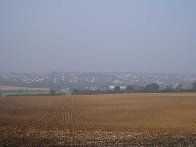
[1] Very hazy view of Cuffley
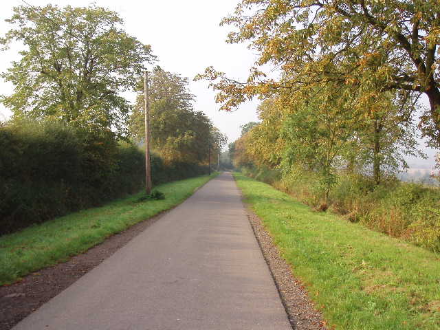
[2] Drive leading to Burnt Farm
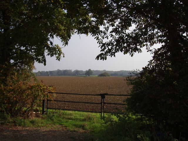
The first few miles of this walk followed the same route as parts of the Hertfordshire Way, so I had no worries about navigating the route in this section. A footpath left the service road parallel to the main road to Cuffley, passing between garden fences and then running beside a paddock on the right, heading roughly south. A stile gave access to another small paddock, beyond which the path joined the drive leading from a farm house. The guide book said to just walk down the drive, but the map and the footpath sign showed that I should really cross the grass to the left of the drive to a hedge corner – I did this, even though it added a few yards to the walk, as I then turned right on the road. After a few hundred yards, I turned left at a T-junction onto a private drive – a sign across a gate indicated that I was entering the Theobalds Park estate. I remembered there was a nice view towards Cuffley here, but it was still rather misty at this time [1]. I followed the tarmac drive [2] for almost half a mile towards Burnt Farm. Beyond the entrance to the farm, the tarmac drive became a gravel farm track and I soon reached the crossroads of track where this second walk of the Hertfordshire Chain Walk met the route of Walk 1 coming from the opposite direction [3]. I turned right here – I could hear the sound of traffic on the nearby M25 at this point, but only for a few minutes.
The track I was now on headed slightly downhill between large open fields of cabbages or something similar, before running alongside a wood on the left. Ahead of me I could see a railway line on an embankment and an impressive railway viaduct with about 10 arches [4]. The track turned right near the end of the wood. It almost immediately turned left again, to pass under the viaduct, but the Hertfordshire Chain Walk continued ahead on another track, still parallel to the railway line. This continued through another cabbage field, before turning left to pass through a bridge under the railway line. So far the Hertfordshire Chain Walk had been following the route of the alternative Leg 10A of the Hertfordshire Way, now I would be on the route of Leg 9. Beyond the bridge a path ran between hedges, soon with playing fields on the left, to reach a road on the edge of Cuffley.
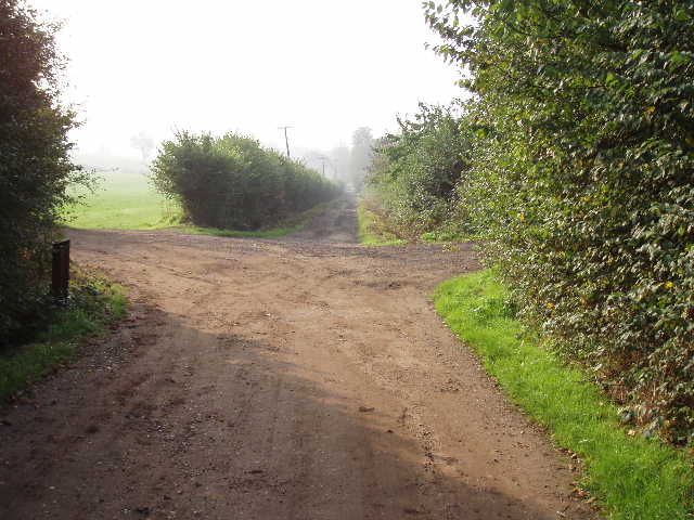
[3] Track junction where Walks 1 and 2 meet - Walk 2 turns right here
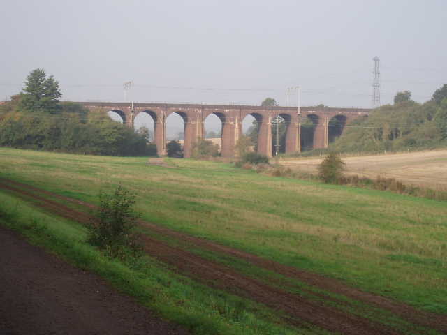
[4] Railway viaduct near Cuffley
This commuter village achieved a measure of fame during World War One, when on September 3 1916 the German airship SL-11 was shot down and crashed in Cuffley. There is a Memorial to Lieutenant W. Leefe Robinson the pilot who shot the airship down, who was awarded the Victoria Cross. Contrary to many reports of the incident, the SL-11 airship was not a Zeppelin but an army Schutte-Lanz airship. Nevertheless, the local football team is still nicknamed 'The Zeps' after this event. There is a model of the airship in the village hall. Cuffley is also the birthplace of Cliff Richard (I promise that is the last ‘celebrity’ I will mention in this journal entry – I don’t want this to turn into a parody of ‘Hello!’ magazine).
I turned left along the road, heading towards Northaw. There was a pavement on both sides of the road, so it was a perfectly safe stretch of road walking – it was quiet in the morning, but coming back here about 3pm the road was very busy and noisy, presumably due to people collecting their children from school at that time. Where the road reached a valley bottom, I turned right on a footpath. This was hard-surfaced until it passed a building, then continued along the valley bottom following a right-hand hedge with green fields on either side [5]. After about half a mile, there was a gap in the hedge where I took another path branching right, finally leaving the Hertfordshire Way - I remembered seeing a fox near this spot when I did that walk. Also, somewhere near here was the site of the King’s Well, a natural spring rich in iron salts that was popular with James I and Charles II – its exact location is no longer known.
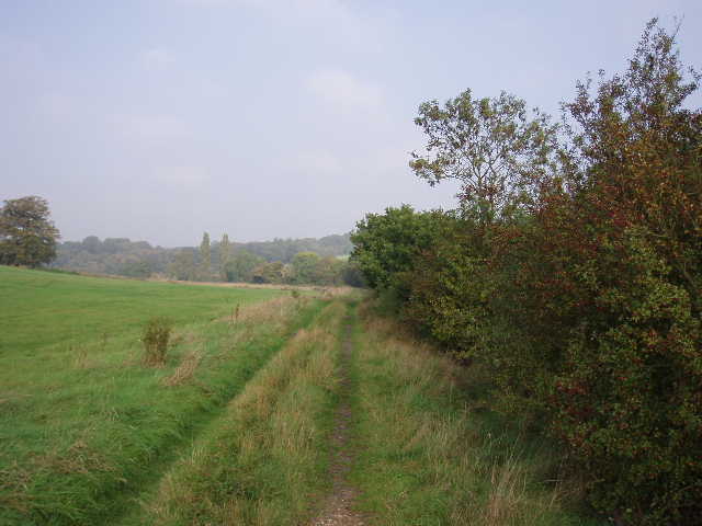
5] Track from Cuffley towards area of King's Well
[6] Looking back along woodland path between Cuffley and Newgate Street
The path ran between a barbed-wire fence and a right-hand hedge, with a rough grass field to the left. It then entered a wood, still with the fence running on the left, and climbed up hill – although not too steep, this uphill section through the trees went on a bit longer than I expected [6]. At the top of the hill it reached a road, The Ridgeway, with many large and impressive houses along it. I turned left, and after 200 yards or so turned right into Hanyards Lane, entering a private estate. At the end of this road I turned left into Hill Rise and followed this downhill to its junction with Tolmers Road where I turned left again. This road soon came to an end, but a footpath continued onwards, bearing slightly to the right alongside a fence as it rose back uphill through another wood – I was now on the same route as the Hertfordshire Way again this being part of Leg 10. The path soon started to descend again, to reach another road. I turned right here, to follow the twisty road uphill towards the village of Newgate Street. The Hertfordshire Chain Walk guide book doesn’t say anything about it, but I remember the Hertfordshire Way guide book warning that care needed to be taken here. There was no footpath, and hardly any verge in places, and I remembered it as being a bit awkward. Several times I had to stop and press myself into the roadside hedge as vehicles approached.
Where the Hertfordshire Way turned left in the centre of the village of Newgate Street, the Hertfordshire Chain Walk left it and turned right instead. Within a few yards, I turned left on a bridleway that ran along the drive of Ponsbourne Park. After passing a few houses and a stables, a view opened out ahead of the grand house of Ponsbourne Park [7], now a hotel and conference centre. The drive went down and up a small valley, passing a small Par-3 golf course in front of the hotel. With the hotel on my left, I continued on the tarmac drive passing various outbuildings of the hotel complex and then a farm, where the tarmac gave way to a farm track (still well-surfaced, though). This track continued onwards through very pleasant countryside [8,9], with ploughed fields on either side and woods further away. The land here was all part of the Ponsbourne Park estate, owned by the same company as the hotel. The track turned sharp right at one point, then sharp left soon after, before running between an avenue of trees to reach a road.
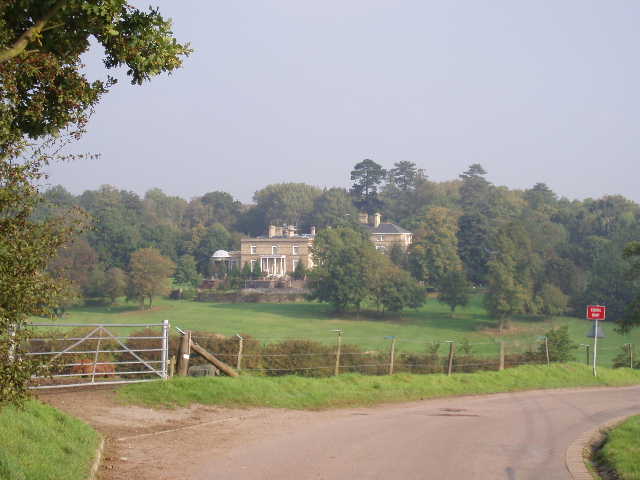
[7]Ponsbourne Park
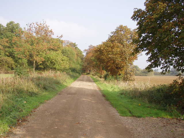
[8]Track leading through Ponsbourne Park estate
Here I turned right to follow the road for about a third of a mile – almost straight away I crossed the course of the Ponsbourne railway tunnel, indicated by the top of an air shaft in the field on my left [10]. There was no pavement, but the road wasn’t too busy – it was much busier when I came back in the afternoon. Just after passing a kennels and cattery on my right, I turned right into the ancient Wormley Wood, managed by the Woodland Trust. Together with Hoddesdonpark Wood, Bencroft Wood and part of Broxbourne Wood, this was designated a National Nature Reserve (NNR) in 1996. It is Hertfordshire's only NNR, and was designated due to its national importance for nature conservation and its rich variety of wildlife habitats. Locally Wormley Wood is known for its birdlife, including hawfinches and redstarts. The wood is recorded as far back as the 6th century. In Elizabethan times it was owned by Lord Burghley, and for 300 years it was managed traditionally for coppicing.
[9] View from the track through the Ponsbourne Park estate
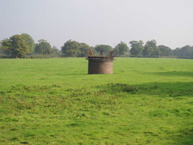
[10] Air shaft for the Ponsbourne railway tunnel
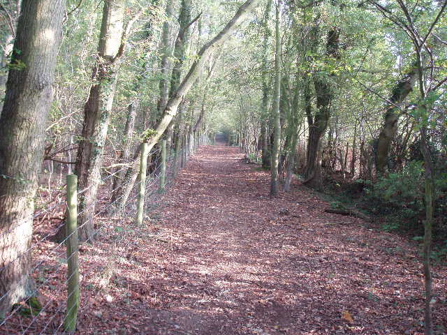
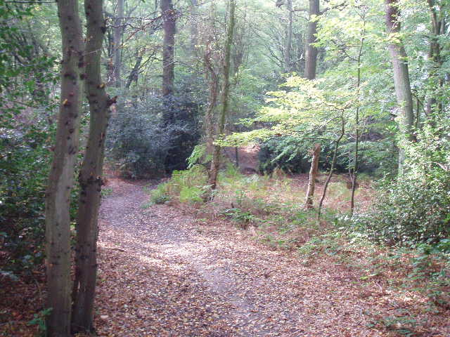
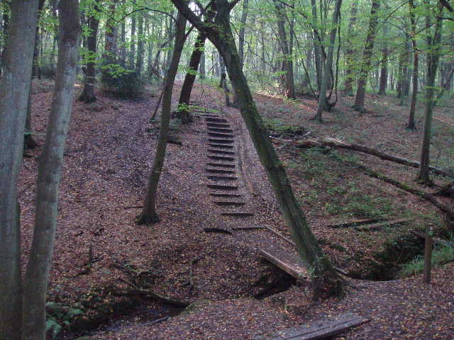
I followed the path through the wood, heading almost due south [11]. This was definitely the most enjoyable part of today’s walk – I always love walking through woods in their autumn colours. At one point wooden steps had been put in where the path descended and re-ascended either side of a steep gulley worn away by a little brook, with a simple footbridge across the water [12]. At first the path went through mature woodland, but later on went through a large area of fairly young trees. I couldn’t really follow the instructions in the guide book – the scrub bushes and saplings it referred to had obviously grown a lot in the 12 or so years since the book was written. Nevertheless I had no difficulty finding my way for about a mile through the wood, just following the path southwards. When it finally came to a T-junction, I correctly surmised from the map that I needed to turn right (the sight of electricity lines crossing my route soon confirmed I was going the correct way). At the edge of the wood, the path went through a kissing gate to run between a hedge and a fence, with a drive to what I presumed was a nursery on my right (I got glimpses of large greenhouses through a tall hedge on the other side of the drive). After a short while, the path went through another kissing gate to join the drive and within a few yards emerged at a road junction.
[11] Path through Wormley Wood
[12] Steps and bridge in Wormley Wood
I crossed over the road and carried on down the road opposite. I knew I now had a mile of road walking back to Goff’s Oak to complete Walk 2 of the Hertfordshire Chain Walk – only, as I was then turning round again, it would actually be two miles of road walking. This was possibly the longest bit of road walking I have had to do (except for maybe Day 6 of the Chiltern Way, where again I turned around at the end of a mile long lane walk) and I wasn’t really looking forward to it. I decided it was only going to take about 40 minutes or so anyway, so I just needed to get on with it and get it over. The first half mile was dead straight, with a few houses spread out along the left and a high hedge on the right. There were few places where I could peer over this hedge, and when I could I couldn’t see much in the hazy sunlight – but on the way back, I could see that in fact there were large sheep pastures there, sloping down towards a distant valley with woods on the opposite side, a much nicer and more rural view than I had expected. The hedge also reminded me that autumn is ‘the season of mellow fruitfulness’, with a variety of black and red berries, acorns and hazelnuts to be seen. Where the road finally turned slightly to the left, I passed the sign saying Goff’s Oak, and the last half mile was along a residential street with housing on both sides. I reached the village centre [13,14] close to a roundabout and turned around (I made sure I crossed over where I’d walked when I set off, to make sure I walked a full circle and didn’t miss a few yards out!). In fact the two mile road walk wasn’t as bad as I’d expected, and seemed to go by quite quickly.
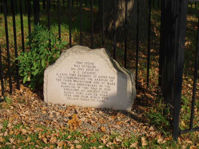
[13]Stone plaque on the site of the original oak tree that gave Goff's Oak its name
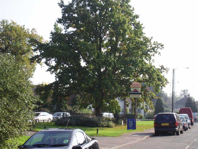
[14]Replacement oak tree in centre of Goff's Oak
I stopped for lunch about 1.15 on a bench in Wormley Wood. This was a lovely spot to eat my sandwiches, watching the squirrels gathering nuts. The walk back was pleasant on this lovely autumn afternoon, but quite tiring. Today’s walk was about three miles more than my normal distance, and I certainly felt it. Towards the end, on the farm drive near Burnt Farm, I could really feel myself slowing down, something that doesn’t happen too often on these walks. But I managed to buck myself up and didn’t feel too bad when I got back to the car in Goff’s Oak. It took me quarter of an hour longer coming back to going out (3 hours instead of 2 hours 45 minutes), which was unusual – normally it’s about the same time, as any tiredness in the afternoon is offset by the fact that I don’t need to navigate anymore and take far fewer photos.
Strangely, although the distance of nine miles was confirmed by the tiredness I felt and the time it took me to do the walk, looking back over the route it somehow didn’t seem a longer walk than usual, if anything it seemed shorter. I think this misperception was possibly because the walk consisted of just a few sections, each of which were quite lengthy e.g. a mile through Wormley Wood, a mile walk back into Goff’s Oak, a mile and a half along the bridleway through the Ponsbourne Park estate. Therefore there were relatively few points where I had to navigate and change direction. So it took less time going over the route in my mind than a shorter route that required many changes of direction, and therefore the walk seemed shorter than it was. Well, that’s my theory anyway!
This was an enjoyable walk, although there was quite a lot of road walking. A bit of care needed to be taken on the road into Newgate Street and the road leading to Wormley Wood, as there was no verge in places and the roads could be quite busy. There were a few stretches of the walk in built up areas, notably in Cuffley and Goff’s Oak, but there were also some sections that were surprisingly rural, considering how close the walk was to North London. The best part of the walk was definitely the section through Wormley Wood.
Total Distance: 16 miles (each way)