Pete's Walks - Hertfordshire Chain Walk
If you are considering walking this route yourself, please see my disclaimer. You may also like to see these notes about the maps and GPX files.
Walk 4 21/10/06 Little Berkhamsted to Letty Green (6 miles each way)
Parked in cul-de-sac in Little Berkhamsted.
This was a Saturday – I seem to have walked on Saturday’s quite often in recent weeks, having generally avoided walking them in the past. I thought that there would be more people about at the week-ends, but I haven’t seen too many more people out walking than I do on week-days. Today, for instance, I only saw two other walkers.
Little Berkhamsted’s greatest claim to fame is that it was the place where William the Conqueror accepted the surrender of the City of London after the Battle of Hastings. The village dates back to at least Saxon times, and is mentioned in the Domesday book. It has previously been known as Berkhamsted Parva or East Berkhamsted to distinguish it from the town of Berkhamsted in the west of Hertfordshire. There are a number of impressive residences in the village, including two former manor houses and two former rectories. The cricket commentator Brian Johnson lived here (famous for that immortal line “As you join us, the bowlers Holding, the batsman’s Willey”). The church has a rather unusual wooden tower, which somehow reminded me of churches I’d seen in Scandinavia [1].
I parked in the same cul-de-sac that I used when I walked the Hertfordshire Way. It had rained while I’d driven to Little Berkhamsted, but had stopped by the time I’d got there. As soon as I started walking it started again, and so I had to stop and don my waterproofs almost straightaway. The walk started outside the Five Horseshoes pub, and then turned right down a footpath beside the churchyard, following the same route as Leg 10 of the Hertfordshire Way. The path went through a grassy field, following the boundary of the churchyard on the left. It went through a kissing gate at the next field boundary, and continued on the same line through another grassy field. Near the next field corner, the path I’d used on my previous walk came in from the right and shared today’s route for a few yards to a gate and a lane. Here I turned left, while the Hertfordshire Way and Walk 3 of the Hertfordshire Chain Walk went right to take the footpath to Bayford. This will be the last I’ll see of the Hertfordshire Way for some days now.
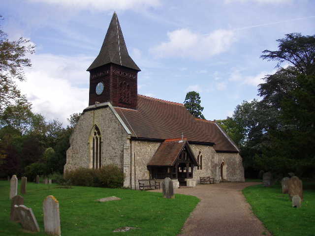
[1] Little Berkhamsted church
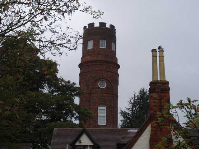
[2] Stratton's Observatory
I followed the lane for a couple of hundred yards to a T-junction. On my right I passed Stratton’s Observatory [2], which I mentioned in my last entry. This Georgian prospect tower was built in 1789 by John Stratton on the site of a former brewhouse. Stories that Stratton was an admiral who wanted to be able to see his ships moored on the Thames are almost certainly fiction. Most likely he simply wanted to enjoy the views offered by this folly.
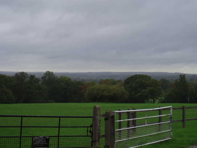
Certainly the tower is quite a landmark and would be visible throughout most of the walk today. I turned right along the road called Robin’s Nest Hill (along with Cucumber Lane, one of the best road names I’ve come across on my walks) and followed it for a few hundred yards, with nice views opening out to my left over the Lea valley and the flatter land around Hatfield and Welwyn Garden City [3]. I then turned right into Stockings Lane, After about a quarter of a mile, where the lane turned right, the Hertfordshire Chain Walk continued ahead on a gravel drive (the bridleway sign mentioned in the guide book was missing, and I checked and rechecked the map as there was no evidence that this private drive was a public right of way). The drive went slightly downhill, with nice woods on the other side of the grass field on my right. When the drive reached a house, I forked right (there were two footpath signs near the house) to continue on a muddy bridleway between hedges. This went downhill a bit more steeply now, the high banks on either side showing that this was quite an old track [4]. I passed some fungi in the middle of the path – I have seen a lot of toadstools and mushrooms recently.
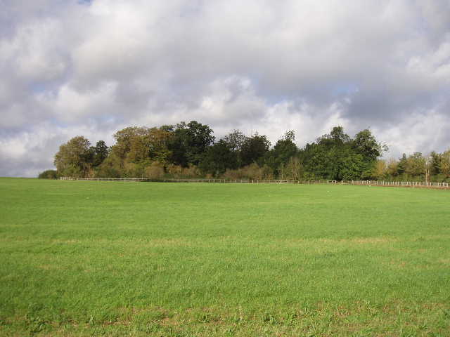
[3] Looking northwest from edge of Little Berkhamsted
[4] Old track
The path came to a small wooden footbridge over a dry stream bed. I took the alternative path mentioned in the guide book, that followed the right hand bank of the stream – I initially tried to follow the original route on the left, but after following the hedgerow in one field I came to a ditch with no sign of a path in the next field, so turned back. The alternative route was a good path, easy to follow but muddy in one small area – it was along here that I met the only other two walkers I’d see all day. The path soon passed a couple of houses and reached the B158 road.
Across this, I entered the road leading to Water Hall, which sounds nice but is actually a gravel quarry and landfill site. The road crossed a concrete bridge over the river Lea, then the Hertfordshire Chain Walk took a bridleway leading right. This was a wide track between a wooden fence on the left and a hedge on the right - the quarry was on the other side of the fence, with the river and some water meadows beyond the hedge. The track went on for about half a mile – after some distance the landfill site seemed to give way to a natural green field, but a notice board proclaimed that this was land restored from the quarry workings [5]. The rain, which had never been very heavy, had now stopped, so I halted to remove my water proofs. It was now quite sunny and bright, although there were still dark grey clouds about. By Roxford farm, the path turned left to go uphill away from the Lea Valley, soon reaching Grotto Wood [6]. This was the site of some formal gardens created in the late 17th or early 18th Century, with a grotto and ponds amongst other features – it was associated with Roxford Manor, which stood on the site of the farm I’d just passed. The Hertfordshire Chain Walk went round to the right of the wood without entering it, but on my way back I took a detour to follow the marked path through the wood [7]. There wasn’t too much to see – there was a sequence of three ponds in the wood, one of which was now dry, and there were some fine sycamore and yew trees.
[5] Looking towards Grotto Wood
[6] Looking back towards Little Berkhamsted from Grotto Woodt
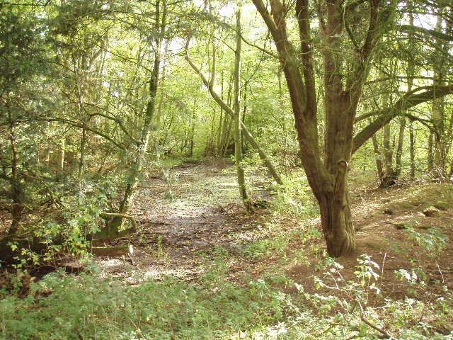
[7] Remains of old pond in Grotto Wood
The Hertfordshire Chain Walk followed the edge of the wood, running between wooden fences with what seemed to be a landfill site to the right. The path continued ahead as it passed the end of the wood. The green fields that were here when the guide book was written a dozen years ago have long gone, this whole area seems to have been given over to gravel working and landfill. There were a lot of gulls about, as you’d expect, but I also saw some partridges here, both in the morning and when I came back in the afternoon. Eventually the path came to a track, which I followed for a few yards to the right to reach a bend in a lane. I followed this to the right for a very short distance, before taking a footpath on the left. This went through a sheep pasture, staying close to the right hand hedge, with nice views ahead across several large green fields with horses in them. The path then followed a fence in the next empty field, and then passed through some bushes and went up some steps to reach an old railway line. This was the route of the Welwyn-Hatfield Line, which has now been converted into a path for walkers, cyclists and riders. Another long distance path, the Lea Valley Walk, also makes use of this path.
[8] Track running along the old Welwyn-Hatfield railway line

[9] Remains of Cole Green Station
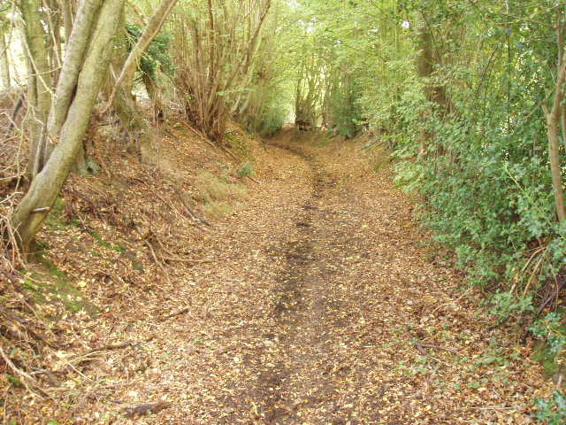
I went left and followed the good path along the old railway line for about half a mile [8]. The Hertfordshire Chain Walk turned left off it on a footpath just before the site of the old Cole Green Station [9], now a parking place and picnic area (the guide book could have been a bit clearer here, I actually went a few yards past the station before realising my mistake). The footpath soon led between gardens to reach a lane in the small village of Letty Green. I turned right and then left at a junction in the centre of the village. After a few hundred yards, I turned right on a RUPP (Road Used as a Public Path) – there was no obvious evidence that this had ever been a road, it was a pleasant path between trees [10]. At the end of this path, I turned left along a minor road [11] which I followed for about half a mile – there was no footpath or verge, but the road wasn’t too busy. The road went downhill and crossed the river Lea, with nice views westwards along the valley [12], and then ended when it reached the B158.
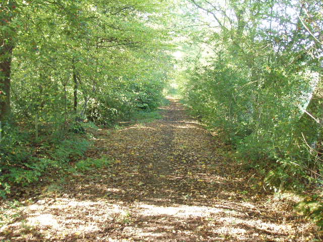
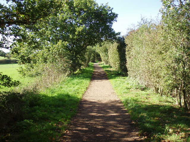
[10] RUPP near Letty Green
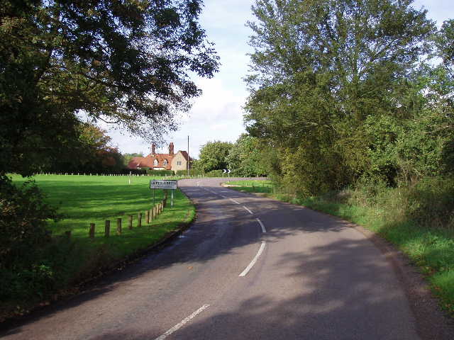
[11] Letty Green
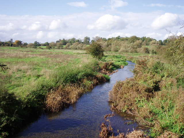
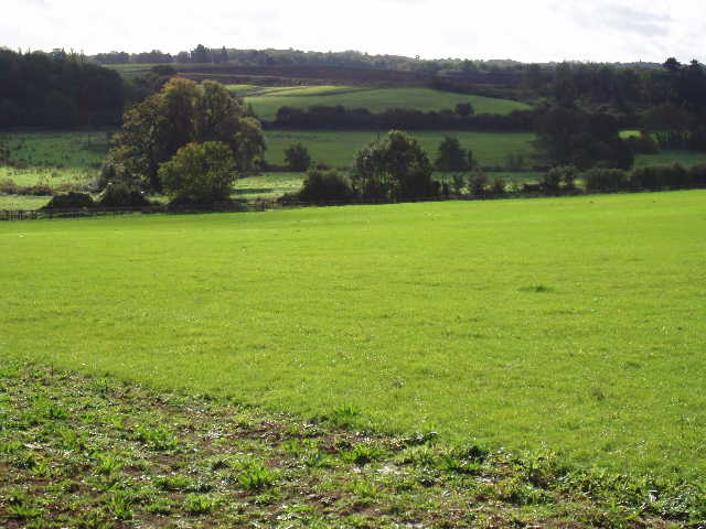
[12] River Lea, south of Letty Green
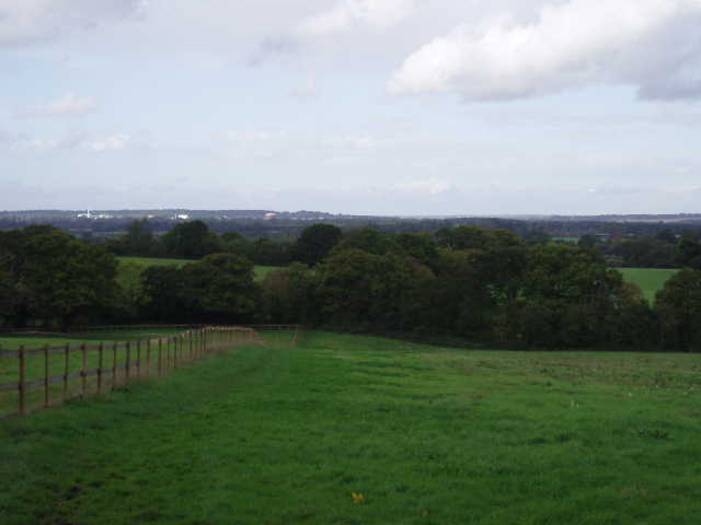
Across this main road I followed a bridleway along a private drive, with a golf course behind the high hedge on my right. After about a quarter of a mile, I turned left on a footpath that led uphill across a grassy pasture. Over a stile, I turned left on another drive near a large house. The drive turned to the right, and just past a white bungalow I took another footpath on my right. This followed a right hand hedge, then fence, across a well-manicured grass field, with the gardens of a very large modern house away to my right beyond the fence. The path then crossed a grassy field diagonally to a field corner – I could only just about make out the path here in the ankle-length grass. Over a stile, I then followed a left hand hedge in a small pasture, then crossed another stile to reach a track junction near a pig farm (strangely I could see the pigs in a nearby field but not smell them). The Hertfordshire Chain Walk then followed a very pleasant bridleway between hedges [13], with a view of Stratton’s Observatory appearing above the wooded slopes to the left. Where the bridleway came to a fork, I went left following a wooden fence on my right that divided this very large pasture in two, climbing steadily uphill to reach a lane on the edge of Little Berkhamsted [14]. I followed this to the right to a T-junction (another part of Robin’s Nest Hill), where I went right for a few yards, then turned left by the church to return to my starting point by the village pub.
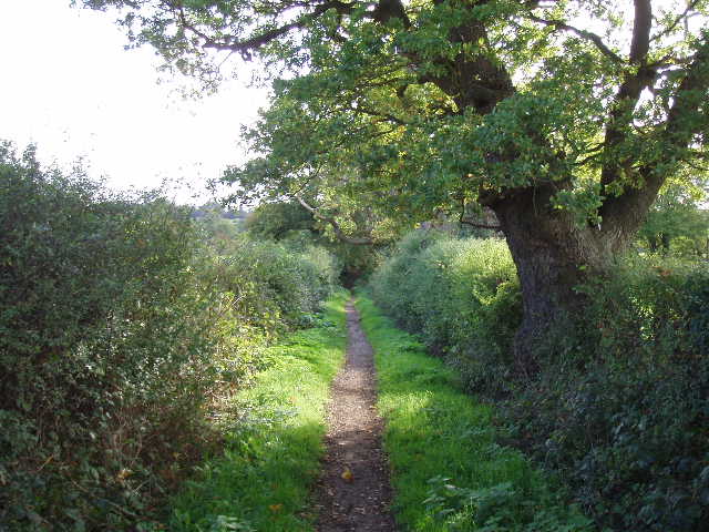
[13] Bridleway leading towards Little Berkhamsted
[14] View back from near Little Berkhamsted
It started to rain again shortly after I turned round, but not heavily or for long and I didn’t need my waterproofs. I had my lunch at a picnic table by the site of Cole Green station. There were three cars parked there now, and I saw several cyclists pass by as I ate. Once more there was a little rain as I started off after lunch, but again it didn’t come to anything and I didn’t need my waterproofs.
This was another pleasant shorter walk – the section through the quarry and landfill site didn’t detract from it too much at all. There were several nice views over open countryside, and the old railway line added a bit of variety to the walking. Incidentally, this was the first loop of the Hertfordshire Chain Walk that has gone anti-clockwise, the others so far have all been described in a clockwise direction in the guide book. Of the remaining walks, only 6, 14 and 15 will be anti-clockwise (obviously, I am walking each loop in both directions, but I will describe the route in the same direction as the guide book).
Total Distance: 27.5 miles (each way)