Pete's Walks - Hertfordshire Chain Walk
If you are considering walking this route yourself, please see my disclaimer. You may also like to see these notes about the maps and GPX files.
Walk 5 24/10/06 Hertingfordbury to Marden Hill (6.5 miles each way)
Parked in cul-de-sac in Hertingfordbury.
I had been in two minds about whether I should go for a walk today – my back has been playing up a bit recently, and also it was raining all the time before I set off from Kensworth. But having already postponed the walk from yesterday for similar reasons, and as the forecast said the rain would clear, I eventually set off from home about 40 minutes later than usual, and in the end I was very glad I went.
As recommended in the guide book, I parked in the cul-de-sac formed by part of an old road on the edge of Hertingfordbury (the village is on the south-western edge of Hertford, and can be traced back to the Domesday Book - its name means ‘stronghold of the people of Hertford'). Officially Walk 5 of the Hertfordshire Chain Walk starts from outside the village church, but I chose to start from where the route crosses the end of the cul-de-sac – otherwise I would have had to walk the quarter mile to the church and back an extra time. In fact, I really excelled myself this morning by getting lost before I reached the official start of the walk! An unfortunate feature of the Hertfordshire Chain Walk so far has been that each loop has been split over two maps (OS Explorer 174 and 182) – this morning I ‘memorized’ the short section at the start that was on one map, and just opened out the other in my map case. I thought I just had to follow the road south from Hertingfordbury – in fact, there was an odd junction where the road turned 90 degrees to the right where I should have left it and taken the road going almost straight ahead. I went about another quarter of a mile before realizing my mistake (I had to get the map out to work out what had happened).
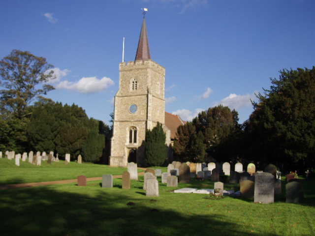
[1] Hertingfordbury church (photo taken in the afternoon)
Having found the correct road and passed the church [1], I soon passed under an old railway bridge where I took a path on my left that went up the embankment to join the course of the former railway line. This was the same track as used on the previous walk, part of the old Welwyn-Hatfield Line. I followed the well-surfaced track westwards. I have to say that I was in one of my ‘Grumpy Old Man’ moods at this point. It had still been raining slightly when I reached Hertingfordbury, so I’d had to don my waterproofs, and walking is never quite so much fun when the weather’s wet and grey and you’re smothered in Gortex. Then I’d got lost – really dispiriting to do this before you’ve really started. To make things worse, my shins were really sore from all the road walking at the start of the walk (some of it unnecessary!). So I was not in the best of moods as I tramped along the old railway line. Perhaps that explains why this bit of the walk seemed to go on for far longer than I expected – I was really surprised how far I seemed to have to go along the track, whereas it seemed much shorter when I came back in the afternoon (I had a similar experience with a section of the Grand Union Canal on Day 1 of the Greensand Ridge Walk).
Eventually, about 200 yards after crossing a lane, the track reached a footpath crossing, where Walk 4 had joined the track from the left. Here I left the old railway line and took the path on the right. This followed the right hand fence of a grass field, then crossed a stile (where I saw a Green Woodpecker nearby) and passed between gardens to reach the end of a cul-de-sac in the village of Birch Green. I turned right at the far end of the cul-de-sac and followed the road through the village (rather unprepossessing, not many houses or buildings of any age or interest). Just past a war memorial, I came to a T-junction where I turned left.
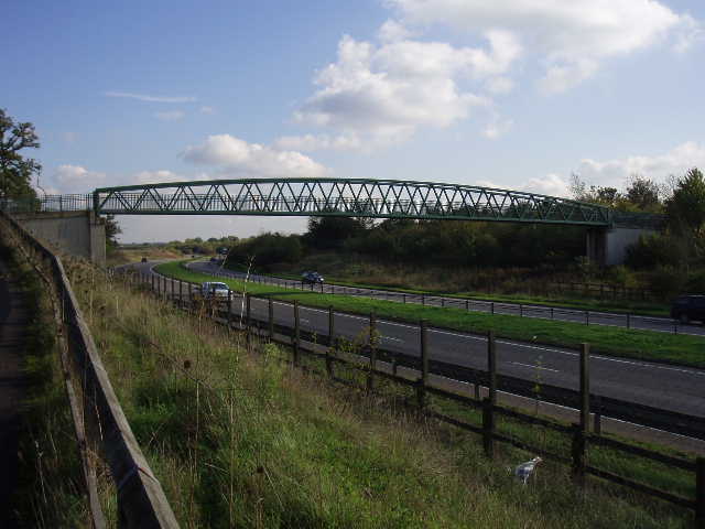
[2] Footbridge over the A414
After about a hundred yards, I turned right on a footpath down a gravel drive (with an attractive old cottage on my left and a pond on my right). After another hundred yards, the path left the drive half-left across a lawn, then went over a stile and continued in the same direction across a corner of a garden to reach a field. The path then turned almost back on itself, leaving the field straight away to run alongside the garden boundary with a small area of scrub on my left. The path then turned left alongside a fence before turning right to cross over the A414 dual carriageway on a metal footbridge [2]. The rain had stopped and the skies had started to brighten up, so I paused to take off my waterproofs – my earlier bad mood had also disappeared (probably about the same time as the soreness in my shins!) and I was now beginning to enjoy the walk.
The next section of the walk was through the old grounds of Panshangar Park (my paternal grandmother had stayed at the house when she worked as a Lady’s Maid). Much of the land here has been quarried for gravel, then used as landfill and then reclaimed – the quarrying is still going on. But some attractive bits of woodland and open grass areas still remain. The Hertfordshire Chain Walk continued alongside a wood, with an area of reclaimed landfill to my left. It then went slightly downhill through an area of bracken and small trees (lots of pheasants along this stretch) and then crossed a grassy area in a slight dip to reach a kissing gate [3]. Here I crossed a road used by the trucks going to and from the quarry, and went through another kissing gate into another grassy area. The path followed the course of a power line across the grass, to emerge at a road junction by a lodge in the hamlet of Poplars Green. I took the road straight ahead of me – I was now in the Mimram valley, with the river about 20-30 yards to my right. After about 200 yards or so, I took a footpath on the right which ran through a pasture occupied by a few bullocks – the path crossed the river on an old bridge and then soon came to a gate.
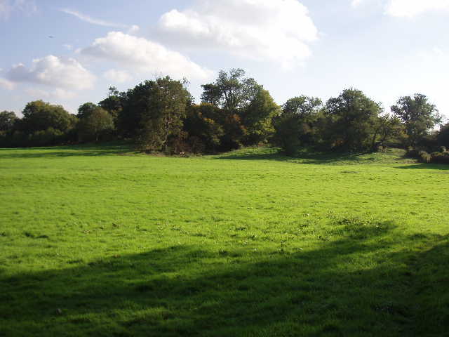
[3] Panshangar Park
Here I took the footpath going half-left, running between wire-fences up the hillside (a shorter route would have been to take the footpath straight ahead). Where the path reached a hedgerow with several mature trees, the Hertfordshire Chain Walk turned left for a few yards, before turning right alongside a fence (there were nice views both ways along the Mimram valley at this point) [4]. At the next field corner there was a crossroads of paths where I turned right again. Beyond a short avenue of trees (possibly pollarded hornbeams – I found a reference on the internet to such trees being here) I passed in front of Marden Hall – this grand house was built in 1790-94 as a plain block of yellow brick, but in 1819 Sir John Soane added a four-column porch. It has some impressive outbuildings, including an 18th-century red brick former stable, a 16th-century weather-boarded barn and an octagonal brick stock house.
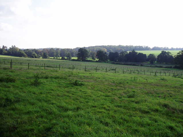
[4] Mimram valley, near Marden Hall
The path then turned left and soon joined the drive to the house which it followed to a road. On the other side, I took a bridleway beside a wood on my right, with nice views over open countryside ahead and to my left – mainly cabbage or potato fields interspersed with woods, on undulating ground. When the small wood ended the bridleway continued beside a right hand hedge. At the next field corner there was a stile with a waymark indicating a path going straight on, while the bridleway appeared to turn right between fences to pass to the right of the buildings of Bacon’s farm. Here I got confused over the route – the map showed the path going through the buildings, not round the side. Also, the guide book said to cross the stile and turn right to a gate, then cross a paddock to a stile and then pass between the buildings to a track between hedges. Eventually I followed the instructions in the book, although there was no evidence for the path here except for a stile at the far side of the paddock. When I got through the farm buildings, I saw that if I’d stayed on the track it would have brought me round the buildings to the same spot, so on my way back I went that way instead – I suspect the path has been rerouted and the guidebook and map are out of date.
Speaking of maps, yesterday I bought OS Explorer Map 180 which I will need for the Bernwood Jubilee Way (a walk in Buckinghamshire and Oxfordshire that I’m thinking of doing in the coming months). The last time I bought a map at the Book Castle in Dunstable, I was told that many of the local maps were about to be re-issued, and sure enough there were now a lot of maps with new pictures on the cover. A bit annoying really, considering I’ve bought 12 or 13 of them in the last 18 months at about £7.50 each and now they’re out of date. I really do have impeccable timing! Anyway, the point of this whinge is that any comments I’ve made about maps not showing long distance paths or showing out-of-date routes are probably no longer correct. I had a quick look on the back of some of the maps to see if any new walks were shown (an inset map on the back cover highlights all the long distance paths shown on the map) and at least one showed the Hertfordshire Way when it didn’t before. I also saw a path I’d not come across before, the Watling Chase Trail, which I’ll have to investigate.
From Bacon’s farm, the Hertfordshire Chain Walk followed a track between hedges to a lane (this part of the walk is the bit that is shared with the next walk, Walk 6). It then continued on a track on the other side of the lane, running between fields of cabbages or potatoes or some such crop (shameful that I don’t know!) to reach a wood [5]. The sky had clouded over again now, and I thought I might have some more rain. At the entrance to the wood was a burnt out car, but also a tree stump where I’d have my lunch on my way back. The path through the wood was a little muddy, but not too bad – considering the amount of rain recently, the paths generally on this walk weren’t too bad at all. Beyond the wood, the path followed a left-hand hedge, the field being sparse and rough grass – I could well-believe that it was reclaimed landfill, but I’m not sure. The path followed the hedge as it curved round to the right to reach a gate and a road.

[5] View just east of Bacon's farm
I went left along the road for a few hundred yards, with the edge of the town of Hertford in front of me. On my left, some lads were riding a pair of motorbikes over some land that had obviously been set up for the purpose. A couple of hundred yards before reaching the houses, I turned right on a path that passed through a small belt of young trees then followed a right-hand fence across a grassy area. The path continued inside the edge of a wood, still beside the fence. Beyond the fence was an area of land that was definitely landfill – I could see the trucks and other equipment still working at the far end, and I noticed there was a peculiar smell when I came back – I’ve no idea if it was methane or what, it wasn’t a smell I’d ever come across before. Beyond the wood, the path went right then left, descending through trees to a road. I turned right to a roundabout, where I crossed the A414 and within a few yards reached the end of the cul-de-sac where I’d parked.
The clouds that had threatened rain had now disappeared, and it was a lovely sunny afternoon as I made my return trip. My earlier grumpy mood had long since gone, and I really enjoyed the walk. I was very glad that I hadn’t let the early morning rain deter me from walking. As I got near to Hertingfordbury, I saw six other walkers using the path on the old railway line (a couple, and two couples together) as well as a cyclist, a bird watcher and a man with a very young girl on a little bike with stabilisers, so the track there is obviously being put to good use. I got back to my car about 2.45pm.
Total Distance: 34 miles (each way)