Pete's Walks - Kensworth, Flamstead, Gaddesden Row (page 1 of 2)
If you are considering walking this route yourself, please see my disclaimer. You may also like to see these notes about the maps and GPX files.
Google map of the walkDownload GPX file of the walk
I did this walk on Saturday, 9th January 2010. The route is approximately 15.2 miles long. I did it in the clockwise direction, starting and finishing at my home in Kensworth.
There was three to four inches of snow on the ground, after a heavy snowfall on Tuesday night topped up by a few subsequent snow showers. The weather forecast said it would be dry with sunny intervals, but strong winds from the north or east would mean that it would feel several degrees below freezing with the wind chill factor. So for the first time this winter I wore an extra layer of clothing, donning my thermal undies under my usual Paramo shirt, coat and waterproof trousers.
I didn't have a fixed route in mind when I set off, deciding to 'play it by ear' and see how I felt as I went along - walking in snow can be tiring and rather slow going, so I wasn't too sure just how far I'd want to go. I loosely planned to do my Kensworth-Briden's Camp walk in the clockwise direction, but trimming it down a bit and with a few options to shorten it further. I set off from home about 9.30am and started out by walking most of the length of Common Road through Kensworth to just past the village school, then taking a footpath on the right. This crossed a paddock, then went slightly left across a second paddock before turning left along the hedge on the far side to reach a gate. The path continued across a large field, passing a small copse on the right. It then went through a hedge gap and crossed a small corner of a field, before continuing beside a hedgerow on the left. After several hundred yards I passed a sports hall or school on the right, the path going straight on down a short alley to reach a street in Markyate.
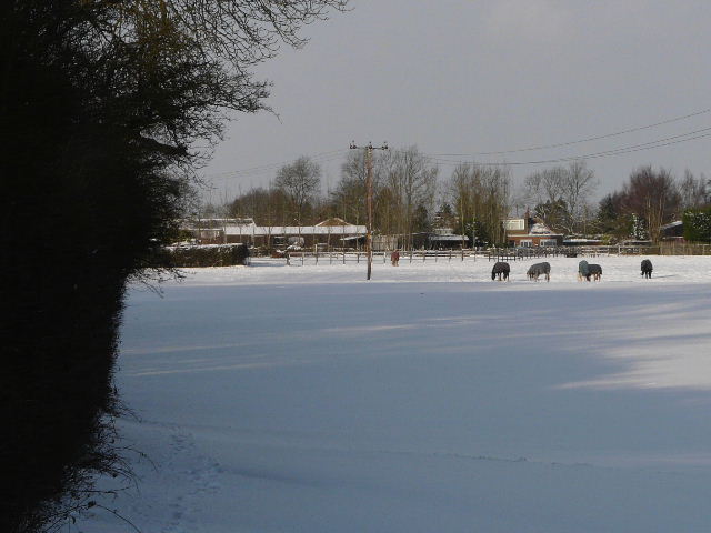
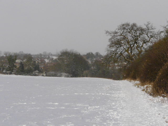
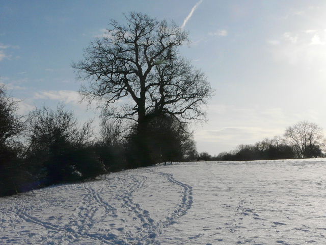
Looking back towards Kensworth, from near the start of the path to Markyate
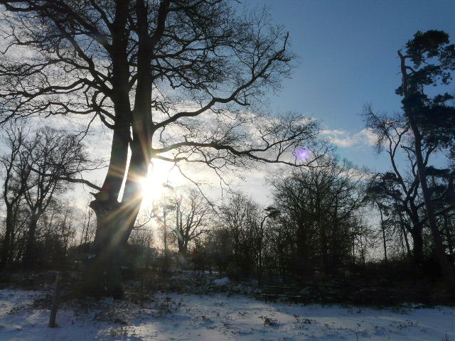
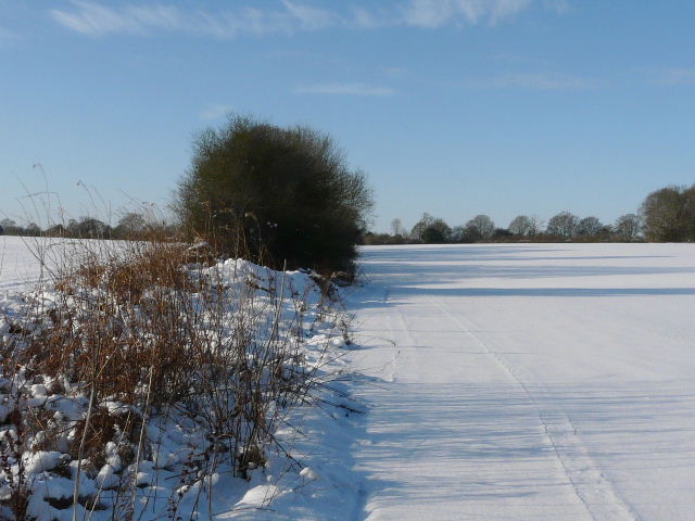
Sunlight through a small copse beside the path to Markyate
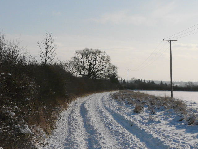
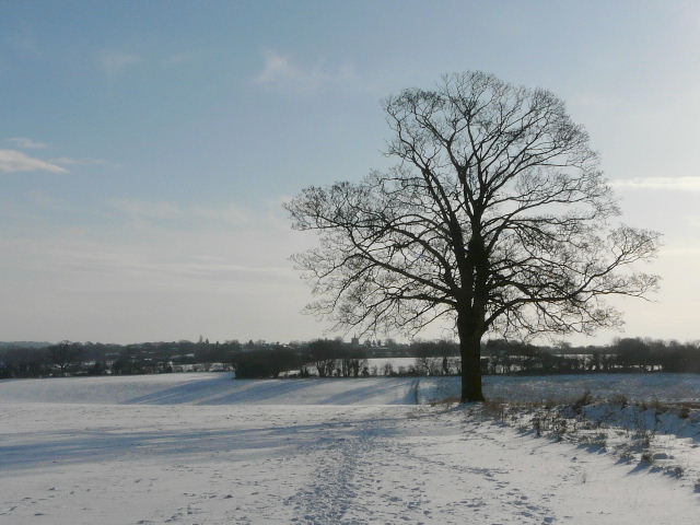
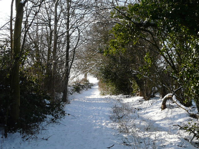
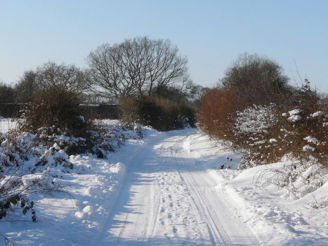
The path to Markyate
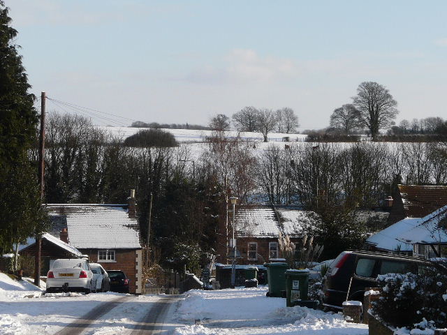
A snowy view of Markyate
I decided to take the northern-most of three parallel paths to Flamstead (I correctly suspected that I'd be using the southern-most path beside Friendless Lane on my way back later on). I turned left for a few yards, then took a surfaced path going right. I continued straight on beside some roads, soon dropping downhill to a T-junction. I went straight on down an alley, with Markyate Baptist Church on my left, then went through a small gate in a brick wall surrounding a tiny ornamental garden (I have no idea what this feature is, really!), then left a few yards along a street before turning right at a footpath sign. The path went between some houses and left the village, soon coming to a fork where I went slightly left. The path now followed a tall hedge on the left, beside a large field. I'd been walking with blue skies and a dazzling sun ahead of me, so I was surprised to be overtaken by a brief snow flurry just after I left Markyate - I turned around and saw the skies were all grey behind me. But I was obviously just on the edge of the snow, it only lasted a couple of minutes and I didn't see any more snow fall during the rest of the walk. After some distance, where another path crossed, the path continued beside a hedge on the right and soon I could make out Flamstead Church some way off ahead of me.
When the path reached a crossing hedgerow, it turned left. Immediately before the hedge turned right, the path went through a gap in the hedge. It continued with the hedge now on the left. The path then followed the hedge through a large field that usually contains horse but which was empty today. Next the path ran between the hedgerow and a wire fence next to some empty paddocks The path then entered a meadow, staying beside the hedge for a while before bearing very slightly to the right to reach a metal kissing-gate. I turned left and followed Friendless Lane into Flamstead.
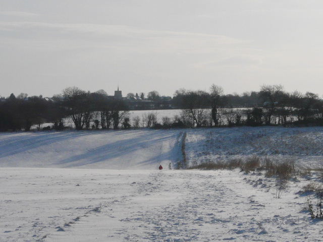
Looking back towards Markyate, from the path to Flamstead (photo taken during a brief flurry of snow)
The path to Flamstead (the church, with it's 'Hertfordshire Spike', is visible on the horizon in the centre of the photo)
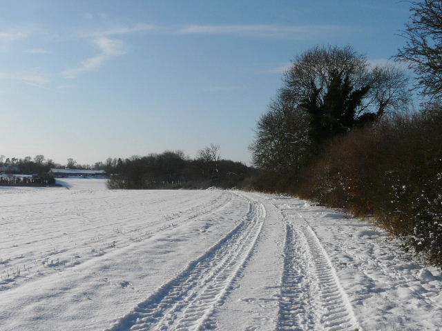
The path to Flamstead
Looking back, from further along the path to Flamstead
Looking ahead from the same spot as the previous photo
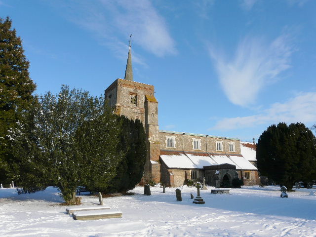
Flamstead church - the Chiltern Way and Hertfordshire Way cross just outside the churchyard here
On reaching the end of the lane I turned right and walked through part of Flamstead, passing the church on my left. A quarter of a mile or so beyond the church, by a right-hand bend, I turned left onto a path that is part of the Hertfordshire Way. The path crossed the alligator-infested valley south of the village (look, I met a man and his grandson 'fishing for alligators!' here once - it stands to reason they wouldn't be doing that if there weren't any alligators! :)). After passing a wood on the left at the top of the opposite slope I looked for where the path turned left across a field. On the far side I reached a hedge-lined track, where I turned right. The track ended at a sharp corner of a lane, where the Hertfordshire Way turns left on a farm track towards Flamsteadbury and Redbourn. I continued ahead, though, down the lane (I could have shortened the walk by turning right here and following the lane to Trimley Bottom).
Looking back across the alligator-infested valley to Flamstead
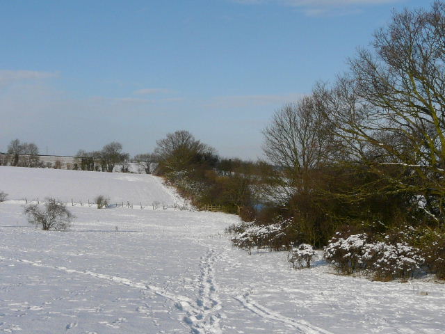
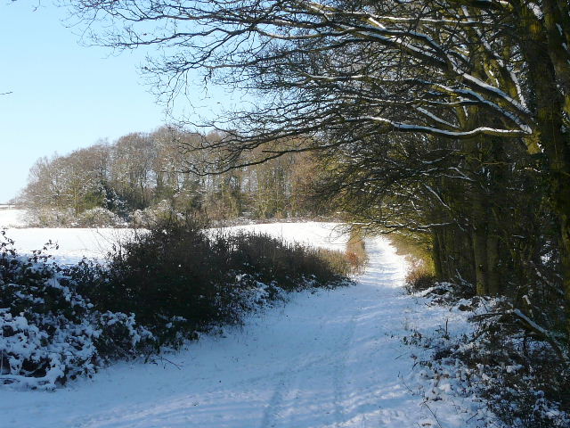
Bridleway along a hedge-lined track near Flamstead, part of the route of the Hertfordshire Way
Lane leading to Nirvana
The lane turned to the left, and then I took a track on the right which soon passed a cottage (named Nirvana on the map). I then turned off left, onto a footpath that crossed a field (I could see the tracks where someone had been using cross-country skies here) and then followed a hedgerow and the edge of a large wood. The path turned right at the corner of wood, staying beside the wood. At a path junction I turned left - there were no footprints in the snow to help me as I crossed the next large field uphill to reach another hedge-lined bridleway where I turned right- so far several other people had walked the paths I'd used, making life much easier. Even so, the snow had slowed me down so I realised continuing on to Briden's Camp would have meant probably getting home in the dark (and been a bit too tiring), so instead of turning left off the bridleway at the next path junction to reach Gaddesden Row, I continued along the bridleway past Upper Wood Farm.
Footpath between Nirvana and Gaddesden Row
Bridleway near Gaddesden Row, heading towards Upper Wood Farm
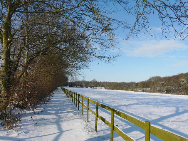
Bridleway beyond Upper Wood Farm
At the end of the bridleway, I went about 100 yards right along a minor road between Markyate and Gaddesden Row, then followed a field path on the other side. Again I had to make my own way as I was the first to walk here through the snow (or rather some previous footprints had been filled by drifting snow), so this was rather tiring as the snow came to about the top of my boots.
Footpath near Gaddesden Row, just west of the minor road from Markyate