Pete's Walks - Milton Keynes Boundary Walk
About the Milton Keynes Boundary Walk
As its name implies, the Milton Keynes Boundary Walk is a circular walk around the new city of Milton Keynes. It is actually about 60 miles long, extending a fair way from the centre of Milton Keynes, especially to the north-east where it passes to the far side of Olney.
The originator of the walk was a certain Christopher Meredith, and the walk was established in conjunction with Milton Keynes Borough Council and local groups of both the Long Distance Walkers Association and the Ramblers Association, along with the assistance of local landowners.
Originally a leaflet was produced showing a map of the route, with a list of numbered points along the route giving brief descriptions. Unfortunately this leaflet is no longer available. Ian Andrews of Milton Keynes Ramblers has tried to keep the walk alive by putting a detailed route description of the Milton Keynes Boundary Walk in PDF format on the Milton Keynes Ramblers website (it's almost at the bottom of the page). The information above about the history of the walk is taken from that source.
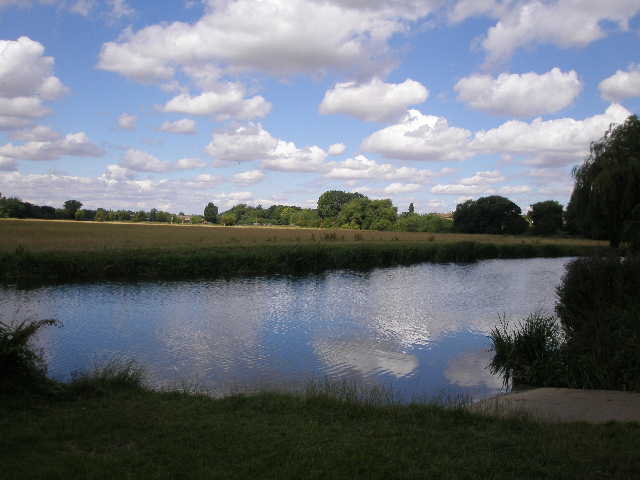
River Great Ouse, at the car park on Calverton Road, Stony Stratford (start and finish of the walk)
The Milton Keynes Boundary Walk follows existing rights of ways and one or two permissive paths. There are no waymarks for the route [Update 24/01/10, according to the MK Ramblers website, above, "A new Waymarker is being placed along the route. When you see the Oakleaf symbol just follow the direction of the arrow on the host waymarker."], but it is shown on the OS Explorer Maps 192, 207 and 208 (there have been one or two minor changes since the maps were printed, but these are explained in the written description). It is only really feasible to walk the route clockwise, as that is the way it is done in the route description.
Click here to see a very rough map of the Milton Keynes Boundary Walk (but only if you have already read my disclaimer and notes regarding maps).
Note: I have numbered each photograph (in red) and inserted the same number in the text to show where in the walk the photo was taken.