Pete's Walks - Milton Keynes Boundary Walk
If you are considering walking this route yourself, please see my disclaimer. You may also like to see these notes about the maps and GPX files.
Day 3 24/07/07 Weston Underwood to near Lavendon (7.8 miles each way)
Parked in Weston Underwood.
I had a bit of a slow journey this morning, and didn’t start walking until 10am.
As I had noticed on my last walk, Weston Underwood is an attractive village, built of the local yellow limestone. It has won the best kept village in Buckinghamshire award a record 14 times (between 1957 and 2003). The poet William Cowper lived here at The Lodge between 1786 and 1795 – it was at this house that he wrote the lines ‘Farewell, dear scenes, for ever closed to me: Oh! For what sorrows must I now exchange ye’ when he was about to move to Norfolk.
From the road junction I reached on my last walk, I turned left along the main road through the village, heading east towards Olney. I soon passed the village hall on my right [1], then went through an archway in ‘The Knobs’, an ornamental gateway the road now runs through which was once the entrance to Weston Park [2]. A short distance further on, I turned left along a farm drive. This soon passed a house on my right, beyond which I saw some llamas in a field (they were some way away, but from their size I’m pretty sure they were llamas rather than alpacas). The farm drive (tarmac with a strip of grass down the middle, and now with hedges either side) descended a small valley [3]. At the bottom, a drive went off towards a farm somewhere to my right, while I continued ahead, the drive now being made of stones either side of the grass rather than tarmac.
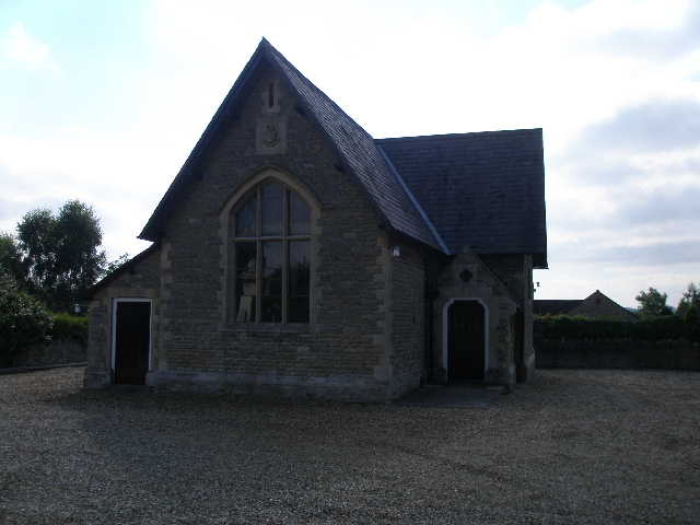
[1] The village hall, Weston Underwood
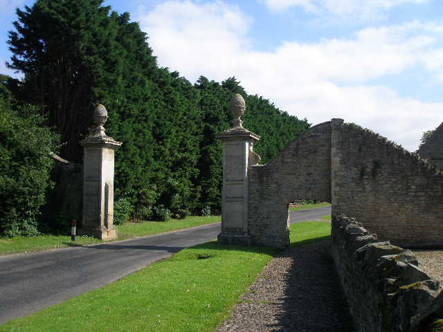
[2] The Knobs, Weston Underwood
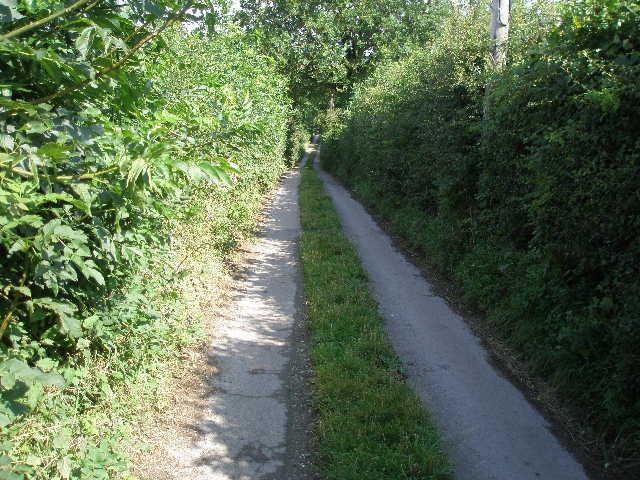
[3] Farm track leading away from Weston Underwood
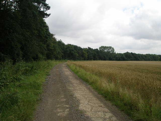
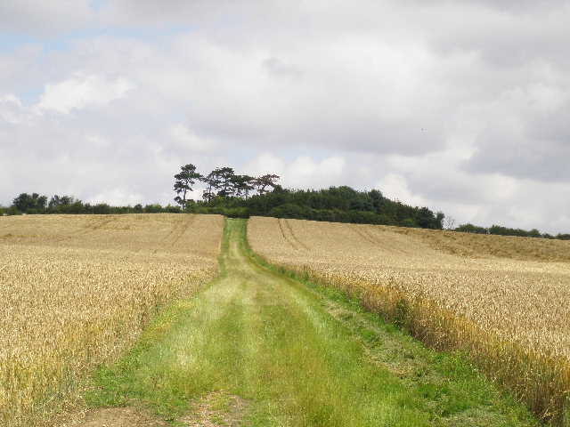
The farm drive rose up the other side of the valley, turning slightly left and running between meadows and corn fields [4]. Over to the left, I could see a small folly in the form of a Greek temple [5]. This was Cowper’s Alcove, created by the Throckmorton family in 1753, where the aforementioned William Cowper often rested while walking the countryside, and where he wrote some of his best known poems. I continued on along the farm drive for half a mile or so, until it crossed a former railway line and passed a small wood on the left. On the far side of the wood, I turned left and followed the edge of the wood downhill [6] – there was a lot of Selfheal growing in the long grass here. At the valley bottom I braved the tall nettles to make my way to a footbridge over a stream and then climbed over a broken stile, before continuing along the left-hand hedge of a large corn field. Here I saw some Red Bartsia, which I recognised as I’d seen it for the first time a couple of days ago at the College Lake nature reserve near Tring.
[4] The farm track leading north from Weston Underwood
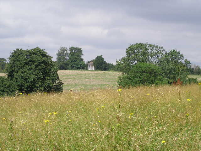
[5] Looking to Cowper's Alcove, from the farm track
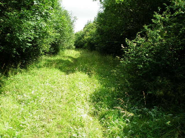
[6] Path beside wood
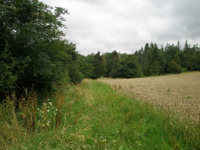
The path continued beside the corn field for about a third of a mile, before entering a wood, Ash Beds [7]. I immediately saw some tall blue flowers, which I recognised as some type of Bellflower, but not the Clustered Bellflower that I’d come across before in a few places. When I got home and looked at my flower books, I decided that the flowers were Nettle-leaved Bellflower, but posted a couple of photos of them on a wildlife website to get a second opinion. It turned out that I was correct – I hadn’t realised that they are quite uncommon in this part of the country, and in fact this was only the second time they’d been recorded in the north of Buckinghamshire. Quite bizarrely, the chap who’d first seen them there sometime in the 1990’s happened to come across them again just a few hours after I saw them, at a place about half a mile away along the disused railway line I’d crossed. So having only ever been seen once in the north of Buckinghamshire, they were suddenly discovered in two different places on the same day. Quite a coincidence!
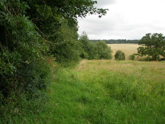
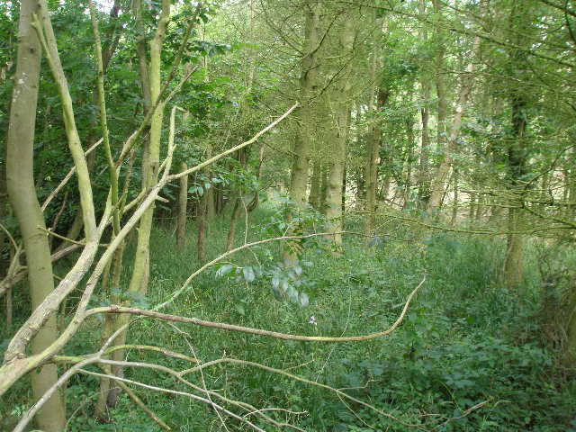
The path through the wood was a little indistinct [8], but there was no real chance of going astray as it followed a stream on the left. After two or three hundred yards, I turned right along a broad track that rose slightly uphill – this was initially very wet underfoot. As the track levelled out, it started to run just inside the edge of the wood, with another large cornfield visible to my left. Another track came in from the right, and a bit further on I passed a bulldozer, where part of the wood on my right was being cleared. After walking just inside the edge of the wood for about a third of a mile, I turned left on a farm track that crossed the corn field, with a house and a large barn over to my left.
[7] The path leading to Ash Beds and Kilwick Wood
[8] Path through Ash Beds
[9] Farm drive beside the forest
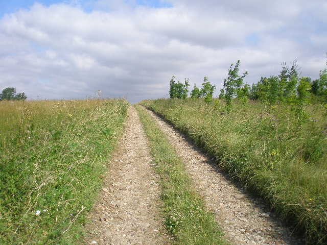
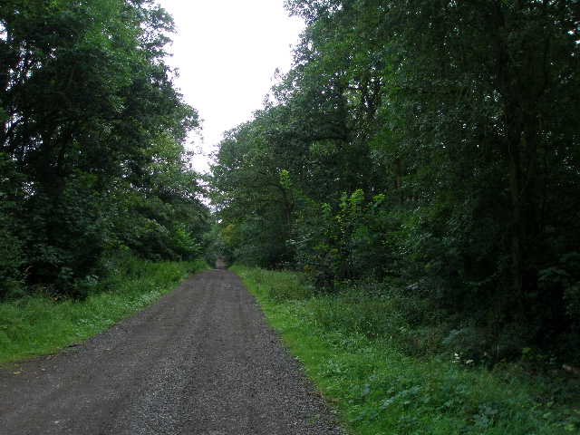
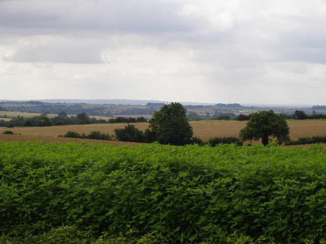
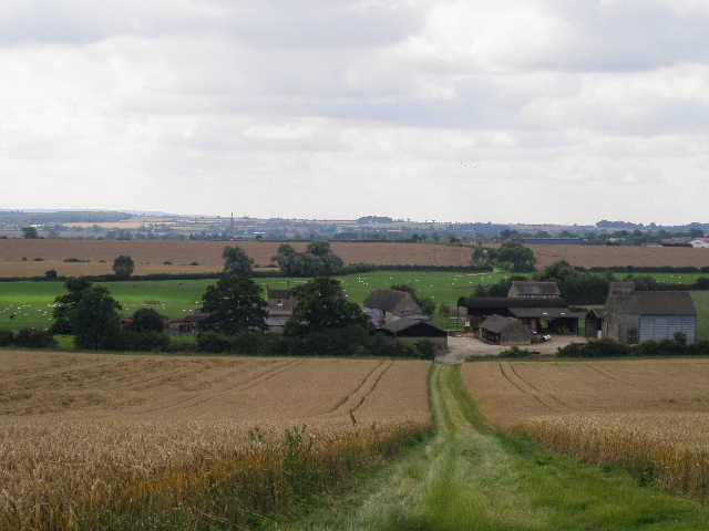
Where the track met the drive from the house, I turned right and followed the drive [9], with a larger wood now on my left. After another third of a mile, the drive entered the wood and carried on, remaining close to the edge of the wood. I saw a buzzard take off from a tree ahead of me as I followed the drive through the wood [10]. Where three rather indistinct tracks through the wood went off to the left, I turned right onto a farm track and followed this as it headed east alongside the left-hand hedge of another corn field. The landscape here was fairly flat, but I could see across the Ouse valley to the Greensand Ridge beyond [11].
The farm track turned left, now with a hedge on the right. I was a bit concerned here, as the guide leaflet said the path through the farm yard ahead was blocked by a new wooden fence, and I might need to take a slight unofficial detour. In fact when I got there, I could see a footpath waymark on the new fence, indicating where there was a gate in it. The gate (made of the same wood panels as the fence) was latched on the other side, and I only just managed to reach over the top and unlatch it (and I’m 6 foot 3 inches tall!). On the far side, I should have turned right between outbuildings but the way was clearly blocked by safety barriers where building works were going on, so I went a little further before turning right along the drive from the farm house to reach the concrete farm drive, which I then followed for quarter of a mile to a road.
[10] Forest track
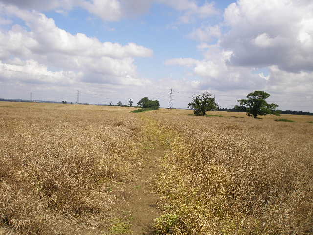
[11] View from track to Olney Park farm
[12] Track leading to Olney Hyde
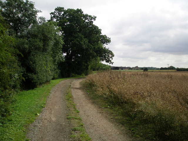
I turned left and followed the road over the brow of a hill and down the other side, where I turned right over a stile by a gate and followed another long farm drive. This followed a right-hand hedge at first, beside a rather straggly field or meadow, then passed a small triangular wood on the left [12]. It continued on, now with the hedge on the left, and a field of old oil-seed rape on my left. I then passed a recently cut hay meadow on my right before reaching a gravel farm yard at Olney Hyde. On my way back in the afternoon, I saw some Guinea Fowl who made quite a racket as I went past – I’ve seen these a few times now, but not heard them before. I turned left through a gate, and followed a broad grass track between two corn fields, gradually rising towards a wood ahead [13]. When I reached the top of the rise, there were nice views back, where I could see the steeple of Olney church [14].
The path continued with the small wood on the right, then went slightly left with a hedge on the right. At the corner of the large corn field on my left, I went a few yards left before turning right and continuing in the same direction as before, following a narrow path through a field of root crops (I think that was what was in this field – at least, it was something other than a corn field!). Beyond this field, the Milton Keynes Boundary Walk continued on a very pleasant path, a well-kept strip of grass between a left-hand hedge and a line of trees [15], with a corn field beyond. Where the hedge turned right, the path went through a gap and continued ahead, now with a hedge on the right. In the field corner I went through a slightly overgrown gap, over a footbridge, and turned right alongside the hedge of a field of oil-seed rape. I continued through this field and the next similar field [16], then went through another overgrown gap to reach a road.
[13] The path leading away from Olney Hyde
[14] Looking back over Olney Hyde towards Olney
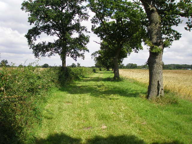
[15] Path near Warrington Lodge
A road sign to my right indicated that I was on the northern edge of the village of Warrington – this would be the nearest I would come to a village or hamlet all day, other than Weston Underwood where I started. Across the road I went down a drive with a couple of houses on my left, then passed beside a metal barrier and continued down a grass track through a wood (with the somewhat odd name of Old Pastures) – a sign warned that there was a military firing range to my left. The track through the wood was a bit muddy in places, but never very bad. I soon reached a small hide, raised about six foot off the ground in the middle of a junction where six paths met. I continued ahead [17] – the path was still damp but not so muddy, and there was a lot of Silverweed growing amongst the grass, though I didn’t see any of its yellow flowers, just the silvery leaves.
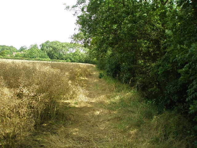
As I left the wood, I saw a buzzard again – unusually, it didn’t fly off as soon as it saw me, but circled once or twice in a leisurely fashion before heading off slowly over the wood. The path now crossed another oil-seed rape field (these fields are not the bright yellow I’d seen in the spring, but are now that corn-coloured tangly stuff) [18], then followed a left-hand hedge through a corn field. Where the hedge went left, a clear path continued through the corn, soon turning half-right. This was quite muddy in places, and the sticky clay started sticking to my boots as I made my way through the corn. I went through a hedgerow and continued on a similar path through the next corn field. This took me to a large wooden footbridge over a stream [19], with a farm a short distance to my right where I heard a dog bark. The path then crossed the top-left corner of another corn field, and continued across the bottom right corner of yet another corn field.
[16] Path near Warrington Lodge
[17] Path through Old Pastures
[18] Path beyond Old Pastures
As I crossed this last corn field, I could see the land ahead of me dropped away but I was too far from the brow of the hill to get any decent views. At the far hedge I turned sharp right, almost doubling back on myself – I didn’t realise so until some days later, but this was actually the most northerly point I have reached on any of the walks I have done from my home in Kensworth. I now walked with the hedge on my left to the field corner. Beyond a kissing gate, I continued on across another corn field, the narrow green strip of the path now containing a lot of some type of mayweed, as well as some Redshank. The farm I’d seen before was now on my right, and I soon crossed its drive. The path continued as before, through two further corn fields, with a main road over on my left. Beyond the second corn field, the path turned left along a hedge to reach the road (it’s the A509, between Olney and Wellingborough, which I recognised as I use it on the way to my brother in Kettering).
On the other side of the road, a rather overgrown and nettle-infested path went beside a water-tank and phone mast, then past a farm yard. It then turned right, between the farm yard and a bright blue field – I didn’t recognise the flowers growing here, but later learnt that they were Purple Viper’s-Bugloss (the oil from the seeds is used as an anti-wrinkle treatment, apparently) [20]. The path soon turned left, along a track between two fields of the blue flowers (actually there were also some white and a very few purple ones). At the field corner, I went over a footbridge in the hedgerow, and turned right. The Milton Keynes Boundary Walk now followed a stream and hedge for about half a mile, along a broad grass strip beside a corn field. I saw a few Peacock and Small Tortoiseshell butterflies along here. Several times I was startled by rabbits running for cover from the long grass just feet in front of me. There was some Hop Trefoil growing in the grass, and Teasel and Great Willowherb by the stream.
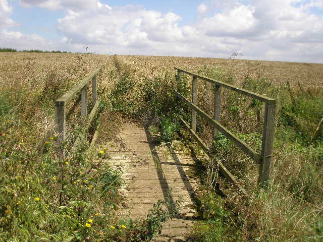
[19] The footbridge between corn fields
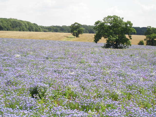
[20] Field of Purple Viper's-Bugloss

[21] Path near junction where I turned round
Eventually I crossed another footbridge. I continued with a stream on my right and another corn field on my left [21]. After a hundred yards or so, the corn ended and there was a barren piece of land on my left. Shortly after, as the stream turned to the right, I reached a waymark where I turned left and crossed the barren ground to another waymark where the path crossed a bridleway. This was my turn-around point for the day. Over to my left was Threeshire wood, where Bedfordshire, Buckinghamshire and Northamptonshire meet.
It was now 1pm as I headed back to Weston Underwood. I ate an Alpen snack bar to keep me going – I knew I had to walk back for about an hour to reach somewhere I could sit and eat my lunch, a fallen tree by the hide in the last wood I’d walked through. Sure enough, it was almost exactly 2pm when I stopped there. It was 4.10pm by the time I got back to my car in Weston Underwood. Allowing 10 minutes or so for lunch, I’d been walking almost 6 hours, much longer than normal for a walk of this length. I can only put it down to the vastly increased numbers of photographs I’m taking nowadays (80 today, including many flower photos).
This was a fairly good walk, by no means unpleasant but nothing exceptional. I did grow rather tired of the numerous corn fields I passed through at one point – it rather lacked for variety, although the three or four woodland sections did break it up a bit. It was a fairly flat route, with only one or two very small ups and downs and a few undulations. The flattish landscapes meant that views were generally restricted, though there were one or two nice views towards the Greensand Ridge to the south.
Total Distance: 23.1 miles each way (approximately)