Pete's Walks - The North Bucks Way, Day 1
Day 1 2/09/05 Great Kimble to Lower Hartwell (7.6 miles each way, approximately)
Parked in long lay-by off A4010 in Great Kimble, signposted ‘Tourist Information’.
From the A4010 at Great Kimble I had to begin my walk by first following the North Bucks Way steeply uphill along a bridleway, to reach its starting point on the Ridgeway. When I reached the path junction, a fingerpost saying ‘North Bucks Way – Wolverton 35 miles’ confirmed that I was in the right place. I took a stroll to the nearby hilltop of Chequers Knap to admire the view over the Vale of Aylesbury where I would be walking, and then returned to the junction and retraced my steps back down the hill.
In the first field across the busy A4010 there were a lot of large bumps in the ground, evidence that mediaeval Great Kimble was larger than it is today according to the North Bucks Way leaflet. I don’t know why the population decreased, but I have noticed on the map that the Vale of Aylesbury is studded with the sites of mediaeval villages that no longer exist. The leaflet also mentions that Great Kimble is where John Hampden and others, in 1635, signed a document against the payment of Ship Money, one of the events that eventually triggered the Civil War. John Hampden lived at nearby Great Hampden, and I passed his house there on Day 24 of my Chiltern Way walk.
The North Bucks Way passed through a few small paddocks and fields to skirt the outlying houses of Great Kimble, before crossing a railway line. After a large field of stubble, it crossed a road that I recognised from several of my journeys on the Chiltern Way, and followed a bridle way along a wide track between hedges (on my way back in the afternoon, I came across a man trimming the hedges here with a tractor or JCB). I then followed a road for a few yards before walking down the drive of a very attractive farm, the footpath turning off onto field paths to skirt the farm to its left. The fields were all horse paddocks or stubble, eventually leading to the hamlet of Kimble Wick.
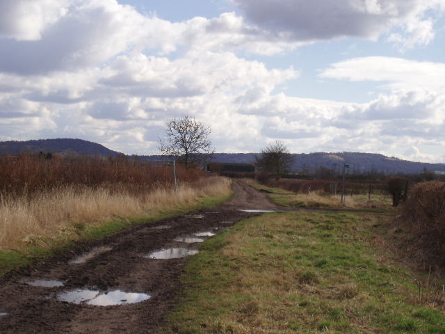
Looking back from near Kimble Wick to the Chiltern Hills (28/2/06)
Another wide bridleway led onwards. The North Bucks Way had already started to share its route with the Aylesbury Ring – here, I soon came to a junction that showed that at that point I was also on the Midshires Way and the Swans Way (a long-distance bridleway). I continued on the clear and wide bridleway, generally with hedges on both sides, before reaching a large cattle pasture which led on to a lane into the small village of Bishopstone. Another wide bridleway then led on beside two more fields, before turning northwards and leading on past more fields of stubble to reach the hamlet of Sedrup. I then crossed the A418 Aylesbury-Thame road, and went down a quiet lane near Hartwell House (which is now a hotel, but was lived in by the exiled French Court during the Napoleonic Wars). I noticed the ammonites set in the wall, mentioned in the North Bucks Way leaflet. Having crossed two fields to reach another lane, I decided that was a sensible point to turn round. I think parking may be a problem on this walk, as there aren’t too many villages that I pass through. By stopping here I should be able to park in Stone at the start of my next walk.
I enjoyed the journey back to Great Kimble – going in that direction, I could see the northern escarpment of the Chiltern Hills ahead of me. I could pick out the monument on Coombe Hill and also see the distinctive shape of the neighbouring Beacon Hill (not to be confused with Ivinghoe Beacon). Between Sedrup and Bishopstone, much to my delight, I saw a Red Kite take off from the field I was walking through – I watched it for several seconds as it soared over the next field. I thought I’d heard one at Lower Hartnell, but couldn’t be certain. This was a very pleasant surprise, as I hadn’t expected to see one on the Vale of Aylesbury – although I was only a few miles from Little Hampden in the Chilterns where I’d seen or heard them before.
I stopped for lunch about 1pm, as usual, sitting on a stone by the side of the bridleway going towards Kimble Wick. It was a very warm day, probably 23-24C, and I was glad to find somewhere in the shade. I only had about another hour or so to walk in the afternoon.
This was a very pleasant walk, on a very nice day for walking although it was a little on the warm side. Apart from the very start of the walk, it was very flat with hardly any changes in elevation all day. The paths were clear and well sign-posted, and there was enough variety to make it an enjoyable walk.
Total Distance: 7.6 miles each way