Pete's Walks - The North Bucks Way, Day 3
Day 3 19/9/05 Quainton to Addington (6.9 miles each way, approximately)
Parked by village green in Quainton.
There was a two-week gap between the last walk and this one. I was waiting to receive a digital camera that I’d ordered on the internet, so that I could take photographs to put on this web-site. Meanwhile, I did some local walks from my parent’s house. Eventually I gave up waiting for the camera to arrive, and borrowed my parent’s camera instead.
I set off from Quainton about 10am, passing the fifteenth century Market Cross on the triangular village green. Immediately on leaving the village, the North Bucks Way started to climb over Quainton Hill. The climb was surprisingly gentle as I passed through a succession of grassy pastures. One field contained some very obvious lumps and bumps, the result of stone quarrying according to the North Bucks Way leaflet. The path was marked on stiles and gates, but as some fields were very large, and the contours of the hill meant that parts of the fields were hidden from view, it was not always obvious exactly where the path went. I managed to get lost at one point, and wandered round one large field for about 10 minutes before I realised where I had gone wrong. The descent on the other side of the hill was much steeper, with sheep now grazing the grass rather than cattle.
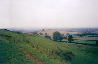
View from Quainton Hill
From the bottom of Quainton Hill, the North Bucks Way crossed a couple of grassy fields containing more sheep and then continued along a path through three very flat arable fields. It then crossed another large grassy field (no animals but, strangely, evidence of recent occupation by both horses and cattle) to reach a fenced path that led on to a lane. Turning left down the lane, I soon passed a small field on my right containing several sheep and what was evidently a ram (he had much more impressive horns, for one thing). Where the North Bucks Way left the lane, the next field had recently been ploughed but there was a vague line indicating where the path went so I plodded slowly across – it was a large field, with the path crossing it diagonally. In the corner, I climbed over a gate and followed the now clear path along a hedge row through two fields. Since Quainton Hill this had been a very flat section, so I was quite glad the next grassy field led gently uphill – it was quite an unusual field in that it contained a large number of horses (as did the one on the other side of the fence). I’m used to seeing a small number of horses in paddocks, but this was a large field with quite long grass and probably 30-40 horses – from a distance, I’d assumed they were cows. From the field, a track led into the village of East Claydon.
From here, another clear path led across another grassy field, and then downhill beside the hedge of a recently ploughed field. The path then crossed two flat fields of stubble to reach a lane, which I followed to the left to reach the hamlet of Verney Junction. Here a short track led across a railway line (there were the usual warning signs, but judging by the bushes growing in the tracks there can’t have been a train for several years) and then a path followed a hedgeline through two more fields. I then crossed another thin grassy field (strangely I didn’t see anything in it, but it contained a small herd of cows when I came back 15 minutes later) to a small footbridge over a stream. The next field had just been ploughed and there was no sign of the path, so I followed the field boundary before crossing another small field to reach Addington. This seemed a rather unusual hamlet, as it consists solely of a church and four or five very large and impressive old houses. I walked down the lane through Addington to reach a lane junction where I decided to turn round (originally I’d planned to turn round at Verney Junction, but that would have made it a very short day).
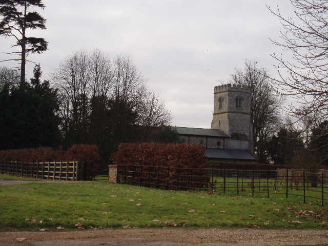
Addington Church (10/2/06)
The walk back was uneventful. There were no good places to stop for lunch, so it wasn’t until about 1.45pm that I finally stopped, sitting on a stile about halfway between East Claydon and Quainton. The climb up Quainton Hill was much longer and steeper from this direction.
Overall, this was a pleasant but rather uninspiring walk. There wasn’t too much of interest to see on the route, and apart from Quainton Hill it was very flat. This was a very grey day with the sky overcast all day long, although it remained dry and reasonably warm. If it had been a sunnier day I would probably have a better opinion of the walk – certainly the views from the Quainton Hill would have been more impressive.
Total Distance: 21.5 miles each way