Pete's Walks - Swan's Way
If you are considering walking this route yourself, please see my disclaimer. You may also like to see these notes about the maps and GPX files.
Day 3 5/09/07 Shenley Church End to near Swanbourne (7.5 miles each way, approximately)
Parked in side street in Shenley Church End.
I had another bad night’s sleep, but managed to get up at the usual time of 7.30am and even managed to set off from home two or three minutes earlier than usual. It only took about 35 minutes to drive to this part of Milton Keynes (I managed to park within yards of where the last walk ended), and I was walking by 9.40am.
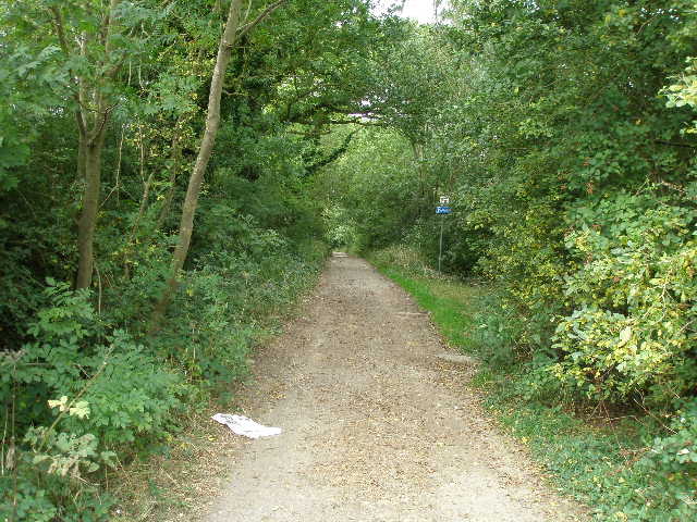
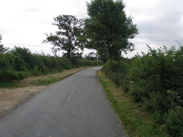
The bridleway I’d been following on the last walk continued westwards as a sandy path, at first to the left of a private drive to some large houses but soon switching to the right. Beyond the end of the drive, the bridleway continued as two sandy paths separated by small bushes and undergrowth, with hedges either side [1] – I followed the left hand path in the morning, the right hand one coming back. I soon reached a T-junction of bridleways, where I turned left.
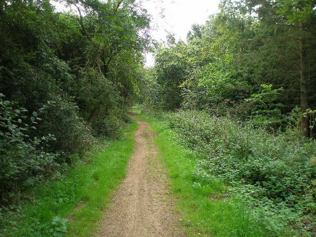
[1] The path from Shenley Church End to Oakhill Wood
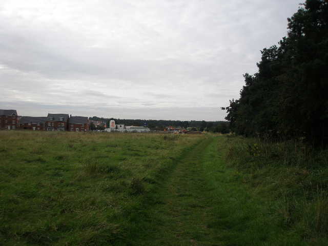
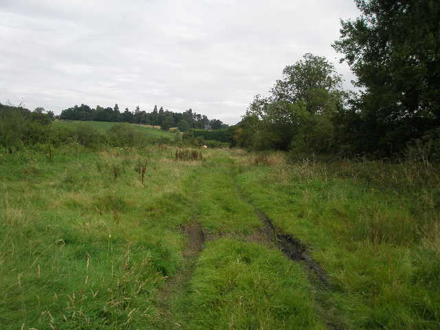
[2] From the end of Oakhill Wood, looking to the new houses and the construction site on the edge of Milton Keynes
[3] View from the bridleway towards Whaddon
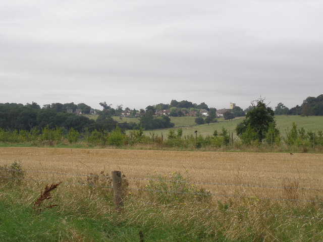
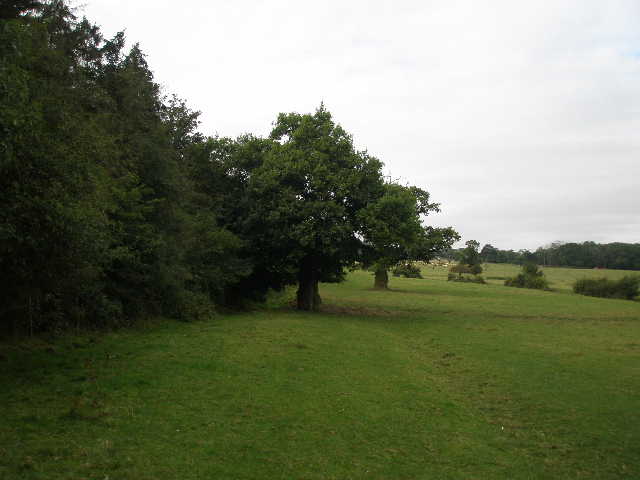
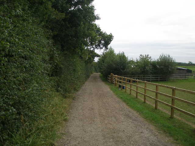
I was now on familiar territory, as I’d walked this path on the last day of the Milton Keynes Boundary Walk about a month ago and it was also part of the North Bucks Way which I walked two years ago. On my right was Oakhill wood, a large mainly coniferous wood, while somewhere out of sight behind the trees and bushes on my left was Woodhill Prison. I saw several Speckled Wood butterflies along here. After a third of a mile or so the bridleway emerged from the trees, though the wood continued on my right for another couple of hundred yards [2]. To my left was a large area of rough grass, with new houses and a construction site beyond. Soon I had a fence and arable fields on my right, with a view towards Whaddon [3] and Whaddon House, perched on a corner of a slight hill. I passed the building site on my left, noticing that at least one of the new houses was being clad in the attractive local yellow limestone that I’ve seen so often on this walk and on the Milton Keynes Boundary Walk. There was then a corner of a huge cattle pasture on my right.
The bridleway then became enclosed between hedges [4]. After a few hundred yards, I turned right, entering another corner of the cattle pasture with another mainly coniferous wood on my left. I was now leaving the route of the Milton Keynes Boundary Walk, though remaining on the North Bucks Way. I followed the edge of the wood westwards towards Whaddon [5]. Initially there were some lumps and bumps in the ground over to my right [6], which according to the map marked the location of Snelshall Priory. This was founded around 1166 and disbanded in 1535 during the Dissolution of the monasteries. The huge pasture I was in was obviously once part of the parkland of Whaddon House, as it was studded here and there by mature trees, including some impressive oaks. There were some cattle over to my right as I reached the far corner, where I met a couple of horse riders coming the other way.
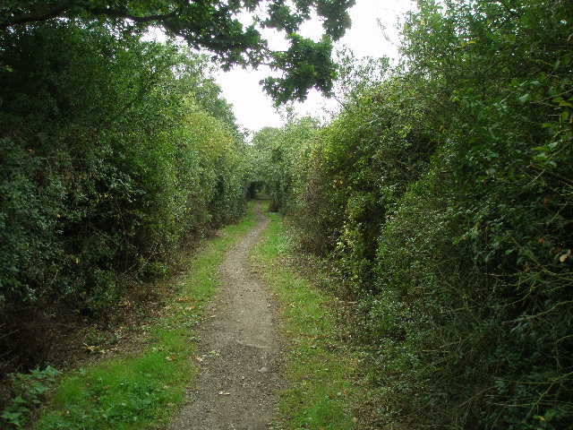
[4] The bridleway beyond the construction site
[5] Start of the path along the edge of the huge parkland pasture
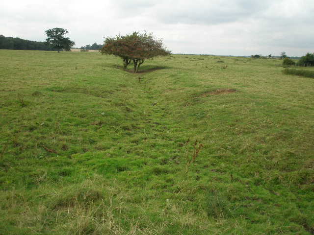
[6] This slight earthwork or ditch is possibly part of the site of Snelshall Priory
I now followed the bridleway along the left-hand edge of an arable field. On the far side, I went slightly left. I thought that I was leaving the North Bucks Way at this point, as when I walked it two years ago it went right here and then left, round two sides of a small wood. However as I passed another side of the wood and then joined a short residential street to reach the main road in Whaddon I saw a North Bucks Way sign pointing back the way I’d come, so that route has obviously been changed in the last two years (my map showed the old route).
I turned left along the road – I was only on the outskirts of Whaddon, and passed just a few houses before taking a farm drive going half-right. Beyond the farmyard it ran between hedges [7], and I saw some rabbits and a large number of young pheasants on the track ahead of me. Through a gate, I followed a tractor trail through the grass of an empty pasture (I saw a Muntjac deer beside a small copse here on my way back). Through a gate, I then followed the left-hand hedge of another pasture. There was a number of young bullocks here, who grouped together and fled at my approach. The daft creatures all crowded together in the corner that I was walking towards, so as I drew nearer they had to make a run for it again, following a large semi-circle to my right and then going through an empty gate I’d just passed into the adjoining pasture.
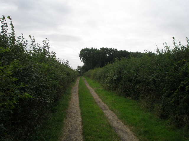
[7] Farm track just beyond Whaddon
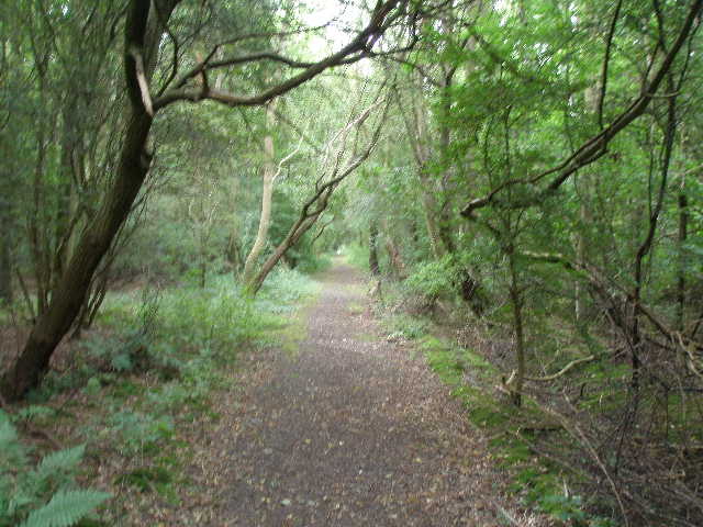
[8] Track through Thrift Wood
[9] Track by paddocks after Thrift Wood
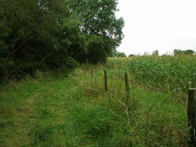
I then crossed quite a busy main road, and continued along the bridleway opposite. This went through some scrub and nettles, turning half-right. It then passed through Thrift Wood on a dead straight track [8]. On the far side, I turned left on a hard surfaced track that ran past some stables and parked horse transporters on my right [9]. Across the paddocks here I could see several new houses, though the map only indicated a farm. I next went through a series of gates through a couple of paddocks, following the hedge on my left. The bridleway then followed the edge of a maize field, and in the far corner met another bridleway coming in from the left. I turned right here, following a hedge and sunken stream on my left, with a wire fence and the maize field on my right [10].
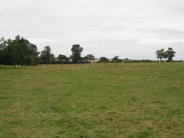
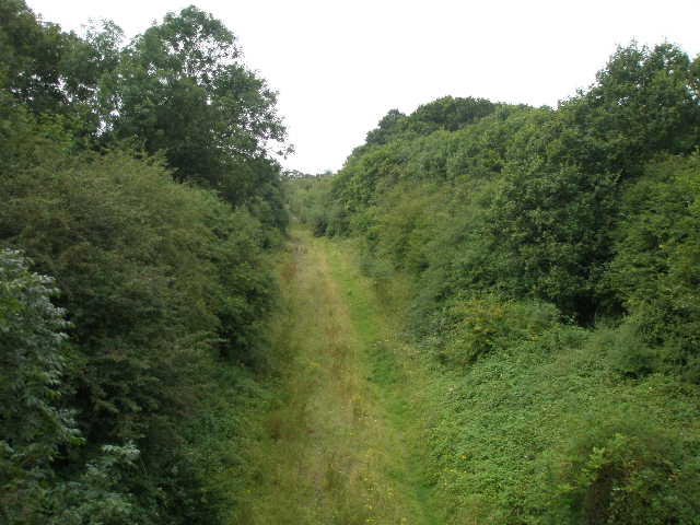
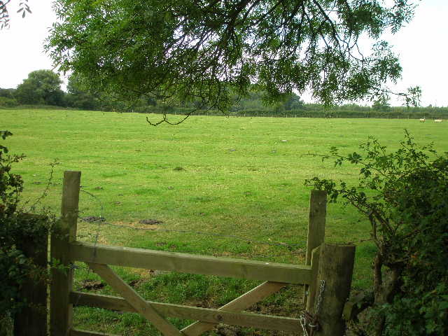
The bridleway turned right in the next corner, but soon went left through a gate in the hedge. I was now in another huge pasture, this one shared by both sheep and some black-and-white cows. The bridleway went half-left across the pasture – part way across I went through one of at least two gaps in a wire fence that presumably had once divided it into two smaller pastures [11]. On the far side of the huge pasture, I went through a gate and turned left along a road. Though only a B road, this was quite wide and quite busy. There was a reasonable verge, though, which I used whenever traffic approached. On the way back, I noticed some Honeysuckle in the left-hand hedge. The road crossed an old railway line [12], and soon after I turned right onto another bridleway.
[10] Path by the Maize field
[11] The sheep and cattle pasture
[12] The disused railway line from the B road
This was a hard-surfaced track, which I’d soon discover was part of the national cycle network [13]. Initially there were tall hedges either side, and I saw some Lords-and-Ladies growing here (one of its numerous folk names is Kitty-come-down-the-lane-jump-up-and-kiss-me!). I also saw some unusually large Herb Robert growing here. The track was soon running close to the railway line on the right, with a lower hedge and arable fields (now mainly stubble) to my right. I passed an unusual waymark post (sponsored by a bank) that marked the Millennium and the creation of the National Cycle Network [14]. The hard and level surface made for easy walking and I marched along at a good pace, being followed by a couple of horse riders a short distance behind [15].
[13] Start of the bridleway that is part of the national cycle network
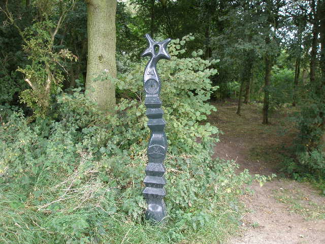
[14] Waymark post celebrating the Millennium and the national cycle network
[15] Further along the same bridleway
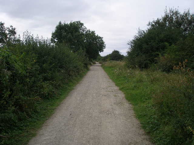
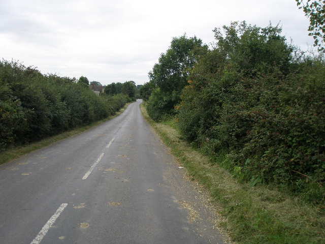
The track ended at a road junction, where I took the minor road ahead of me [16]. There was now about half an hour’s road walking to reach the village of Swanbourne. I still had the old railway line on my right, and after about quarter of a mile I passed a house that had formerly been Swanbourne station. The minor road was very quiet, and really not much more than a lane. Very few vehicles passed me as I continued on, with mainly arable fields beyond the hedge on my left. At a junction, the road went to the left and I stayed on it, still marching along at a good pace [17]. Occasionally I got glimpses, ahead and to the right, of Quainton Hill which I will cross on the next walk. I passed a farm on my right, and soon after came to a gate in the hedge in my right. Here I saw immediately that the pasture there showed the regular sequence of humps and hollows indicative of Ridge and Furrow [18], the ancient strip system of farming, which I’d seen so frequently on the Bernwood Jubilee Way (I wasn’t too many miles from the route of that path).
[16] Start of the road walk to Swanbourne
[17] The road to Swanbourne
[18]Field with clear signs of Ridge and Furrow beside the road to Swanbourne
The lane eventually brought me to the attractive village of Swanbourne, where I turned left along the main road, passing an infant’s school and then the church on my left. As so often, numerous power lines and telephone wires criss-crossed the street, ruining any opportunities for photos of the village, but I did manage to take one of the church (I guess that’s another reason why I seem to take so many photos of churches, they don’t usually have too many wires coming out of them to spoil the shot!) [19]. I had actually intended to turn round here, but as the walk had only taken 2 hours and 10 minutes so far, and as I’d got a nice early start to the walk, I carried on for about another mile or so.
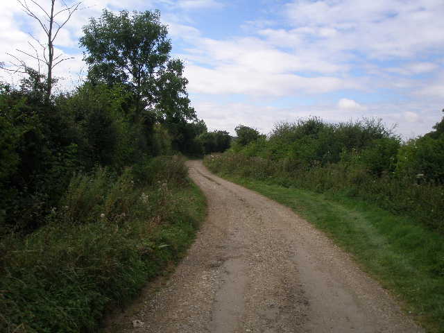
I continued along the main road, passing the entrance to a private school on the right. After a few hundred yards I turned right onto a hard-surfaced track running between hedges [20]. The hard surface soon ended where the bridleway turned left. I was now walking along a very wide ‘green lane’, a very broad strip of somewhat overgrown grass running between hedges maybe 30 yards apart [21]. I followed a clear path through the long grass for several hundred yards. I had thought to continue as far a wood called Christmas Gorse, but soon realised that would take too long, so I decided to turn round where a huge electricity pylon stood in the middle of the green lane.
I had lunch on a bench at a road junction by Swanbourne church, the same bench I’d used on Day 2 of the Cross Bucks Way. As I eat my cheese and branston pickle rolls, I vaguely recollected that I’d regretted not exploring the church on that earlier walk. So after lunch, I crossed the road to the church. As I was unlatching a gate, a friendly cyclist (possibly the vicar or a churchwarden) stopped and told me to go ahead, the church was open. He mentioned there was a leaflet inside showing local walks.
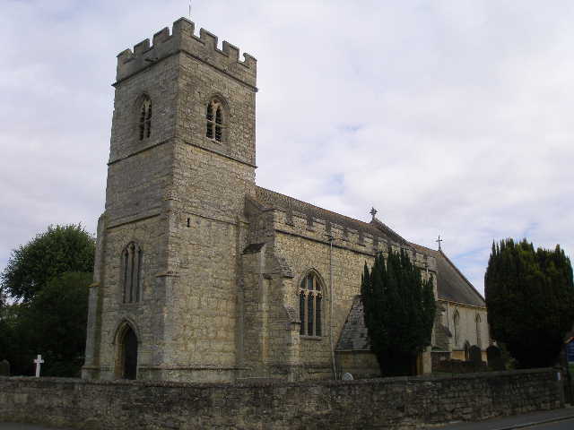
[19] Swanbourne church
[20] Start of track heading away from Swanbourne
[21] Looking back along the wide green lane, from near the end of the walk
The church of St Swithun, ‘the weather saint’, was originally built in 1230, and its font dates to that time. The west and chancel arches both date to the 13th century as well. The north aisle was added in the sixteenth century, and the tower was rebuilt in the 17th century on the original foundations. There was a small section of poorly preserved wall paintings, showing ‘The Four Last Things’ – Heaven, Hell, Death and Judgement (shouldn’t one of them be taxes? J). There were some interesting plaques and brasses, including a brass recording a man murdered in 1626 and a plaque remembering Vice-Admiral Sir Thomas Fremantle who fought under Nelson at Copenhagen and Trafalgar.
The guide leaflet for Swan’s Way mentioned that most of the village had been destroyed in the Civil War, and the leaflet in the church gave more details. About 400 armed men calling themselves the King’s Forces had invaded Buckinghamshire in 1643, robbing and pillaging. The villagers of Swanbourne refused to pay them the £100 they demanded, and consequently the village was burnt and a woman murdered, many villagers taking refuge in the church. The marauders then moved on to nearby Great Horwood, where according to local legend the people paid up.
The walk back to Shenley Church End was quite straightforward, and I got back to my car about 3pm. The weather had remained pretty much the same all day, nicely warm but with generally grey but unthreatening skies, though occasional patches of blue sky were visible. By the afternoon it was quite humid again. This was another enjoyable walk, though not outstanding. There was a fair amount of road walking, but I’m not complaining as I expected that to be the case on a long-distance bridleway. The field with Ridge and Furrow was an unexpected sight, and I really enjoyed looking round Swanbourne church, which I hadn’t planned on doing when I set out.
Total Distance: 22.4 miles each way, approximately