Pete's Walks - Swan's Way
If you are considering walking this route yourself, please see my disclaimer. You may also like to see these notes about the maps and GPX files.
Day 4 8/09/07 Near Swanbourne to near Waddesdon (7.5 miles each way, approximately)
Parked near Christmas Gorse, south-east of Winslow.
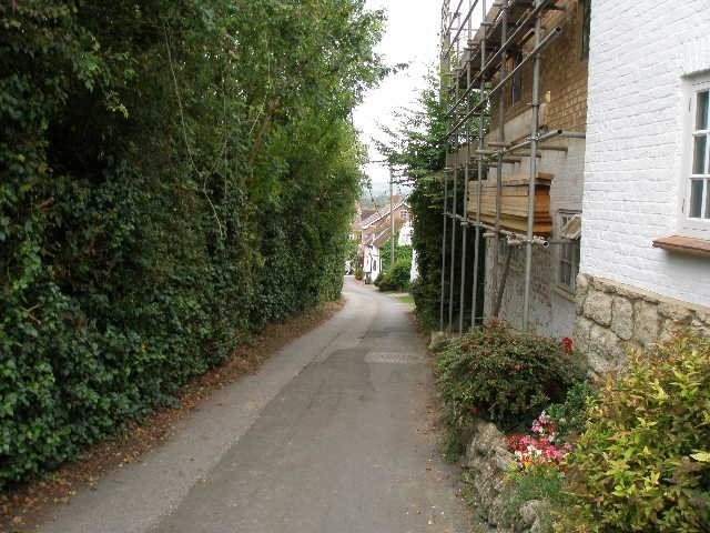
I again skipped my second cup of coffee this morning, and set out about 20 minutes earlier than usual at 8.45am – it was Saturday, so I wasn’t worried about getting caught in rush hour traffic. The guide leaflet for Swan’s Way indicated a parking area near a wood called Christmas Gorse, about a mile on from the tall pylon where I finished the previous walk. In fact it was just a small grass area on the verge of a narrow lane, where maybe a couple of cars (or a car and horsebox) could park. I started by walking back to the pylon, which took almost twenty minutes.
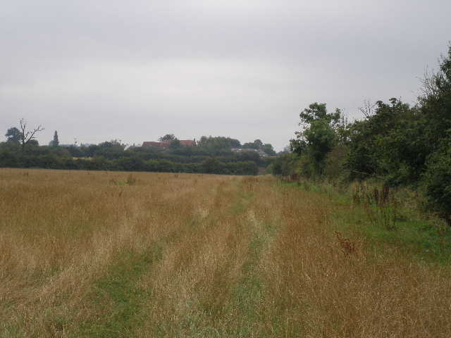
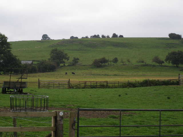
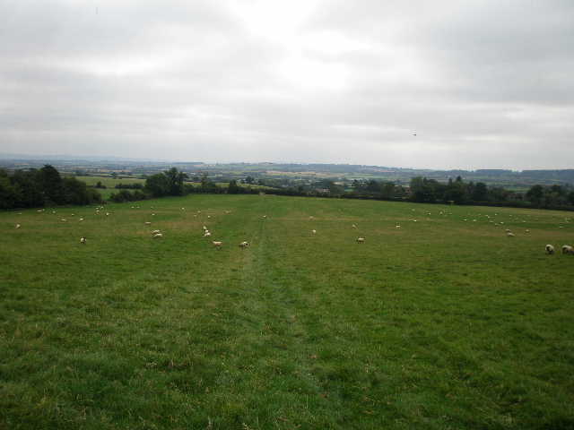
It was about 9.50 when I turned at the pylon. I continued along the very broad green lane I’d been on at the end of the last walk for about 200 yards [1]. The bridleway then continued along the left-hand hedge of a large field – the first fairly small section of this field was recently cut hay, but then the far larger part of the field was planted with maize. In the next field corner I went through a gate and crossed a road (from Whitchurch to Winslow, I’d driven along it earlier). On the other side I continued on another green lane [2], the hedges either side much closer together than the previous one. By now, the bottoms of my trouser legs were quite wet from the heavy dew still on the thick grass I was walking through. The green lane, which occasionally showed patches of a hard surface, turned to the right. It soon had Christmas Gorse on the left, and shortly after ended at a sharp bend in a narrow lane.
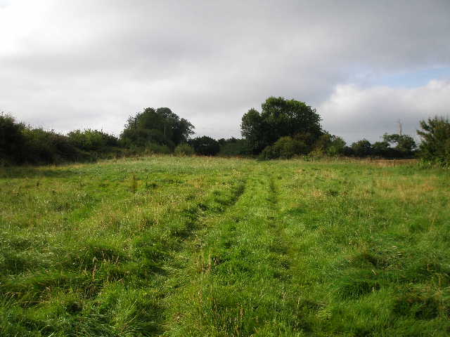
[1] The wide green lane at the start of the walk
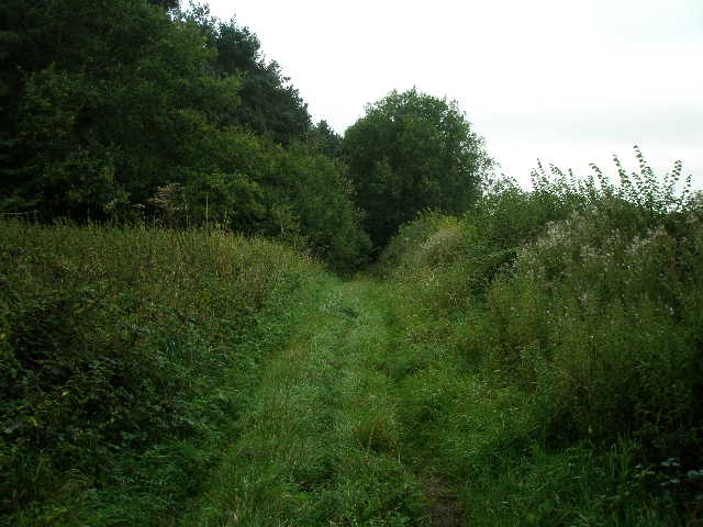
[2] The green lane on the other side of the road
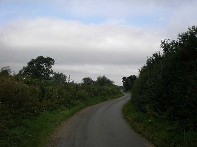
[3] The lane just beyond Christmas Gorse
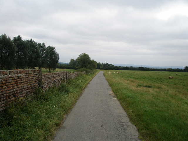
I turned left along the lane, with the wood still on my left. Where the wood ended after two or three hundred yards a bridleway went left, but Swan’s Way continued along the lane a short distance further [3] before taking a second bridleway on the left (almost opposite my parked car). I followed the left-hand hedge of another cut hay meadow [4], and went through a hedge gap in the corner to follow the right-hand fence of the next field. This was long and rather rough grass, with patches of dock growing here and there. The walk had been across very flat ground so far, but now across the fields to my left I could see a very low hill. I continued on through another similar field, now with a hedge on my right [5], then crossed through a field of what I think was old oil-seed rape [6]. The next field was a small pasture of tall and rough grass, where sheep were grazing.
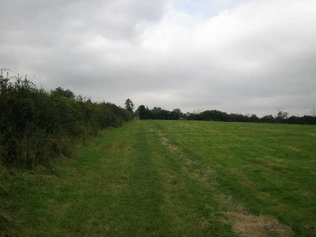
[4] Start of the bridleway to Marstonfields Farm
[5] Looking along the bridleway towards Marstonfields Farm
[6] View from the bridleway to Marstonfields Farm
Through a gate on the far side of the sheep pasture, I followed a path going half right through a large and empty grass field, to reach another gate on the corner of the yard of Marstonfields Farm. I followed a short track, with the farm buildings to my right, then turned left along the tarmac farm drive which I would follow for three quarters of a mile to the village of North Marston. I soon passed a very large modern house on my right (at least twice the size of a normal 4-bedroom house) which according to my map was ‘The Bungalow’! In fact the original bungalow now seemed to be just a workshop attached to the garages of the new property [7]. A bit further on a cyclist coming the other way said ‘hello’ as he passed. He must have turned round at the farm, because he soon came back and pulled up alongside me and we had a good chat as we continued on towards the village. He asked where I was going, and we talked a bit about the routes I’d walked and about cycling and about knee problems. He had to dash off just as we entered the village, saying something about bell-ringing.
As I entered North Marston, I turned left to pass the church on my right [8]. According to the Swan’s Way guide leaflet, the church roof dates to the time of Chaucer, and the church was restored by Queen Victoria from a fortune left her by a local miser. In fact the church looked somewhat odd to me, the tower looking as if it was brand new, its clean yellow stones contrasting sharply to the weather-worn stones of the rest of the building. From the church the lane descended steeply beside some attractive old houses [9] to reach the main road through the village, where I turned right. The guide also says that the village was once a place of pilgrimage with a reputed healing spring – this is now marked by a pump and a stone structure, but I failed to see them. I turned left at a junction – a woman said ‘hello’ as she cycled past with her children, and a man in his front garden with his young daughter also said ‘hello’ as I walked by, so I got a distinctly favourable impression of North Marston being a friendly place (most people just stare at me as I go past, or run away!). I saw a sign saying that it was the Church Fete that afternoon, and indeed on my way back I saw several people obviously on their way there.
[7] The drive from Marstonfields Farm to North Marston
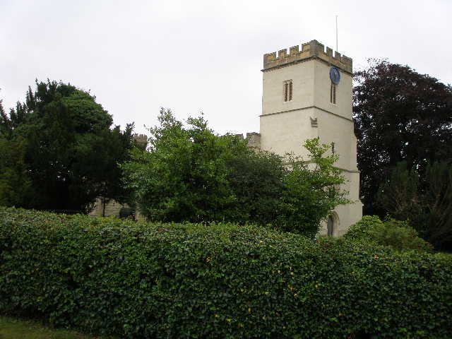
[8] North Marston church
[9] North Marston
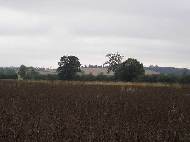
The minor road soon left the village behind, turning left and then right. From entering North Marston, I had about two miles of road and lane walking, possibly the longest stretch I’ve ever had on any of my walks. I passed a large farm on my right, and continued down a long straight section of the road, with Quainton Hill now directly in front of me [10]. I didn’t see much in the way of wildflowers on this walk, but I did see some Great Willowherb along here. The road was crossed by another line of huge electricity pylons, and I heard the cables humming and crackling as I went under them. The road then turned sharply left, and after a hundred yards or so I turned right down a narrow lane [11].

[10] The road from North Marston
[11] Looking towards Quainton Hill from the lane junction
[12] The lane to Fulbrook Farm
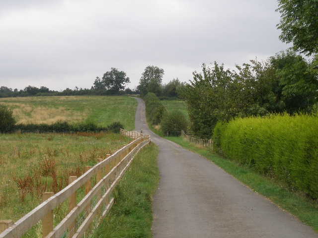
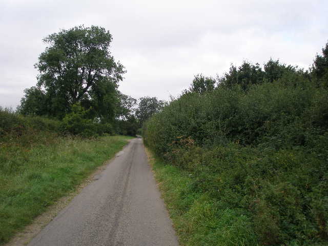
The lane ran between hedges, with the long ridge of Quainton hill to my left. There had been little traffic on the road I’d just walked, and now there was virtually none as I followed the lane for about half a mile [12]. There were occasional tufts of grass breaking through the tarmac, and the surface of the lane was generally pretty poor and uneven. The hedges either side eventually gave way to fences, and soon I crossed the point where the North Bucks Way crossed the lane, having come down from Quainton Hill. The Swan’s Way continued along the lane for another two hundred yards or so, passing some mounds in the sheep pasture on the left that indicated the site of a mediaeval settlement [13].
I then turned left down a farm drive [14], soon branching slightly left across the sheep pasture to a marker post in an intermittent hedge. It was quite boggy as I passed through the old hedge, it must follow the course of a stream (the name of the nearby farm was Fulbrook). I continued across the pasture, with the slope of Quainton Hill rising steadily before me. In the hedge on the far side of the pasture were two gates – the bridleway I was on went through the right-hand one, but this was chained up so I had to use the gate a few yards to the left which marked the route of the footpath carrying the North Bucks Way (the two paths merged just beyond the hedge anyway).
As I started up the steep slope in the next huge pasture on the open hillside, I met a birdwatcher (the binoculars and telescope were a bit of a clue!) whom I’d just seen talking to a farmer. I’ve seen Quainton Hill mentioned on a birding web site a few times, so I asked if he’s seen anything. He said he’d seen a couple of Common Redstarts, a Peregrine Falcon and a couple of Ravens – apparently I’d just missed the Ravens. We chatted briefly about how good it was that Red Kites, Buzzards and now Ravens were making a comeback in the area, then went our separate ways. I slowly made my way up the steep slope, passing a few sheep and seeing signs of the numerous old stone quarries that are dotted all over Quainton Hill. As I drew nearer the top, I spotted the farmer again on his quad bike – he and his dog were rounding up some cattle and presumably moving them on to a different pasture.
[13]These lumps in the ground near Fulbrook Farm are the site of a mediaeval village
[14] Quainton Hill from near Fulbrook Farm
[15] View over North Marston and the Vale of Aylesbury from Quainton Hill
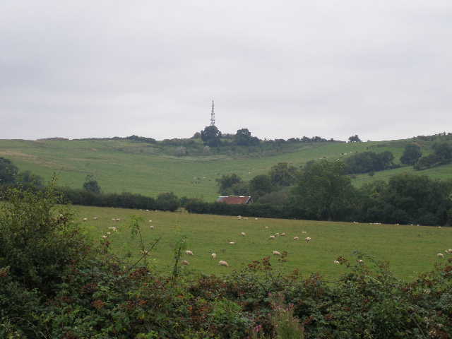
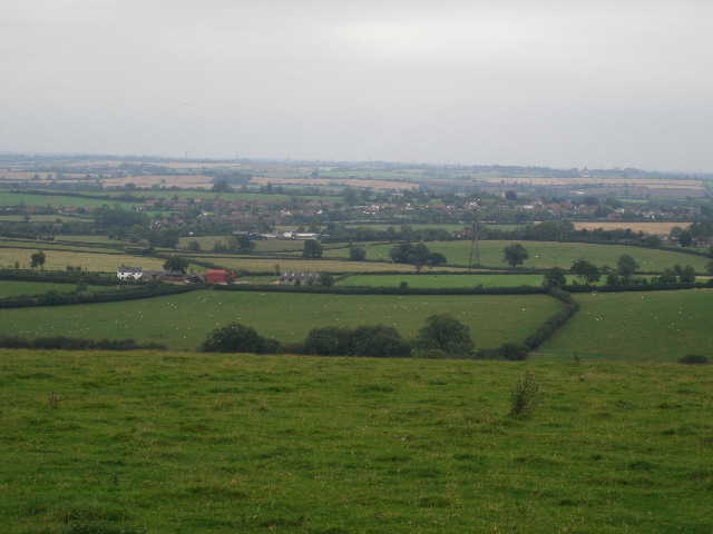
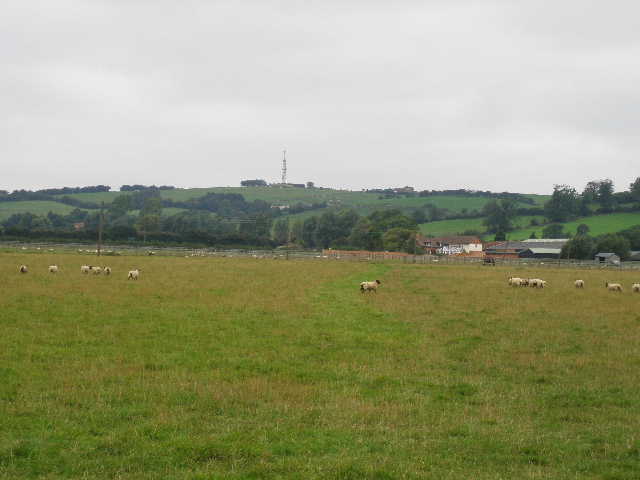
Quainton Hill rises out of the Vale of Aylesbury, running irregularly for about a mile from northwest to southeast, with the village from which it takes its name immediately to the south. Looking at the contours on the map, it only rises about 270 feet from the flat lands of the Vale of Aylesbury (it felt a lot more than that as I struggled uphill!), but that is enough for the views from the top to be quite extensive. Unfortunately today was another grey and slightly gloomy one, with only a very occasional blue patch appearing in the generally overcast sky, so the views were not as extensive as they might have been. In most directions I could see for many miles across the Vale of Aylesbury [15], and could pick out the Ski-Dome at Milton Keynes and the radio mast near the Brickhills on the northern horizon. To the south I could see Aylesbury and the long line of the Chiltern Hills beyond – I could see the hills as far east as Ivinghoe Beacon.
I went through a gate at the top of the hill [16], and crossed a thin section of another large pasture, passing a few cattle. At the gate on the far side I passed a couple walking with their daughter and their dog. They followed me as I passed more cattle in the next pasture either side of a small reservoir and a radio mast at the summit of the hill. I then started the steady descent down the other side of the hill, heading south – the map showed this as a track, but it was no more than a vague line through the grass. I could see the village of Quainton and its windmill ahead and slightly to my right, with the wooded hill where Waddesdon Manor stands beyond [17]. As the slope started to ease, I went through a gate in a hedge, and continued in the same dead straight line through a large sheep pasture [18], the ground slowly levelling out as I reached the foot of the hill. Through another gate, I followed a short track that curved left to a junction of tarmac drives.
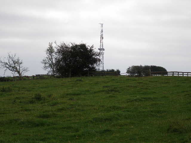
[16] The mast at the top of Quainton Hill
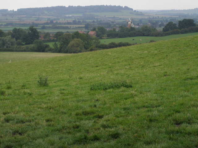
[17] Looking over Quainton towards Waddesdon from the south side of Quainton Hill
[18] Sheep pasture at the bottom of Quainton Hill
Here I took the drive heading south-eastwards, soon passing close to Denham Lodge, a fine early 17th century house, apparently still surrounded by a moat although I wasn’t close enough to see that. The drive continued along with another sheep pasture on my right and a long stone wall on my left – much of the wall looked to be built of really old bricks, much smaller than modern bricks [19]. I passed in front of Ladymead Farm, and where the drive turned right the bridleway continued ahead, crossing diagonally two more large sheep pastures, with a few horses in a paddock to my left [20]. Through a gate, a short track led to a road.
Here the guide leaflet clearly showed that Swan’s Way followed the road to the left, then turned right along another road at a crossroads. This was a bit annoying, because there was a perfectly good bridleway going straight on from more or less where I joined the road, which then turned left to reach the second road I had to walk. So it seemed daft that I had to follow roads round two sides of a square when there was a bridleway going round the other two sides. The Midshires Way, a long-distance path with which Swan’s Way shares much of its route, used the bridleway. I even checked to see if there was a waymark indicating that Swan’s Way had been redirected along the bridleway, but there wasn’t, so I set off along the road. This was quite unpleasant, as there was quite a bit of traffic and no verge that I could walk on. After a third of a mile I reached the crossroads (I had to take avoiding action as two cars came round the blind corner very quickly) and turned right, passing an RSPCA sanctuary on my left. At least there was now a reasonable verge on the left of the road. Most annoyingly, when I reached the point where the bridleway came in on the right there was a Swan’s Way waymark pointing along the bridleway! If there’d been one at the other end (I checked again when I got back there, there definitely wasn’t one) I’d have been spared the unpleasant and somewhat dangerous road walk.
[19] The drive to Ladymead Farm
[20] Looking back to Ladymead Farm and Quainton Hill
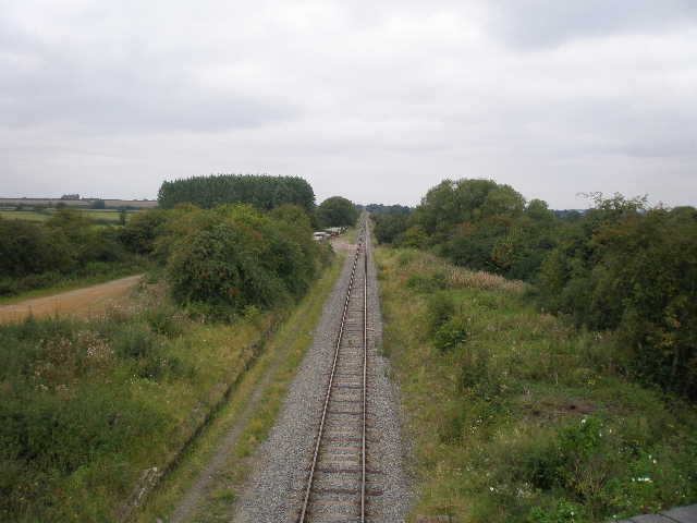
[21] The railway line from the bridge at the end of the walk
I carried on along the road for about another third of a mile – at a right-hand bend I joined the route of the Aylesbury Ring, which I walked about eighteen months ago. Just past a bridge over a railway line (the Buckinghamshire Railway centre is near here, close to Quainton), where the Aylesbury Ring turned right to cross the fields towards Waddesdon, I stopped and turned round [21]. My next walk will start with a bit more road walking, but I thought it better to split the long stretch of road walking between two walks.
Needless to say, I used the bridleway on the way back (it generally runs between wooden fences with horse paddocks either side, and passes a former farm that is now Quainton Stud) rather than repeat the unnecessary section of unpleasant road walking. I stopped for a rather late lunch (about 1.30pm) on top of Quainton Hill, admiring the far-reaching views, and got back to my car about 3pm.
I enjoyed this walk, though it wasn’t outstanding. It was a very flat route, apart from going up and over Quainton Hill in the middle. The views were very good from the top of the hill, it was a shame they were a bit restricted by the grey skies. North Marston was an attractive village, and I got the impression that it was a friendly place with a good community spirit. I enjoyed chatting to the cyclist and the birdwatcher, I don’t get to talk to too many people on my walks. I probably did more walking on hard surfaces today than on any other walk (with the possible exception of the short walk through Bedford and Elstow on the John Bunyan Trail), and my feet were a bit sore at the end of the walk.
Total Distance: 29.9 miles each way, approximately