Pete's Walks - Swan's Way
If you are considering walking this route yourself, please see my disclaimer. You may also like to see these notes about the maps and GPX files.
Day 5 10/09/07 Near Waddesdon to near Kimble Wick (7.5 miles each way, approximately)
Parked in lay-by on edge of Waddesdon.
I’ve found it very difficult to divide this walk up into roughly 7 or 7.5 mile segments that start and end in villages, so this is another walk that starts ‘near’ a village and ends ‘near’ another one. I parked in the lay-by on the eastern edge of Waddesdon (which I’d used before, on the Aylesbury Ring) and had to walk back about a third of a mile to reach the route of Swan’s Way. I then had to follow a road to the left for about three quarters of a mile to reach the railway bridge where I turned round on my previous walk. It was about 10.10am when I got there, and turned to start walking towards Kimble Wick.
It was another grey and overcast morning – the skies were much darker and more threatening than on the previous walks, and I’d had some slight drizzle as I’d set out from Kensworth and driven to Waddesdon. The forecast however said it would stay dry and brighten up, and fortunately this proved to be accurate. The three quarter mile road walk towards Waddesdon wasn’t too bad – not much traffic, and reasonable verges for walking on anyway. Behind me, I could look back to Quainton Hill, while to my left I could glimpse the low line of the Chiltern Hills in the distance. Ahead of me I could see Waddesdon Hill which I would be going over shortly [1].
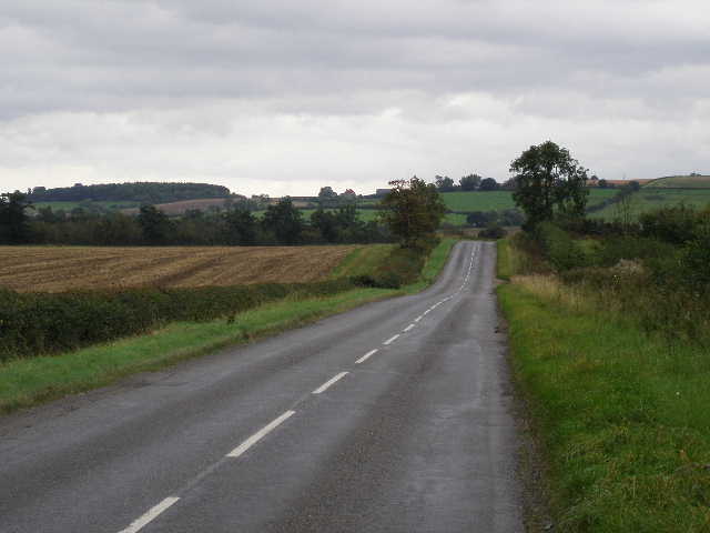
[1] The road heading towards the T-junction
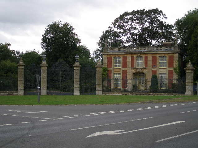
[2] Lodge gate and house near Waddesdon
[3] The bridleway heading for Waddesdon Hill
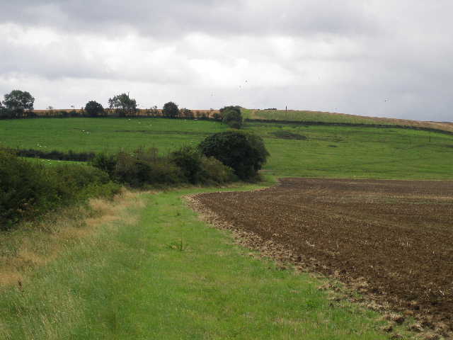
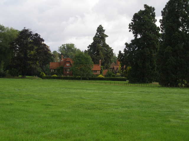
The road ended at a junction, a slightly staggered crossroads, with the A41 Trunk road, between Aylesbury (about five miles to my left) and Bicester. The village of Waddesdon was about half a mile to my right. On the other side of the junction was a tall iron gateway and a house [2], obviously an old entrance and a lodge on the Waddesdon estate. Across the main road, I went through a gate in the hedge and turned left, following the hedge with a ploughed field on my right and Waddesdon Hill beyond – I could see Waddesdon Stud where the road reached the top of the hill. The bridleway soon went through a hedge gap into a far larger ploughed field, where the hedgerow bore slightly right for quite some distance, then turned fully right to head towards the hill [3]. I went through another gate, and climbed quite steeply through an empty pasture. I heard and then saw a Buzzard to my right here. Through another gate I continued uphill, still with a hedge on my left but now in a large field of stubble. To my right I could see Waddesdon Manor [4], almost surrounded by trees on its hilltop setting.
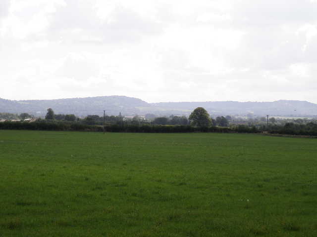
The ground levelled off as I reached the top of Waddesdon Hill. I didn’t notice it until I came back in the afternoon, but I passed a trig column in the hedge (147 metres above sea level). As with Quainton Hill on the previous walk, Waddesdon Hill is only a few hundred feet high, but because most of the surrounding land is very flat it has quite extensive views. I could see back to Quainton Hill, while to the south I could see the Chilterns extending as far east as Dunstable Downs. The first patches of blue sky appeared as I climbed the hill, but the views were far better in the bright sunshine when I returned here in the afternoon [5].
[4] Looking towards Waddesdon Manor from Waddesdon Hill
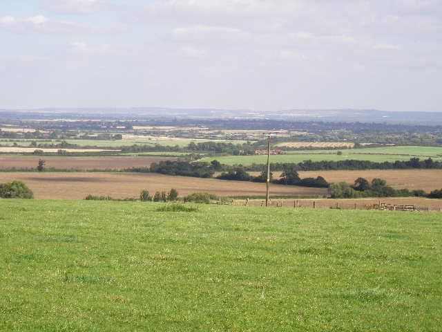
[5] Vale of Aylesbury from Waddesdon Hill (afternoon)
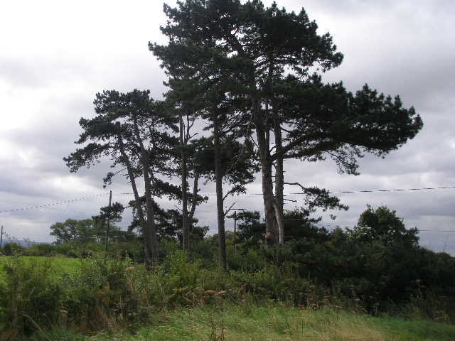
[6] Corsican Pines on Waddesdon Hill
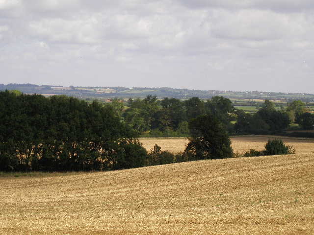
On the far side of the stubble field I reached a lane, with a small group of Corsican Pines on my left [6]. I was now on familiar territory – Waddesdon Stud was a short distance to the right, and I’d previously walked this lane on the North Bucks Way, Aylesbury Ring and Bernwood Jubilee Way. I turned left and followed the lane between hedges as it descended slightly. After about quarter of a mile I reached North Lodge (obviously a lodge on the Eythrope Park estate that adjoins the Waddesdon estate) where I took a track just to the right of the house. I stopped and took the usual photo of the attractive Thame Valley [7], and then continued on alongside a right-hand hedge. On my way back, I realised that one of the trees in the ploughed field to my left was clearly a Horse Chestnut, not a Black Poplar as I supposed when I walked here on the Bernwood Jubilee Way in February! Still there was a Poplar tree of some sort just a little further on in the field.
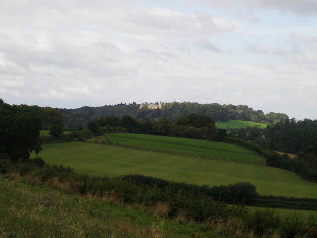
The bridleway passed a small wood on the right [8], where I heard another Buzzard, then became a green lane between hedges as it continued to descend. Where the ground levelled off, I left the familiar route through the Eythrope Estate that I’d used on the three earlier walks, and turned left alongside the hedge of another ploughed field. The ground was hard and a little uneven here, as it would be on several parts of the route today. After a few hundred yards I reached the end of the hedge and the field, and continued across the grassland ahead of me, clearly part of the parkland of the Eythrope Park estate as the grassland was dotted with mature trees and small copses. Indeed I could now see the grand house itself over to my left [9], the first time I’d seen it as it’s not really visible from the route I’d taken through the estate on my earlier walks.
[7] The Thame Valley from near North Lodge, Eythrope Park
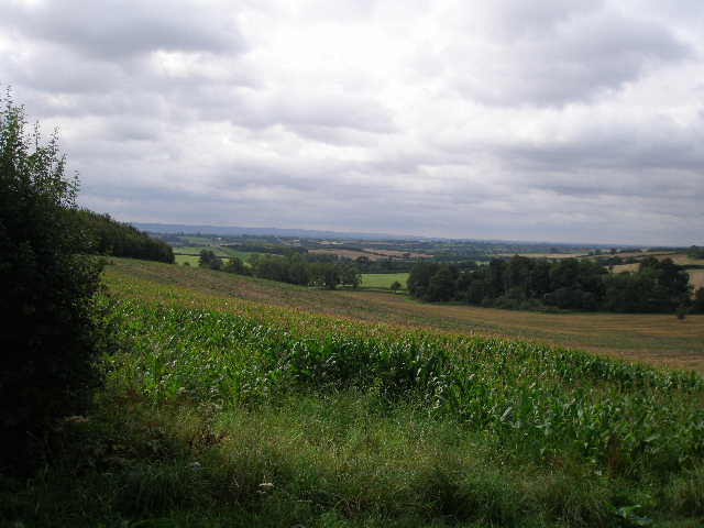
[8] Looking towards the Chilterns from the Eythrope Park estate
[9] Eythrope Park
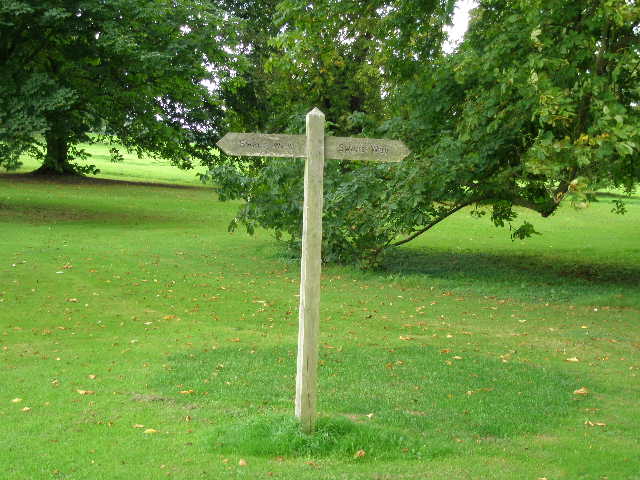
The bridleway ended when it reached the drive to the house by a gate, where I turned right. There were several impressive mature trees along the drive, many of them Horse Chestnuts [10] – it was quite windy in the afternoon, and when I came back I saw that some conkers had been blown down already. I passed a wooden fingerpost for Swan’s Way [11], and rejoined the route of the North Bucks Way, etc., where the drive turned to the left.
The drive then went through an area of grass without any trees, where it was crossed by a temporary track being used by two dumper trucks that were taking mud dredged from the nearby river Thame. I soon reached another lodge house, on my left, and a post that had waymarks for all six long-distance paths that go through this spot. The Bernwood Jubilee Way turned right here, but I continued along the drive and crossed the ornate bridge [12] over the river Thame – I could see why it needed dredging, there seemed little flow of water and a large expanse of bare mud to the east of the bridge [13].
[10] The drive from Eythrope Park
[11] Swan's Way fingerpost
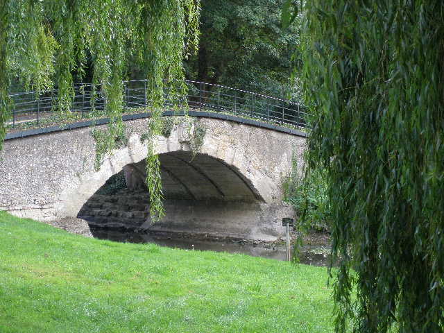
[12] Bridge over the river Thame, Eythrope Park
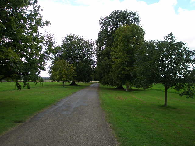
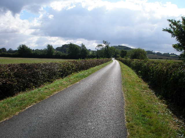
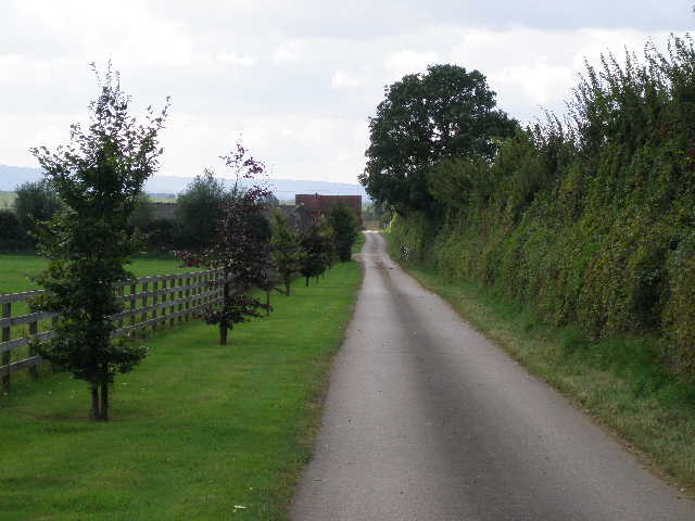
A few yards further on, the North Bucks Way turned left to head towards Upper Hartwell, and after another couple of hundred yards the Aylesbury Ring went right towards Dinton. I continued along the drive, now a tarmac lane with wide grass verges between low hedges [14]. There were pleasant views either side along the Thame valley. After a while, the drive started to rise gently up the other side of the valley. At one point there was a field gate in the hedge on the left, where there was a nice view over the Thame valley towards the villages of Hardwick and Weedon which I had passed through on the Aylesbury Ring [15]. I then reached the outskirts of the village of Stone – the first house was a nice thatched cottage on the right, where I had a nice chat with an elderly gentleman on my way back. The drive now became Eythrope lane, which I followed to the main road in Stone.
I crossed the busy road at a crossroads, reaching a duck pond [16] and the village church [17]. There was an unusual avenue of pine trees in the churchyard. I would have liked to look round the church, but the porch door was locked – according to the Swan’s Way leaflet, the church is partly Norman and has an interesting Norman font. I now followed the road through the village that headed south towards Bishopstone, soon passing a recreation ground on my left (where I’d later stop for my lunch). After about half a mile I crossed another road. So far through the village I’d been on a pavement, but now the road went through countryside and there was neither pavement nor much of a verge, so I often had to stop when vehicles passed.
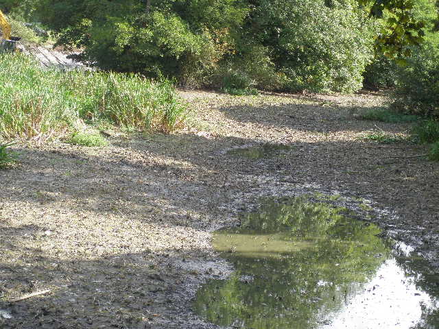
[13] The dried up river Thame
[14] The drive from Eythrope Parke to Stone
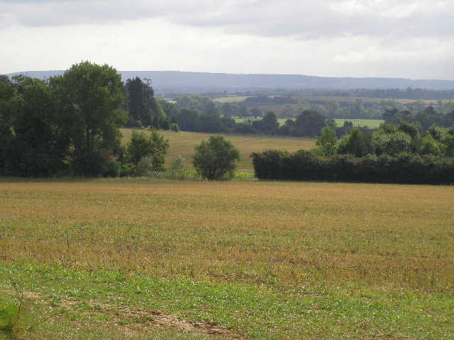
[15] View over the Thame Valley from the drive to Stone (afternoon)
As I’d walked through Stone, I’d been feeling slightly disappointed that I hadn’t seen a Red Kite as I’d walked through the Eythrope Park estate – I’d been looking forward to this walk, as I’d seen Red Kites in the Waddesdon and Eythrope area on previous walks, and I hadn’t seen one for a while (I had a fleeting glance of one on a local walk at Pitstone Hill a couple of months ago, before that the last one was at Whipsnade on the last day of my Chiltern Way walk this Spring). Now, as I passed a gap where there was a gate in the tall hedge to the left of the road I saw the outline of a bird just above the skyline some way off – I went over to check, and soon realised that my initial thought was right, it was a Red Kite! It was flying low over a stubble field, heading towards the hedge a little to my right. When it got there, I turned and continued down the road and soon got a very good close-up view of it as it soared slowly over the road.
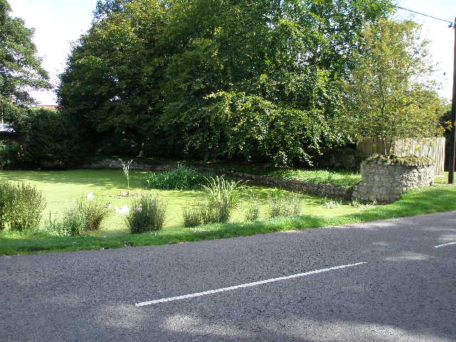
[16] Duck pond, Stone

[17] Stone church
[18] The Chilterns from near Bishopstone
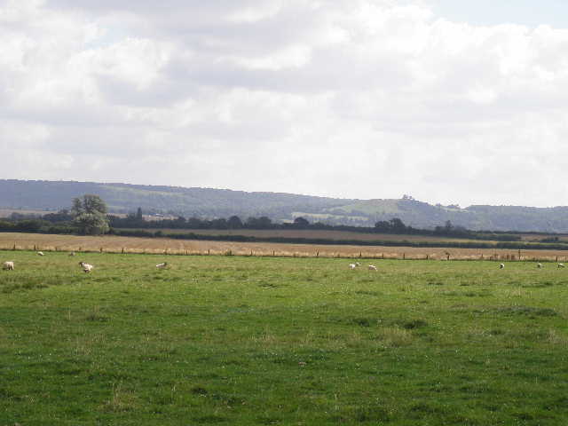
I now turned left down a tarmac drive, immediately before a thatched cottage where a couple of dogs barked. I now saw a couple of Red Kites some way off across the ploughed field on my left, and beyond them the line of the Chiltern Hills [18], now not too far away. I could recognise individual hills along the escarpment, including Coombe Hill, Beacon Hill and Pulpit Hill, familiar from previous walks. The tarmac drive ended at a house [19], but the bridleway continued along a grass track beside a right hand-hedge – a farmer in a tractor was harrowing the ploughed field on my left. In the field corner, the bridleway turned left alongside the same field (I had another good view of a Red Kite here), then turned right in the next corner, passing a much smaller ploughed field on the right and then becoming a short grassy track between hedges to reach a gate.
The gate gave access to a narrow empty pasture (I had an annoying mishap here on the way back, managing to get tar or creosote from the gate post on my hands and shirt). On the other side I had to go through two gates to reach a very large sheep pasture. I had to use my map to work out exactly where I needed to head across the pasture. The map showed that I was crossing the remains of the mediaeval village of Moreton, but I didn’t really notice any odd lumps or bumps in the ground here. According to the map there are a dozen or more such deserted villages in this part of the Vale of Aylesbury, there was another at Eythrope Park and I passed one just north of Quainton Hill on my last walk. The Swan's Way leaflet says many of them were deserted as a result of a change from cereal crops to sheep farming in the late mediaeval period.
I finally spotted a couple of waymarks on the far side of the huge sheep pasture, and went through a gate onto the gravel drive of a modern bungalow, where a couple of Spaniels barked. I followed the drive to the left. Over a crossroads of drives, I then went through a gate on my right, and continued a short distance between a hedge and a wire fence on my right. Beyond the hedge was another modern property at Moreton Farm, while on the other side of the fence was an area that had been planted with young trees by the landowner in association with the Forestry Commission, with a few permissive paths through it.
[19] The start of the bridleway to Kimble Wick from Bishopstone
[20] Another view towards the Chilterns around Beacon Hill
[21] The Track to Kimble Wick
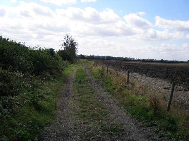
Swan’s Way soon went through a gate, and continued southwards along the right-hand hedge of a large stubble field. Almost directly ahead of me was Beacon Hill – the Prime Minister’s country retreat at Chequers lies just behind it [20]. As I neared the far end of the hedge, I met a lady walking her three dogs. In the field corner I turned right along a farm track – I was now back on the route of the North Bucks Way. I followed the track [21] for about a third of a mile, until it turned to the left at a point where the Aylesbury Ring took a footpath going right. The village of Kimble Wick was only about three quarters of a mile away, but this was as far as I was going today and so I turned and started to make my way back.
It was now about 12.45pm. I had a second Alpen bar to keep me going (I usually have one about 11.30am) as I thought I’d be having a late lunch – one problem following a long-distance bridleway is that they always have gates rather than stiles, so I seldom get a chance to use a stile for my lunchtime stop. As I headed back, I noticed that I was walking into quite a strong wind (typically, I hadn’t noticed it at all when I had it on my back). It wasn’t that strong, but I felt it’s impact and this was the first time I could remember walking into a stiff wind since I went through Flitwick on the John Bunyan Trail (and that was nine months ago, last December!).
I stopped for lunch about 1.30 sitting on a bench in the recreation ground at Stone. I sat facing the village football pitch (the imaginary team in red beat the imaginary team in blue 3-0!). I enjoyed the walk back – the skies had been gradually brightening all morning and it was a bright and sunny afternoon. I had another close-up view of a Red Kite as I walked through the Eythrope Park estate, and the views from the top of Waddesdon Hill were much better in the afternoon sunlight. I got back to my car about 3.30pm.
Any walk on which I see a Red Kite is a good walk as far as I’m concerned, but I think I’d still have enjoyed this one if I hadn’t seen them. There were good views from Waddesdon Hill, and for much of the way there were nice views ahead to the northern escarpment of the Chiltern Hills. I’ve always enjoyed the walk through Eythrope Park and the Thame valley, and it was nice to take a slightly different route there this time. The field paths from Stone towards Kimble Wick were pleasant, though very flat. It was nice that the sun came out and things brightened up, as it made a change from the rather gloomy and grey conditions of the last couple of walks.
Total Distance: 37.4 miles each way, approximately