Pete's Walks - Swan's Way
If you are considering walking this route yourself, please see my disclaimer. You may also like to see these notes about the maps and GPX files.
Day 9 26/09/07 Grim’s Ditch to Goring (6.3 miles each way, approximately)
Parked in car park in Goring.
It was a week since my previous walk on Swan’s Way – I’d needed some work doing on my car, so in the meantime I did a local walk (my favourite one, to Nettleden and Hudnall) and then did a surprisingly pleasant walk in Milton Keynes while my car was at the garage.
It was a long drive this morning, taking about an hour and twenty minutes plus five minutes to get some petrol in Chinnor. I chose to do the walk ‘backwards’, as I often do when completing a long-distance path, so I parked in Goring and first walked back to Grim’s Ditch. It was much colder today than last week, and I was wearing a warm Paramo shirt for the first time this autumn. There was quite a strong wind from the North-East, so about halfway to Grim’s Ditch I donned my waterproof jacket (my fleece would have been too warm on top of the shirt). Having left Goring at 10.30am, it was 12.20 when I reached Grim’s Ditch and turned round.
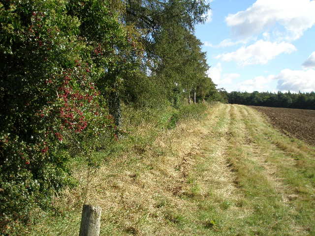
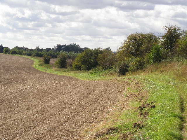
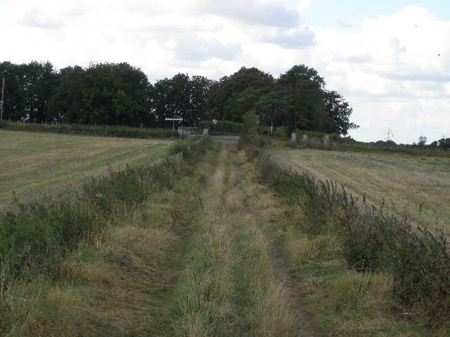
[1] The path along Grim's Ditch heading north towards Nuffield, from the lane at the start of the walk
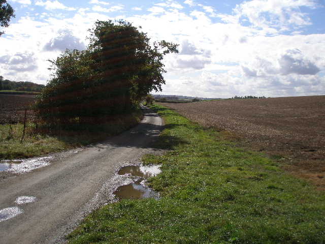
[2] Looking along the lane at the start of the walk
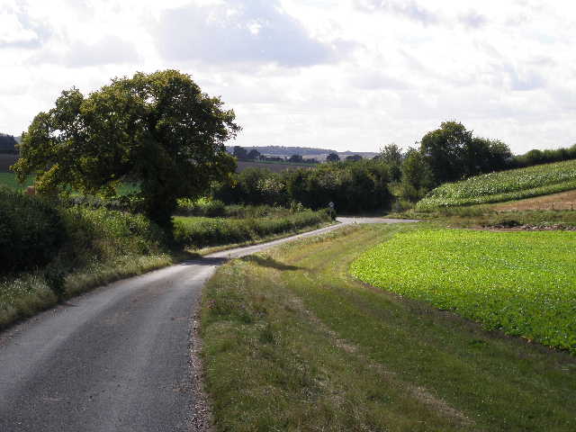
[3] The lane heading to a T-junction and the start of a bridleway
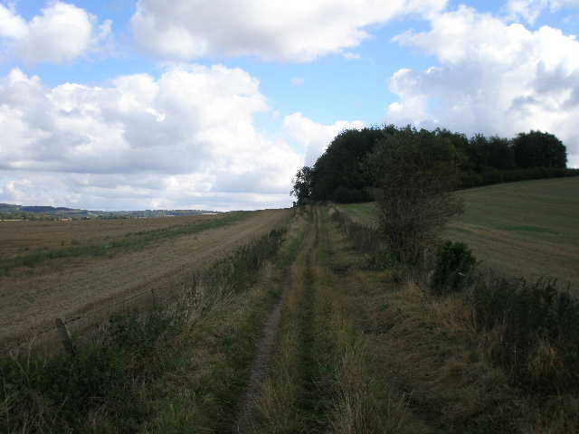
Swan’s Way continued down the lane where my last walk finished [1,2] (it’s called Icknield Way, and the first half of the walk would be following the route of that ancient trackway). Initially I was also on the route of the southern extension of the Chiltern Way, but this turned left along a farm drive after about a quarter of a mile (en route for Poors Farm and Hailey). I stayed on the lane a short distance further until it came to a T-junction [3], where I continued ahead on a bridleway.
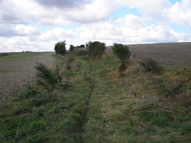
I still had the northern slope of the Chilterns a short distance to my left, but here the escarpment was much gentler – there were fields sloping up to the woods at the top of the hills, rather than steep slopes of grass and scrub. The bridleway briefly had hedges either side, then ran along a headland between fields of some type of root crop. It passed through a very slight valley, with the intriguing name of Drunken Bottom [4]. There was some chicory growing along here, and I would see it in several other places on today’s walk. I next passed Cobblers Hill on my right, a small eminence covered by a ploughed field. Soon there was a hedge to my right with another ploughed field to my left [5], beyond which I reached another lane.
[4] The bridleway through Drunken Bottom
[5] The bridleway near Cobbler's Hill
[6] The bridleway beside Larkstone Stud
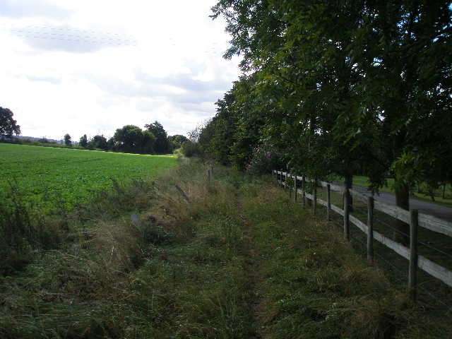
On the other side of the lane the bridleway continued, now with a hedge or fence separating it from a drive leading to Larkstone Stud [6]. There were one or two nettles across the path here, and I managed to get stung. The bridleway continued with some mature trees either side, with occasional views out to my left over more ploughed fields and the Chiltern Hills slowly declining towards the Thames. The bridleway than ran along between two neat hedges of mainly holly [7], descending slightly to reach another crossing lane.

[7] The bridleway between Holly hedges
[8] View towards the Chilterns from beside the A4074
[9] Start of the bridleway over Watch Folly
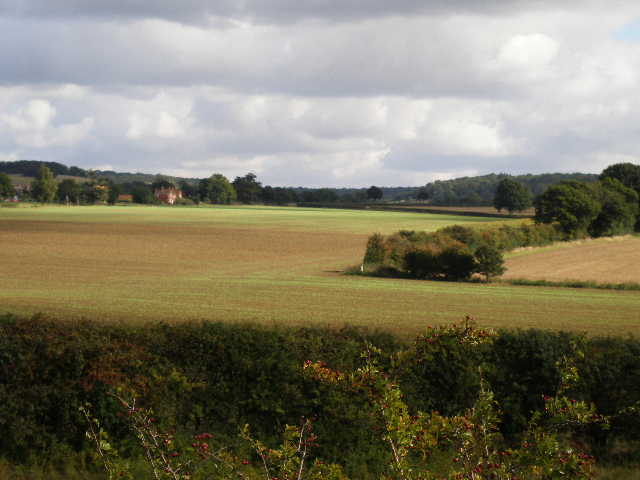
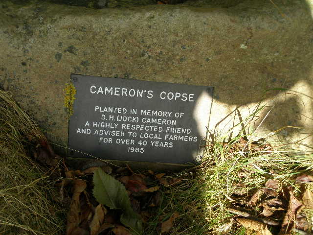
Over the lane I went through a small copse and across another field where some root crop was just emerging from the soil. The path here wasn’t too clear, most unusual for a bridleway. On the far side I went through a hedge gap, and crossed the A4074 (a road I used to get to Woodcote and Whitchurch Hill on the Chiltern Way) [8]. The bridleway carried on in the same southerly direction, now crossing a chalky ploughed field where I saw a Red Kite over to my right. On the far side of the field, Swan’s Way turned right on another bridleway, finally leaving the route of the ancient Icknield Way which I’d been following so far. The new bridleway rose slightly alongside a fence [9] as it went over a small hill called Watch Folly. I stopped for lunch at the top (it was now about 1.10pm) [10], sitting on a stile in the fence (curiously there was a footpath waymark and a clear path heading across the adjacent ploughed field, but no such path was shown on my map). There was a small copse here, and a plaque on a stone saying that it was called Cameron’s Copse and that it was planted in 1985 in honour of D.H. (Jock) Cameron, a respected friend and advisor to local farmers for more than 40 years [11].
[10] Looking towards the Chilterns from Watch Folly
[11] Memorial plaque, Cameron's Copse
[12] The bridleway descending from Watch Folly
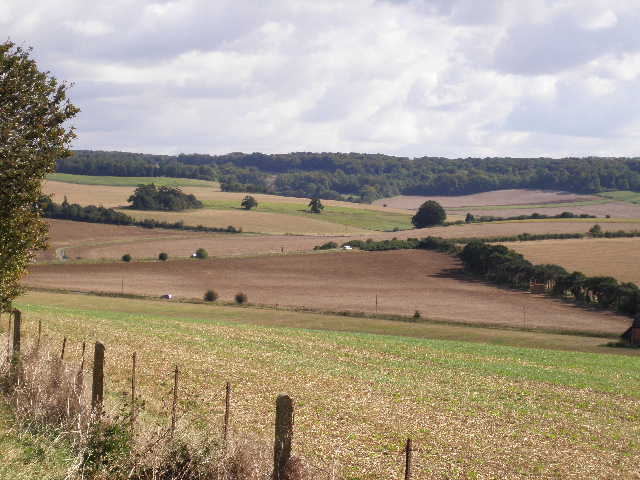
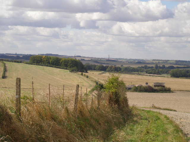
Lunch over, I continued alongside the fence down the other side of the hill [12]. I’d seen a Buzzard here earlier. Ahead of me was the flat expanse of the Oxfordshire Plain, dominated as ever by Didcot Power Station. More to my left was the line of the Wessex Downs, heading west away from the Thames Gap that separates them from the Chilterns. I passed some old farm buildings to my right at the foot of the hill, and then the bridleway rose slightly again as it crossed the northern end of White Hill. There was another copse here [13], larger and obviously much older as it contained many mature trees. The bridleway, now a broad track between stubble fields, led down to a road [14], which I’d earlier driven on to reach Goring.
[13] Looking back to the copse on White Hill
[14] Approaching the road to South Stoke
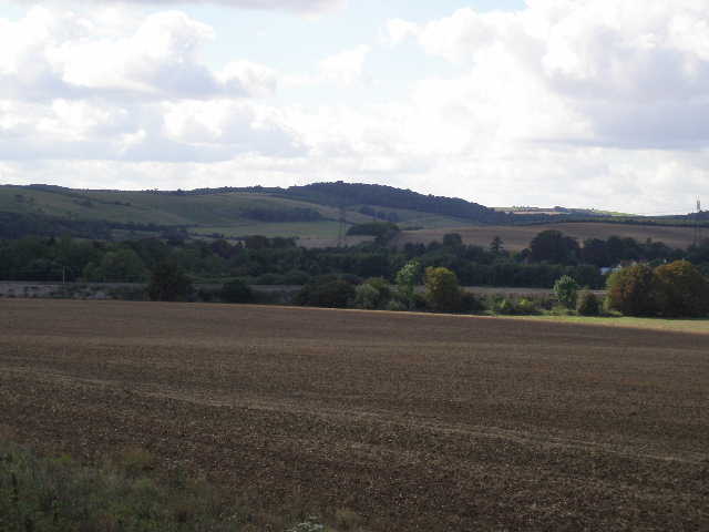
[15] View over the Thames valley to the Wessex Downs, from the road to South Stoke
I turned left along the road. There wasn’t too much traffic, but I had to step onto the verge and stop when cars came from the opposite direction – the verge was long grass and very uneven, not too safe for walking on as I could easily have stumbled. I passed more chicory as I walked about half a mile or so towards the village of South Stoke [15]. I went by a few houses on my left, then turned right down a lane towards the main part of South Stoke, close to the river Thames. I passed under a brick railway bridge [16], and turned left along the main street when I reached a junction. I was now back on the route of the Ridgeway path again.
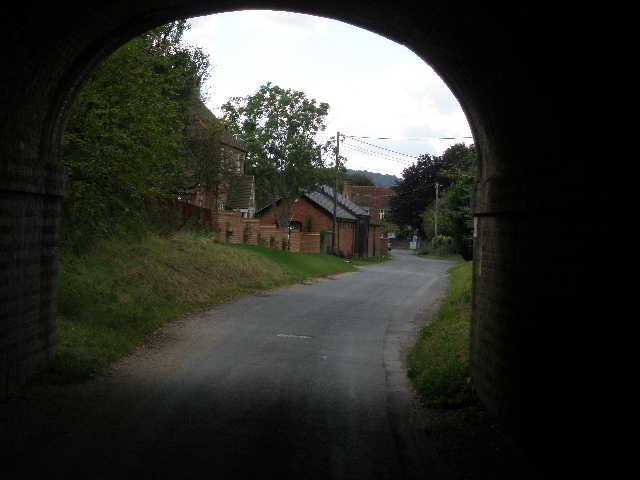
[16] Looking through the railway bridge, South Stoke
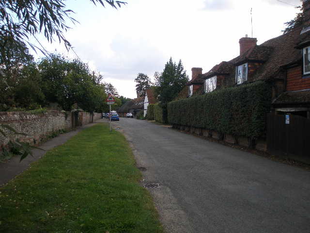
[17] South Stoke
[18] South Stoke church
South Stoke [17] is an attractive village with many old houses and cottages of various dates, some thatched. I passed the church [18] on my left and the village pub, the Pike and Perch. At the end of the village the road turned left, but I continued ahead on a bridleway, with the Thames a short distance to my right. After a short distance the bridleway became a private drive [19], running past some obviously fairly exclusive residences. A bit further on I reached a stretch where the drive separated some residences on my left from the lower part of their gardens, which sloped down to the river on my right. Across the river I could again see the Wessex Downs [20].
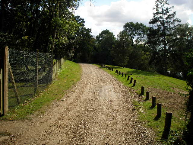
[19] The private drive near the Thames
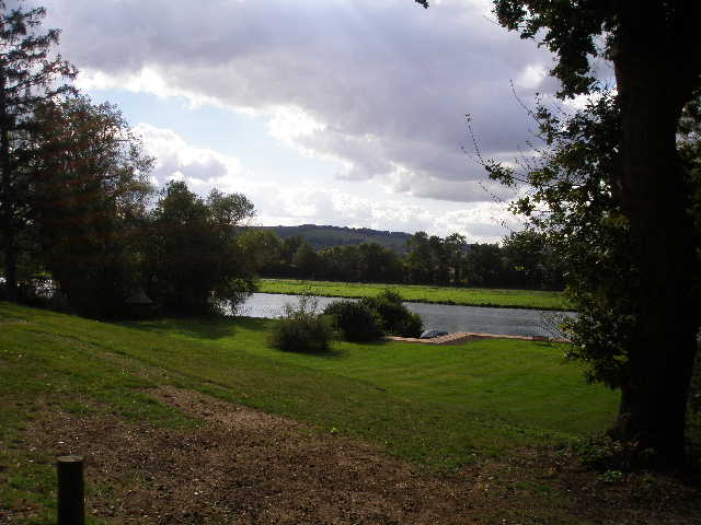
[20] Looking across the Thames towards the Wessex Downs, from the private drive
[21] Recreation ground, Cleve Road, Goring, where Swan's Way ends
The private drive ended where it reached the access road for a riverside pub called The Leatherne Bottel, but the bridleway continued on ahead, generally between a hedge and a fence on the right, so there were seldom views of the river. The bridleway then became a short private drive again, and ended at a bend on Cleve Road, Goring. Here I continued ahead along the road, and reached the end of Swan’s Way at a recreation ground on the left [21]. It was now about 2.35pm
I was lucky with the weather. Apart from the cold wind it had generally been a bright and pleasant day, but I’d noticed it starting to cloud over as I got back to Goring, and it actually started to rain just as I drove out of Goring. Good timing!
I enjoyed this walk, apart from the section along the main road to Goring. It was a very straightforward walk, very easy to navigate, and there were good views to be seen for much of the way – along the Chiltern Hills, or over the Oxfordshire Plain or across the Thames Valley to the Wessex Downs. The one disappointment, view-wise, was that I didn’t have too many good views of the Thames, despite being very close to it for a couple of miles. I saw a Buzzard and a few Red Kites, but not much else in the way of wildlife.
Total Distance: 64.7 miles each way, approximately