Pete's Walks - Ver-Colne Valley Walk
If you are considering walking this route yourself, please see my disclaimer. You may also like to see these notes about the maps and GPX files.
Day 2 23/05/09 Near Colney Street to Watford (5.5 miles each way, approximately)
Parked in car park in Drop Lane, Bricket Wood.
I wasted 20 minutes on my journey to the start of the walk this morning. Looking at my OS map last night, it looked a simple route to Colney Street - from Kensworth, down the A5 to M1 at Junction 9, south on the motorway two junctions to Junction 7, then along the M10 a couple of miles to its end and I would almost be there. Unfortunately the motorway system here has changed. Heading south from Junction 9, the next junction was marked as Junction 7 & 8 which really confused me - as it didn't mention the M10 I decided to carry on. But the next junction was 6A, the M25 - I had to turn off, go to the next junction on the M25 and turn round. Going back north from the M25/M1 junction, the next Junction was Junction 8 - I remembered from my map, that you can only go west from that junction to Hemel Hempstead, the opposite direction to the one I wanted, so I returned to Junction 9, turned round and started again! Turning off at Junction 7 & 8, I found the road ran parallel to the motorway for some distance before turning east. The M10 had been scrapped and was now part of the A414. Anyway, I finally managed to find the car park on Drop Lane (actually in the borough of Bricket Wood rather than Colney Street) and started walking at about 9.50.
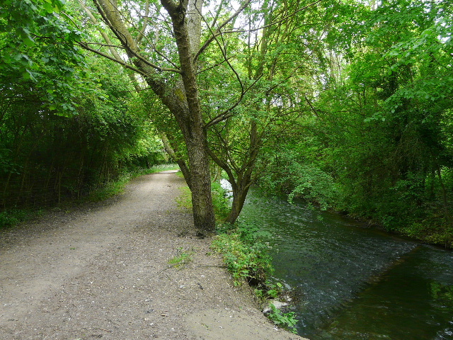
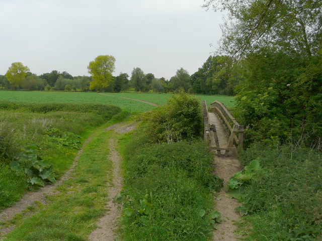
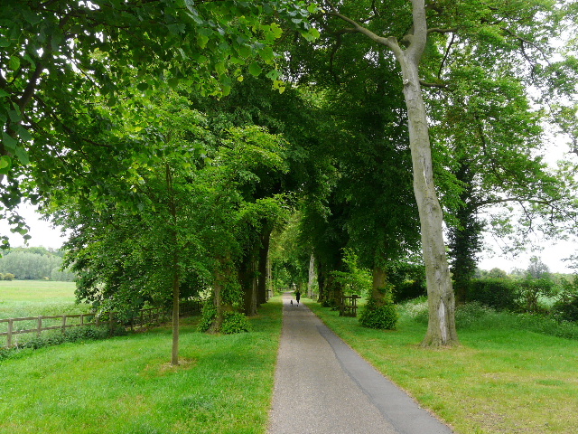
[1] The 'Riverside Way' near Colney Street
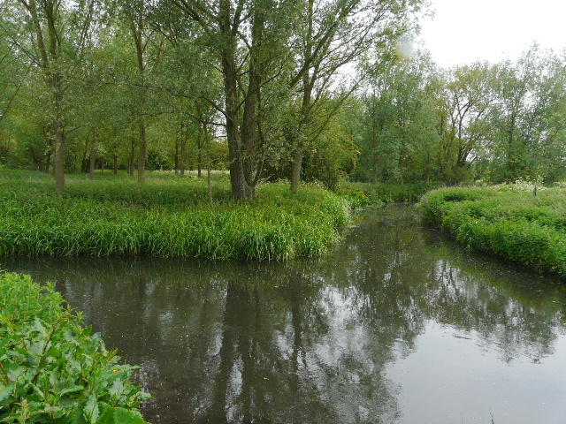
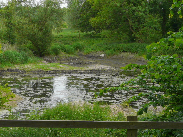
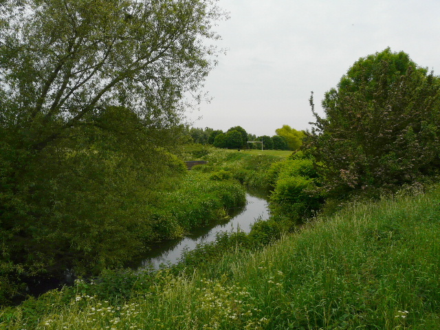
[2] The confluence of the Ver (coming in from the left) and the Colne
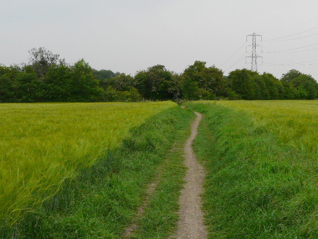
[3] Footpath through a Barley field
It was a disappointingly grey and almost overcast morning, not as nice as the forecast on the London News had said it would be. Very surprisingly (to me at least!) this was actually the first time I'd continued a walk on a Long-distance Path since I finished Swan's Way, almost 20 months ago. The path ran initially between bushes and garden fences, then crossed a footbridge and continued as a wide and well-surfaced track following the river Ver on my right. This was 'Riverside Way' [1], an easy-access path for walkers and wheelchair users that ran beside the river for about three-quarters of a mile, with several benches and at least one picnic table, plus a few wooden sculptures. It made for a pleasant start to my walk, between the river and a thick hedgerow, with numerous trees along the riverbank. I spotted Water Crowfoot and Yellow Iris again along the river.
I crossed another footbridge and followed Drop Lane for a hundred yards or so. I then continued on a footpath beside the river - I was glad that I wasn't taking a bridleway that went further left here, as I'd have got my feet very wet trying to use the stepping stones across the river at this point. As I walked along between the river and a green corn field, I totally forgot that I was passing the point where the river Ver met the river Colne and so I had to remember to look out for the confluence when I returned [2] - in fact there was a clear path through the nettles bordering the river at this point, so other people clearly had wanted to see where the rivers met. So far the route had been reasonably well sign-posted with 'Ver Valley Waymarks', but unfortunately the rest of the route along the Colne to Watford didn't seem to be waymarked at all.
I crossed another footbridge back to the left bank of the river, now the Colne, and followed a wide path through a field of green barley [3]. My route then turned right, along a well-surfaced bridleway running between hedgerows. I followed the bridleway for some distance, as it ran parallel to the river a field or so to my right. I passed a turning to a farm on my right, and further on passed an isolated cottage. I saw several different waymarks at path junctions, but nothing for the Ver-Colne Valley Walk, so I was guided only by the route shown on my OS map. After a while I had a wood on my left, and a large cabbage field to my right [4]. There was a lot of Red Campion here (I'd see it often throughout the walk) and just one White Campion - next to it was a clump of 'Pink' Campion [5], where the two had hybridised as they commonly do.
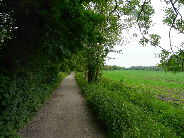
[4] The bridleway
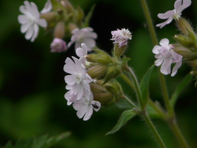
[5] 'Pink' Campion, the common hybrid of Red and White Campion
[6] Redundant footbridge
At the end of the wood I reached a path junction, where I turned right and crossed a footbridge [6] (redundant really, as this side stream was currently dry), briefly joining the Hertfordshire Way as I crossed the cabbage field. Another footbridge took me back across the Colne, and I then turned half-left through the parkland of Munden House [7]. After a short distance I reached a drive to the house, where I turned left. I met several dog-walkers and joggers as I followed the drive, with pleasant views over the flat Colne Valley to my left. The drive passed a large pond [8], and a little further on ran between an avenue of majestic beech trees [9]. Eventually it crossed over the M1 motorway (I wrongly thought it was the M25 at the time!), and then there were houses and gardens just to my right, as I was now on the edge of Watford.
[7] The path through the park of Munden House
[8] Pond in the park at Munden House
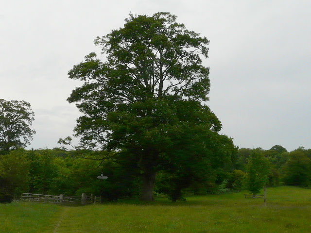
[9] The drive from Munden House
The drive ended at some ornate metal gates. I carefully crossed over a dual carriageway, and continued along a cycle path, again with houses and gardens close-by on my right. The path ran through grass and trees, with the river hidden by nettles and other vegetation just a few feet to my left. I seemed to be in a long linear park, and in fact that was exactly what it was - at the end of a dark avenue of trees, I passed a sign saying it was the Colne Valley Linear Park [10]. This was the end of the park though, and I now continued ahead beside a residential road. There was still a strip of grass though, and the river to my left [11]. The map showed the route crossing some playing fields next, but in fact there was a clear path running along the edge of the river, as it curved left and then right, next to the playing fields. This was marred slightly by the road noise from the far side of the river, though the road was hidden from view by the riverside bushes and trees [12].
[10] The Colne Valley Linear Park, Watford
[11] River Colne, Watford
[12] River Colne, Watford
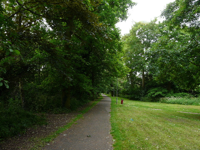
Where the playing fields ended, I rejoined a surfaced cycle path and went below a road bridge, continuing on for several hundred yards with allotments on my right [13]. The route crossed another road, and a cycle path continued beside a large area of grass on my right, another park or playing area. In fact, on my way back I found that again there was a pleasant path cut through the vegetation along the river bank on my right. At the end of the playing area, the cycle path went under a tall railway viaduct [14]. It then a passed a small obelisk - a brass plaque on the ground said it was a 'coal post' one of several erected around the edge of London in the 1860s to mark where tax on coal being imported into London could be paid [15]. I remembered seeing another one in the wood near Broxbourne on the Hertfordshire Way. I passed another small park and a children's playground, the cycleway here running along a line of tall trees. The river on my left seemed to have been somewhat 'canalised' along here, straightened and with obviously man-made banks.
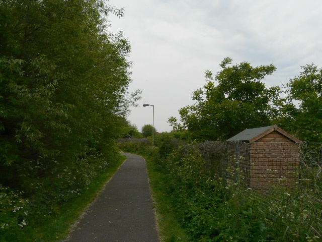
[13] Cycle path past allotments, Watford
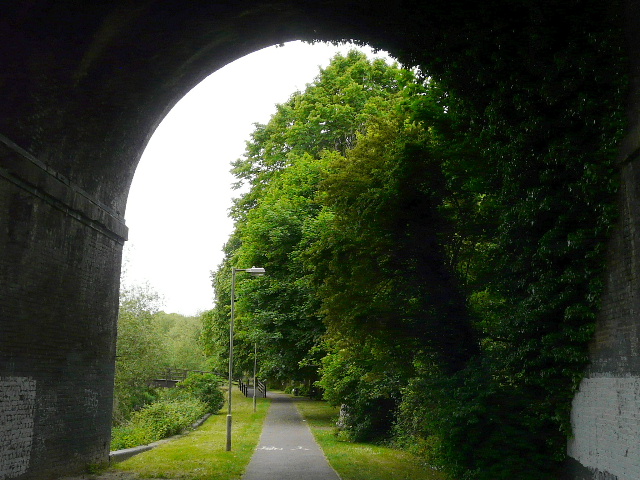
[14] Railway arch, Watford
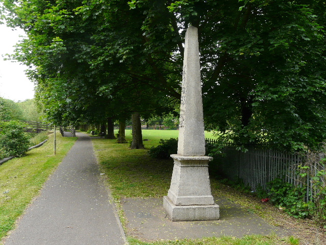
[15] 'Coal post', Watford
Just after crossing another road, I came to a fork where the map showed I should bear right, away from the river. This path took me past a giant Tesco superstore to reach a main road at a T-junction. The green diamonds on the map had now run out, and so I assumed this was the end of the Ver-Colne Valley Walk. I did wonder if the end might actually be at the railway station just up the road, but if so I thought there would have been another Green Diamond on the map. So I turned round and headed back.
It was now about 11.40am, the walk so far having taken one hour and fifty minutes. It was a straightforward walk back to the car, and I had lunch on one of the benches along 'Riverside Way' at about 1.30pm, just before getting back to the car park. The skies brightened up a bit on the walk back, and there was a bit of sunshine at last. As I crossed the footbridge over the Colne just before reaching Drop Lane, I saw some male Banded Demoiselle damselflies and as I walked back along the 'Riverside Way' I heard and possibly saw a Turtle Dove, but that was about it as far as wildlife went on this walk.
This was a shorter walk than I usually do, with hindsight it would have been better to split the walk at Park Side to get two walks of roughly equal length. It had been dull and grey for most of the time, unlike the much sunnier weather on Saturday, but still fairly warm (21C when I drove home). It had been a pleasanter route than I'd expected, although inevitably much of it was more like walking in a municipal park than in countryside.