Pete's Walks - Ver-Colne Valley Walk
If you are considering walking this route yourself, please see my disclaimer. You may also like to see these notes about the maps and GPX files.
Day 1 23/05/09 Redbourn to near Colney Street (9 miles each way, approximately)
Parked in car park on the common at Redbourn.
Redbourn is only a few miles from my home, so I was able to start walking about 9.30. Amazingly, considering this was a Bank Holiday Saturday, it was a beautiful sunny morning as I parked on the common by the historic cricket pitch [1] (some of the earliest games in the country were played here). I didn't really know exactly where the Ver-Colne Valley Walk started, the map showing it first going down a street leading away from The Cricketers pub. Next to the pub was some type of Museum, and outside it was an information board about local walks and the Ver valley. This seemed as good a point to start as anywhere, so off I went. (I have subsequently learnt that Silk Mill House, the home of Redbourn's Museum, houses exhibits ranging from Roman to modern times and is open at weekends. The house was built in 1857 for the manager of Woollam's Silk Mill which was on the site until 1938).
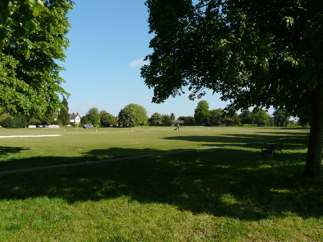
[1] The cricket pitch on Redbourn Common
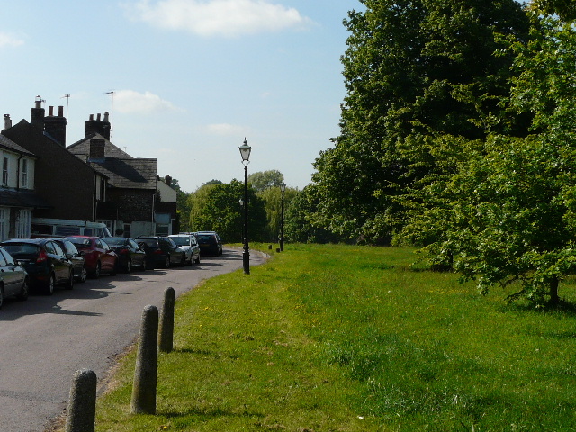
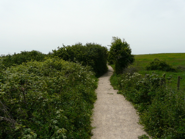
[2] The start of the walk
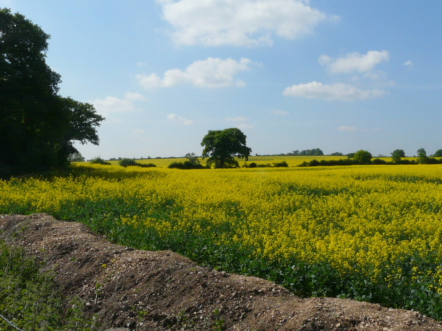
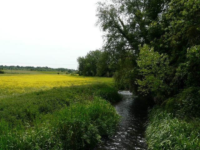
[3] Oil-seed rape fields near Redbourn
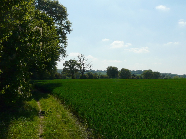
I turned left down the street by The Cricketers, with houses on my left and part of the large common on my right [2]. I saw my first Ver Valley Walk waymark here, which was reassuring (I assume that the Ver-Colne Valley Walk is an extension of the Ver Valley Walk to include part of the Colne valley). At the bottom of the street I turned left through a residential area, and within about a quarter of a mile I came to a T-junction on the edge of the village. A footpath continued opposite, initially along a drive which had been temporarily diverted while work was done on a new bridge over a stream. Within yards, the path left the drive, running beside a mature hedgerow with a huge field of bright yellow oil-seed rape on my right [3]. As always, the combination of yellow crop and blue sky was quite striking. After a few hundred yards, the path turned half-left, with a large, rather unkempt, paddock behind a fence on my left and the hedge now on my right [4]. The path then went along the gravel drive of a couple of properties to reach the A5.
[4] The path to the A5
[5] The path from the A5 to Redbournbury
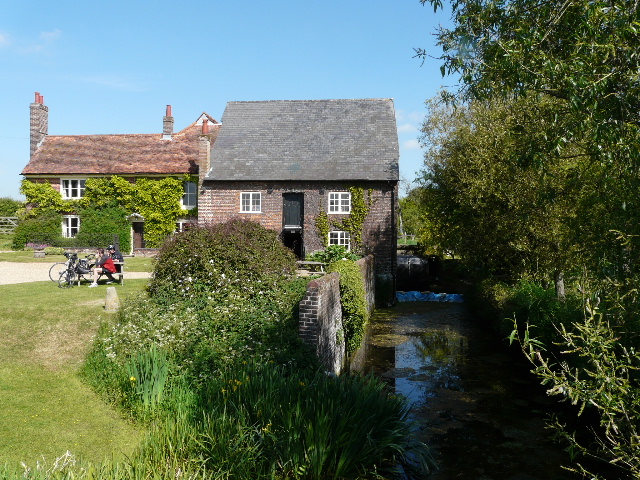
[6] Redbournbury Mill
Safely across the main road, the path continued beside a large green corn field, the hedgerow on my left slowly curving to the right [5]. Beyond the hedge were pastures or meadows, where I saw a couple of Herons take flight. The route from the edge of Redbourn to St Albans was the same as Day 7 of the Hertfordshire Way, which I walked about three and a half years ago - I remembered that when I came back this way, I found a calf had escaped from the pastures into the corn field, and was running up and down the hedge and fence trying to find a way back to its mother and the rest of the herd. I had told the farmer at Redbournbury farm, and he'd set off to get it. No such diversion today though, as I followed the pleasant path along the hedgerow to reach Redbournbury Mill [6]. There is now a bakery here, and they had a stall out selling bread and other of their products - I thought I'd buy something on the way back (I wasn't going to carry a loaf an unnecessary 15-16 miles!) but in the event it was closed when I came back.
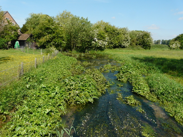
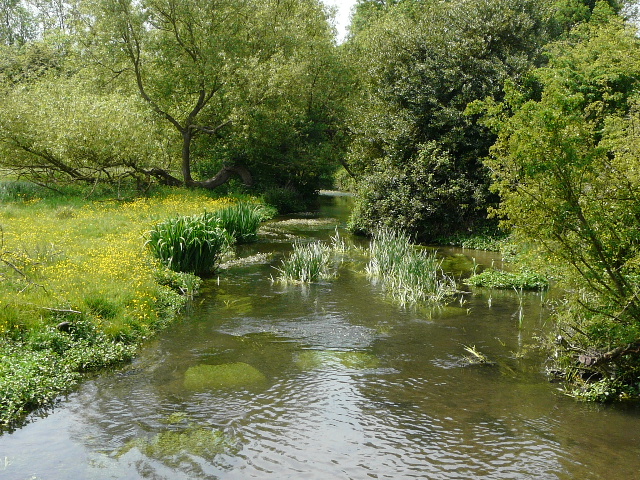
[7] The river Ver at Redbournbury
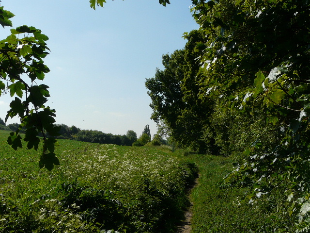
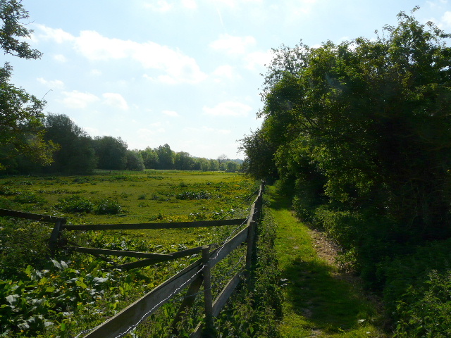
[8] Path just beyond Redbournbury
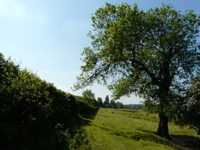
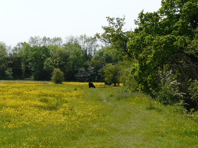
[9] Cattle pasture just beyond Redbournbury
I took photos as I passed the mill (a sign said the waterwheel was currently undergoing repairs) and crossed a bridge where I got my first view of the Ver [7]. Like the river Chess, which I followed on Wednesday's walk, the Ver is a chalk stream, with clear water on a gravel bed. Here there was some Water Crowfoot growing in the stream. I passed a pond and walked round to the left of Redbournbury farm (an information board said that it was part of the Crown Estates), passed a second pond, and followed a track a few yards, continuing ahead when it turned left and uphill. There was a field of beans to my left and a wooded area on my right for a few yards [8], but I soon came to a gate into a corner of a large pasture [9], with some mainly white cattle. I followed the hedge on my left, with views ahead of the meadows along the flat valley bottom (where I'd see a Red Kite on my return in the afternoon).
In the far corner of the cattle pasture, a gate led into a narrow nettle-lined path between hedgerows. There were occasional views over the meadows to my right, yellow with buttercups. Despite the proximity of nettles, this was pleasant enough walking, despite some road noise from the A5, a couple of fields away to my right. I crossed the drive to an industrial site, where a sign named some environmental services company (the noise from a radio wasn't doing much for my environment!). The path continued a little further, before joining a hard-surfaced farm track [10]. The river now ran along on my right, but I seldom saw any water because of the reeds and other vegetation - I saw some Banded Demoiselle damselflies here in the afternoon. After several hundred yards I passed a farm and another mill, now a private residence - here I met an elderly gentleman walking the other way, and I noticed he had a Hertfordshire Way guide book in his hand. He was probably only going to go as far as Redbourn, he said, but might go on to Markyate. He told me he was 80, and I said I hoped I would be as fit as him if I reach that age.
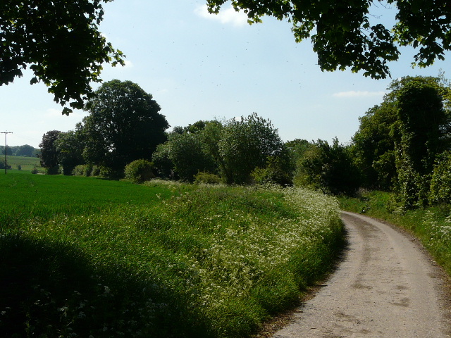
[10] The farm track beyond Redbournbury
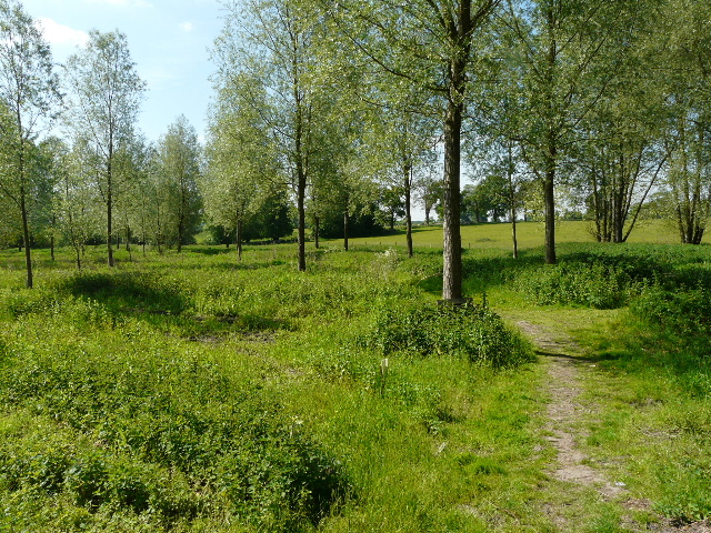
[11] Start of the permissive path through the Gorhambury Estate
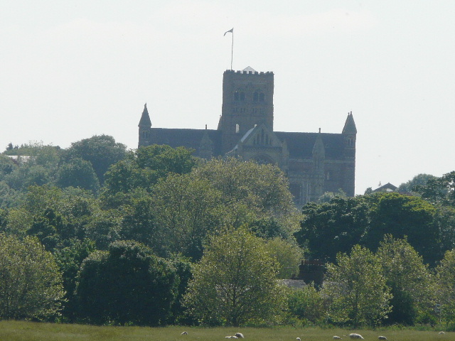
[12] Distant view of St Albans Abbey
In all my walks I've never ever met anyone doing the same long-distance path as me (although I did meet two people doing the Ver Valley Walk this afternoon) and I have very rarely met anyone that has done any of the the long-distance paths that I've walked. But this is now twice in the last month or so that I've bumped into someone walking the Hertfordshire Way, as I recently met a lady walking the section through Ashridge (she kindly emailed to say she appreciated my web site - I'm afraid I shamelessly plug it whenever I meet a fellow walker). Again it was the guide book in her hand that told me what she was doing.
I now followed a drive that passed a few cottages to reach the A5 by a brick bridge - I heard a Buzzard here, and looked up to see it being harassed by some crows. I crossed the road, and was delighted to see a Ver Valley Walk waymark pointing the way ahead along a permissive path through the Gorhambury Estate, the route used by the Hertfordshire Way. On the OS map, the Ver-Colne Valley Walk is shown following the A5 to the edge of St Albans, then turning right to reach the museum. The permissive path (which is occasionally closed) would save a mile of unpleasant road walking. I followed the path through trees [11], as it curved left to run parallel to the A5 (which of course is the old Roman road known as Watling Street). After a few hundred yards I came to a small brick building beside the river, presumably a pumping station. Here the permissive path turns right along a hard surfaced drive between grassy meadows. After a few hundred yards it came to a junction with another drive, where I turned left. Here I saw the grand house of Gorhambury in the distance, and also got my first glimpse of St Albans Abbey.
The hard-surfaced drive ran along an avenue of trees. After about a quarter of a mile it passed through a belt of trees, and now there were clearer views of the Abbey [12] and part of the city, across the large sheep pastures on my left (I believe much of the Roman city of Verulamium remains unexcavated below them). The drive continued for another half-mile beside the sheep pastures, with a long line of Red Horse-chestnuts on the right of the drive [13], very colourful just now as their red flowers were in bloom. At the end of the drive, the path passes the site of the Roman theatre (there's a charge to visit it, and as I've been before I didn't bother today). I carefully crossed over a main road and went down the street opposite (rejoining the route shown on the map). At a bend in the road I took a street going right, to reach the Verulamium museum [14] (well worth a visit if you are interested in the Romans!) and Verulamium park.
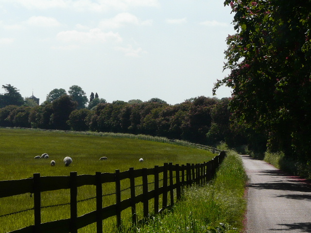
[13] The drive through the Gorhambury Estate
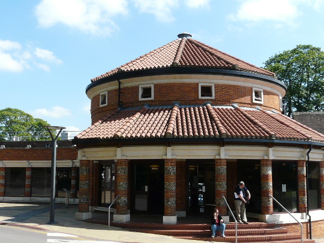
[14] Verulamium Museum
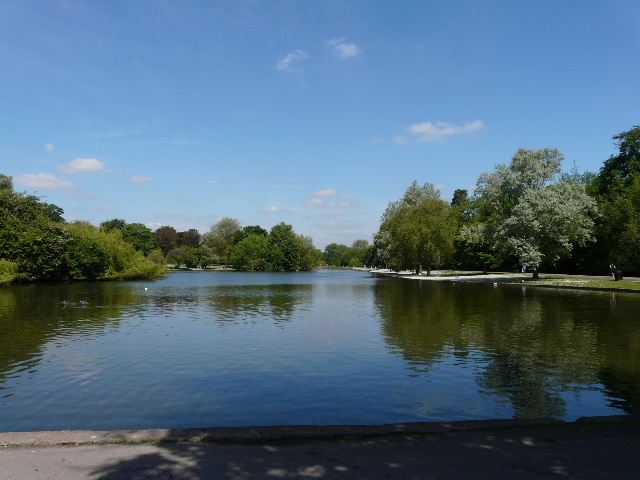
[15] Looking back along the lake in Verulamium Park
The initial route through the park wasn't very clear - the route so far had been well waymarked, but I couldn't see any signs here, and all I had to go on were a few unconnected green diamonds on the OS map. I turned right through the large museum car park, then went left along a clipped hedge through part of the large park. At a gap in the hedge after a couple of hundred yards I turned left, passing the Inn in the Park (where I only just resisted the temptation of an ice cream in the afternoon!). Having walked three sides of a small rectangle, I joined a path that had taken the direct route from the museum car park. I walked past the end of the huge lake in the park, and turned right, following a wide surfaced path between the lake and the river on my left. There were plenty of people about enjoying the pleasures of the park on this warm and sunny Bank Holiday Saturday, but the park was much more crowded on my return in the afternoon.
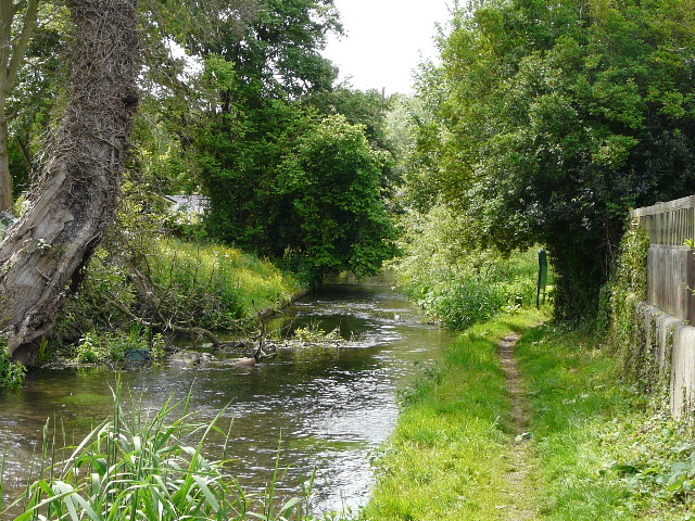
At the end of the lake [15], I went a few yards right, then resumed my previous south-easterly direction. I was still following close to the river on my left, with more of the green open space of Verulamium Park on my right. At the end of the park, I crossed a main road (the A5 again - although hereabouts its technically the A5183, apparently due to trunk roads being funded differently to other main roads) and continued beside the river on the other side. I noticed that there was sometimes less road noise here in St Albans than there had been by the meadows south of Redbournbury. The path soon crossed to the left of the river on a metal footbridge [16], continuing through an area of trees and Cow Parsley. I crossed another road, switching back to the right of the river and entered another park the 'Sopwell Nunnery Green Space' [17] - I've just noticed the map shows that the nunnery remains were just yards away to my right, I wish I'd gone to see them. The river here was fast-flowing and clear, and an information board mentioned Water Voles and Kingfishers. I passed under a bridge carrying a former railway line, and a little further on turned right to cross a playing field. A short track then led me to the residential street of Cottonmill Lane, which I followed to the left for about a third of a mile, the longest bit of street walking on today's route.

[16] River Ver in St Albans
[17] Sopwell Nunnery Green Space
[18] Ver Valley Meadows
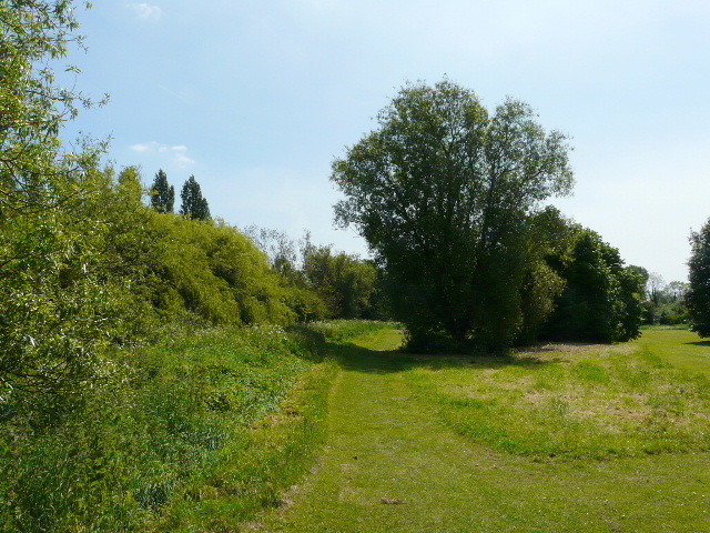
The road narrowed as it left the houses, and twisted and turned as it went over a bridge and through an old mill complex, now a residential care home. I took a path on the right here, alongside the mill stream on my right, and soon entered the Ver Valley Meadows (there was an information board telling me this!). The first meadow was a huge flat open area, again yellow with buttercups, browsed by a few cattle [18]. I followed the path beside the mill stream, which was rather sluggish, almost stagnant. Soon though it rejoined the main course of the river, and the water was clear and fast-flowing again. A cow stood by the river, apparently concerned that some calves had crossed the river and were trying to make their way through the hedge on the far side to another pasture. Near the end of the huge meadow, I went over a footbridge [19] to the right bank of the river. I soon left the cow pastures, the path passing under a bridge carrying the A414 and then switching back to the left bank.
[19] River Ver in the Ver Valley Meadows<
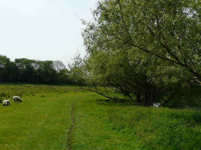
[20] Ver Valley Meadows
[21] The river Chess at the start of the path from Park Street
I was still in the Ver Valley Meadows (another information board), but this one had sheep rather than cattle, and was almost devoid of buttercups [20]. I followed a path that stayed close to the river before curving left to a gate in the far corner, a distance of about a third of a mile through this huge green meadow. On the way back in the afternoon, I realised that I hadn't followed the true line of the footpath, which took a more direct route rather than following the curving river - I tried to go back the correct way, but where a waymark indicated the path crossed from one side of the meadow to another there was no indication of a path, and there was no waymark on the other side so I could be excused for having gone wrong. Anyway, the path now passed beside some allotments and then turned right along a track or drive to reach the village of Park Street opposite The Falcon pub.
I turned left along the road (the A5 or Watling Street again, still masquerading as the A5183). After a quarter of a mile, I turned right along a footpath [21]. This soon had a lake just over to the right, with a mobile home park across the river on my left. I turned left at a junction, continuing down a broad tree-lined track [22]. Emerging from the trees, I passed a large group of anglers with some parked vans where a refreshments stall was being set up. Here I went wrong - I later realised I should have turned sharp right here, but the path was hidden by the vans and the waymark post was buried in shrubbery. Instead I turned right a few yards later at the next junction - I soon realised my mistake but continued anyway, just walking the wrong two sides of a small rectangle amongst a number of small lakes (I used the correct route on the way back). I assumed these fishing lakes were former gravel pits, and indeed a quick internet search has just shown that Frogmore Pits once produced fine-quality gravel for roads.
I soon rejoined the proper route, going left at a junction by an information board telling me that I was close to the site of the Park Street Roman Villa. The path was now hard surfaced, running between the fishing lakes and then some woodland on my left, and large fields and paddocks on my right [23]. I could now hear some road noise, but I was glad as it meant I was close to the M25 and my turn-around point. I crossed the motorway on a footbridge - I'd originally only planned to walk this far, but decided to carry on another mile to check the car park which I hope to use for the next walk. The path turned left for a short distance beside the motorway (I saw some Grass Vetchling here on my return, only the second time I've seen this lovely and delicate flower), before turning right and passing through an area of trees to a road. There was a view here of the river Ver between a yellow oil-seed rape field and a wood [24]. I continued a short distance through the wood, and found the car park shown on the map really did exist, right next to the path, ideal for the start of my next walk.
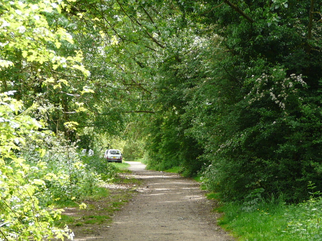
[22] Path to Frogmore Pits
[23] The path beyond Frogmore Pits, heading towards the M25
[24] The river Ver near Colney Street
It was now just after 12.30 as I started to make my way back to Redbourn. I thought I'd only walked 7.5-8 miles, so I was concerned that it had taken three hours to walk that distance, although I had taken numerous photos and had to check the map many times. I was relieved when I measured the route with Google Maps and found I'd actually walked nine miles in each direction - that explained why the walk both ways took just over six hours, when I'd expect to do 15 miles in just over five hours.
The walk back was perfectly pleasant, though high clouds had now replaced the bright sunshine and I took off the sunglasses I'd been wearing since Redbournbury. In St Albans I met a couple of walkers coming the other way who asked if there were any pubs or places for food ahead, and I mentioned the pubs in Park Street a couple of miles on, but warned that they might stop serving food at 2pm (in ten minutes). The couple were walking the Ver Valley Walk, whereas I'm doing the Ver-Colne Valley Walk which goes a little further, but this is the closest I've ever come to meeting someone doing the same Long-distance Path. It remained a warm and rather muggy afternoon - Verulamium Park was crowded, and I was sorely tempted to get an ice-cream. There were several people along the drive through the Gorhambury Estate too. A cricket match was in progress as I got back to my car, the last wicket of one team falling as I walked by and all the players adjourning to the pavilion for tea.
I enjoyed the walk more than I'd expected too, the section through St Albans being along a green corridor and involving little street walking. Obviously being a river walk it was a very flat route, but I found the walk was quite varied which kept it interesting. The Ver is a smaller river than the Chess, which I followed three days ago, but still attractive and a pleasure to walk alongside. A couple of slight disappointments were that I didn't get to see any of the Roman remains in Verulamium Park or get a decent view of St Albans Abbey - the best view I had of it was actually when I was coming back along the long residential street of Cottonmill Lane. Of course, it would be easy to take slight diversions to remedy both these points.