Pete's Walks - Aylesbury Ring
If you are considering walking this route yourself, please see my disclaimer. You may also like to see these notes about the maps and GPX files.
Day 1 28/02/06 Wendover to Ford (7.5 miles each way, approximately)
Parked in Wendover.
I parked in the same car park in Wendover that I used when I walked the Chiltern Link last August. This was the first of several reminders of previous walks today – part of my route would be along the North Bucks Way, I passed below Coombe Hill where I started the South Bucks Way and I crossed or followed several roads that I’d driven along to reach various bits of the Chiltern Way.
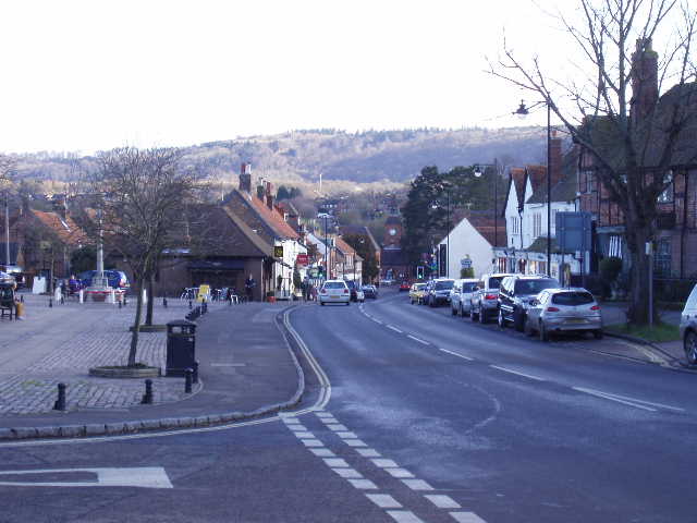
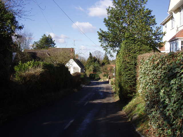
[1] Wendover
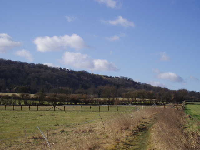
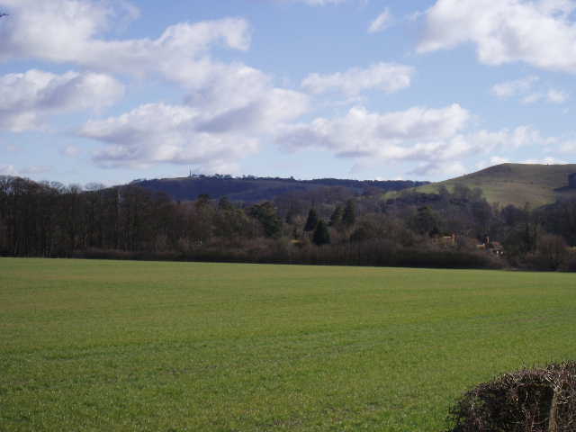
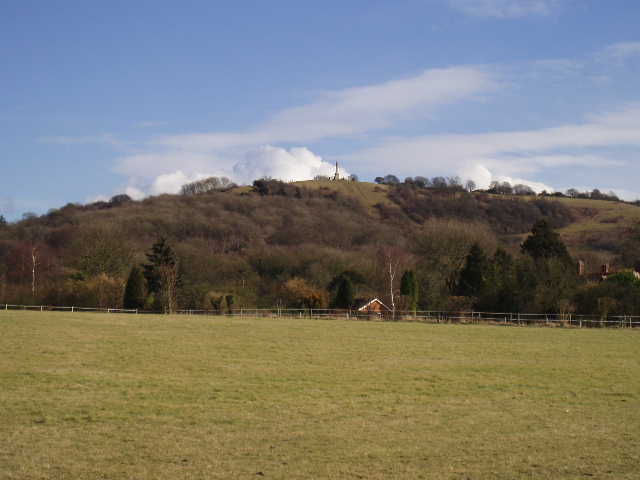
[2] View towards Coombe Hill from near Wendover
It was very cold when I set off walking from Wendover [1] at about 9.45am (I’d had to scrape the windscreen before leaving home) but it was a lovely sunny day with hardly a cloud in the bright blue sky. I took the main road heading west, crossing a bridge over both the railway line and the A41. A track on the left then led past a cricket ground, before a path crossed a very large ploughed field. After recent experiences on the Cross Bucks Way, I was encouraged to see that this path had been re-instated after ploughing and was clearly well-used. The path then went along the edge of a couple of paddocks [2], before following a very tiny embankment between fields to reach a farm, where a farmer was moving bales of hay with a fork-lift truck. Beyond this, I crossed another paddock containing three or four horses and then passed through the garden of an impressively large stone and brick house.
The next couple of miles were in a more or less straight line heading west, crossing ploughed fields and pastures, only occasionally passing buildings. In the bright sunshine and on a clear path, this was a very enjoyable section. The steep northern escarpment of the Chiltern Hills was to my left, with the Vale of Aylesbury on my right. Combe Hill, with its monument, was very prominent, followed by the rather isolated and distinctively shaped Beacon Hill [3,5]. I remembered how foggy it had been when I’d started the South Bucks Way from Combe Hill. I passed below Ellesborough church [4] on a slight rise to my left, and for a short while walked close to Ellesborough Golf Club. Eventually, the path led through another garden to a road I recognised in Little Kimble. Here I turned right and followed the road for a few hundred yards to reach the church.
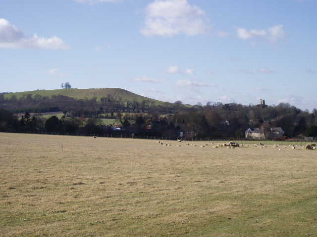
[3]View towards Ellesborough and Beacon Hill
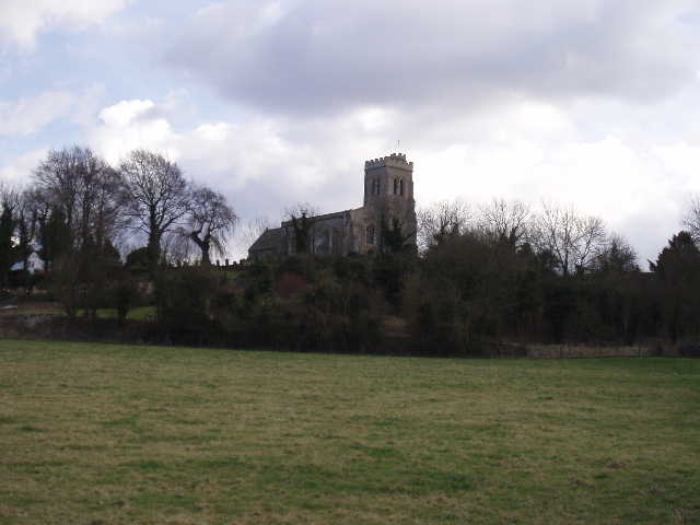
[4] View towards Ellesborough church
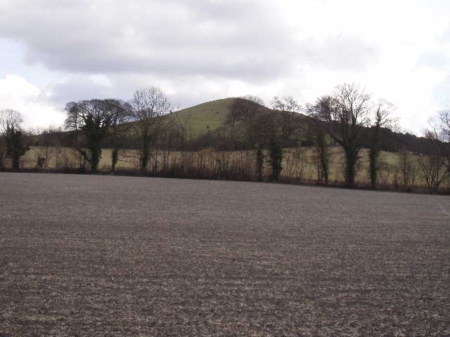
[5] View towards Beacon Hill
I had driven past Little Kimble church [6] several times when I walked the Chiltern Way and had seen the sign saying that it had mediaeval wall paintings and tiles. I’d never had the time to stop and look, so I was glad of the chance to do so now. It was certainly well worth visiting. There were a number of wall paintings [7] (more than anywhere else in Buckinghamshire, according to a sign) and in the small chancel there was a roped off section of mediaeval floor tiles [8], something I’d never seen before. The church itself was very simple, just a small nave and chancel with no tower, dating to the thirteenth century. It was built on the site of a Norman church, and still contained a Norman font.
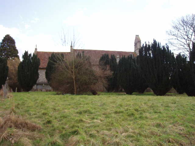
[6] Little Kimble church
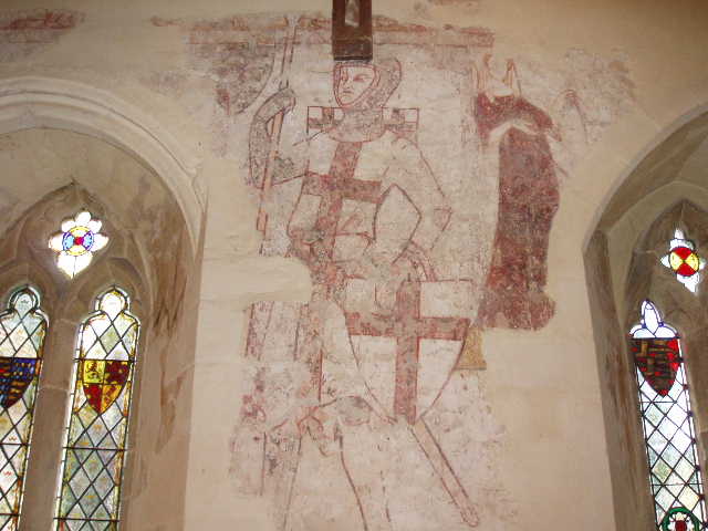
[7] Wall painting, Little Kimble church

[8] Mediaeval floor tiles, Little Kimble church
On leaving Little Kimble church, I turned left onto a busier road and within about a quarter of a mile I reached Great Kimble church [9] (which I photographed but didn’t enter). This church has associations with John Hampden who, along with 30 other parishioners of Great Kimble, refused to pay ‘Ship money’ when it was extended to inland counties in 1635, one of the factors contributing to the Civil War. I had passed John Hampden’s home in nearby Great Hampden when I walked the Chiltern Way.
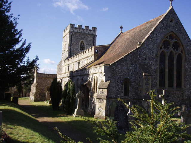
[9]Great Kimble church
[10]Lane through Great Kimble
From Great Kimble church, I could see where the North Bucks Way crossed the main road, shortly after its starting point on the Ridgeway up on the hills to my left. The Aylesbury Ring now turned right down a lane through Great Kimble [10], the start of a section that would head roughly north-west all the way to Waddeson (the destination of my next walk). A path by the village school led through a couple of green pastures and then crossed a railway line. It then followed a hedge line to a road, another one I’d used regularly to get to the Chiltern Way. Across this, the path crossed another ploughed field and then followed a garden boundary to another minor road [11].
At this point, the Aylesbury Ring joined the North Bucks Way, which it had been parallel to since Great Kimble church. The route went down the drive towards Kimblewick farm [12] and then went over a stile on the left and across a pasture to a gate and stile. Beyond the stile, I followed a hedge row in the next two empty pastures and the following ploughed field, to reach a track that led to a minor road in the small village of Kimble Wick. Across the road, a lane continued in the same direction for about a third of a mile, passing a couple of farms and a few cottages, before deteriorating to a wide muddy track. After a few hundred yards [13], this turned to the right – at this point, the North Bucks Way continued with the track, but the Aylesbury Ring took a footpath continuing ahead. I well remembered this junction from when I walked the North Bucks Way, because of the vast number of footpath signs here – both the Swans Way and the Midshires Way also pass through this point.
[11] Looking back to Coombe Hill and Beacon Hill
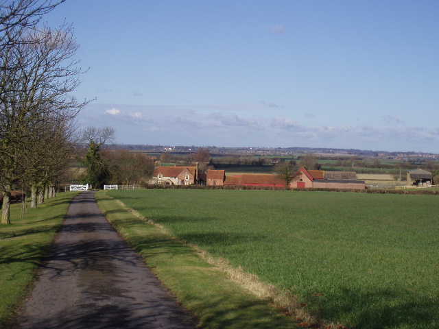
[12] Looking over Kimblewick farm and the Vale of Aylesbury
The path ahead crossed another couple of grass fields and then passed over a stile and through a small thicket. The next field was the only one where the path wasn’t really clear, but it was just about visible and I managed to find the stile on the other side quite easily. I then crossed another grassy field and then crossed a track (that led to a small farm building). The next field was a large grassy one with a small flock of sheep. The waymark on the stile (and the route on the map) showed that the path went slightly left across the field, but it was only when I’d almost reached the other side that I could see where the next stile was and I had to bear a lot more to the left. A dog barked at me as I passed across a drive and beside a house. After two very small and muddy fields, the path then went across two gardens (the route was clearly marked) before a last grassy field brought me out by a pub called The Dinton Hermit , which was where I intended turning round. The pub name seemed a bit odd, in that it was in the village of Ford, Dinton being the next village I’ll reach on my next walk. The Dinton Hermit was a certain John Bigg who was reputed to be the executioner of Charles I (two Dinton men were amongst those who had signed the death warrant). He was said to be so full of remorse that he lived the rest of his life as a hermit.
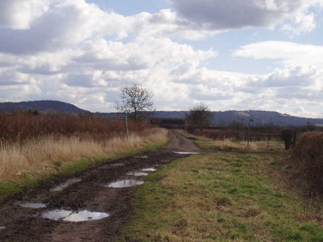
[13] Looking back along the track from Kimble Wick
According to my OS map, which I’d been following all the way, the Aylesbury Ring should have continued by turning left here, but the signpost indicated it went right. To make sure, I walked right along a track a hundred yards or so to the next path junction, where there was another Aylesbury Ring sign – the route has obviously been altered to avoid a bit of road walking (when I checked later, the map on the Aylesbury Ring leaflet shows the new route here). I then turned round and headed back to Wendover.
I stopped for an early lunch at about 12.30, sitting on a stile just before I reached the North Bucks Way north of Kimble Wick. I quite often use a stile for this purpose, as there aren’t often too many convenient places to sit – I think today was the first time I had to interrupt my lunch and stand up to let someone pass, as a woman walking her dog came along while I was munching my sarnies. I also got a reasonably close view of a Red Kite while I was there – it flew low over a hedge and then went up and down the field a couple of times. I’d seen one a couple of times a bit earlier, but both times it was a very long way off.
I took several more photos on my way back [14,15], as I’d not been able to take some I’d wanted in the morning as I’d been looking straight towards the sun. I stopped at one point near Ellesborough to have a drink, and was surprised to see a few drops of snow – the sky ahead was clear blue. I turned around to see a large dark cloud had been coming up behind me, and for the next 5 or 10 minutes there was a shower of snow.
[14]View of Coombe Hill on the way back in the afternoon

[15]Coombe Hill from the other direction about 25 minutes later - note the difference in the weather!
All told, I really enjoyed today’s walk. It was a lovely day, despite the cold and the snow shower, the paths were clear and easy to follow, the views of the Chilterns contrasted with the undulating Vale of Aylesbury, there were villages with bits of historic interest and there were a few pleasant reminders of previous walks. Best of all, though, was Little Kimble church with its mediaeval wall paintings and floor tiles – definitely the highlight of the walk.
Total Distance: 7.5 miles each way