Pete's Walks - Aylesbury Ring
If you are considering walking this route yourself, please see my disclaimer. You may also like to see these notes about the maps and GPX files.
Day 2 02/03/06 Ford to Waddesdon (6.0 miles each way, approximately)
Parked in lane in Ford.
Another very pleasant walk on a sunny but cold day. As with the previous walk, some of it followed part of the North Bucks Way, which you may know is my least favourite of the walks I’ve done so far. But the sections I’ve repeated have been from the first two days of the North Bucks Way which were fine, it was the last three days that I found a little uninteresting. In fact, I was looking forward to doing the section of the North Bucks Way today, as the section from Eythrope to Waddesdon was probably the most enjoyable of that whole route – I wasn’t disappointed either, as I really enjoyed it again today. This is probably just as well, as two other long distance paths that I might walk also share this same route so I may well walk it again!
[1] Path leading towards Dinton
[2] View looking back from Dinton (photo taken in afternoon)
I had a bit of trouble finding the way straight off this morning. As I discovered when I reached Ford on my previous walk, the Aylesbury Ring has been rerouted here and doesn’t follow the course shown on my OS map. There was an Aylesbury Ring sign where a footpath was marked on the map, but I couldn’t match the map to what I could see in front of me. In the end I just followed a farm drive, and then fortunately could see a stile when I got near the farm. As I new the route shown on my map was out-of-date, I had to rely on Aylesbury Ring waymarks on the stiles to guide me through the next two pastures, until I emerged on a road. The Aylesbury Ring then took a footpath starting a few yards down the road to the left, crossing an arable field on a clear path and then a couple of sheep pastures [1,2], making a beeline for Dinton church visible ahead.
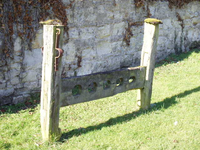
[3] The stocks at Dinton
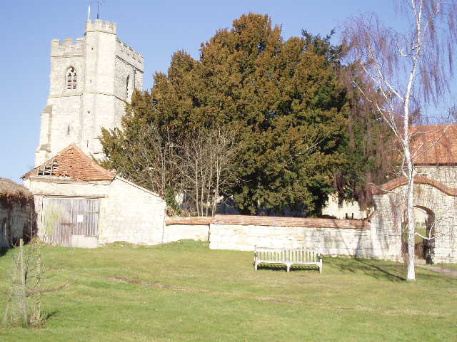
[4]Dinton church
Dinton Hall, next to the church, looked quite impressive, but was marred by a large section being covered in scaffolding and plastic sheets, obviously while some major conservation work was going on. I also noticed some stocks on the green [3] outside the church [4]. I followed the road through the village for a few hundred yards until it met a main road (the A418 between Aylesbury and Thame). Almost opposite the junction, I passed Dinton Castle [5], an eighteenth century folly created as an ‘eyecatcher’ to be seen from Dinton Hall. From here, I followed a right-hand hedge downhill towards the valley of the river Thame [6] (Note: I do mean Thame, as opposed to Thames!), before crossing a pasture of rough grass and then following more hedges to reach Starveall farm. The path then continued across some more pastures in the flat valley bottom, to reach a tarmac drive leading into the estate of Eythrope Park. This is one of several large properties in the area that were owned by the Rothschild family – I couldn’t actually see the great house itself from my walk, but got a glimpse of ‘The Pavilion’, built for Alice de Rothschild in 1883.
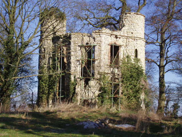
[5] Dinton Castle
[6]View over the Thame valley from near Dinton Castle
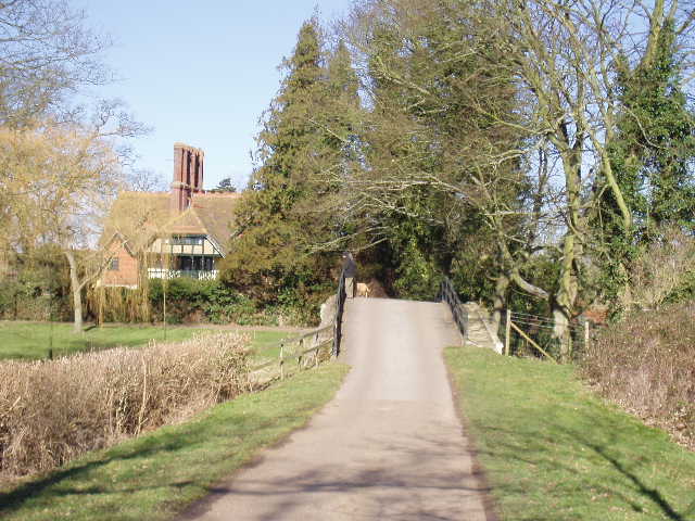
The drive [7] soon crossed a bridge [8] over the river Thame [9], just after the Aylesbury Ring rejoined the North Bucks Way which came in from the right. Over the bridge, the drive turned to the left in front of a very grand lodge, before turning right. At this point, a post covered in waymarks indicated that the Thame Valley Walk continued ahead alongside the river, while the Aylesbury Ring, North Bucks Way, Bernwood Jubilee Way and the Swans Way followed the drive to the right. The map showed that the Midshires Way also went through here, so there were no less than six long distance paths that shared a short section of route over the bridge!
[7] Drive leading to the bridge over the river Thame
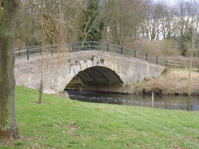
[8]The bridge over the river Thame
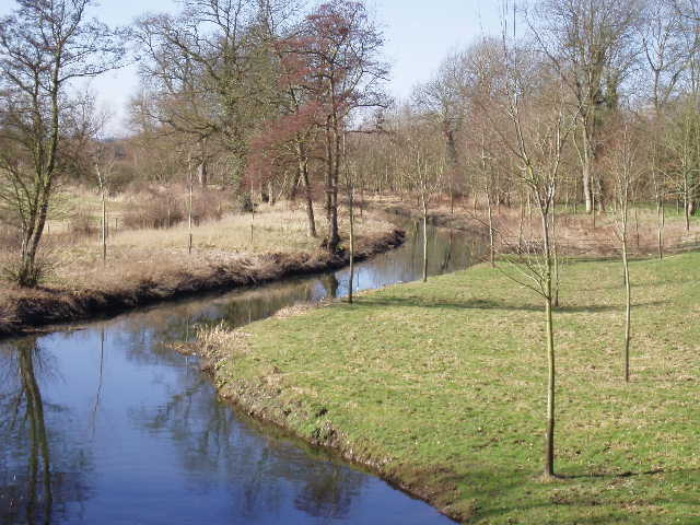
[9]The river Thame
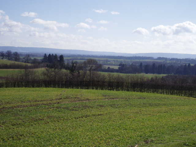
I really enjoyed the next section of walk, as I had done when I followed the same route on the North Bucks Way. After a few hundred yards, I left the drive when it turned sharp right, and continued straight ahead through the parkland, climbing slightly uphill with lovely views of the Thame valley to my left [10]. After passing through a small copse of young trees, the path crossed a rough pasture to a stile in a hedge alongside another drive on the estate. Here I saw a Buzzard circling overhead – I thought it might be a Red Kite at first, as I’d seen or heard them near here when I did the North Bucks Way. After a few hundred yards along the drive, I turned right along a hedged track that led gradually uphill past a small wood on the left, where I did see a Red Kite (on the way back, at this point I saw a Buzzard and about six Red Kites soaring overhead!).
[10]View from Eythrope Park
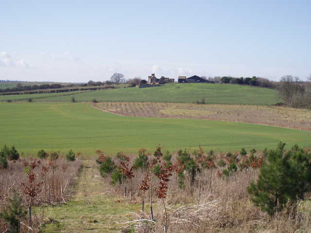
[11]View east from near Waddesdon Stud
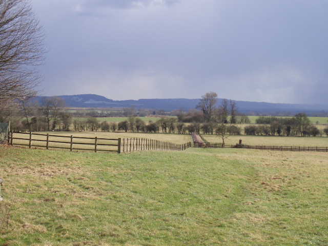
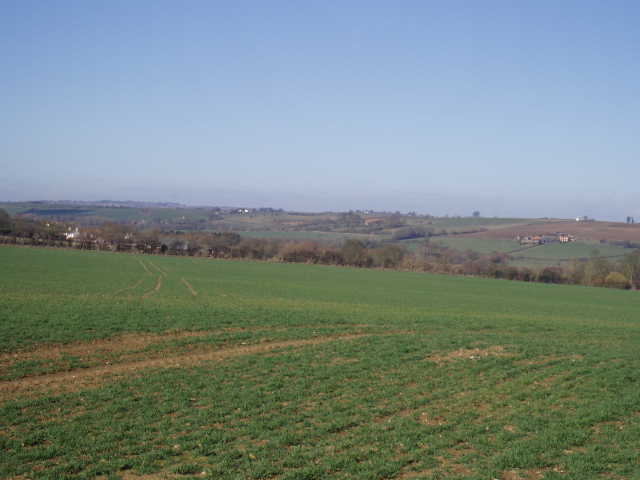
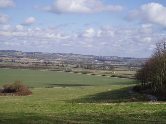
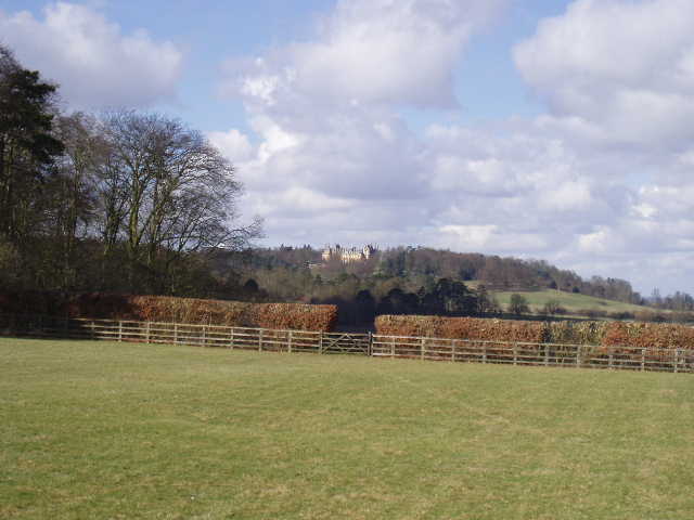
The track soon reached a lane, which I followed to the left. This section had been ascending the Upper Winchendon ridge, a broad mass of higher ground between the Thame valley to the south and an area of very flat ground between Waddesdon and Quainton to the north. Although not very high, there were some very good views from the ridge over the lower areas [11], the view extending to the long line of the Chiltern Hills to the south [12]. There were also views towards Waddesdon Manor, built in the style of a French Chateau for another of the Rothschilds, now a very popular attraction managed by the National Trust.
[12]Looking back towards the Chilterns from near Waddesdon Stud
[13]View towards Waddesdon Manor from near Waddesdon Stud
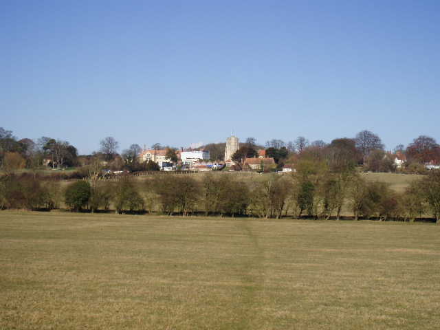
The lane ended at a road by Waddesdon Stud (I saw a stoat here on my way back). A footpath took me past this and across a paddock [13], through a small wood and then downhill beside a hedge. At the valley bottom, there was a notice board (which I remembered from the North Bucks Way), giving information about Bernwood forest, the Bernwood Forest Way and Black Poplars – I should see some of these trees further along the Aylesbury Ring. The path then led across some rough ground and beside a farm to come out at the end of a lane, by some cottages. Across the lane, the path continued through a small wood and then crossed a ploughed field to the edge of a school in Waddesdon. I followed the path around the edge of the school grounds, and then turned right through some allotments to emerge on a road near its junction with the main road through Waddesdon [14].
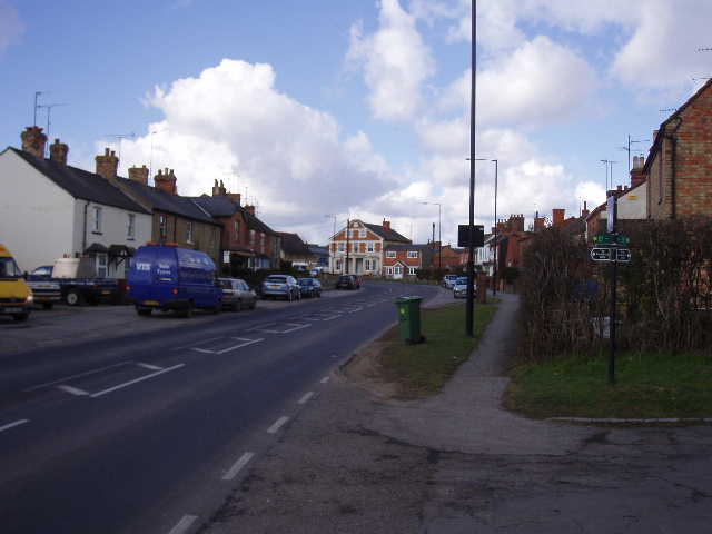
[14]Waddesdon
It had only taken me two hours to reach Waddesdon, so I stopped rather early for lunch again on the way back, stopping at a stile near Eythrope Park about 12.30 with a lovely view of part of the Upper Winchendon ridge. I got back to my car at Ford by about 2.10pm, but then had a bit of a disaster, by locking myself out of my car! In fact, it was more of a case of the car locking me out – I left the keys on the driver’s seat while I sat on the front passenger seat to change out of my walking boots. I closed the passenger door and walked round to the back of the car to put my boots in the back, when there was a ‘click’ and the car somehow locked all the doors! Fortunately there was a pay phone that took coins just a couple of hundred yards away (both of my mobiles, one of which is permanently in the glove compartment in case of a breakdown, were locked in the car) and with the help of my parents I managed to contact the breakdown service. I had to wait for about an hour and a half in the very cold weather, but when he came the chap managed to get the car unlocked in about five minutes. So it was a rather tedious end to what had been a very enjoyable walk.
Total Distance: 13.5 miles each way