Pete's Walks - Berkshire-Essex Walk
If you are considering walking this route yourself, please see my disclaimer. You may also like to see these notes about the maps and GPX files.
Day 10 13/07/06 Near Galley Hill to Ickleford (6.5 miles each way, approximately)
Parked at Treasure Groves car park.
I parked at the small Treasure Groves car park on the Lilley-Hexton road, which I remembered from my Chiltern Way walk, and started by walking about one mile south-westward to the path junction (and notice board) I had reached on my previous walk. It was about 9.40 when I set off from my car, and the skies were grey and overcast. I took several photos of wildflowers on this stretch, including one of a pretty yellow flower that I later identified as Common Toadflax.
At the path junction, where the alternative northern route rejoins the main route of the Icknield Way, I turned round and headed back in a north-easterly direction. The path was a wide track between hedges, initially with a wood on the left and a golf course on the right. Just beyond the wood, a track came in from the left – this was part of the Northern Extension of the Chiltern Way, which would now share the route of the Icknield Way for about a mile and a half. The good track continued ahead between hedges, now with corn fields on either side, crossing one or two other path junctions. After about two thirds of a mile it came out on a sharp bend of the Lilley-Hexton road, which I followed ahead for about a third of a mile to reach the car park where I’d parked.

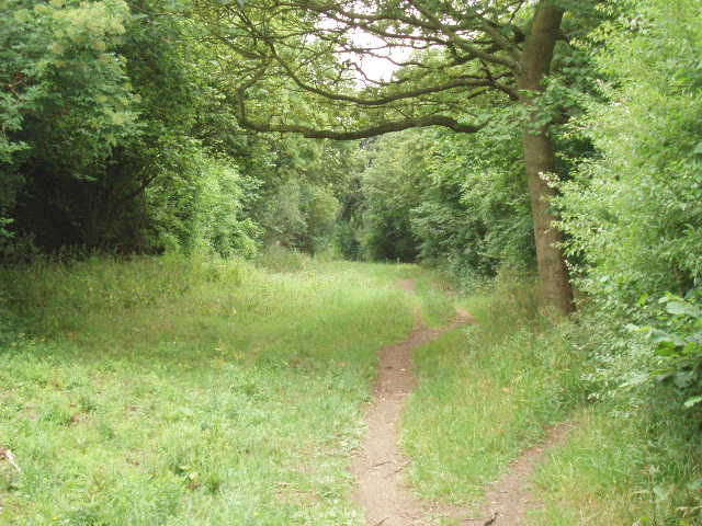
[1] Icknield Way heading towards Telegraph Hill
[2] Path between Telegraph Hill and Deacon Hill
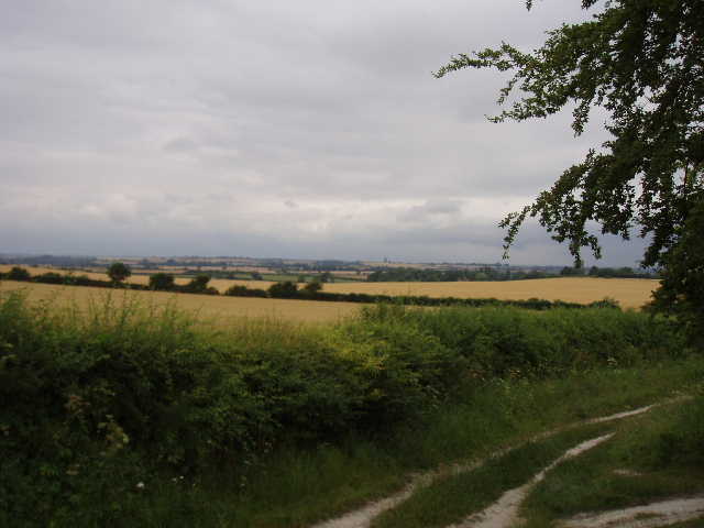
From here, the path continued in the same north-easterly direction, again on a broad grassy track lined by hedges [1], with more cereal crops growing in the fields either side. After about a third of a mile, the hedges were replaced by trees (including one particularly impressive beech tree) as the track started the gentle ascent of Telegraph Hill. Just past an information board about the Telegraph Hill nature reserve, the path emerged from the trees to climb more steeply up the hill. There were a few wildflowers amongst the long grass on the hill, but I didn’t see anything unusual, only the more common species that I have seen a lot of, such as Scabious. I didn’t see the Common Spotted Orchids that the information board mentioned, although on my way back I did see on of the butterfly species it mentioned, the yellow Brimstone. The hill, at 602ft the highest point in North Hertfordshire, gets its name from a telegraph station that was situated there during the Napoleonic wars, part of a chain running from Great Yarmouth to the Admiralty building in London (much of the chain following the route of the Icknield Way). It is thought that the hill was also used as one of a chain of beacons, both at the time of the Armada and also during the English Civil War. To the south of Telegraph Hill is Lilley Hoo, now just cornfields but once a race course and the place where George IV trained his racehorses.
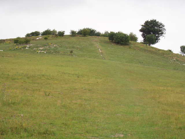
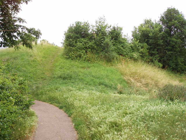
[3] Path to the top of Deacon Hill
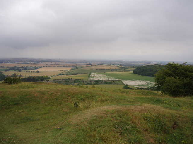
[4] View from top of Deacon Hill
From the top of the hill, the Icknield Way takes a path alongside a corn field before rejoining the broad track going north-east. Shortly after this point, the northern extension of the Chiltern Way turns left towards Pegsdon, while my path on the Icknield Way continued ahead. It was easy going on this broad hedge-lined track [2], which here forms the border of Bedfordshire and Hertfordshire, descending very slightly over the next half-mile. A stile on the right then gave access to a permissive path to the top of Deacon Hill [3]. I took this short detour, across a grass meadow and then a very short, steep climb to the top. As the guide book said, this was an excellent viewpoint [4], with wide-ranging views over about 270 degrees of the compass, all the way from the south-west round through north to the south-east. Unfortunately, it was now spitting with rain and was very grey and rather dismal, so the views weren’t at their best.
[5] Track between Deacon Hill and the B655
[6]View from the bridleway leading to Pirton
I returned to the track and carried on [5], soon reaching the B655 Barton-Hitchin road where there was a small car park (which I’d used on Day 4 of my Chiltern Way walk). I followed the road about 200 yards to the right, in the process leaving Bedfordshire for the last time on this route, then took a bridleway on the left. This followed the right-hand hedge of a large field (I saw some Long-tailed Tits here on my way back) to a path junction, where I again joined the route of the Chiltern Way. Another good track went right, with more wildflowers along its borders. After about a quarter mile of very gentle descent, the northern extension of the Chiltern Way took a path on the right [6] – this would be the last I’d see of the Chiltern Way on this walk. There was a bench by this junction, which is where I had my lunch on the way back.
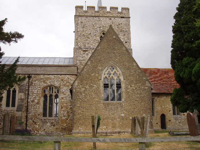
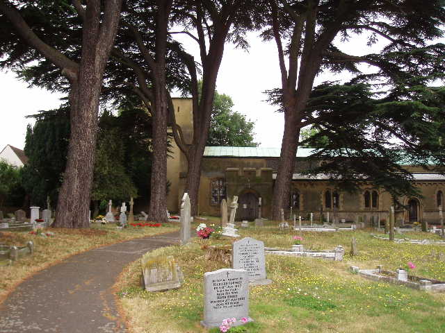
[7]Pirton Church
[8]Part of the earthworks of a motte and bailey castle, Pirton
Carrying on along the good track, still slowly descending, with corn fields beyond the hedges on either side, I reached the village of Pirton after about half a mile. I continued in the same direction along the village street, before turning right down a path that led to the church [7] and to the remains of a motte and bailey castle [8]. An information board showed how the castle and the surrounding village might have looked in 1169 – there is very little left now, other than the motte, as this part of the village seems to have been deserted in recent centuries, leaving only irregular bumps and hollows in the fields. The path took me across a couple of pastures to another street in the village. A short distance to the right, a path on the left went between houses, past a small allotment and then past a sports ground to reach open countryside again.
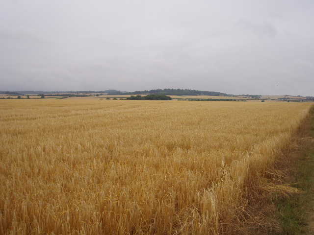
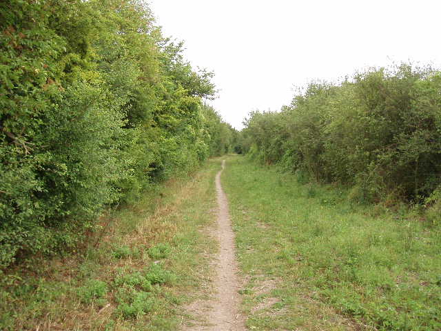
[9] Path between Pirton and Ickleford
The path was now a broad green track between corn fields, at first with no hedges [9] but then following a left-hand hedge. It went on for over a mile, through a flatter, lower-lying area of land, although I could see the chalk-hills rising again ahead of me in the distance. There were still butterflies such as Red Admirals on this stretch, and several types of wildflower. At a junction I turned right onto an artificially-surfaced bridleway, and then turned left by some cottages onto a tarmac lane. This soon brought me into the village of Ickleford, just north of Hitchin. I crossed the A600 road, and continued onwards through the village for about half a mile until I reached the church [10,11].
[10] Ickleford church
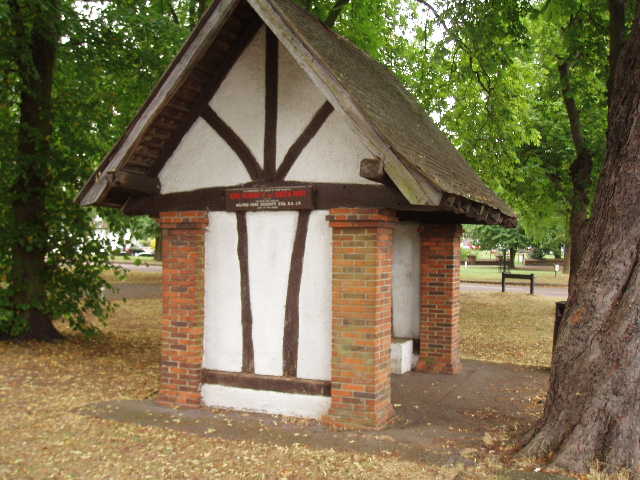
[11] Memorial bus shelter, Ickleford
I turned round and headed back. I had a quick look inside Pirton church, but annoyingly found I had no change to buy a guide book – I would like to have read about its history. I noticed that in the last few weeks alone its Visitors Book had been signed by people from as far away as Canada, Australia and South Africa. I opted for a slightly late lunch, about 1.20pm, on the bench by the junction where the Chiltern Way turned off. Chaffinches and Long-tailed Tits entertained me as I ate. Having already walked about one mile in the return direction first thing this morning, I was left with a very short walk in the afternoon. The clouds gradually broke up, and it became sunnier and warmer as the afternoon wore on. I got back to my car about 2.40pm.
Total Distance: 73.5 miles each way