Pete's Walks - Berkshire-Essex Walk
If you are considering walking this route yourself, please see my disclaimer. You may also like to see these notes about the maps and GPX files.
Day 9 10/07/06 Toddington to near Galley Hill (7.5 miles each way, approximately)
Parked at Toddington.
This was a strange day. Somehow the walk took almost an hour longer than it should have done, and I have no idea at all why. When I originally measured the distance on the map (the guide book doesn’t give distances for this alternative section) I made it to be eight miles. When I reached Streatley, I realised I was running very late, and hurried the last mile or so to my turn round point at the foot of Galley Hill. It still took me three hours and ten minutes – I hadn’t had many stops for photos or to look at butterflies or wildflowers, so I thought I must have miscalculated the distance and walked maybe nine miles. It actually took me quarter of an hour less to walk back, but the whole walk still took just over six hours (excluding the fifteen minutes for lunch). However when I got home and measured the distance again, it was only 7.5 miles! This meant I’d been walking all day at 2.5 mph, whereas I usually walk between 3 and 3.5mph. I certainly hadn’t been conscious of walking slowly, and I made fewer stops than I’ve done on the previous few days. I certainly took more photos and stopped more frequently to look at butterflies and flowers on my last walk – that took almost exactly the same time, and was two miles longer! Very strange. (Update: According to Google maps, the distance was 8.6 miles each way, which would explain things!)
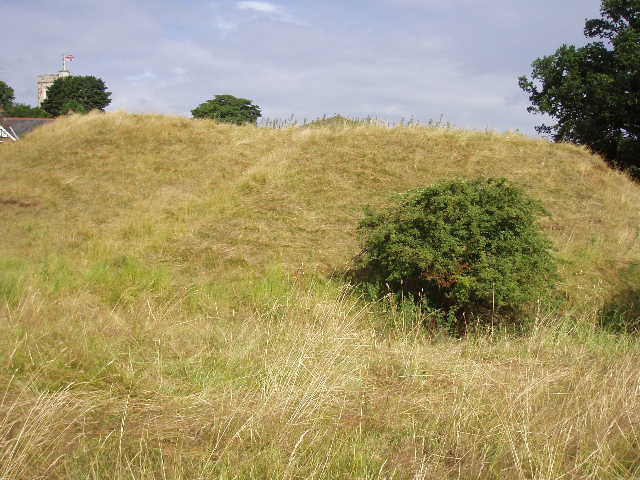
[1] Conger Hill, Toddington
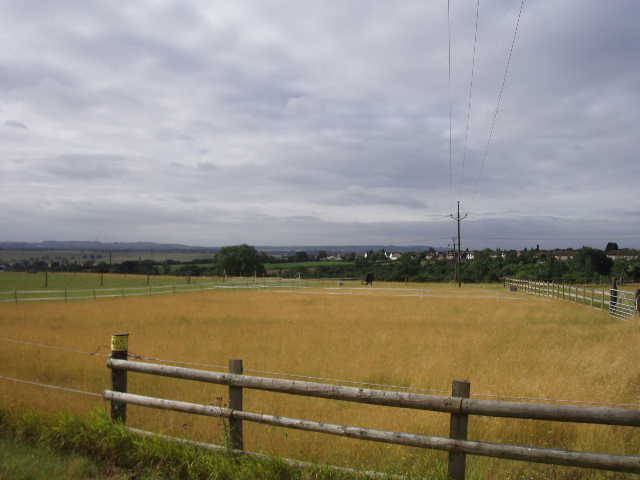
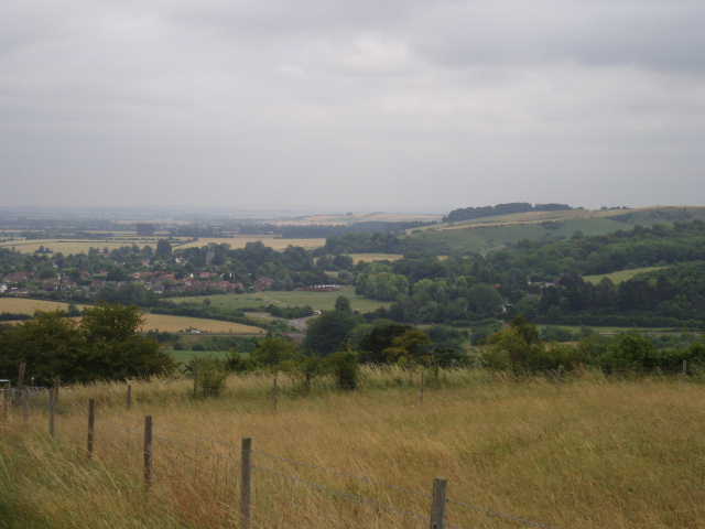
[2] View from Toddington, looking towards Dunstable Downs
All the parking near the centre of Toddington was restricted to 2 hours, so I parked on the main road as close to the centre as I could. I walked towards the church and turned right down the street where I’d finished my previous walk. I went through a kissing gate on the left, and crossed a paddock diagonally, passing a friendly horse on the way. To my left was Conger Hill [1], not a hill at all but the motte of a Norman Castle surrounded by a moat. Over a stile and across a smaller paddock [2], I came to a farm drive where I turned left, with the hedge of a cemetery on my left. I followed this where it turned left, then turned right along the edge of a field of tall grass. A stile on the left gave access to a path running downhill [3]. After a short distance, this ran for some way between a barbed wire fence on my right and an unusual hedge of mainly willow trees on my left – one of these had recently fallen, and I had to clamber underneath it. Over another stile, I continued in the same north-easterly direction, and still slightly downhill, alongside the left-hand hedge of a large sheep pasture, to reach a minor road.
Across this, I carried on through a small field containing some sheep and a couple of Shetland ponies. On entering the next field, the Icknield Way followed the hedge to the left, and went through a gateway to reach a tarmac track. I turned right, and almost immediately went across a bridge over the M1, just north of the Toddington services – the southbound carriageway was almost at a standstill and I could see and hear police cars, so there’d obviously been an accident or something. I followed a tarmac drive down to a farm, then followed a good track round to the right of the buildings and then further right through some set aside land and then some corn fields. Where the track turned right again, I left it on a path through the cornfield on my left. This path passed a large pylon in the centre of the field, and reached another track on the far side of the field near a railway embankment. I went through a bridge under the railway, and then took a path between hedges, with a corn field on the left and a large landfill site on my right.
[3] View towards Harlington from near Toddington
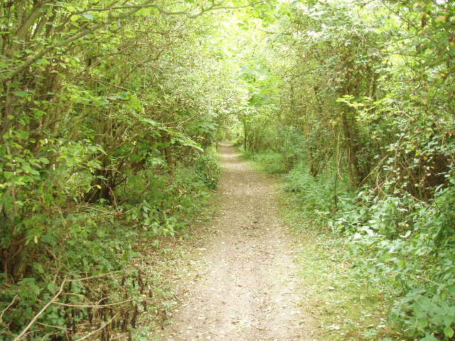
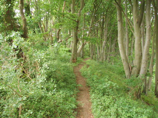
[4] Bridleway through trees, between the Landfill site and the Sundon Hills Country Park
This was another warm but overcast day, very ‘muggy’. I was already quite hot, and had started drinking some of the 2.5 litres of water I’d taken with me. I was wondering if this was enough, but in the end it was, although I’d less than 0.5 litres left at the end of the walk. After about a quarter of a mile, the path emerged from the hedges into the corn field, and then followed the right hand edge of this field and on into the next. It then turned right, to go uphill on a very pleasant bridleway through trees [4]. Where this emerged into a grassy field, I turned left and almost immediately went through a gap in a field corner and turned right to follow a hedge uphill. I was a bit surprised to see a Chiltern Way waymark here, and it took me a few seconds to remember where this was – I eventually twigged that the previous field was near a water works in Sundon, and it was one of the very few places where the guide book hadn’t been very clear. At the field corner near the top of the hill, I turned left with the hedge still on my right and continued along to the next corner, where a gateway gave access to a road. I turned left along the road for a few yards, before crossing it and entering Sundon Country Park.
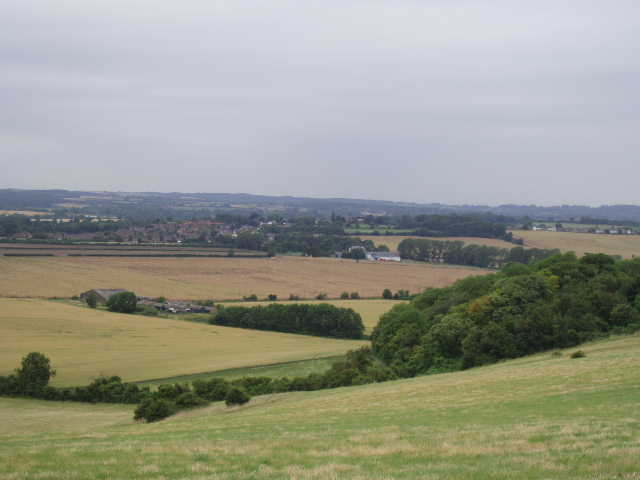
[5] View from Sundon Hills Country Park, looking towards Harlington and the Greensand Ridge beyond
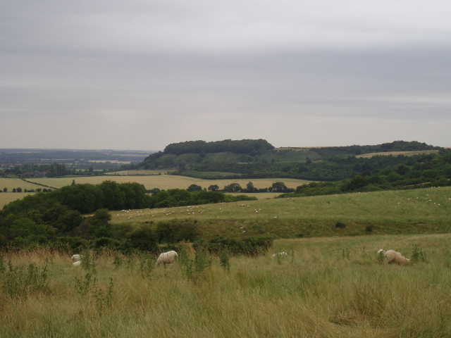
[6] Sharpenhoe Clappers from Sundon Country Park
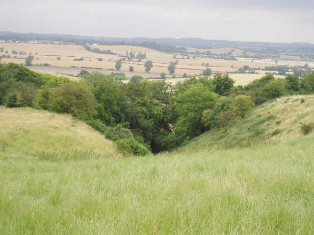
Sundon Country Park has a car park, a small area for picnics, and then a very large field of tall grass grazed by sheep – this field runs along the top of a steep hillside, with extensive views over the lower lands to the north [5]. I followed the path along the southern edge of this field, near the hilltop, admiring the views to my left and ahead to Sharpenhoe Clappers [6], a prominent hill topped by a small beech wood that is a landmark for miles around. I remembered thinking when I walked here on the Chiltern Way that I wouldn’t mind doing it again – as well as Icknield Way and Chiltern Way waymarks, there were also signs for the John Bunyan Trail so I may well do this walk a third time (Update: I have - see my journal for the John Bunyan Trail). At the end of the large field, the path went to the right, then turned left again to follow the edge of a couple of woods for a while. It then entered a wood, and continued in the same direction as before, along the line of the hills, with a surprisingly steep drop through the beech trees on my left [7]. This was a very pleasant part of the walk. Eventually, I crossed another grass field [8] to reach a lane, opposite to the car park for Sharpenhoe Clappers.
[7] Looking back along the path through the woods, near Sharpenhoe Clappers
[8] View north from near Sharpenhoe Clappers
I walked through the car park, and followed the path as it turned to the left towards the wood on the top of the hill. But instead of actually visiting the Clappers (as the Chiltern Way does), the Icknield Way rather bizarrely turns right to cross another area of long grass (owned by the National Trust), and then right again through some scrubland. The waymarking round here was somewhat patchy, to say the least, and I had to rely on the guide book and my map. The path continued on a good track, heading south now [9]. It had been drizzling for a few minutes, but it now started to rain so I stopped and donned my waterproofs. I then turned left on a path that descended the steep hillside through mainly scrub - I saw some Common Toadflax growing here. At the bottom, the path crossed a flower-strewn meadow, then climbed a very high and steep embankment, to reach the A6 dual carriageway. A pavement, protected by a crash barrier, enabled me to follow the road to the right, to reach a roundabout after about a quarter of a mile. I turned right here to reach the village of Streatley – pronounced ‘Strettley’, as opposed to the Streatley where I started this walk, which is pronounced 'Streetley'!
[9] View of Barton-le-Clay and the Barton Hills, from near Sharpenhoe Clappers
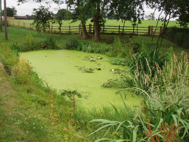
[10] The restored pond in Streatley
At a junction, close to a pub and the church, I turned left and followed the road through the village. I passed the village pond, which an information board told me had been restored the previous year [10]. I continued along the road until it joined the busy A6 (here reduced to a single carriageway road). It took me a couple of minutes to cross the road as the traffic was very busy (it was much easier on my way back). A good farm track led past some wooden cottages, named Swedish Cottages, along the left-hand hedge of some large corn-fields. As I followed the track gradually uphill, several Small Tortoiseshell butterflies flew about in front of me (and I also spotted a couple of Red Admirals here on my way back). To my right, I could see the scrub covered Galley Hill and Warden Hill [11], which I remembered from the Chiltern Way. After almost half a mile, the track turned right alongside another hedge. At the end of a very large corn field, the path entered a short wooded section and then reached a junction which was my turn around point for the day. This crossroads of paths at the foot of Galley Hill is the point where the alternative route from Dunstable Downs rejoins the main route of the Icknield Way, which here comes in from the right. My next walk would be along the path now on my left (the Chiltern Way continued ahead across a golf course and then up Galley Hill and over Warden Hill).
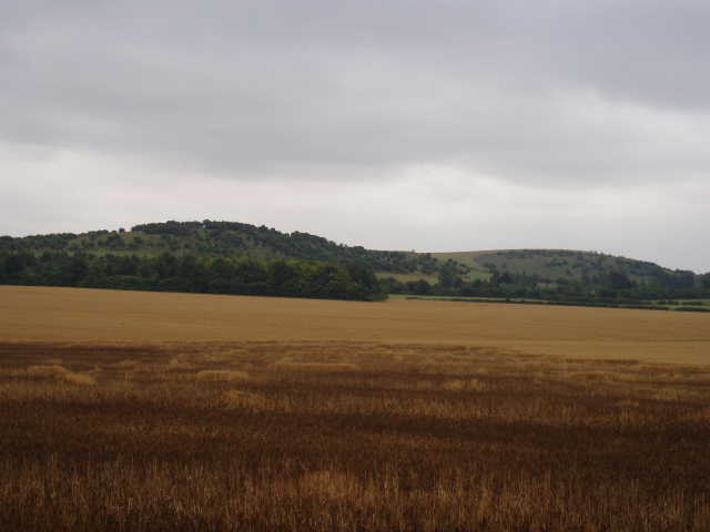
[11] View of Galley Hill and Warden Hill
There was an information board about the Icknield Way here, which I remembered from my Chiltern Way walk. It stated that the route I had followed from Dunstable Downs was 16 miles – at this point, because I seemed to be running so late, I was convinced that it must be wrong, but I now realise that it is correct. Having taken three hours and ten minutes to get here, I was really concerned that this was going to be a much longer day than usual, which I hadn’t expected. I hurried back to Streatley, and then had my lunch seated on a step of the steep path back up towards Sharpenhoe Clappers. Somehow I actually got back to Toddington quarter of an hour quicker than I went, and I remain baffled as to why the walk took so long this morning. I got back just in time, as it started spitting with rain as I got back to my car and it rained quite heavily as I drove home.
Total Distance: 67 miles each way