Pete's Walks - Berkshire-Essex Walk
If you are considering walking this route yourself, please see my disclaimer. You may also like to see these notes about the maps and GPX files.
Day 11 14/07/06 Ickleford to Wallington (8.5 miles each way, approximately)
Parked at Ickleford.
I wasn’t really looking forward to this walk very much, as it entailed a very long section of town walking through Letchworth and Baldock. In the end, it wasn’t as bad as I’d feared, the sections either side of the built-up areas being very pleasant, and I actually quite enjoyed the day.
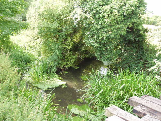
[1] River Hiz, Ickleford
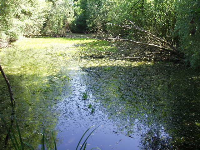
[2] Gerry's Hole, Ickleford
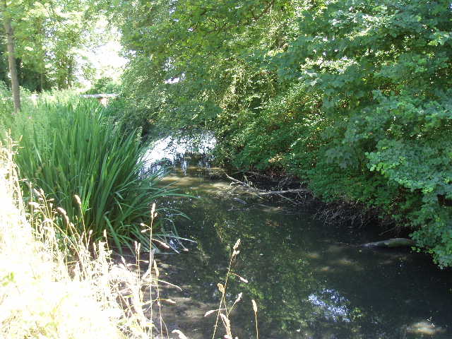
I parked in a side street near Ickleford church, and started the walk by taking a footpath across the road from the church. The walk got off to a great start – after about a hundred yards or so, the path crossed the charming River Hiz [1], and as I got my camera out to take a photo, I saw a blue and orange blur shoot by. A Kingfisher! The path continued, soon passing a pond called Gerry’s Hole [2] – Gerry was a navvy working on the railways who drowned in the pond after a night in a local pub. The pond is now part of a wildlife conservation area. A short distance further on, I crossed a main railway line on an impressive modern footbridge (built since my guide book was written). The path continued onwards, following a hedge on the left [3] (later on the right) through large corn fields, gradually rising towards the slight eminence of Wilbury Hill. I crossed a dangerous road at the top of the rise (fast traffic coming round a blind bend). Wilbury Hill is the site of a prehistoric hill-fort, but there is nothing left of it to be seen now. A short walk along the edge of another corn field brought me to a road called Icknield Way, and the start of the town walking.
[3] Path between Ickleford and Letchworth
[4] A pleasant avenue in Letchworth
Letchworth was the first ‘garden city’ to be created, being planned by Ebenezer Howard in the early 1900’s, and so is a notable early example of town planning. I followed Icknield Way [4], a pleasant tree-lined avenue typical of much of the town, for about half a mile. I then turned right down a side street for a hundred yards or so, before taking a footpath on the left. This ran parallel to a railway lane, amongst trees so that it was cool and shady. Where it ended, close to the town centre, I crossed a road, walked a few yards to the left and then turned right. I was obviously day-dreaming at this point, because I forgot to look at the guide book and went about 200 yards past the turning I wanted on the left! Having corrected my mistake, I followed this road to its end and crossed another road to reach a park called Norton Common. I followed a path to the right, parallel to the road, passing tennis courts and a play area, before coming out by a major road junction. Across this, I followed a road through an industrial estate for over half a mile – on the way back I was surprised to see that one of the industrial units was actually a church [5]! At the end of this road, I turned left and then almost immediately right, continuing through more industrial units. After quarter of a mile, I turned right and after a hundred yards took a path on the left. This path, obviously a well-used cycle path by the tyre tracks in the artificial surface, went over a railway bridge, continued past more industrial units and then turned sharply to the right. A couple of hundred yards further on, I turned left to cross a bridge over the A1(M) and so reach Baldock.
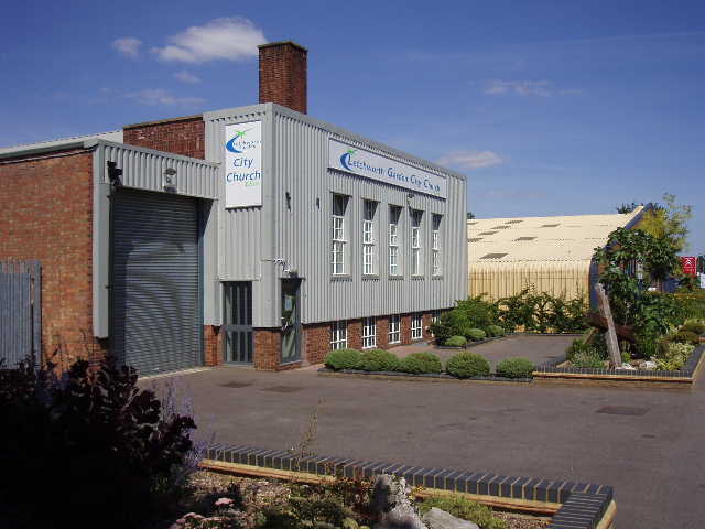
[5] Unusual church on an industrial estate in Letchworth
[6] Looking back towards Baldock, from near Clothall
I carried on ahead. Although still in urban surroundings, this was much more pleasant as I’d left the industrial estate behind and was soon walking through streets of mainly Georgian houses. It was only a short distance to the church at the centre of Baldock, where I had to make my way across a couple of road junctions and then headed up the wide High Street for almost half a mile. I was now heading south-east. At a roundabout near a large Tesco’s I turned left and after a hundred yards or so turned right. I noticed there was a convent housed in a modern building on my right as I walked a short distance along this road, before taking a bridleway that continued in the same direction ahead. This rose slightly uphill, with a caravan park on the left and a wildlife reserve on the right, as I finally left the town walking behind. It had taken just under an hour and a quarter to walk through Letchworth and Baldock, which was not as long as I feared.
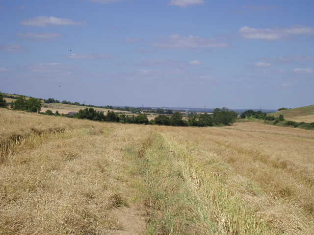
The bridleway levelled out, and after passing a small corn field on the right it crossed a footbridge over the new Baldock bypass (only opened earlier this year). I continued ahead, still heading south-east, beside the right-hand hedge of a large corn field where a combine harvester was in action. At the end of the fields I passed some farm buildings, which I recognised as the Hertfordshire Way took a path on the left here. I continued ahead through more fields – I don’t know what the crop was, it wasn’t a cereal crop, it was something I didn’t recognise at all. In the last field the crop had been cut but not collected, so that it lay in strips, obscuring the footpath in many places. I had to pick my way through it, trying to keep an eye on where I could see the path in places ahead of me [6].
[7] Looking back towards Clothall
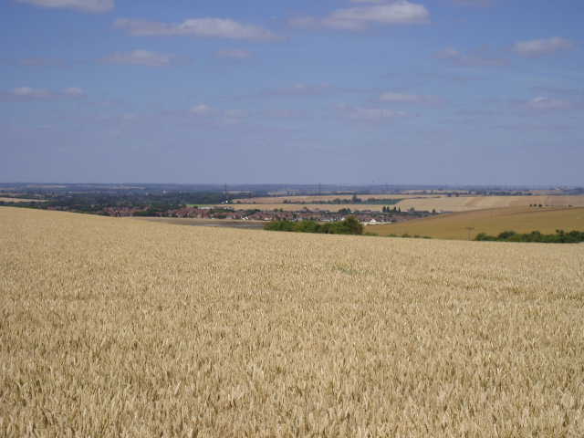
[8] View over Cambridgeshire from path to Wallington
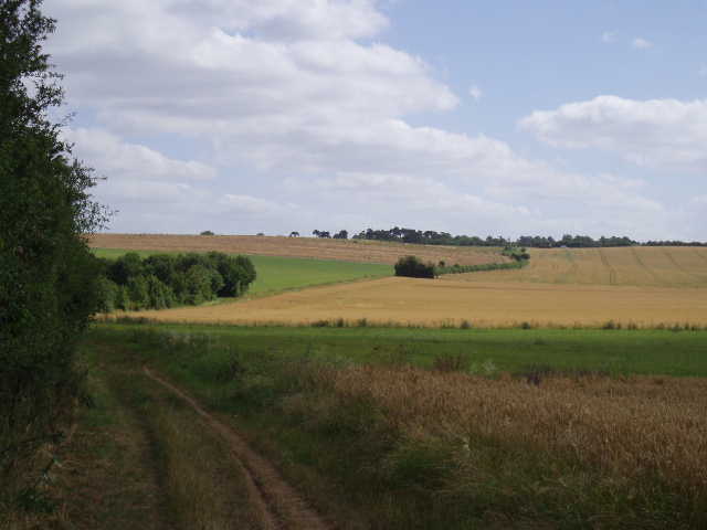
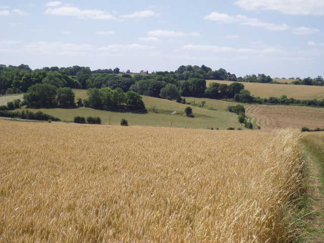
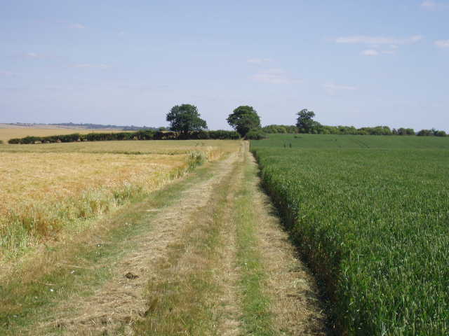
Beyond this field, near the village of Clothall, I parted company with the Hertfordshire Way, as the Icknield Way turned left along the field edge to head in a north-easterly direction towards Wallington. On exiting the field, I crossed the Baldock-Buntingford road and took the bridleway opposite. This grassy path rose steadily between corn fields before levelling out [7]. There were now grand views over to my left [8] – I was back on the long line of chalk hills, looking out for miles over the lower-lying lands of Cambridgeshire to the north. The bridleway, apparently an old coaching road, continued for over a mile, generally following a right-hand hedge through a long sequence of corn fields. This was delightful walking in warm sunshine and under blue clouds, with constant extensive views [9]. There were fewer butterflies and wildflowers in these arable fields compared to some of the grasslands I’d walked through on previous days, but I still saw several Red Admirals and plants such as Bindweed, Scabious and Greater Knapweed. Eventually the bridleway descended slightly to reach the Baldock-Wallington road, where I turned right.
[9]The path to Wallington
[10] Wallington church
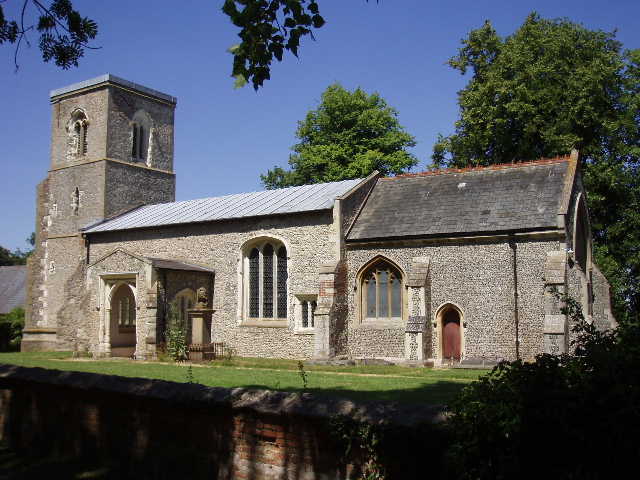
Just before entering Wallington, my route turned left down a bridleway, a wide track between hedges. After a few hundred yards it brought me to a junction by Wallington Church [10] (the Hertfordshire Way also passes through here). There was a small pond opposite the church [11]. A bit further down the lane was another one, surrounded by a circular brick wall in a small wildlife reserve [12]. I walked a few yards further, to a stile where the Icknield way continued onwards towards Royston, then turned around. I went inside the church for a quick look. Some of it dated back to the 1100’s, and as always I found the ancient architecture very impressive. The church also had copies of George Orwell’s marriage certificate for sale – he and his wife lived in the village for a while and ran the village sweetshop (the Hertfordshire way passes the cottage where they lived, which has a plaque on the wall).
[11] Pond in Wallington
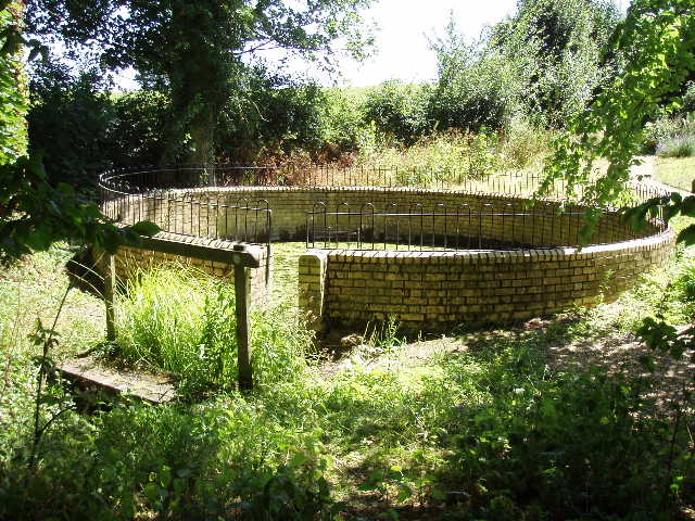
[12] Unusual pond in a nature reserve at Wallington
I got back as far as the nature reserve just outside Baldock before stopping for lunch about 1.20pm. I sat on a bench, grateful that it was shaded by a bush as it was now very warm indeed. As I ate my sandwiches, I saw a pair of Bullfinches fly past, so today was a very good day as far as bird watching went! The walk back through Baldock and Letchworth in the heat of the afternoon was not the pleasantest part of this journey, but again it only took about an hour and a quarter, so it wasn’t too bad. I got back to my car in Ickleford about 3.30pm – it took some time to cross the road by the church, as there was a lot of congestion as parents were collecting their kids from school.
Total Distance: 82 miles each way