Pete's Walks - Berkshire-Essex Walk
If you are considering walking this route yourself, please see my disclaimer. You may also like to see these notes about the maps and GPX files.
Day 12 27/07/06 Wallington to Therfield Heath (8.0 miles each way, approximately)
Parked at Wallington.
There was a gap of almost two weeks between the last walk and this one due to a prolonged heat wave, with temperatures rising above 30C almost everyday. Even today the temperature was forecast to reach about 28C (in the shade), with thundery showers expected later in the afternoon. I wouldn’t normally have walked on such a hot day, but was getting fairly desperate to get on with this walk. I think I’m much better at handling cold weather than hot – walking in hot weather really seems to drain me, and I’m always slightly worried that I might get one of the mild Migraines that I very occasionally suffer from.
I wasn’t completely idle during the heat wave. I went out for a short stroll two or three times, taking photos of wildflowers and butterflies. I also had a great weekend away in North Norfolk with a friend, ostensibly to go bird watching but we also spent a lot of time looking for butterflies and wildflowers.
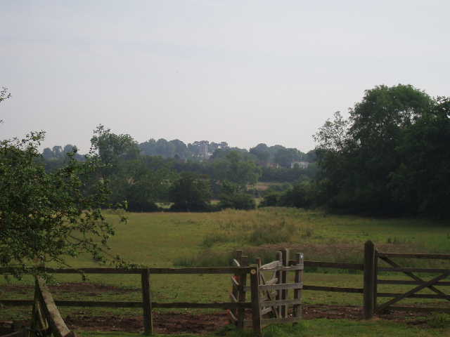
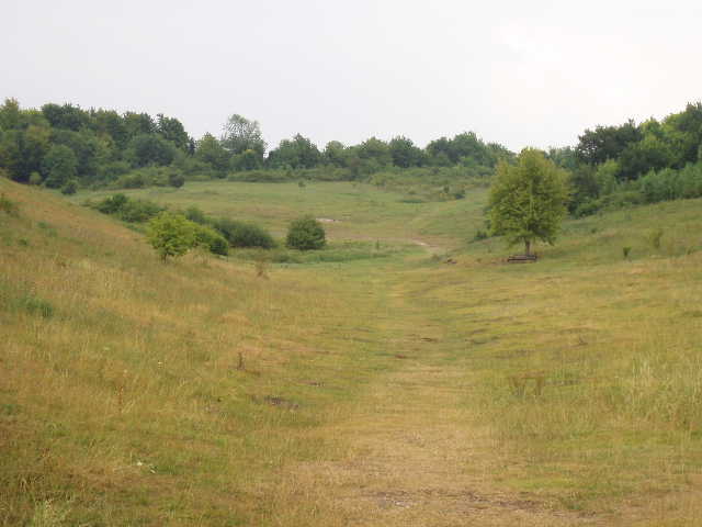
[1] Looking towards Sandon from near Roe Green
Much of today’s walk was familiar to me, as the Icknield Way shared the same route as the Hertfordshire Way for most of the way (I walked this section on Days 1 and 2 of my Hertfordshire Way walk late last September). From Wallington, I took a footpath across a small pasture by a farm (there’d been a bull with some cows here last time, but today the field was empty). I was pleased to see a clear path through the cereal crop in the next field, as in September there was no sign of a path and I’d walked round the two sides of the field instead of crossing it diagonally. In the next field I followed a hedge on my left to reach a footbridge over a ditch. Here I took the leftmost of three cleared paths through the corn, to reach a road by some cottages. Across this, a short track between hedges led to a vast field which I remembered well from last September. The path followed a left hand hedge round the edge of this field (I can’t remember what the cereal crop was, but I know I walked through fields of Barley and Oats as well as corn on this walk) for over half a mile, before I turned left (the huge field still continued for some distance!). I crossed a paddock (there were two horses here when I returned) to reach the pretty village of Roe Green. Like so many places I have passed through on my walks in the Chilterns and elsewhere, this consists of several houses and cottages spread round a large green (in this case a long and fairly thin one, with a section set up as children’s playground).
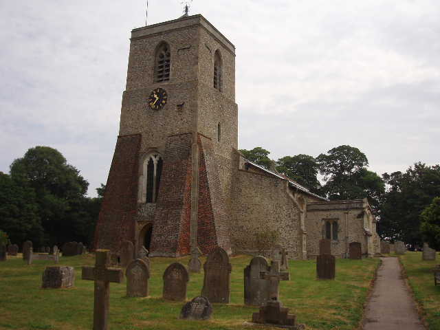
[2] Sandon Church
From Roe Green, I followed the familiar route through a sequence of small paddocks [1], and then across two larger grass fields (the first of which had two horses in it) to reach the larger village of Sandon. Here I turned left along the road for about a quarter of a mile, before crossing a corner of the village green to reach the church [2] (this was where I had finished Day 1 of my Hertfordshire Way walk). I passed through the churchyard, noticing examples of ‘Hertfordshire Bedstead’ [6] gravestones, and followed a path between trees to a road [3]. A short way to the right, at a bend, I reached the start of a bridleway called Park Lane. Here I noticed a sign, stating that part of the path I wanted to follow was temporarily closed for repairs, by order of Herts County Council. I continued down Park Lane, a nice track between trees which can apparently be muddy at times but was fine today. At its end I followed a lane ahead, soon turning left at a junction. After a few yards, I turned left up a long driveway towards a cottage, but soon bearing right along a green lane.
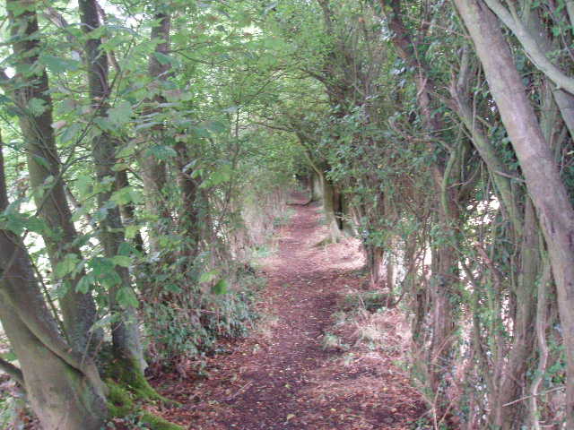
[3] Looking back along the path from Sandon church
A few hundred yards down this green lane, I met a couple of walkers coming the other way. They were pleased to see me, as I was the first other walker they had seen since starting their walk four days ago. They were walking the Icknield Way, continuing on along the Ridgeway and then the Wessex Ridgeway, finishing at Lyme Regis. It still surprises me how few other walkers I come across on my walks – I saw several walkers on my first few walks on the Ridgeway Path, but I don’t think I’ve come across anybody else at all while I’ve been walking the Icknield Way part of this route.
A short way further on, I came to a path junction where the Icknield Way went left, the Hertfordshire Way right. This was where the sign had said the track used by the Icknield Way was closed for repairs – it wasn’t too clear to me whether the path was currently closed or that the sign meant that it would be closed at some point, but in the end I decided to follow the Hertfordshire Way route instead. This followed the edge of a wood on its left, then a wood on its right, to reach a crossing farm track. A few yards down to the right, a footpath on the left led across a field and then some paddocks, to emerge by the church in Kelshall. Having gone through the churchyard, the Hertfordshire Way follows a lane through the village (passing the stump of an old cross beside a modern replacement cross with some very informative notice boards) [4], then turns right to follow a path beside a right-hand hedge to reach the church at Therfield.
[4] New and old crosses on Kelshall village green
At Therfield, the Icknield Way diverges from the Hertfordshire Way, taking a much shorter route to Therfield Heath and Royston. I took a path beside the village pub which led to a paddock. Across this, I followed the path round the edge of a small ploughed field, and then across a larger field of stubble. Beyond the hedge on the far side of this field, I joined a wide track. This went on for just over a mile, initially with hedges on both sides, at other times with a hedge on one side only. There were large corn fields on either side for most of the way, although one or two had been harvested and even ploughed. There were several wildflowers along this section of the walk, nothing unusual though, just plants I have seen frequently so far, such as Scabious, Bindweed and Ragwort. Eventually, where the track turned right, I took a hedgeside path straight ahead for a couple of hundred yards, to reach a gate giving access to Therfield Heath. Just before the gate, I saw a Painted Lady butterfly, the first I’ve seen (or at least the first one I’ve recognised!) on this walk.
Therfield Heath [5] is a nature reserve on the western edge of Royston, consisting mainly of grass and a little scrubland on and below a steep chalk hillside. Part of it is a golf club, and there are several other sports fields at the foot of the slope. It is noted for its natural history, notably the largest of only three colonies of Chalkhill Blue butterflies in Hertfordshire. It also has a fascinating history, which I learned from a notice board when I walked the Hertfordshire Way. There are prehistoric barrows, and a Roman Road runs nearby. It was used for jousting and tournaments in the middle ages, and the Yorkist army was assembled there before the first battle of the Wars of the Roses. James I used it for hunting, and during the Napoleonic wars the militia trained on the heath.
[5] Therfield Heath
I continued on a path in the same northerly direction, heading downhill between bushes before coming out on to a more open area leading into a small valley. I walked through this and past a sports centre, to reach a main road, with the centre of Royston about half a mile to the right. I turned round and headed back towards Wallington. As I crossed the heath, I was lucky enough to see a Chalkhill Blue butterfly and managed to get a reasonable photo of it. The day had started with clear blue skies, but it had now clouded over. It was sticky, and the predicted thundery showers were obviously on their way. There were a few spots of rain as I left the heath, and again when I had my lunch on a bench in Therfield, but fortunately neither amounted to anything. There were several rumbles of thunder in the afternoon, but again it remained dry. I noticed several more Painted Lady butterflies on my way back, including three together at Roe Green. I had just about exhausted my 3 litres of water by the time I got back to my car about 3.45pm, and felt pretty drained by my exertions in the heat.
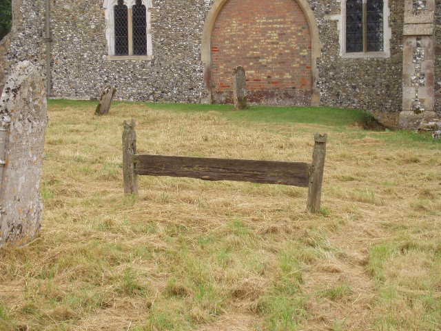
[6] 'Hertfordshire Bedstead' gravestone in Sandon churchyard
I was very lucky with my timing. As I drove back from Wallington, almost straight away I could see that I was heading into a thunder storm. When the rain came, it absolutely threw it down! It was particularly bad as I was driving along the dual carriageway between Hitchin and Luton, where I had to set the windscreen wipers on double speed, and there was a dangerous amount of surface water on the road. When I got home I learned that part of the shopping centre in Milton Keynes had been closed because of flooding!
Total Distance: 90 miles each way