Pete's Walks - Berkshire-Essex Walk
If you are considering walking this route yourself, please see my disclaimer. You may also like to see these notes about the maps and GPX files.
Day 2 22/06/06 Cart Gap to Watlington (8 miles each way, approximately)
Parked in Watlington.
This was an absolutely superb walk, definitely one of the most enjoyable I have done since I started writing these journals. It was very varied, starting with a long steady ascent, followed by several ups and downs and then a flat two miles to finish with, it passed several features of historic interest, and the conditions were almost perfect for walking – warm, but not too warm. And there were lots and lots of Red Kites! As you’ve probably worked out by now, as far as I’m concerned, any walk in which I see a Red Kite is a good walk. Amongst numerous other sightings, I saw seven in the sky near Nuffield church, including three very close overhead, and then saw nine over a field as I got back to Watlington.
I decided to park in Watlington and do this walk ‘backwards’. Although there was a small space at Cart Gap where I could have parked, the remains of a burnt-out car there deterred me from parking there, and there was nowhere else on the route where I could park. However, I will describe the walk from where I turned round at Cart Gap, so that the description follows the same easterly direction as the rest of this journal. I set off from Watlington at about 10am, and reached Cart Gap after a thoroughly enjoyable walk by about 12:30pm.
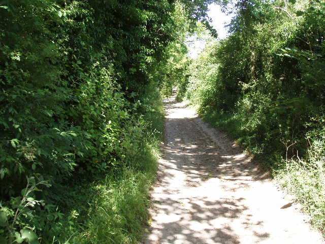
From Cart Gap, the Ridgeway continued following Grim’s Ditch in a straight line eastwards, gradually ascending from the Thames valley into the Chiltern Hills. Whereas the section of Grim’s Ditch I’d walked on Monday was not really perceptible on the ground, it now became more and more obvious. At first it was a slightly raised bank, later becoming a huge ditch about 10-12 feet deep, with the path on the bank on either side or else, for a short section, along the bottom of the ditch. I’ve checked on the internet, and there are several unrelated earthworks throughout the chalk hills of southern England that are called Grim’s Ditch. The most extensive is the one I encountered on both the Chiltern Way and the Hertfordshire Way, which runs for about 16 miles from Potten End to near High Wycombe. Nobody really knows who built them or why, but they are thought to be tribal boundaries rather than defensive features.
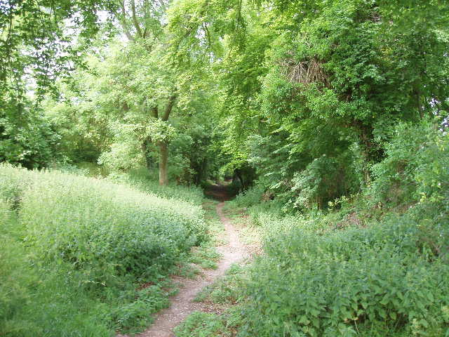
[1] Path along Grim's Ditch
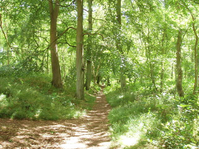
[2] Path along Grim's Ditch
After a short distance, the Ridgeway crossed a lane – I was familiar with this junction, as the lane was part of the Southern Extension of the Chiltern Way which I walked last summer. I remembered wondering if I’d ever come back to walk that section of the Ridgeway. A short distance further along Grim’s Ditch, the steadily rising path passed a small number of pine trees, but thereafter the path was sheltered by beech trees [1,2] which are much more closely associated with these chalky hills. I noticed many flowers alongside the path, but buttercups, dog rose and speedwell were the only one’s I could identify – I wish I was better at recognising flowers and trees. At one point the path passed the gate of a house, where there was a tap with a sign indicating that walkers could drink the water – very thoughtful of the owners (there was a similar sign and tap a little further on at Nuffield church).
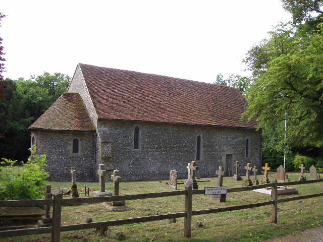
Having already walked from Watlington to Cart Gap, I was feeling pretty tired by the time I reached the end of Grim’s Ditch, after a very gradual ascent for about two miles. But it had been a delightful walk. At the end of the earthwork, the Ridgeway turned left, emerging from the beech trees and following the side of a field to reach a road in Nuffield, a few yards from the church [3]. I stopped and had my lunch on a bench in the churchyard, beside the drinking tap, as it was now about 1:20pm. The church is extremely old, with the walls of the nave thought to date back to 634 AD, although the rest of the church is more modern – being only 900 years old! It is sited at the highest point in the southern Chilterns, about 700 feet above sea level.
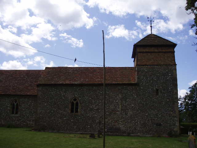
[3] Nuffield church
Across the road from Nuffield church, the Ridgeway crossed a small meadow - this was where I had earlier seen seven Red Kites in the sky, including three that flew very low overhead as I walked along. It never ceases to amaze me how unconcerned they are about the presence of human beings, quite unlike any other birds of prey in this country. Beyond the meadow, the Ridgeway crossed a golf course, the path clearly marked by a series of white posts that lead across the fairways, before passing through the garden of a cottage to arrive at a main road. Safely across this, I followed a path that descended through woodland and then crossed a corn field. On the far side, in a long thin belt of trees, it crossed another path which I again recognised as part of the Chiltern Way – I remembered the junction from that odd day when I walked the section of the original route of the Chiltern Way that the southern extension omitted.
The Ridgeway continued on a clear path through a much larger corn field, descending and then re-ascending. On my left, I could see out over the Oxfordshire plain, with Wittenham Clumps and Didcot Power Station being prominent landmarks [4,5]. I recalled someone telling me once when I worked near Oxford, that at a planning meeting when the power station was being built, local residents had requested that trees be planted round the site to screen the cooling towers - they obviously had no idea of the size of the monstrosity being built in their midst, as the huge cooling towers must be ten times taller than any tree!
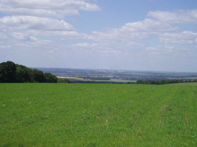
[4] Looking out across the Oxfordshire Plain towards Didcot Power Station
[5] Looking back in the direction of Nuffield
My route then followed a track that passed a horse paddock on my right and then a huge mock-Elizabethan house on my left (Update 26/072022 - "Ewelme Park House is a Lutyens-style property built in 1913 and designed by the architect L. Stanley Crosbie", according to Google), to reach a farmyard. The track turned right here, continuing between hedges for a while and then following the side of another corn field to reach a wood with the curious name of Jacob’s Tent. Here the Ridgeway descended very steeply through the charming beech trees, and then continued downhill through a sheep pasture, with sheep grazing in the parkland behind Swyncombe House on my right [6]. At the valley bottom, the Ridgeway turned right along a broad track and after a quarter of a mile or so it reached the 11th-century church of St Botolph, Swyncombe [7]. I remembered this very well from my Chiltern Way walk, and for the next half mile my walk along the Ridgeway would coincide with the Chiltern Way. I followed the lane from the church a short distance to a T-junction, and took a footpath opposite. This followed a left-hand hedge of a very large meadow, going steeply downhill and then climbing just as steeply up the opposite side of the valley – as I puffed my way uphill, I saw another Red Kite above the far side of the field.
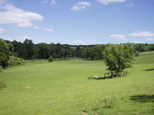
[6] Parkland of Swyncombe House
[7] Swyncombe Church
The path entered a wood (much damaged by a great storm in 1990, according to the guide book) and continued over the brow of the hill. The Chiltern Way then turned left, to go over Swyncombe Down, but I continued ahead on the Ridgeway, gently descending as the path swung round slightly to the left, following a field boundary – I was surprised how insignificant Swyncombe Down seemed from this direction, as from other points it’s quite prominent (and the way the Chiltern Way goes up it is certainly pretty steep!). The path passed beside a farm, and then turned right along a broad bridle way.
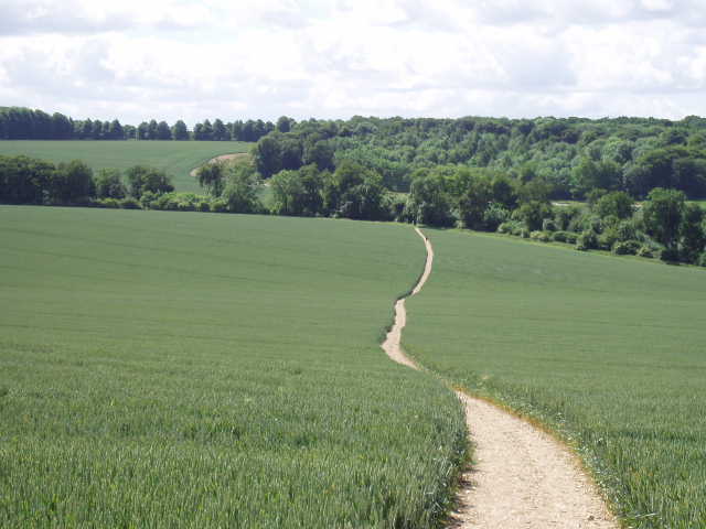
[8] The long chalky track leading towards Watlington
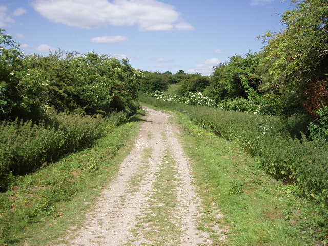
[9] The long chalky track leading towards Watlington
This last descent had taken me from the Chilterns to the plain below. The flat chalky track I was now on [8,9], running parallel to the steep northern slope of the Chilterns, continued for about a mile and three quarters to the road near Watlington where I had parked – in fact, I would be following it for several more miles on my next walk. The track is part of the Upper Icknield Way, a very ancient route although not as old as the Ridgeway. As I followed the track, I passed a sign about the Ridgeway, and another about the Red Kites. Just past a farm, the track became a metalled lane, but a permissive path alongside the far side of a hedge allowed me to avoid this short bit of road walking. Across a road (one I’d used to get to Nettlebed and beyond when I walked the Chiltern Way), the track continued between hedges – it was here that I counted nine Red Kites over the field on my right, the most I’ve ever seen at one time. I got back to my car at about 15:30pm – despite walking 16 miles on a very warm day, I didn’t feel too bad at all and felt that I could have easily carried on walking for another hour.
This was a really good walk, one that I shall remember for a long time. It was a lovely day, warm but not too warm and almost continually sunny throughout – just one large grey cloud passed overhead as I went through Nuffield in the morning. Perhaps that explains why I saw so many other walkers today – I must have seen about a dozen, whereas I usually see no more than three or four on a weekday like today. Apart from the last section, the walk was enjoyably up and down. The long ascent of Grim’s Ditch was a quite delightful part of the walk, quite apart from its historic interest. There was a lot of variety on the walk, as I passed through corn fields, woods, meadows, sheep pastures and a golf course. Both the ancient churches were worth seeing. And, of course, there were plenty of sightings of Red Kites, which always lifts my spirits.
Total Distance: 15 miles each way