Pete's Walks - Berkshire-Essex Walk
If you are considering walking this route yourself, please see my disclaimer. You may also like to see these notes about the maps and GPX files.
Day 3 23/06/06 Watlington to Wigan’s Lane (7.5 miles each way, approximately)
Parked in Watlington.
After a truly memorable walk yesterday, I knew that today’s walk would not be anywhere near as good. In fact, looking at the guide book, I was worried that it might be rather boring, as it followed the flat chalky track I’d finished on yesterday for about another six miles. In the event, it wasn’t quite as monotonous as I’d feared and I enjoyed the walk, although it’s certainly not one of the better ones that I’ve done.
I parked at the same place again, on the very edge of Watlington just before the road climbs for about a mile as it ascends the steep northern slope of the Chilterns. Again it was about 10am as I started walking, having covered my arms and neck in sun cream as it was already very warm. The Ridgeway path continued to follow the course of the Upper Icknield Way, on a broad chalky track running between hedges, with the escarpment of the Chilterns on the right and the flat Oxfordshire plain on the left. As well as going parallel to the steep slope of the Chilterns, the path was also parallel to the road I’d driven to get to Watlington, a few fields away to the left.
The track went on for about six miles, almost completely flat apart from one or two very gentle undulations. At first it was a very broad and chalky track, which could be used by motorised vehicles during the summer months although later on it became a bridleway, closed to traffic. Some parts of the Ridgeway have suffered very badly from damage from 4-wheel drive vehicles and trail bikes, but voluntary and other restrictions seem to be improving the situation. Certainly parts of this section were very badly rutted, which explains why it is closed to motorised vehicles during the wetter winter months.
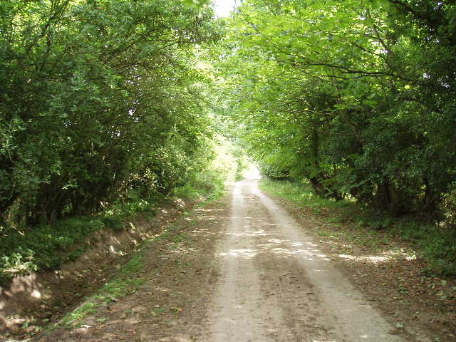
[1] The track near Watlington
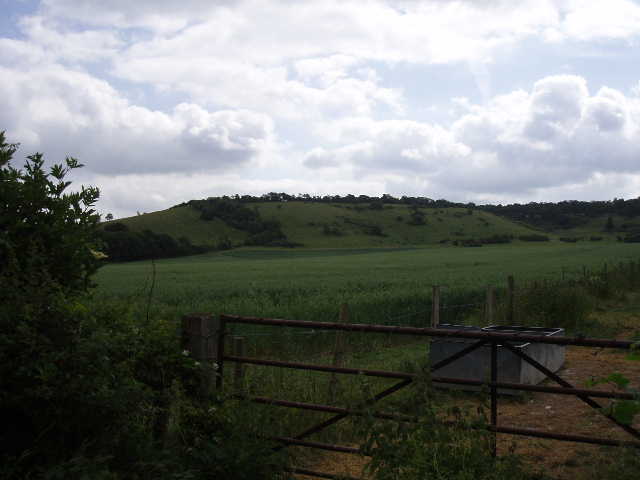
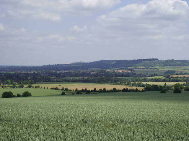
[2] View towards Bald Hill and the Chiltern escarpment
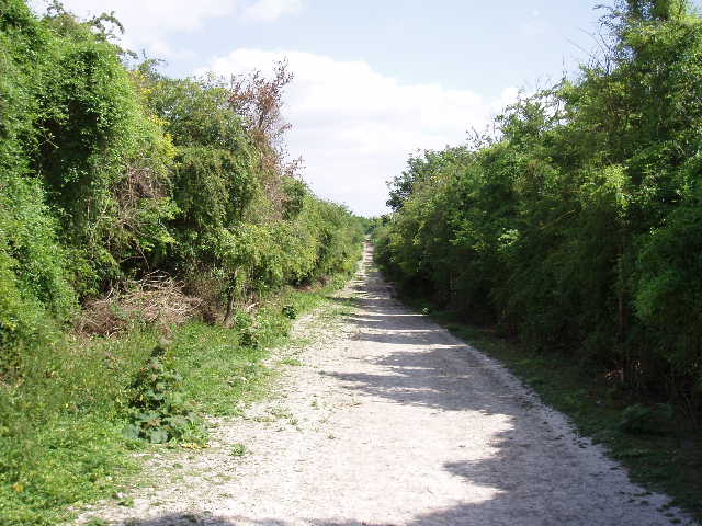
Although flat and pretty straight, the track did vary slightly from place to place. At first it was like a green tunnel as it was overhung by the trees either side [1] – I was glad when it opened out after a mile or so, as it was starting to feel rather claustrophobic as I could seldom see anything on either side (conversely, I was very glad of the shade when I was walking back in the afternoon!). Where it opened out, the trees on either side were replaced by hedges, set farther apart, and the chalky track was replaced by numerous ruts running through the grass. I could soon see and hear the M40 ahead of me, as I walked along still with the steep hillside a short distance to my right [2] and the flat lands of Oxfordshire to my left. The huge scar where the motorway cut through the Chilterns was clearly visible (as shown on the titles for The Vicar of Dibley, I believe). Fortunately, the road noise wasn’t too intrusive at all, not even when I walked under the motorway [3,4,5]. On the other side, the path became a chalky track again and passed through a small beech wood before reaching the A40.
[3] Looking back along the track from near the M40
[4] The M40 cutting its way through the Chiltern escarpment
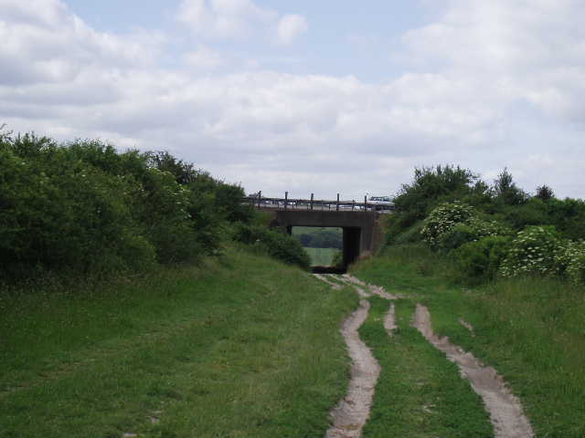
[5] Looking back to the M40 bridge
Across this, there was a noticeable change in the scenery. So far, the steep hillsides on my left had been covered in grass or scrub, but now they were completely shrouded by trees. The path continued onwards for mile after mile, a pleasant enough walk but with very few distinguishable features. I didn’t pass any buildings at all, apart from one or two houses by the very few roads or lanes I crossed. The dominant feature ahead of me was the now disused cement factory at Chinnor, which gradually grew nearer and nearer [6]. As I went past it [7], I could see through the fence and hedge on my left a huge hole that was obviously where the chalk had been quarried for the cement works.
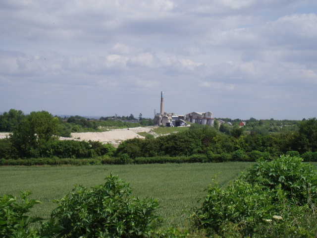
[6] The old cement works at Chinnor
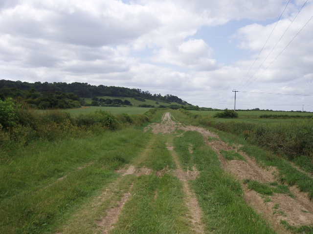
[7]The track near Chinnor
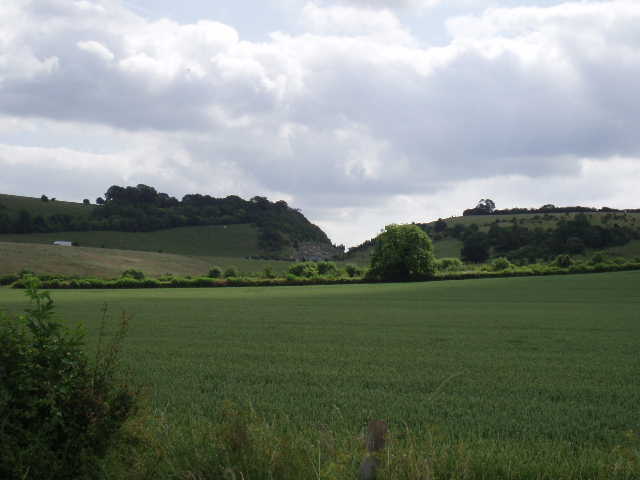
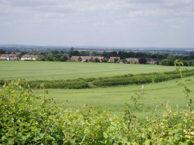
At last, having just crossed a main road heading south from Chinnor, the character of the path began to change. Just east of Chinnor [8], there is a wide gap in the otherwise almost continuous line of the Chiltern escarpment, where the Saunderton valley runs north-south. The Ridgeway path started to ascend very slightly, and slowly curve round the end of this part of the escarpment (known as Bledlow Ridge), changing direction roughly from east to south-east. This was a much nicer part of the path, as it passed through quite substantial beech woods. At one point it crossed the front garden of an isolated cottage on the edge of the woods. Eventually, the Ridgeway parted company with the Icknield Way, bearing half-right in a south-easterly direction across a very large pasture that had obviously recently contained cows, judging by the plentiful evidence they’d left behind! I was rather glad the field was empty, as I remembered from my Chiltern Way walk there was a notice on the other side of the field saying ‘Beware of the bull!’. From this field I had extensive views across the Saunderton valley [9] – I could see Whiteleaf Cross, a chalk carving that I will pass on my next walk, and the windmill at Lacey Green that I passed on the Chiltern Way. The path cut across a corner of the field and then followed a left-hand hedge. Part way along the hedge, the Chiltern Way came in from the left (from Bledlow), and the two routes coincided to the stile in the corner of the field and just beyond, where the Chiltern Way branched off to the right, heading for the village of Bledlow Ridge. The Ridgeway continued ahead, alongside a right-hand hedge to reach Wigan’s Lane, a minor road running between Bledlow and Bledlow Ridge. This was were I turned round, having walked about 7.5 miles in just under two and a half hours.
[8] View towards Chinnor
[9] Looking across the Saunderton Valley
Today was a couple of degrees warmer than yesterday, and I had to put on sun cream three or four times. I had lunch on a tree stump near the old cement works, just after 1pm. I saw a few other walkers today, but nowhere near as many as yesterday. In fact one couple must be very confused by my antics – yesterday, I met them coming in the opposite direction a few hundred yards short of my turning point at Carter Gap, and then a little later I passed them as they stopped for lunch somewhere along Grim’s Ditch. I passed them this morning as I walked eastwards past the Chinnor cement works, and then met them again as I headed back west across the large field that was fortunately empty of cows and bull.
I got back to my car at 3pm. After walking 31 miles over two successive warm days, I was feeling a bit tired but not too bad. I certainly didn’t feel as fresh as I’d done at the end of yesterday’s walk, but I could have carried on if I’d had to. The walk today hadn’t been quite as monotonous as I’d feared, but it didn’t pass through a single village or hamlet and there were very few points of interest on the route. One thing however – just past Chinnor, I crossed from Oxfordshire into Buckinghamshire, so that’s two counties down, five to go!
Total Distance: 22.5 miles each way