Pete's Walks - Berkshire-Essex Walk
If you are considering walking this route yourself, please see my disclaimer. You may also like to see these notes about the maps and GPX files.
Day 4 27/06/06 Wigan’s Lane to Coombe Hill (8 miles each way, approximately)
Parked in Wigan’s Lane.
There is a convenient lay-by with parking for 3-4 cars where the Ridgeway crosses Wigan’s Lane (a road running between the villages of Bledlow and Bledlow Ridge), so I parked there. I could remember seeing cars parked along this road when I walked the Chiltern Way last year, which is why I planned on finishing and starting sections of this walk here.
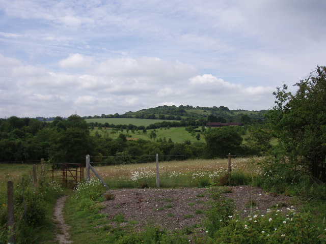
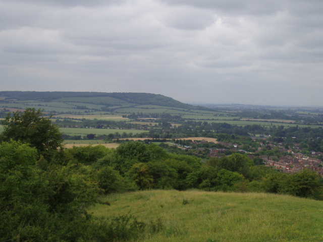
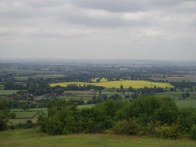
This was another warm day, although very cloudy, almost overcast at times. The walk got off to a great start – after a clear path through a couple of corn fields [1], the Ridgeway immediately began to climb through woodland to the top of Lodge Hill, an isolated hill on the western side of the broad Saunderton Valley. The top of the hill was scrubland, with colourful wildflowers (including Common Rock-Rose) amongst the grass. There were good views all round as I followed the path across the top of the hill – as the guide book says, this would make a great spot for a picnic. Ahead of me across the Saunderton Valley I could see the windmill at Lacey Green, and the chalk figure of Whiteleaf Cross [2] that I would be passing later. To my left, the valley opened out into the wide expanse of the Vale of Aylesbury [3]. To my right, the wide valley continued for a mile or so, before a ridge rose in its centre, creating two smaller valleys (more typical of the Chilterns) on either side [4]. I enjoyed a delightful promenade along the top of the hill when, to make things even better, a Red Kite soared low overhead. Bliss!
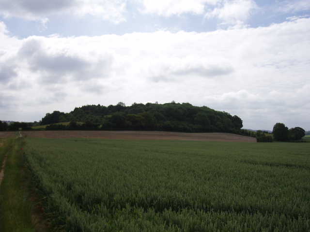
[1] Path approaching Lodge Hill
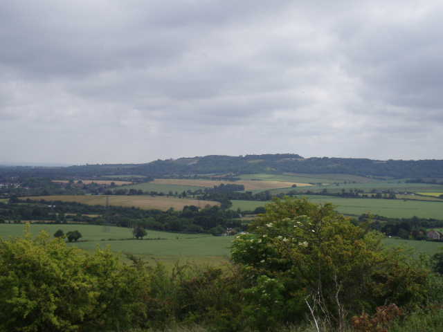
[2] Looking north-east from Lodge Hill, towards Whiteleaf Cross
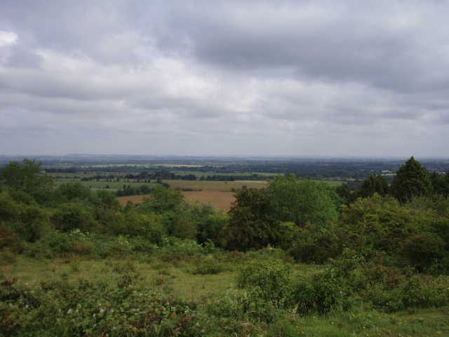
[3] Looking north from Lodge Hill
After passing through a small grove of Beech trees, the path started to descend from Lodge Hill. Below the scrub, it followed a right hand hedge alongside another corn field, turning left at a path junction to reach a minor road. Across this, the Ridgeway followed a gravel drive towards a farm, then following a marked path round the right of the buildings and then between wire fences to cross a field. It then followed a hedged track, with parts of a golf course either side. I then had to carefully cross a railway line, before continuing ahead along a row of bushes – I recognised this spot, as the Chiltern Way came in from the left to join the Ridgeway, as both paths then crossed over the top of a tunnel [5,6] over a second railway line (I’d had my lunch sat here when I did this section of the Chiltern Way, from Bledlow Ridge to Redland End). Where the Chiltern Way turned right after crossing the tunnel, the Ridgeway bore half-left, through a straggly crop that I recognised but don’t know what it is (it has something like miniature pea-pods instead of leaves – it was this stuff that nearly tore my shins to shreds where it had overgrown a section of the Hertfordshire Way near Flamstead).
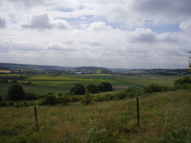
[4] Looking south from Lodge Hill
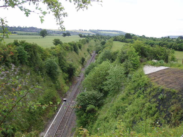
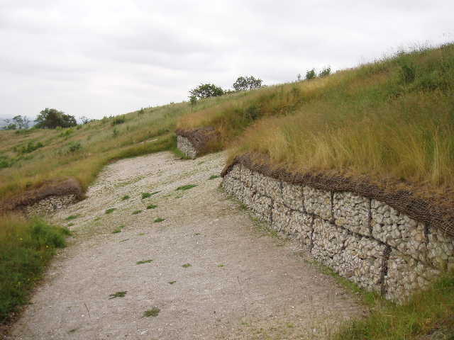
[5] Railway line, from above the tunnel entrance
[6] Looking back to Lodge Hill from above the railway tunnel entrance
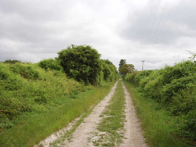
Beyond this field, the Ridgeway turned right along a road, still making a line towards Whiteleaf Cross on the steep hillside ahead. I went across a crossroads, and continued to a main road. Here I turned left along a noisy main road for just over a quarter of a mile (there was a pavement, fortunately) to reach the edge of Princes Risborough. Here I turned right, now on the Icknield Way again [7], and followed the broad chalky track for some way, with a school and the houses of the town on my left. I saw another Red Kite flying over the town - again, this is quite unlike other birds of prey, they seem to be happy over human habitation as well as out in the country. As I walked the track, I kept getting glimpses of Whiteleaf Cross ahead [8]. Beside a playing field on the left, the Ridgeway turned right on a path that followed a hedgerow, and then began the ascent of the steep slope ahead. This was initially through woodland, with steps made in the path at the steepest parts. Beyond a kissing gate, the trees gave way to scrubland as the path continued to ascend through the grass and bushes. This was Brush Hill Nature Reserve, a noticeboard informed me, as I reached a gateway onto a lane [9]. Here, instead of taking the lane, the Ridgeway turned away from it, heading left along the brow of the escarpment I’d just climbed.
[7] Icknield Way, on the edge of Princes Risborough
[8] Looking towards Whiteleaf Cross from the edge of Princes Risborough
[9] Looking back over Princes Risborough from Brush Hill
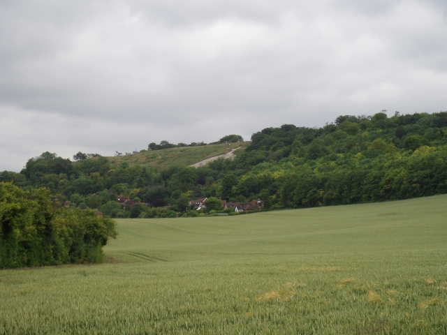
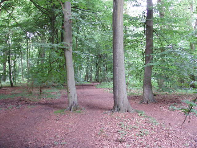
After crossing a lane, the walk continued onwards, sometimes through beech trees [10], sometimes through more scrubland, until I arrived at a Neolithic barrow [11]. This was temporarily fenced off, as it had been recently reseeded with wildflowers and grasses in order to create a layer of turf to protect it from further erosion. There was no information board about the barrow, nor does the guide book say much about it, unfortunately. It was right on the brow of the steep escarpment, so had obviously been deliberately sited so that it was visible from many miles away [12]. Below it, on the steep slope, was Whiteleaf Cross, the oldest of the chalk figures on the Chilterns according to the guide book (the other chalk figures I know of are a triangle near Watlington, and the White Lion at Whipsnade Zoo dating only as far back as the 1950’s). It was first mentioned in documents in 1742, but is thought to have been created by monks in the 15th or 16th centuries for devotional or navigational purposes (presumably the same monks who gave the adjacent village of Monks Risborough its name). The figure is in the form of a large triangle, surmounted by a small cross. I clambered down a few yards to take a close look at it [13], and it has evidently been well maintained. It was more substantial than I’d expected – rather than just the turf being cut away to show the underlying chalk, some of the walls of the figure were actually built up to a height of a few feet by lumps of chalk held in place by netting.
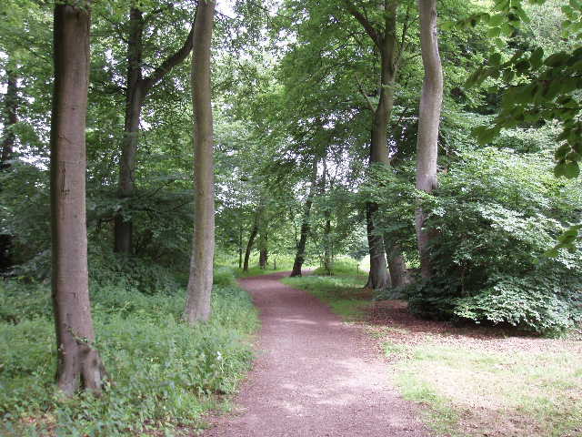
[10]Path through beech trees, heading towards Whiteleaf Cross
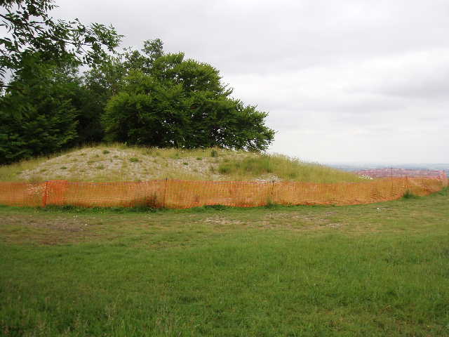
[11]The Neolithic Barrow near Whiteleaf Cross
[12] Looking back over Princes Risborough from Whiteleaf Cross
The Ridgeway turned right at this point, and commenced a very long and occasionally steep descent through some fairly typical Chiltern beech woods. To my right was a deep wooded combe called The Hanging. This section of the path was a bit of a struggle on my way back in the afternoon, one of the biggest bits of uphill I’ve done in the Chilterns (of course, absolutely nothing compared to the Dales where I was walking a couple of weeks ago, let alone the Lake District!). At the foot of the hill, I continued past a pub and along a road for a short distance, before ascending steeply on a well-made flight of wooden steps. This led up through more woodland, to emerge onto a recently-mown hay meadow. Across this, and over a pair of rather complicated but well-signposted path junctions, the Ridgeway continued onwards round the slopes of the heavily-wooded Pulpit Hill (the site of a hill-fort, according to the map) [14]. To my left were horse paddocks, with some scrubland on my right below the trees surmounting the hill. After a few hundred yards, I reached a bridleway in a sunken lane, rising up the hill to my right. Again, I had a moment of recognition – a fingerpost indicated that this was the start of the North Bucks Way [15], another walk I did last year. I turned right, but left the bridleway after a few yards to go through a kissing gate into a field on the left. Here I quickly came upon a large party of junior school children with their teachers and assistants – I had seen them earlier from a distance, they were sitting round the top of Whiteleaf Cross just before I started to climb the hill from Princes Risborough. I carried on across the field, a very large pasture for cows, as it contoured round the hillside. When I reached the corner of the field, I admit I had to take a slight detour. I wanted to use a kissing gate in the corner formed by two wire fences that met at right angles. There were some thorny bushes in this corner, leaving just a narrow passage between the bushes and each of the fences. For some reason, all the cows and calves that lived in the field were all tightly packed in the corner by the kissing gate, completely blocking both these passages. Cows with calves can be aggressive, and they were so tightly packed in the narrow passages it would have been difficult, if not potentially dangerous, to try to ‘shoo!’ them out of the way. So I climbed over one of the wire fences about 30 yards from the kissing gate, making use of stones by a water trough that almost formed a perfect stile.
[13]Close-up view of Whiteleaf Cross
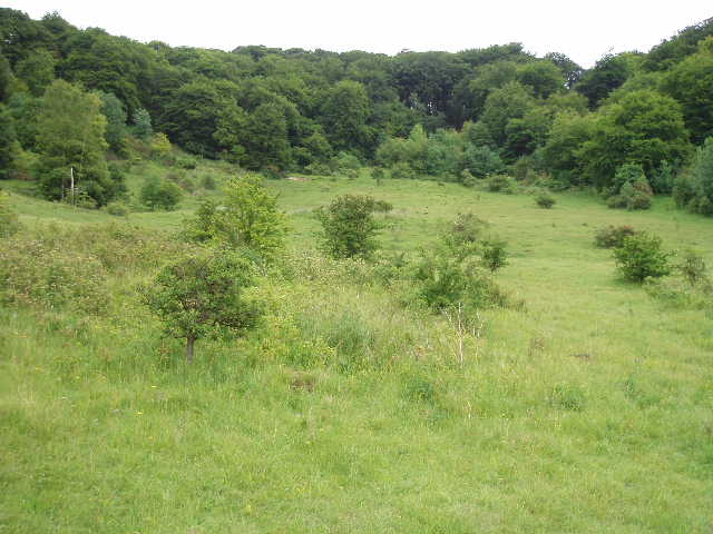
[14]Meadow below Pulpit Hill
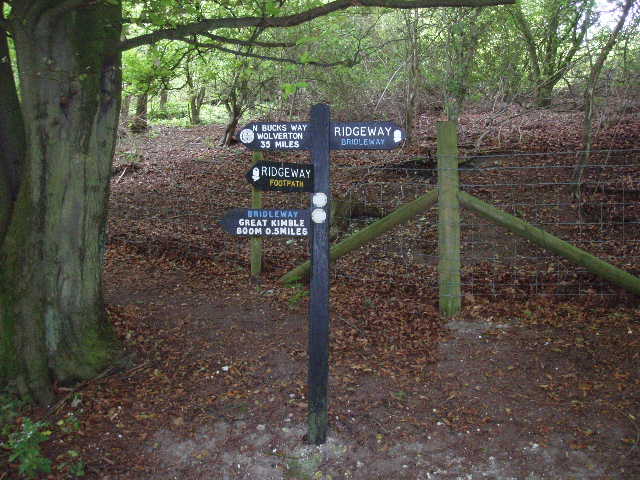
[15] Fingerpost where the North Bucks Way startsg
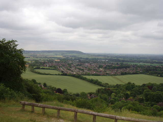
I continued across the next field, which was grazed by sheep. The Ridgeway then took a path alongside a wood, with a fence on the left. Looking across this, I could see the 16th century house of Chequers, with my destination of Coombe Hill beyond it [16]. Chequers was presented to the country as a country residence for the Prime Minister in 1917 by Lord Lee of Fareham, who also donated the land around Coombe Hill to the National Trust. I followed the path alongside the wood, then took a path going downhill to my left. Across a field, this went through a series of gates to cross the drive to Chequers (security cameras were an obtrusive presence - I resisted the temptation to stand close in front of them and pull faces!). After crossing another field, the path reached a minor road by a junction at a bend. On the other side of the road, a path led through a belt of trees that started climbing up the hillside. Where this reached the woods on the upper slopes of this hill, another fingerpost indicated the South Bucks Way going off to the right – I’d been here before too! In fact the rest of my journey to Coombe Hill was shared with the South Bucks Way, which starts there and heads south to Denham.
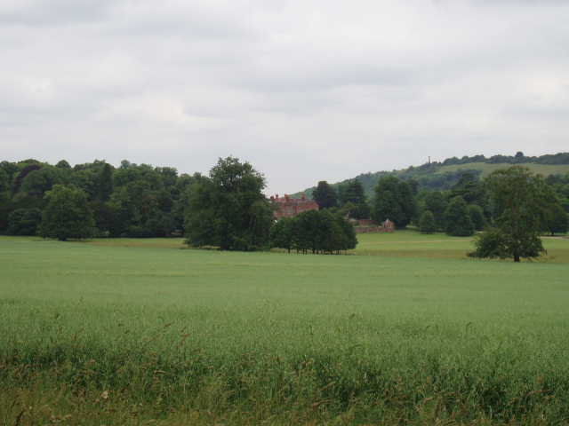
[16]Looking towards Chequers and Coombe Hill
[17]Path through beech wood, leading towards Coombe Hill
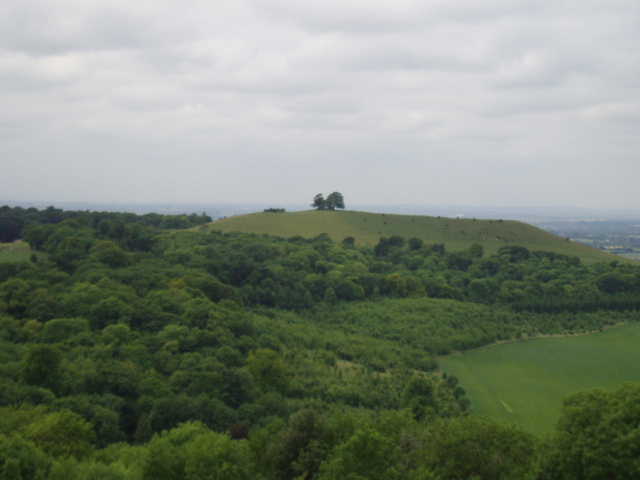
[18] Beacon Hill from Coombe Hill
The path continued uphill quite steeply through the beech wood and then turned left. The guide book rather gives up on route finding at this point and more or less says just follow the signs – this is fair enough however, as although this section of wood contained numerous branching paths, there were Ridgeway waymarks or fingerposts every 50 yards or so, almost always visible from the preceding one, so I had no trouble finding my way at all (anyway, I’d done it before!). As always it was a pleasure walking through the beech trees [17], and I came across several other people walking there. When I reached a road, I turned uphill to the right, and after a couple of hundred yards turned left to continue on another path through the woods. This soon reached a kissing gate, where I took a left fork, emerging from the woods onto a more open area of scrubland near the top of the hill, with the monument at the top of Coombe Hill soon in view. I stopped to take a couple of photos looking back over Chequers to the way I’d come [18], and within a few minutes I’d reached the monument.
The monument [19] on Coombe Hill is a memorial to the men of Buckinghamshire who were killed in the Boer War. A plaque on the monument [20] records their names, listed by regiment. I have visited Coombe Hill several times, including when I started the South Bucks Way here last August when it was covered in fog! This was the first time when I’d had the place to myself. I sat by the monument and admired the tremendous views out across the Vale of Aylesbury [21] – I could see Wendover and Wendover Woods to my right, where I would go on my next walk, and I could trace the route of part of the Aylesbury Ring near Ellesborough below me. It was about quarter of an hour before my usual lunchtime, and I’d planned on going on a mile or so back towards Chequers before stopping, but the views were too good for me not to stop and enjoy them while eating my sandwiches. My peaceful reverie did not last long as a couple with a dog soon turned up and sat on the grass in front of me, then two older couples turned up together, at least two of them with South African accents – they were very interested in the plaque on the monument. When one of them went to take a photo of the other three, I offered to take a photo of all of them together – a couple of people did this for us when I walked A Dales Walk a couple of weeks ago, so I thought I could return the favour for someone else. They asked about my walk, and seemed impressed that I’d walked 8 miles.
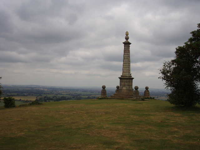
[19] The monument on top of Coombe Hill
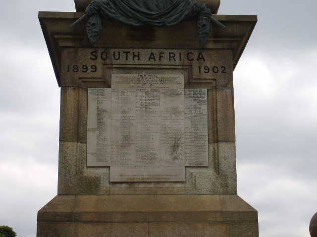
[20] Plaque on the monument on top of Coombe Hill
[21] View over Vale of Aylesbury from Coombe Hill
As usual I enjoyed my walk back. When I reached the sunken lane where the North Bucks Way starts, the school party I’d seen earlier were all lined up and began marching off just as I got there. I waited for them all to go, hoping they’d go downhill along the North Bucks Way, but they turned off almost straight away along the path I wanted to take. After following them slowly for a few yards, I decided to stop and have some water in order to let them get ahead – I didn’t want to trail immediately behind them, nor to try to overtake them. I carried on when they were about a hundred yards ahead, contouring round below Pulpit Hill. Soon I totally forgot about them though, as I discovered a wealth of wildflowers by the path, including some that looked like an orchid (I discovered the next day that it was a Common Spotted Orchid, presumably named after the black spots on its leaves). I took several photos, so that my parents might be able to identify them for me afterwards.
This was another really great walk on the Ridgeway. Although pretty cloudy, it was a dry and warm day, but not too warm, so very good conditions for a long walk. Lodge Hill made a superb start for a walk, and the hills and beech woods between Princes Risborough and Coombe Hill were excellent for walking. The Neolithic barrow, Whiteleaf Cross and the monument on Coombe Hill all added some historical interest to the day. The wildlife was good too, with wildflowers and butterflies to be seen in many places along the route, and a few Red Kites too!
Total Distance: 30.5 miles each way