Pete's Walks - Berkshire-Essex Walk
If you are considering walking this route yourself, please see my disclaimer. You may also like to see these notes about the maps and GPX files.
Day 5 28/06/06 Coombe Hill to Wigginton (8 miles each way, approximately)
Parked at Coombe Hill.
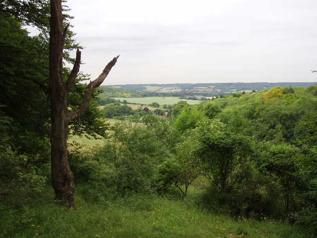
This was another fine day for walking, not quite as cloudy as yesterday and maybe a degree or so warmer (about 23C). Again the walk got off to a really good start, with a lovely gradual descent of about two miles from Coombe Hill over Bacombe Hill and down into the centre of Wendover. As usual, there were many dog walkers on Coombe Hill as I set off. The easy-to-follow path headed north, going downhill almost imperceptibly at times [1], with frequent good views left over the Vale of Aylesbury or ahead over Wendover to Wendover Woods [2]. Much of the way was through the typical sort of scrubland to be found on the steeper slopes of the Chilterns, with bushes dotted about the rich grassland [3]. There were again many wildflowers visible, and several types of butterfly – I managed to identify a Speckled Wood, and also saw Marbled White which I see frequently on these hills. As I gradually got down towards Wendover, it dawned on me that although this long descent was a lovely way to start the day, I might not be so happy on the way back up at the end of a second 16-mile walk on successive days!
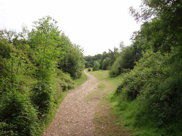
[1] Path descending from Coombe Hill
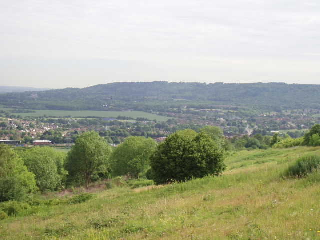
[2] Looking over Wendover to Aston Hill and Wendover Woods, from Bacombe Hill
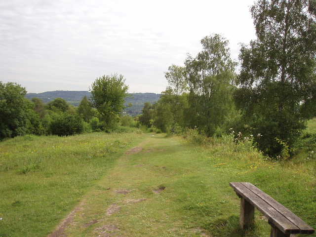
[3] Path descending from Bacombe Hill
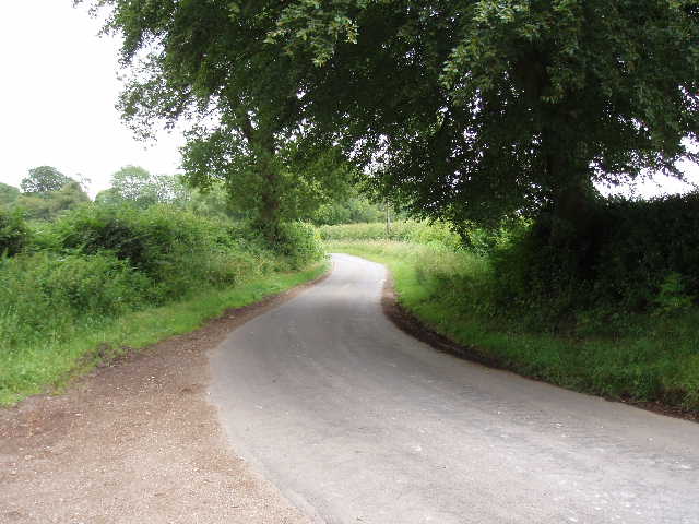
Shortly after joining the road into Wendover, I was back on the route of the Aylesbury Ring, which I walked earlier this year. And when I got into the town centre [4], I picked up the route of the Chiltern Link, which I walked one day last year. In fact, I followed the route of the Chiltern Link for about a mile from the centre of Wendover, before it went on its way to Chesham (thus linking the Ridgeway with the Chess Valley Walk). From the town centre, the path went between a stream and a park, and continued to emerge by the church of St Mary the Virgin [5]. A short walk along a road led to the start of a track called Hogtrough Lane, which I followed eastwards as it slowly rose towards the hills [6]. After about half a mile, after passing a farm and a couple of houses, the track reached a wood. Here the Chiltern Link went straight ahead steeply uphill, but the Ridgeway turned to the left and then started to rise up the hillside on a gentler gradient.
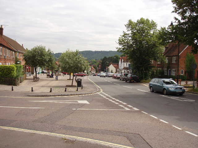
[4] Wendover
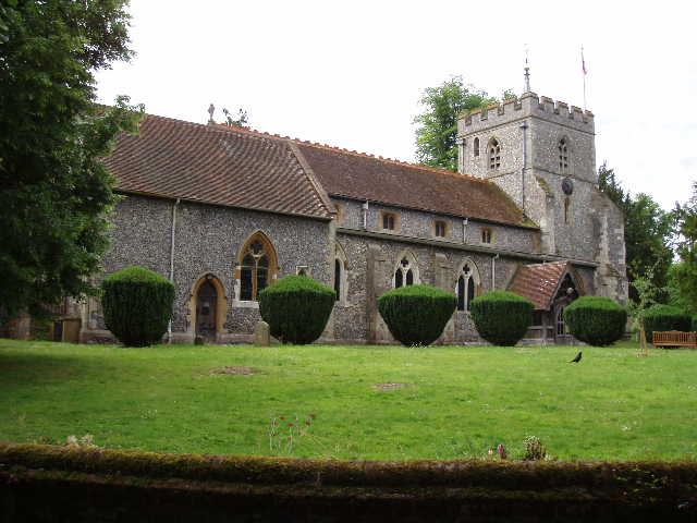
[5] Wendover church
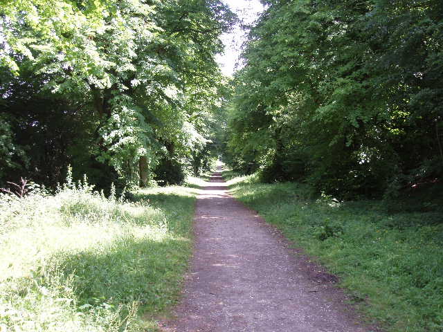
The path here had been recently repaired and covered with gravel [7]. A lot of money must have been spent on the work, as the gravelled path went on for at least a mile. Wooden boards were pegged in place on the downhill side of the path, to prevent the artificial surface working its way down the hillside over time. It seemed wrong to be walking on an artificial surface in such lovely sylvan surroundings, but I guess there must have been a serious problem with erosion or else with the path becoming impossibly muddy (the guide book, written about 10 years ago, mentions muddy sections after wet weather). Anyway, it was a pleasant section of the walk as the path slowly rose through the trees of Barn Wood. At the top of the slope, the path continued northwards through the trees, with the steep slope now on my left. Various footpaths branched off left and right, but the well-signposted Ridgeway stuck to the main path through the trees. The woods here were quite mixed (willow, hawthorn and hazel as well as beech, according to the guide book). The artificial surface eventually ran out just before the path reached a lane, climbing steeply up the hillside.
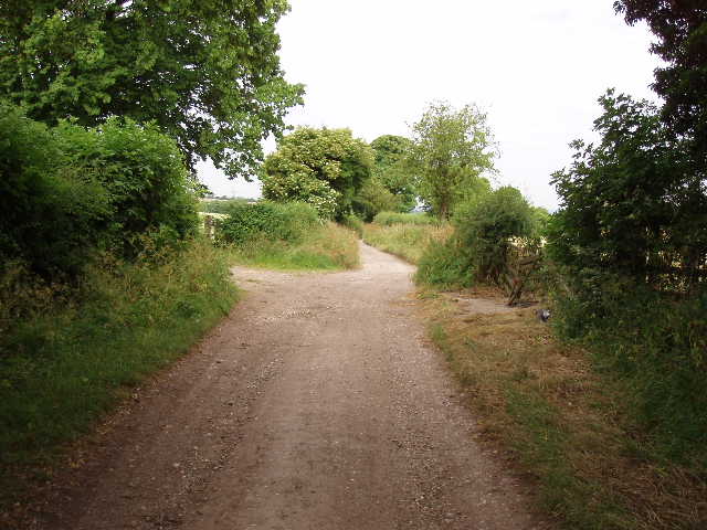
[6] Looking back along Hogtrough Lane
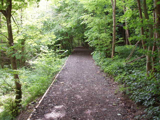
[7] Recently re-engineered path through the woods near Wendover
Across the lane, the Ridgeway continued through a section of beech wood [8]. After a short distance, it forked left steeply downhill on a path on the edge of the wood, with views over a valley called The Hale on the left [9]. At the bottom of the slope, it met a bridleway where it turned right to climb steeply uphill again. This section of the path was obviously very ancient as it was in a ‘sunken lane’ or ‘hollow way’ [10], with the level of the ground on either side 10-12 feet higher than the path. This path too had been given a gravel surface.
[8] Path through beech trees
[9] View over The Hale
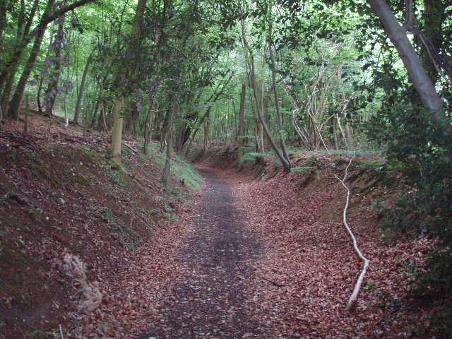
[10] The 'sunken lane'
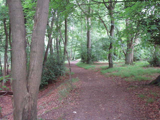
As I puffed my way to the top of this steep climb, I wondered why the Ridgeway had descended and re-ascended quite needlessly when there was a level (and much shorter) footpath continuing along the top of the hill! The steep path levelled out, and soon reached a lane. Across this, I entered a large meadow that had been recently mowed, and followed its right-hand hedge, before crossing a large cow pasture to reach another lane by some farm buildings [11].
On the other side of this lane I entered Northill Wood, another beech wood. I followed a level path through the wood [12], with the steep slope of the northern edge of the Chilterns still a little way to my left. At some point the wood became Pavis Wood, and after about half a mile I emerged from the beech trees at a sharp bend on Shire Lane (so named as it marks the ancient boundary between Buckinghamshire and Hertfordshire) [13] – I remembered the name of the lane, as the Chiltern Way crossed it a few hundred yards to my right. I walked straight on down the lane, leaving it for Church Lane at a junction. This took me through the hamlet of Hastoe to a road junction. Although I was now in Hertfordshire, I couldn’t quite tick off Buckinghamshire from the list of counties I’d pass through as I would pass through other parts of that county again in the next couple of days.
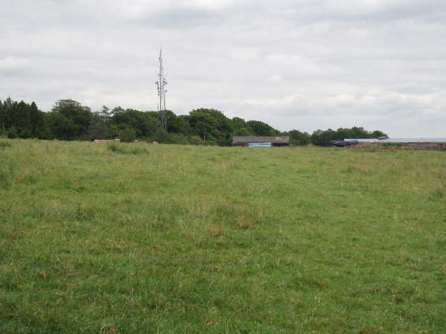
[11] Path across large Cow Pasture, heading for Northill Wood
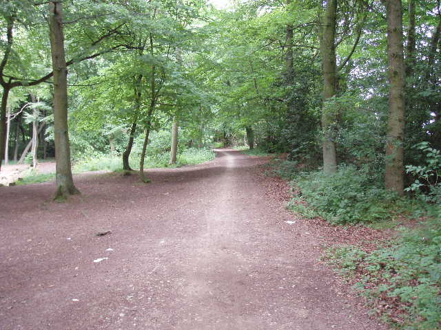
[12] Path through Northill Wood
[13] Shire Lane
Here I had to rely on the Ridgeway signposts and waymarks (which have been excellent all through this walk), as the guide book stated that the next section was about to be re-routed and so the description in the book was now out-of-date. This was no problem, as there was a sign at the junction pointing left, and after a hundred yards or so another one indicated the way going right. Here I entered Tring Park, and spent a few minutes reading all the information on a welcoming Notice Board provided by The Woodland Trust (it included a drawing of a Common Spotted Orchid, which was how I identified the flower I saw yesterday!). Tring Park was owned for almost a century by the Rothschilds, like so many other great houses in this area. At one point the parkland was grazed by exotic species they brought back from their travels abroad, such as Zebras, Wallabies and Cassowaries. In earlier times, it was visited by King Charles II and his mistress Nell Gwynn – indeed, the Ridgeway followed a hilltop track through the park that was called King Charles’s Ride [14,16]. This was again a very pleasant part of the walk, with occasional glimpses through the trees over the parkland at the foot of the wooded hillside, to Tring and the Vale of Aylesbury beyond [15]. At one point I had my first glimpse of Ivinghoe Beacon, the destination of my next walk and the endpoint of the Ridgeway. At the far end of Tring Park I emerged onto a road in Wigginton, where I turned round and headed back the way I’d come.
[14] King Charles's Ride in Tring Park
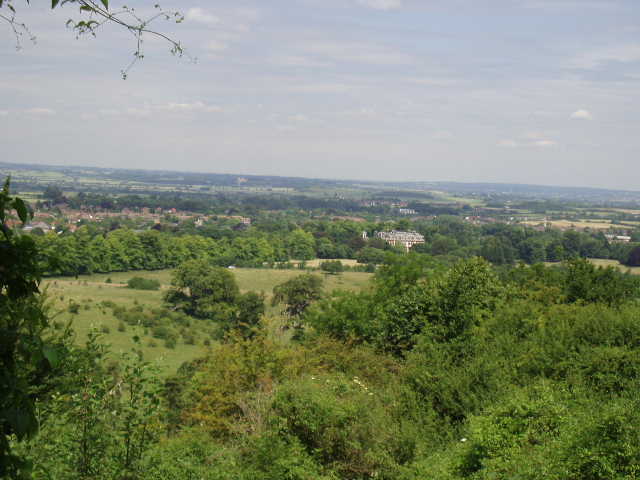
[15] Looking over Tring Park from King Charles's Ride
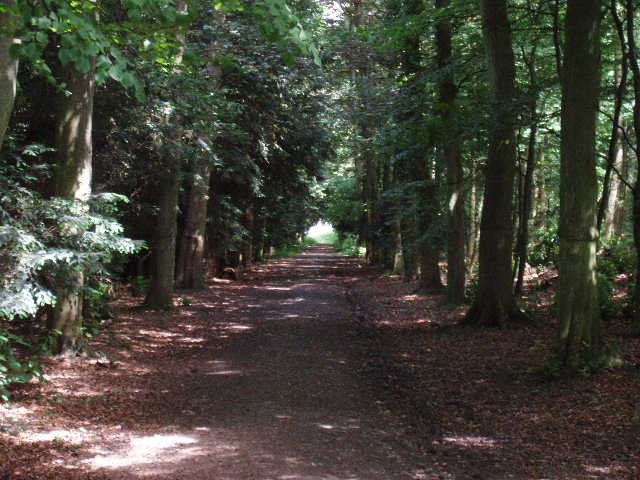
[16] King Charles's Ride in Tring Park
I stopped for lunch just after 1pm, sitting on the ground near the top of the steep sunken lane. The highlight of my return journey was an unexpected sighting of a Grey Wagtail on the little stream near the centre of Wendover. The long climb from Wendover across Bacombe Hill to Coombe Hill at the end of the walk was no problem at all – it was not steep anywhere, in fact it was such a gentle climb that at times I hardly noticed I was going uphill.
This was another great walk on The Ridgeway, on another lovely day.
Total Distance: 38.5 miles each way