Pete's Walks - Berkshire-Essex Walk
If you are considering walking this route yourself, please see my disclaimer. You may also like to see these notes about the maps and GPX files.
Day 6 29/06/06 Wigginton to Ivinghoe Beacon (5.5 miles each way, approximately)
Parked at Ivinghoe Beacon.
I chose to park at Ivinghoe Beacon and do this walk ‘backwards’, although I’ll describe the route as though I’d started in Wigginton. This walk was shorter than usual, as I decided I wanted to finish one day at Ivinghoe Beacon in order to make a clear distinction between the Ridgeway and the Icknield Way sections of this walk. Unusually, this was the third successive day that I’d walked. I try to do three walks a week, selecting which days to go according to the weather reports, ideally walking on Monday, Wednesday and Friday. However this week Monday was wet, and the forecast for Friday was too hot (29-30C) so I ended up walking the middle three days of the week. Today was about 24C, which was warm enough but perfectly OK for walking, especially as the walk was finished by lunchtime.
From the road in Wigginton where I finished my walk yesterday, the Ridgeway followed a path through a short sequence of recently-mown hay meadows, following a hedgeline first on the right, then on the left as I passed a small wood, passing through a sequence of seven kissing gates. A few of the kissing gates were redundant as there was a gap between them and the hedge. On ‘A Dales Walk’ a couple of weeks ago I had climbed over all the redundant stiles we came across, so here I had to go through all the redundant kissing gates – well, all except one that was overgrown with nettles, I might be daft but I’m not that daft!.
After crossing a very short section of a cow pasture, the Ridgeway then crossed a footbridge over the A41 dual carriageway. The footbridge was quite an impressive structure, the fanciest and probably most expensive footbridge I’ve ever crossed [1]. The road passes through quite a deep cutting at this point, so the bridge’s walkway was about 100ft above the level of the road. It was supported by quite a graceful arch (well, as graceful as concrete can get!), the whole bridge being quite striking and elegant for a modern structure. It was nice to know that the council or somebody was prepared to spend so much money to prevent walkers having to brave the fast traffic on the dual carriageway.
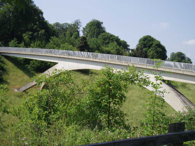
[1] The footbridge over the A41
[2] The artificial gallop
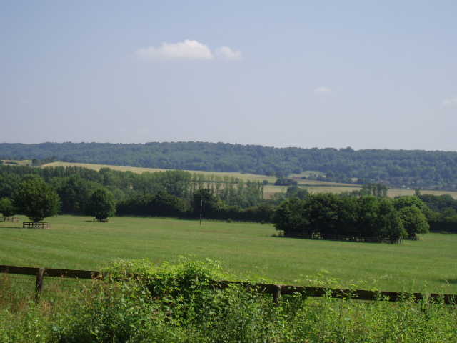
[3] Looking towards Ashridge, from the artificial gallop
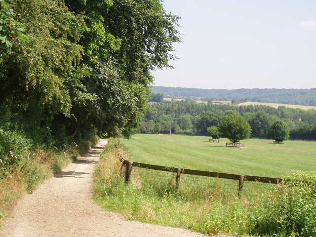
Having then crossed the old road that was the A41 before the dual carriageway was built (it was on the line of Akeman Street, a Roman Road), the path followed a line slightly downhill between a hedge and a high fence. There must be a stable nearby, as part of the path was also part of an artificial gallop for horses, judging by the material the surface was made from [2,3]. The path led down to a road, where I turned left and then right at a T-junction to pass Tring Station – there is obviously a serious problem with parking round here, judging by the number of cars parked on the roads and a ‘First Class Parking Farce’ sticker on a road sign. At the station the Ridgeway shared its route with the Hertfordshire Way for a few hundred yards, as it continued a short way up the road and then turned left up a concrete driveway. I had passed a small string of racehorses on this road on my walk out from Ivinghoe Beacon this morning, and seen another across a large field. I couldn’t remember seeing any round here before, but then remembered crossing an artificial gallop very near here when I walked the Hertfordshire Way, and then I remembered that Walter Swinburn has a stable at the nearby village of Aldbury.
At a crossroad of paths, the Ridgeway turned left while the Hertfordshire Way continued ahead towards Aldbury. This path led between hedges to another path junction, where I turned right to go uphill. On my left now was the “Queen Elizabeth the Queen Mother’s Nature Reserve, Duchie’s Piece (Aldbury Nowers)”, not the snappiest name I’ve ever come across! The reserve is a haven for butterflies, half the species in Britain having been recorded there, including the Duke of Burgundy Fritillary, according to the information board provided by the Herts and Middlesex Wildlife Trust.
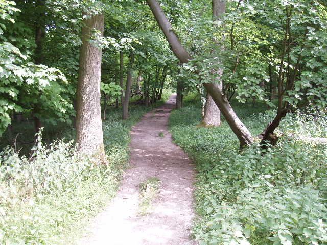
[4] The path round the side of Aldbury Nowers
The Ridgeway then turned left, by a section of another Grim’s Ditch, and followed a delightful woodland path as it contoured round the side of a hill called Aldbury Nowers [4]. I was now definitely on known territory, as this path is part of one of my favourite local walks (through the beech woods of Ashridge and over Pitstone Hill) – in fact I was very familiar with the rest of the route to Ivinghoe Beacon. The path worked its way round the side of the hill, generally pretty level but with a few steps in one or two short steep sections. The writer of the guide book mentioned hearing a peacock down below on the left – I remember having the same experience about 20 years ago, but haven’t heard one here for many years now (though I did hear a cock crow this morning!). After half a mile or so, the path emerged from the trees on the grassy slopes of Pitstone Hill. Here it followed another visible section of Grim’s Ditch to climb the hill at a steady gradient – notices asked walkers to walk along the bottom of the ditch rather than on the bank, as the latter was gradually being worn away [5,6].
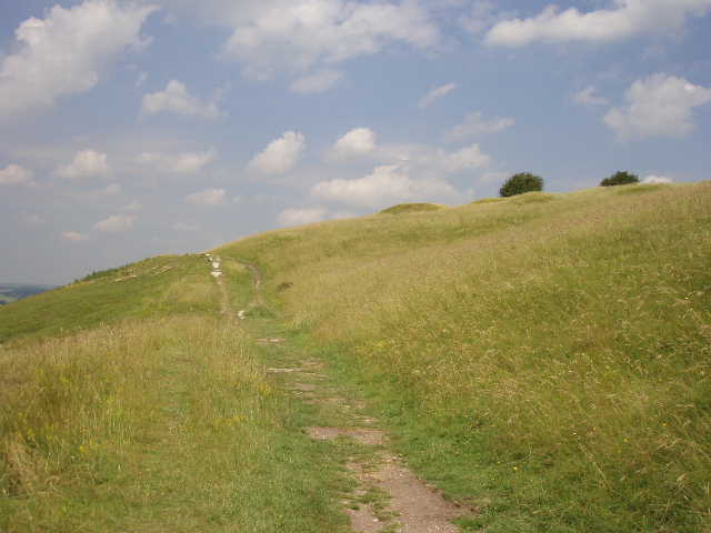
[5] A section of Grim's Ditch on Pitstone Hill.
[6] Looking back along a section of Grim's Ditch on Pitstone Hill. Wigginton is on top of the hill in the background.
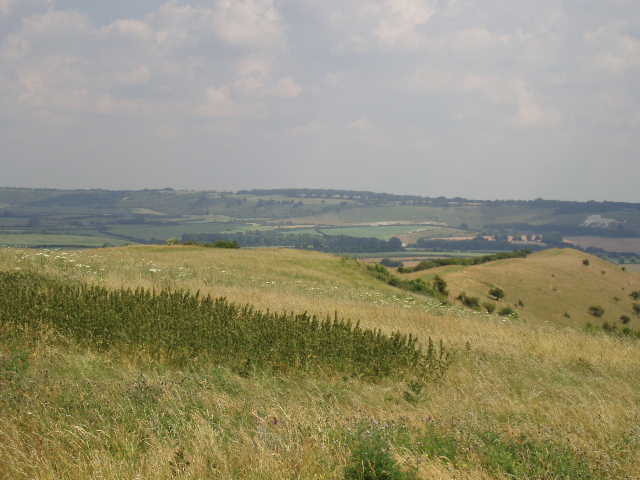
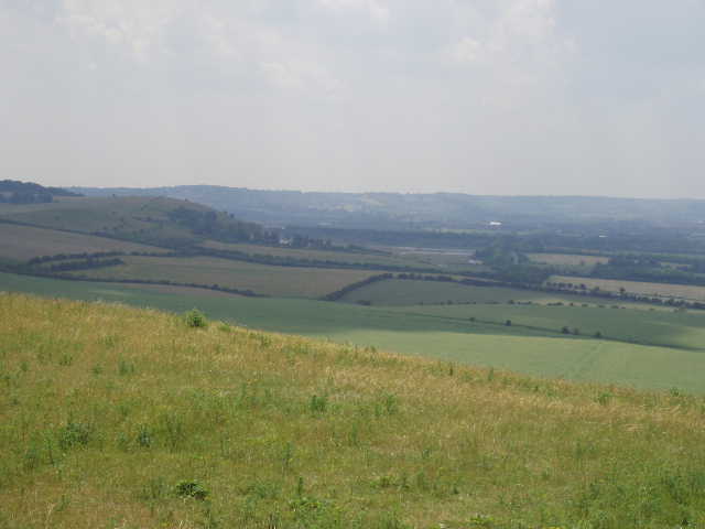
I stopped to admire the views from the top of Pitstone Hill. I could look west back towards where I’d come from, north over the wide expanse of the Vale of Aylesbury [7], east to Ivinghoe Beacon and south to the tree-covered hills of Ashridge. There were plenty of wildflowers in the grass and several types of butterfly flew up as I walked along, while a skylark sang overhead in the blue sky. A perfect English summer’s morning!
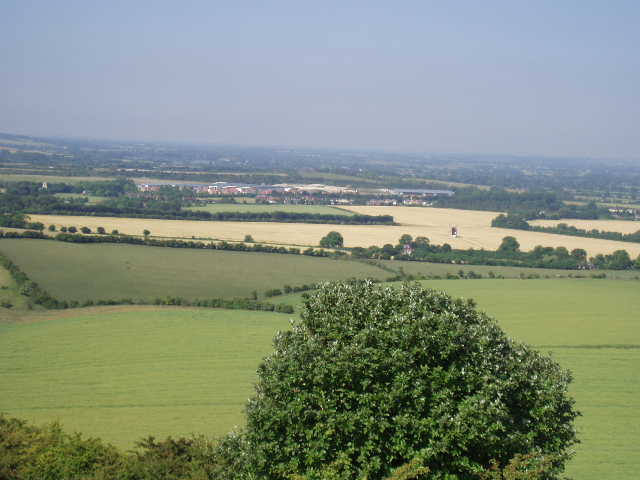
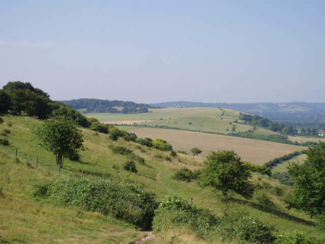
[7]The Vale of Aylesbury and Pitstone Mill from Pitstone Hill
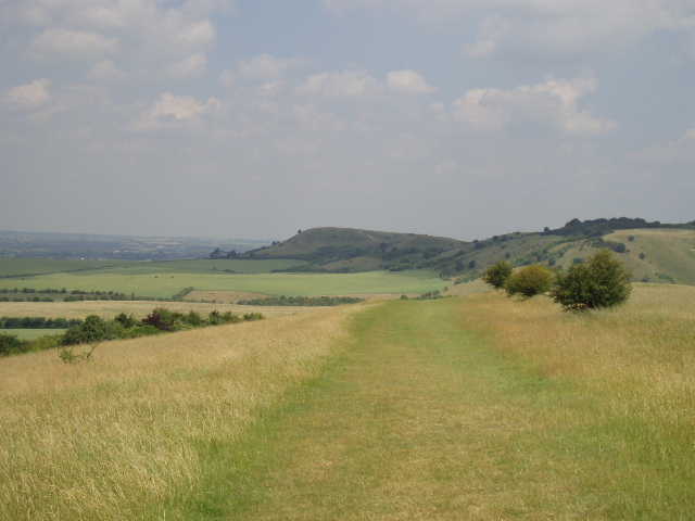
[8] Looking from Pitstone Hill to Ivinghoe Beacon (centre) and Steps Hill (right)
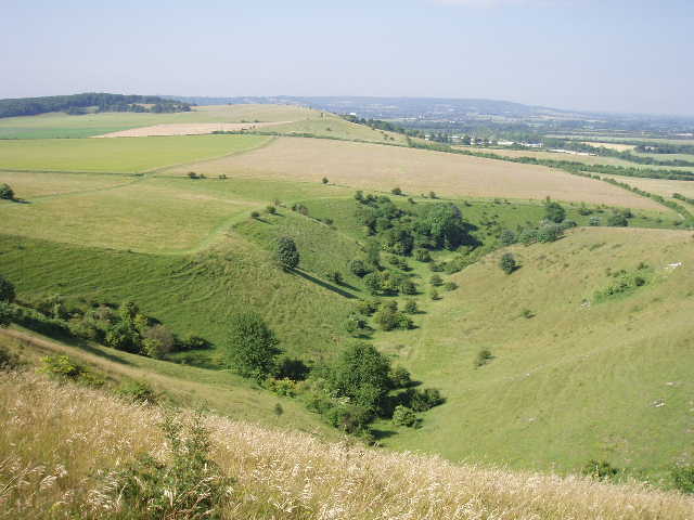
[9] Incombe Hole
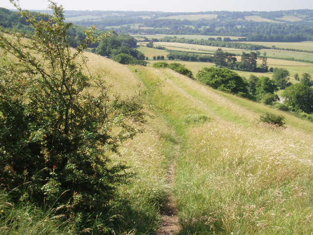
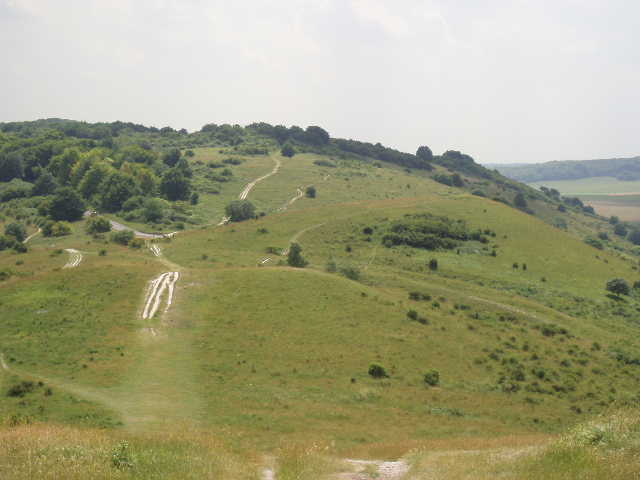
The Ridgeway then descended gradually from Pitstone Hill [8], heading north or north-east. It crossed a lane, running between Ivinghoe and Aldbury, and continued on a good clear path across a very large grass field, again with a profusion of wildflowers and butterflies. This path very, very gradually gained height until, after crossing another footpath, it started the steeper climb up Steps Hill, first turning to the right then swinging back sharply to the left as the ascent got stiffer. Down to my left now was the deep and steep-sided combe of Incombe Hole [9], an impressive natural feature quite hidden from any road. Where the track reached a gate near the top of the hill, the Ridgeway forked left alongside a fence, to remain in the same grassy area of scrubland that surmounts Steps Hill. A sign warns of the dangers of military debris in this area (later, a man who got chatting to me on Ivinghoe Beacon mentioned how he could remember soldiers training on this hill during the war). The path continued through bushes, then headed slightly downhill through a more open area [10] to reach the road that winds round the southern side of Ivinghoe Beacon. Beyond the road, all that was left was for me to follow the well-used chalky track [11] in the flower-rich grassland (I think I identified both Fragrant and Pyramidal Orchids here), over a subsidiary ‘bump’ and then up the short, sharp, chalky climb to the top of the Beacon [12].
[10] Looking back from near Steps Hill over Pitstone Hill towards Wigginton
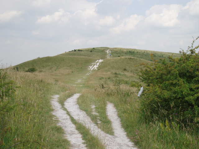
[11] The path up Ivinghoe Beacon
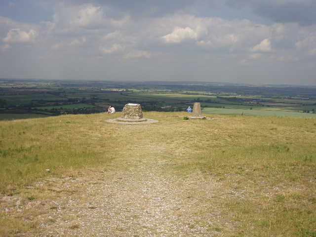
[12] The top of Ivinghoe Beacon
It was now 1pm, so I sat by the OS column at the summit to eat my lunch, enjoying the far-reaching views in almost all directions. Most of the panorama was of the Vale of Aylesbury, with Mentmore Towers and the steeple of Leighton Buzzard church noticeable landmarks. To the north-east I could see the long line of Whipsnade and Dunstable Downs, where my next walk would be taking me [13] – the chalk figure of the White Lion, of course, indicating the whereabouts of Whipsnade Zoo (the figure was renewed recently at a reported cost of £30,000!). To the south-west, I could look back the way I’d come, past Pitstone Hill towards Wigginton on its wooded ridge [14,15].
[13] View from Ivinghoe Beacon over Galley Hill towards Dunstable Downs and Whipsnade Downs
[14] Looking back from Ivinghoe Beacon over Pitstone Hill towards Wiggintonl
[15] Looking back towards Steps Hill from Ivinghoe Beacon
This was a splendid shorter walk, on a glorious summer day. The skylarks, butterflies and wildflowers all added to the delights of the scenery to make this a very pleasurable morning. I have really enjoyed my walk along the Chiltern Hills section of the Ridgeway, and I am sure that I will go back and walk some parts of this route again in the future.
Total Distance: 44 miles each way