Pete's Walks - Berkshire-Essex Walk
If you are considering walking this route yourself, please see my disclaimer. You may also like to see these notes about the maps and GPX files.
Day 7 7/07/06 Ivinghoe Beacon to Dunstable Downs (7 miles each way, approximately)
Parked at Ivinghoe Beacon.
This was a very grey and overcast day, although very warm and sticky, with light showers forecast. I wouldn’t normally have walked on such a day, being very much a ‘fair-weather’ walker, but it was eight days since my last walk and I was getting desperate to make further progress on this route. The last week or so had seen a heat wave with temperatures over 30C, too hot for walking, followed by a couple of days of thundery showers.
I wasn’t especially looking forward to this particular walk, as the entire route was very familiar to me, all of it being less than seven miles from my home, with Whipsnade and the visitor centre on Dunstable Downs only being about one and a half miles from Kensworth. Although I’d not done this exact walk before, all the paths on the route were ones I’d walked several times before on my local walks. I’ve twice walked to Ivinghoe Beacon and back from my home, the return route I used being the same as this walk as far as Whipsnade. All the paths round Whipsnade and the Downs are very familiar to me, having walked them many times on my shorter walks from home. But despite the familiarity of the route, and the imperfect weather conditions, this turned out to be a very enjoyable day’s walking. The route would certainly interest anybody not familiar with it.
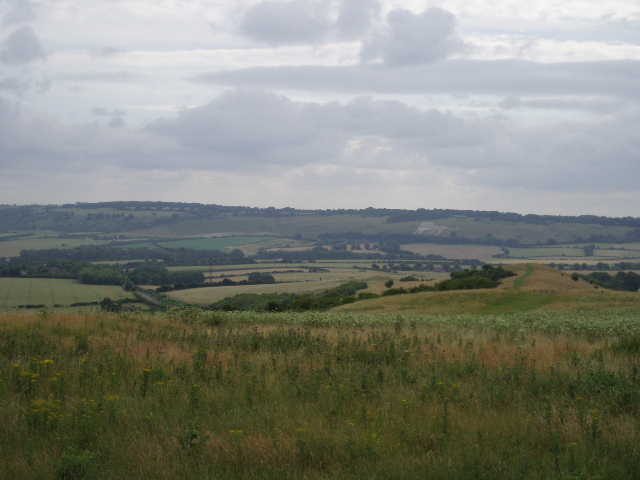
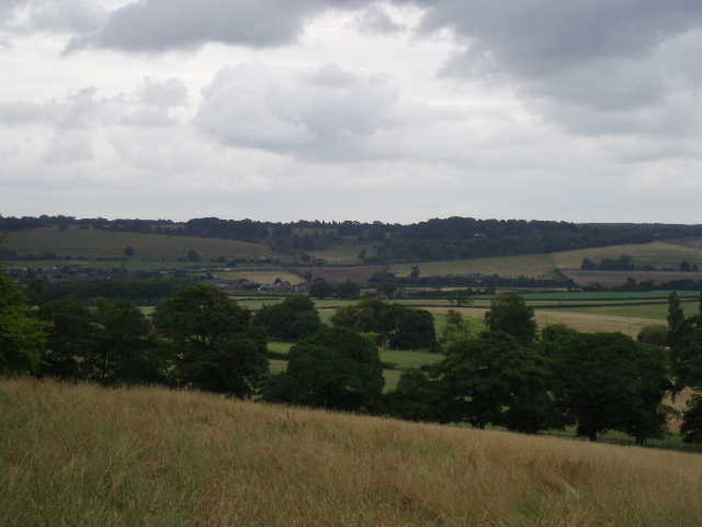
[1] View over Galley Hill of Whipsnade Downs from Ivinghoe Beacon
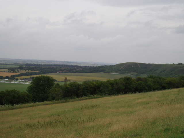
[2] View of Dunstable Downs from Ivinghoe Beacon
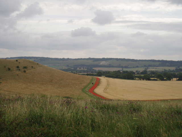
[3] Red border of poppies around a corn field below Galley Hill
Having completed a section of the Ridgeway, I would now be following part of the Icknield Way for the rest of this journey. From the top of Ivinghoe Beacon [1,2], I took the steep path down, going back the way I’d come at the end of my last walk, but instead of heading towards the road I veered slightly left to a stile in a fence. There was a small column or milestone here, indicating the Icknield Way and the distance to the Peddars Way (which starts at the far end of the Icknield Way and goes up to the Norfolk coast). The column also showed the symbol used to waymark the Icknield Way, a stone axe. I would now be following these symbols for the rest of the trip, having so far been following the acorn symbols used for the Ridgeway National Trail.
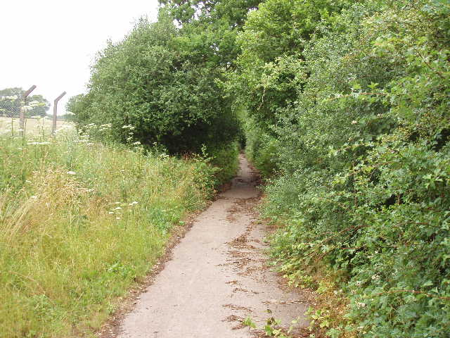
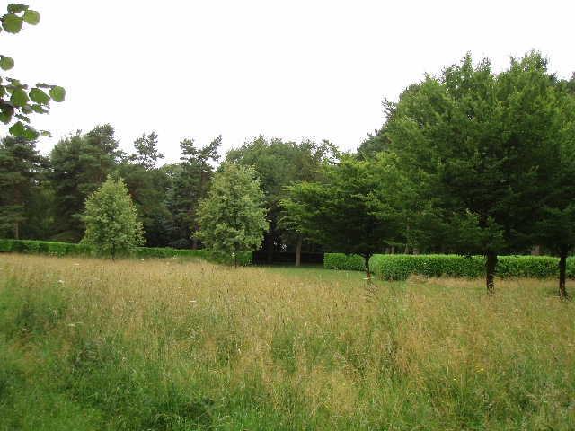
Across the stile, the path went along a fence on the edge of a corn field, heading slightly downhill with a steep grassy hillside over the fence on my right. Coming down from the Beacon, I’d seen a broad red strip of poppies all along the far side of this corn field [3]. At the end of the field [4], a stile led over into the next corn field, but the path there was totally overgrown (although I’ve managed to walk it previously) so I used a gate to get onto the National Trust land on the other side of the fence, and followed the good path there, with the fence now on my left. At the end of the fence (where a stile marked the point where the official footpath rejoined my path), I turned slightly right on a clear path through the long grass to reach a kissing-gate on the edge of the wood.
Despite the thunder storms of the last few days, the path was not too muddy – I know from past experience that it can be quite bad sometimes. The wood was mainly a mixture of beech, ash and oak, but after a while there was a section of rather spooky conifers, obviously deliberately planted as they were in straight lines. Beyond them, the path joined a wider track on the edge of what was again deciduous woodland. After only a hundred yards or so, the track turned sharply to the right but the Icknield Way took a path going on ahead. This immediately started to climb very steeply through a section of mainly beech trees. As it neared the top of the slope, the trees on the left gave way to a field, separated from the path by a hedge and wire fence. Eventually the path levelled out, and emerged by a large farm, close to a pond.
[4] View over Dagnall towards Whipsnade Zoo, from below Ivinghoe Beacon
[5] Looking south along the Gade Valley from near Hog Hall
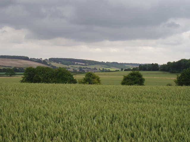
Five footpaths meet in or around this large farm yard, all but one of which I’ve walked before – the one I haven’t is part of the Ashridge Estate Boundary Trail, a 15-mile circular walk that I’d like to do someday (Update: I have now walked the Ashridge Estate Boundary Trail). I turned left, and followed a well-marked track through some grassy fields, descending gradually with the Gade valley [5] ahead of me with Whipsnade Downs and Dunstable Downs beyond. There were various blue, white and yellow wild flowers in these grassy meadows, and plenty of butterflies too, including Gatekeepers and a Red Admiral. To the right of the fields were further woods. After the third meadow, a stile took me onto a path round an arable field and round the hedge of a house called Hog Hall (a modern building, presumably built on the site of an earlier house). The Icknield Way then continued along the long track or drive leading from Hog Hall [6,7], still descending gradually over about half a mile (still with good views of the Downs ahead) to reach a main road where it entered the village of Dagnall. This is the road running south from Leighton Buzzard to Hemel Hempstead – I’ve crossed it several times on previous walks such as the Chiltern Way and the Hertfordshire Way, further south where it runs through the Gade valley.
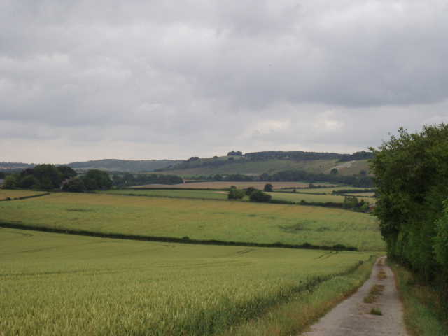
[6] Looking towards Dunstable Downs and Whipsnade Downs from the Hog Hall track
[7] Looking back along the track from Hog Hall
I turned right and followed the road through Dagnall, going straight ahead at a roundabout. Immediately past the village school, I took a footpath on the left alongside the school car park and then past paddocks on my left to reach a lane – on the far side of the lane was the distinctive wire fence of Whipsnade Wild Animal Park and the steep grassy slopes of part of the Downs. I turned right for a short distance, then took a path on the left that went through a garden for a few yards and then over a stile. This path started to rise steeply up the hillside, with a wood on the right and a sheep pasture beyond the fence on my left. The steep path was slightly overgrown in places, but not too bad. At the top of the slope it crossed the drive to a cottage on the left, then reached a stile - I stopped here for a breather and a drink of water, as I always seem to do when I come up this hill!
Beyond the stile was Whipsnade Golf Course. There was obviously a competition going on, as people were teeing off in threes with a lady with sheets of paper seeing them off. I waited by the stile while three people drove off, then walked across in front of the tee and then headed slightly left. Again I crossed in front of a tee (people were waiting by it, but not actually teeing off) and then walked through a belt of trees separating two fairways. After a couple of hundred yards or so, a post with waymarks indicated a path junction, where I turned left and crossed a sequence of four or five fairways separated by belts of bushes and small trees (taking care to see if any golf balls were headed my way!). I looked back and checked to see where I’d come a couple of times here, as when I walked this path in the opposite direction a few weeks ago I got lost! I could now understand why, as the waymarked posts showing the way were only really visible if you were walking in the direction I was now going (the way I normally walk this path).
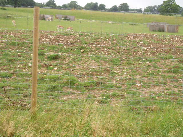
[8] Deer in Whipsnade Zoo
[9] Whipsnade Zoo
Beyond about the fifth fairway I crossed (by a green, which I had to take a slight detour round) the path reached the boundary fence of Whipsnade Wild Animal Park. I followed the fence a few yards to the right to a corner, then followed it to the left. This part of the zoo (to give it its old name!), is a very large grass paddock inhabited by several species of deer and such like [8,9], which visitors can only drive through on a roadway or else pass through on the little train that goes round the zoo (I just heard it whistle in the distance as I typed this sentence!). I once saw a rather odd-looking creature here, which I couldn’t identify at all. I later looked on the zoo’s web-site, and discovered it was a Nilgai, which is the largest antelope found in Asia. The one I saw was a brown female, the males are known as ‘blue bulls’ because of their grey-blue colouring. Today, as I followed the boundary fence for about a mile, I saw two or three different types of deer, and several wallabies (which roam freely all over the zoo, and have been known to occasionally escape into the local countryside). In the distance, I saw some elephants and some musk ox. There was a bit of a shower as I followed the path round the edge of the zoo, but I was sheltered by a hedge and didn’t need to put my waterproofs on. About half–way along this path, another path came in from the right – this was part of the Chiltern Way (to read some of my childhood memories of the zoo, see Day 26 of my journal for that walk).
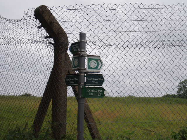
[10] Zoo fence and fingerpost
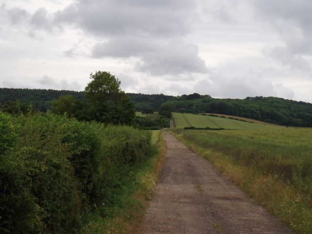
[11] The old lane between Holywell and Whipsnade
The path ended at what was once a lane between Holywell and Whipsnade [10,11] – it was blocked to cars about 20 years ago, and is gradually being reclaimed by nature. I followed it to the left, still with the zoo fence to my left. The Chiltern Way turned right on to a footpath after about quarter of a mile, but the Icknield Way continued ahead into the village of Whipsnade. Living only about a mile and a half away, I think I’ve rather taken Whipsnade for granted, but it is actually rather an unusual and attractive village. It consists of a huge open green, rising over both sides of a hill, with houses and cottages dotted around the edge. The main road to the zoo goes through the irregularly shaped green, and has gates at either end of the village – although I’ve not seen them closed since I was a child in the sixties. Presumably in days gone by the gates were closed so villagers could keep their livestock on the green. The church is quite unusual, too, in that it is built of brick. And, of course, Whipsnade has a zoo and a Tree Cathedral.
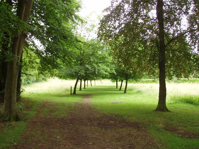
[12] The Nave of Whipsnade Tree Cathedrall
[13] Whipsnade Tree Cathedrall
I crossed the green to the entrance of the Tree Cathedral (where the Chiltern Way briefly shared my route again, having taken a path that took it through the church yard). The Tree Cathedral [12,13] was created by Edmund Kell Blyth in the 1930’s as a tribute to friends killed in the war. It consists of numerous trees of various types, planted in the shape of a cathedral, with a nave, side chapels, etc. An information board explains the layout and which type of tree are used where. The Tree Cathedral is intended as a place of meditation, and services are held there occasionally.
The Icknield Way took a path to the west of the Tree Cathedral (while the Chiltern Way took a path to the east, taking a shorter route to Dunstable Downs). Through a kissing-gate, I walked along the right-hand edge of a field containing a strange menagerie – there was a jersey cow (or something similar), a couple of donkeys and a herd of sheep that were obviously an unusual breed. At the bottom of the field, I went through a couple of gates to join a good hedge-lined track that went northwards for about half a mile, reaching the edge of the Downs near a car park on Bison Hill (so-called because on the other side of the road is the huge paddock where the zoo keeps its Bison or Buffalo). The car park is a popular spot for walkers and people who just want to admire the views towards Ivinghoe Beacon, especially nice towards sunset.
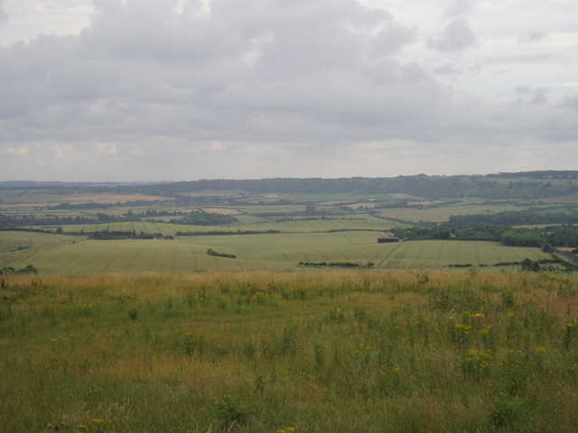
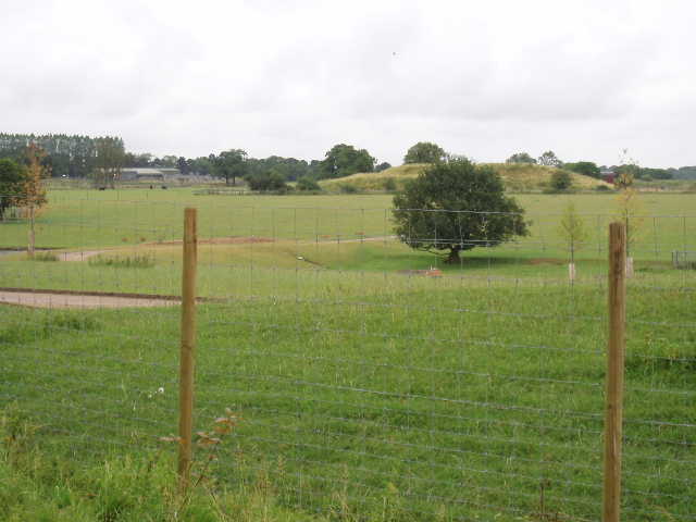
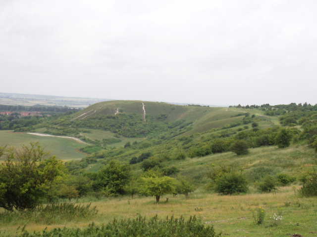
[14] Dunstable Downs from the large grassy field
[[15] Looking back to Ivinghoe Beacon from the large grassy field
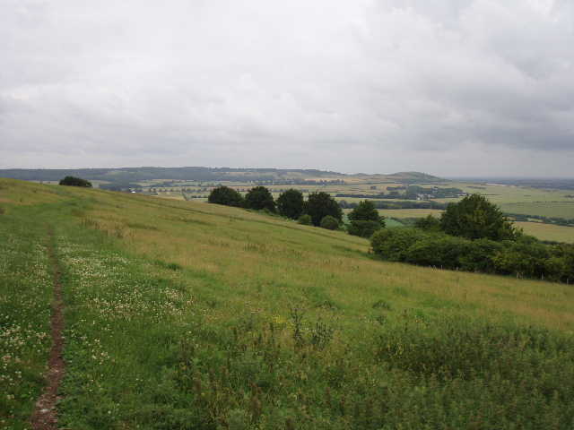
From the car park, I went through one of a number of kissing gates into a very large grassy field, that extends for about half a mile along the tops of the Downs (as with much of this area, it is owned by the National Trust). To the left, the steep hillside was covered in scrub, penetrated by a number of well-used footpaths. I followed the path across the middle of this huge field [14,15], admiring the views over the Vale of Aylesbury to my left, although these were not as extensive as they can be because of the gloomy overcast conditions. Around the car park and through this field I was again very aware of the numerous butterflies, and identified Marbled White, Large White, Ringlet and Meadow Brown amongst them. Beyond this field, the path led through some scrub land and then into a large open grass area, which I crossed to reach the Information Centre on the top of Dunstable Downs [16] (a new much larger visitor centre is currently being built a short distance away). There were only one or two people about, admiring the far-reaching views and watching the activity at the London Gliding Club [17] at the foot of the Downs. On a nicer day, especially at week-ends, the grass area would be full of people flying kites, kicking balls, picnicking or just enjoying the views.
[16] Dunstable Downs
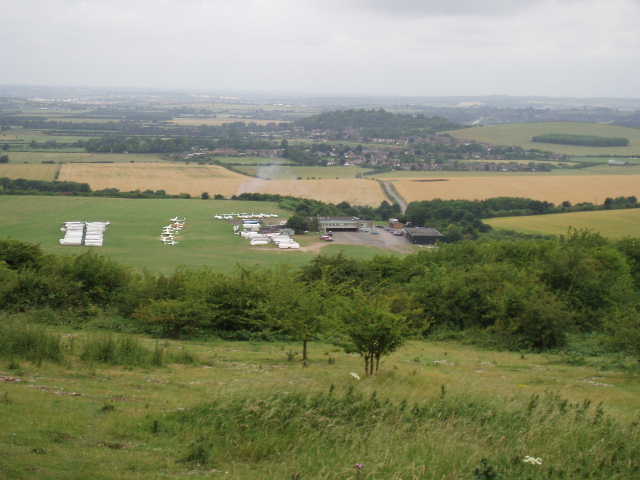
[17] Looking over the London Gliding Club from Dunstable Downs
I turned and headed back to Ivinghoe Beacon. I had lunch near the Tree Cathedral – it started to rain gently and I had to wear my waterproof coat for about 30-40 minutes, although the rain was never heavy. The whole walk today took me slightly longer than I’d expected, but that was probably because I stopped to take quite a large number of photos, and also spent some time watching the butterflies and trying to identify wildflowers (quite unsuccessfully!). The highlight of my walk back, indeed of the whole day, was when I reached the lane near Dagnall – I saw a Red Kite flying over the zoo! This is the nearest to my home that I’ve seen one! They are definitely getting closer as they extend their range north-eastwards along the Chilterns, so I hope that soon I’ll be able to see them regularly in Kensworth.
Total Distance: 51 miles each way