Pete's Walks - Berkshire-Essex Walk
If you are considering walking this route yourself, please see my disclaimer. You may also like to see these notes about the maps and GPX files.
Day 8 8/07/06 Dunstable Downs to Toddington (8.5 miles each way, approximately)
Parked at Dunstable Downs.
The main route of the Icknield Way goes through the built-up areas of Dunstable and Luton. I have chosen to follow the alternative route, which branches north at Dunstable Downs, goes out to the large village of Toddington, and then rejoins the main route at the foot of Galley Hill, just east of Luton. Although five miles longer, and certainly not as historically authentic as the main route, I am sure that this will be a more enjoyable route to walk – especially as I will have to walk through Letchworth and Baldock later on.
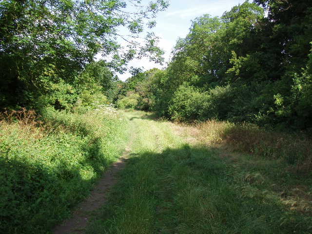
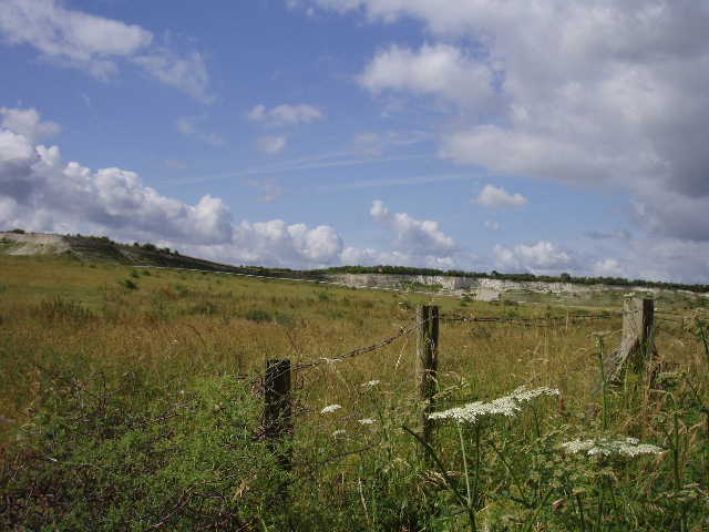
As I only live a few minutes drive from Dunstable Downs, I managed to start walking as early as 9.10am this morning. It was much brighter and sunnier than yesterday (although it would cloud over in the afternoon), so the distant views from the Downs were much better [1]. Consequently, the morning got off to a rather slow start as I took so many photos as I walked across the tops of the Downs. I could see the Gliding club below, Totternhoe with its wooded hill surmounted by the earthworks of a motte and bailey castle, the prominent spire of Leighton Buzzard church, Ivinghoe Beacon and the wide expanse of the Vale of Aylesbury. As this was a Saturday, there were already many people about on the Downs, mostly walking dogs. I remembered starting off on my Chiltern Way walk from Dunstable Downs fourteen months ago – much of today’s walk would be along the same route.
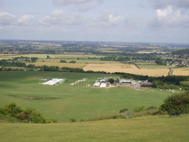
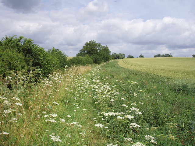
[1] From near the Visitor Centre on Dunstable Downs, looking over the London Gliding Club to the Vale of Aylesbury
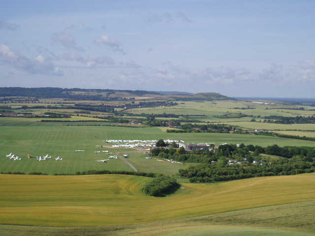
[2] From near Orange Hill, looking over the gliding club towards Ivinghoe Beacon
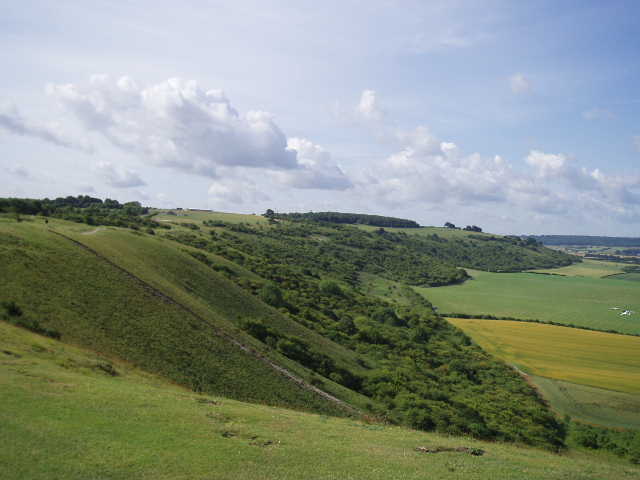
[3] Looking back along Dunstable Downs from near Orange Hill
At the end of the Downs, I passed by what we locals call Orange Hill [2,3] – it used to be an Easter tradition to roll oranges down it for children to chase, but this has stopped because it was too dangerous and children broke legs or ankles too frequently! Hardly surprising when you consider the steepness of the slopes. I passed by the Five Knolls, Neolithic and early Bronze age burial mounds. When the most northerly was excavated in 1928 by Mortimer Wheeler, it was found to contain a crouched female burial, with Roman and Saxon burials added to it. The mounds are very well positioned on top of a narrowing ridge, so that they would be clearly visible both from the Vale of Aylesbury and from the opposite direction towards what is now Luton.
[4] View over Dunstable towards Toddington, from near Five Knolls
[5] Green Lane, Dunstable
[6] Green Lane, Dunstable
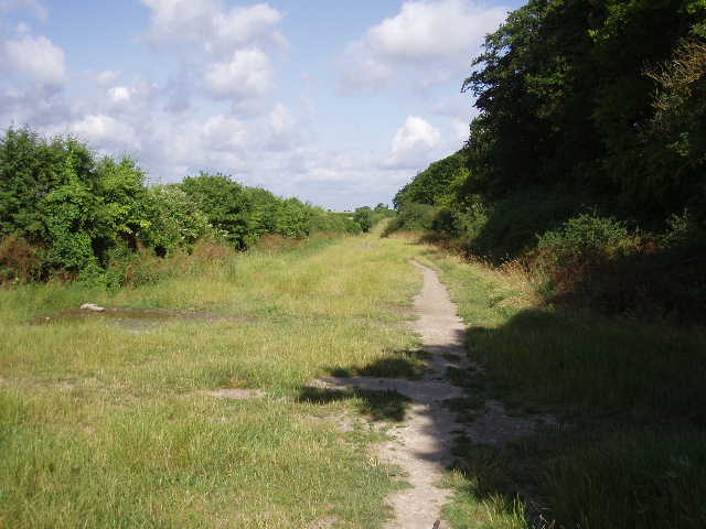
I took the broad path that descends down to Dunstable [4], crossed the busy road to Tring, and continued opposite on the broad hedge-lined track of Green Lane. I have always assumed that this is an old drover’s road, as there is a parallel modern road nearby called Drovers Way. Although there were houses the other side of each hedge, they weren’t really visible and it felt like I was out in the countryside somewhere, although there were a few dog-walkers and a couple of joggers [5,6]. After about half a mile or so, after Green Lane had left the houses behind, I turned right at a crossroads of tracks [7]. This path followed a hedgerow on my left, with a field of barley on my right. The path turned to the left – where another footpath crossed it, I could see through the gap in the hedge to the tree-covered embankment of Maiden Bower [8], a large Iron-age ‘plateau-fort’ built on top of Neolithic enclosures (according to my Chiltern Way guide book). The path soon became a green lane, descending downhill – there were several wildflowers here, some of which I later identified (probably wrongly!) as St John’s Wort and Musk Mallow. To my left was an old chalk quarry [9].
[7] Looking back to Dunstable Downs from Green Lane/p>
[8] The hedge marks the bank of Maiden Bower
[9] Old chalk quarry, near Sewell/p>
The path then went under a bridge of a disused railway line [10], now used as a cycle path (the ‘Sewell Greenway’), to reach the hamlet of Sewell. I followed the lane through the village, and took a footpath on the left – I was relieved that this was quite clear, as it had been rather overgrown when I walked the Chiltern Way in May last year. The fenced path wound its way around some gardens, and then I had to cross a grassy paddock to a stile. The path then ran down the centre of a hedge between fields, to emerge across a footbridge onto a very long field of tall grass. I turned right and followed the hedge, along an indistinct path in the grass. Again there was a profusion of both butterflies and wildflowers – I am getting more and more interested in both of these, and try to identify them when I get home using my parents’ little reference books. The path continued through the grass for about half a mile, at one point crossing a ditch by means of a dangerously overgrown plank. It then turned right along the foot of a high embankment carrying the A5, and after a hundred yards or so a very steep flight of steps climbed up to the road. Having crossed this carefully, and walked along it a short distance to the right, a much shorter flight of steps took me down to the houses of Chalk Hill.
A footpath almost opposite the steps then took me on eastwards, with a hedge on my left and a large area of ‘set aside’ land to my right, beyond which was an old chalk quarry. The path soon passed a sewage works, and further on entered a small wood. Beyond this it reached a concrete drive, but almost immediately left it by turning right to head northwards on a path across a field. Where the path reached the corner of a hedge, the Icknield Way now parted company from the Chiltern Way, which turned off left. The Icknield Way continued ahead across the field. I don’t know what the plant growing in the field was, it looked to me like a weed but it seemed to be uniformly planted across the field as if it was a crop. The path through the field was very clear, obviously cleared to the regulation four-feet wide by the farmer, but was full of a beautiful blue flower – it seemed such a shame that it was unavoidable to tread on these flowers as I walked along. I tried to identify the flower when I got home, but it wasn’t in the reference book – however, a couple of days later I found a useful site on the web for identifying wild flowers and discovered that the flower was Flax [11].
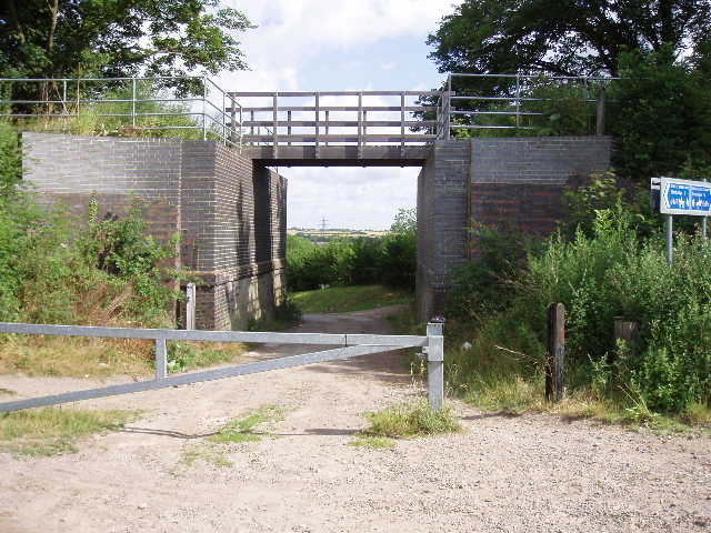
[10] Old railway bridge, Sewell
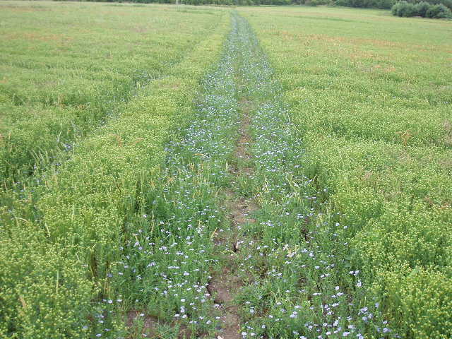
[11] Flax growing along path near Bidwell
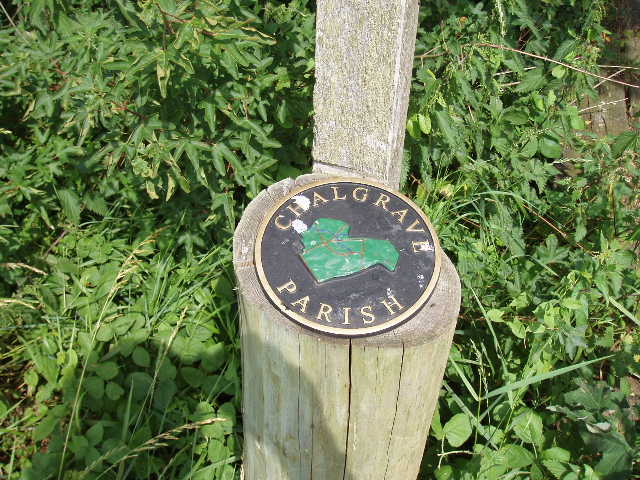
[12] Chalgrave Parish boundary marker
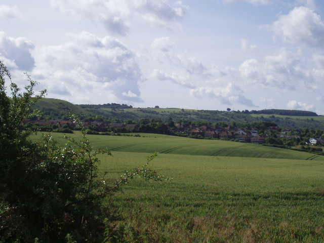
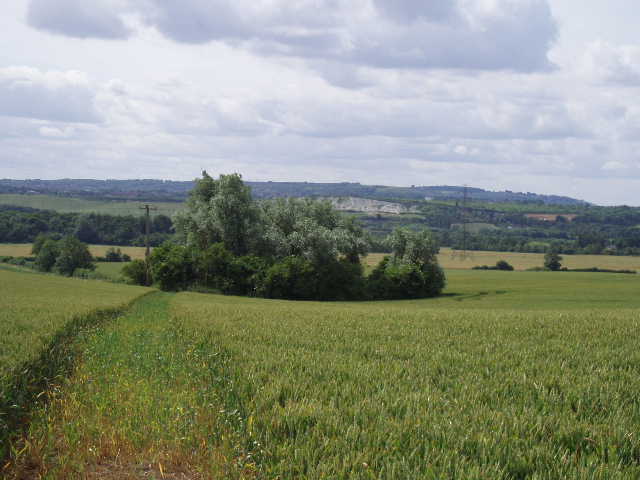
The path continued across another couple of fields to reach a road. This was a dangerous crossing as it was on a sharp bend making visibility very limited in each direction – I walked some yards to the left to find a safer place to cross. The path then continued onwards in a northerly direction, generally following a hedgerow through a number of corn fields and slowly rising uphill [13,14]. For most of this section, a narrow strip of land had been left uncultivated next to the hedge, and this was covered in many wildflowers, with many butterflies fluttering about – I recognised some Small Tortoiseshells here. After about a mile, the path went through a small gap in a hedge to emerge onto a cricket ground. I followed the boundary to the right, to reach the road through the hamlet of Wingfield. Looking on the map, Wingfield and its near neighbour Tebworth appear to be in the parish of Chalgrave (I’d passed a Chalgrave Parish marker about a half mile back [12]), although Chalgrave itself now appears to consist only of a church, manor house and farm. Presumably Chalgrave was much bigger in times gone by but has since shrunk, while Wingfield and Tebworth have grown. (I’ve just looked on the web and that has confirmed my hypothesis. They still ‘beat the bounds’ by walking the parish boundary once a year, presumably this explains the boundary marker I saw).
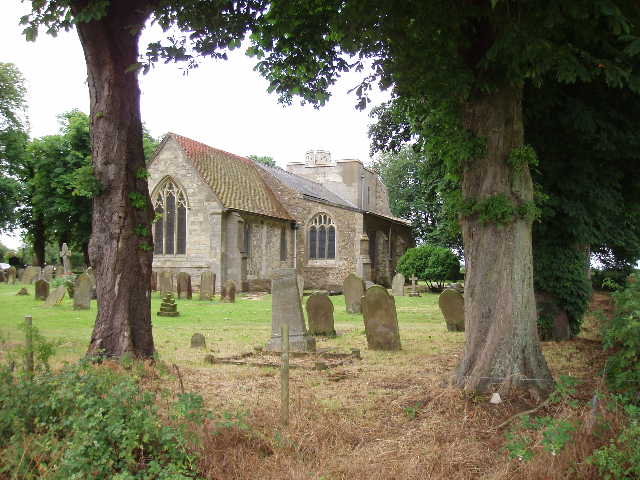
I turned right and followed the road through Wingfield, turning left onto a footpath just before the last house. This crossed a grassy field containing a handful of cows, then continued north-eastwards on a clear path through two corn fields – because of the recent dry weather, there were huge cracks in the ground all the way along this path. Beyond the second corn field, I reached the main road from Dunstable to Toddington. I followed this north for a few hundred yards, then turned right onto a ‘No through road’ that quickly brought me to Chalgrave church [15]. I would have liked to have gone inside, but there was a wedding taking place. Apparently there are some mediaeval wall paintings inside the church, and the tomb of Sir Nigel Loring, the hero of a couple of novels by Sir Arthur Conan Doyle about the Hundred Years War. The church tower is rather short, as the upper part collapsed in 1889 (amazing what you can learn with a quick search on Google!).
[13] Hedgerow path leading towards Wingfield/p>
[14] Looking back towards Dunstable Downs from near Wingfield
[15] Chalgrave church
The Icknield Way didn’t enter the church yard, but took a footpath to the right that entered the grounds of Chalgrave Manor Golf Club. It followed the boundary round two sides of the church yard, and then turned right [16] to head downhill, with the greens and fairways of the golf course on the right. Near the bottom of the hill, I turned left along a path partly overgrown with nettles, then followed waymarks that guided me along hedgerows in fields that were obviously lying fallow this year, to reach a minor road. Across this, the way continued through a sequence of empty cattle pastures – in the first of these, I thought I detected the regular pattern of the mediaeval ‘ridge and furrow’ system – nothing on the map indicated that this was so, but an Icknield Way notice board I came across on my next walk said there were such features at Toddington, so it was nice to be proved correct. Beyond these pastures, I crossed a large grassy field and then a track between bushes led me into Toddington, near the church [17,18]. The church clock started to strike twelve O’clock as I stopped and took a photograph.
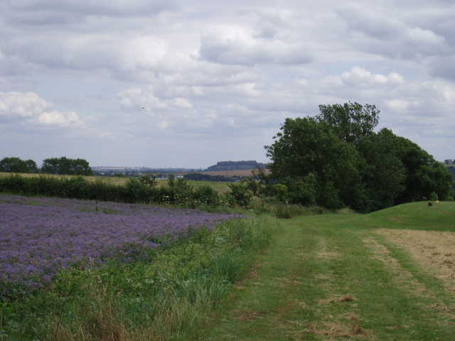
[16] Footpath by Chalgrave Manor Golf Course, looking towards Sharpenhoe Clappers
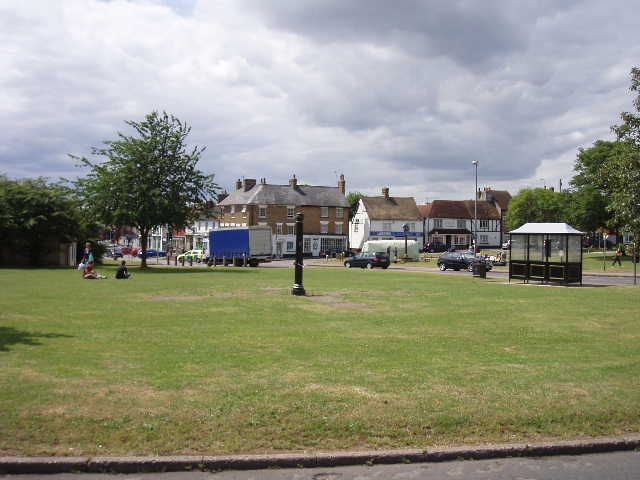
[17] The green at Toddington
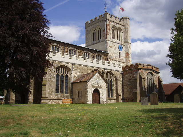
[18] Toddington church
Toddington is a large village four miles north of Dunstable, formerly a market town and a centre of the straw-plaiting industry. I remember a school friend of mine who lived there telling me that it once had more pubs per head of population than anywhere else in England – there are certainly a good few pubs still there now. Of course, nowadays most people only know of it because of the service station on the adjacent M1.
I turned round and headed back. I stopped and ate my lunch at the cricket ground in Wingfield. Although it was still very warm, some grey clouds came over in the afternoon so it was much duller than it had been in the morning. I got back to the car park on Dunstable Downs about 3.10pm – as I expected, the Downs were now very busy and the car park was full.
Total Distance: 59.5 miles each way